
South Coast Track (Tasmania) Walker’s Notes
You need this guide before setting foot on Tasmanian Wilderness

We completed the SCT going Northbound on the 29th of December 2024.
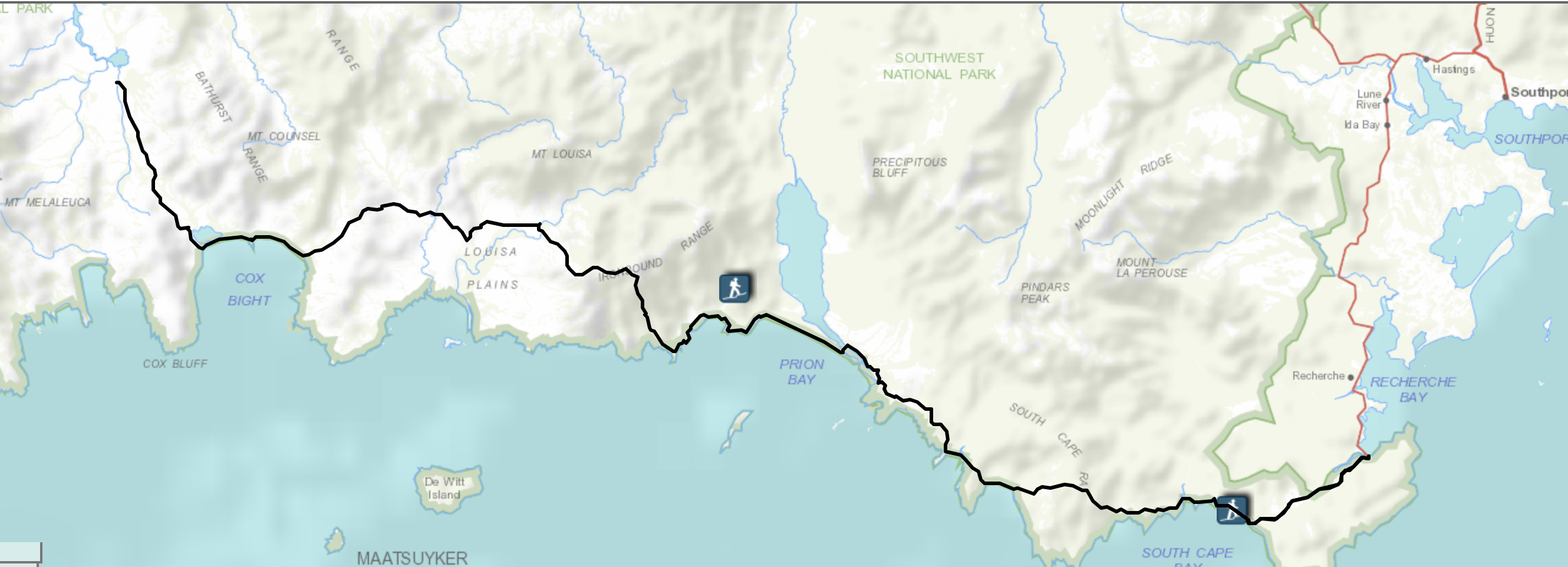
If you haven’t done so, check out the trail overview before you dive in.
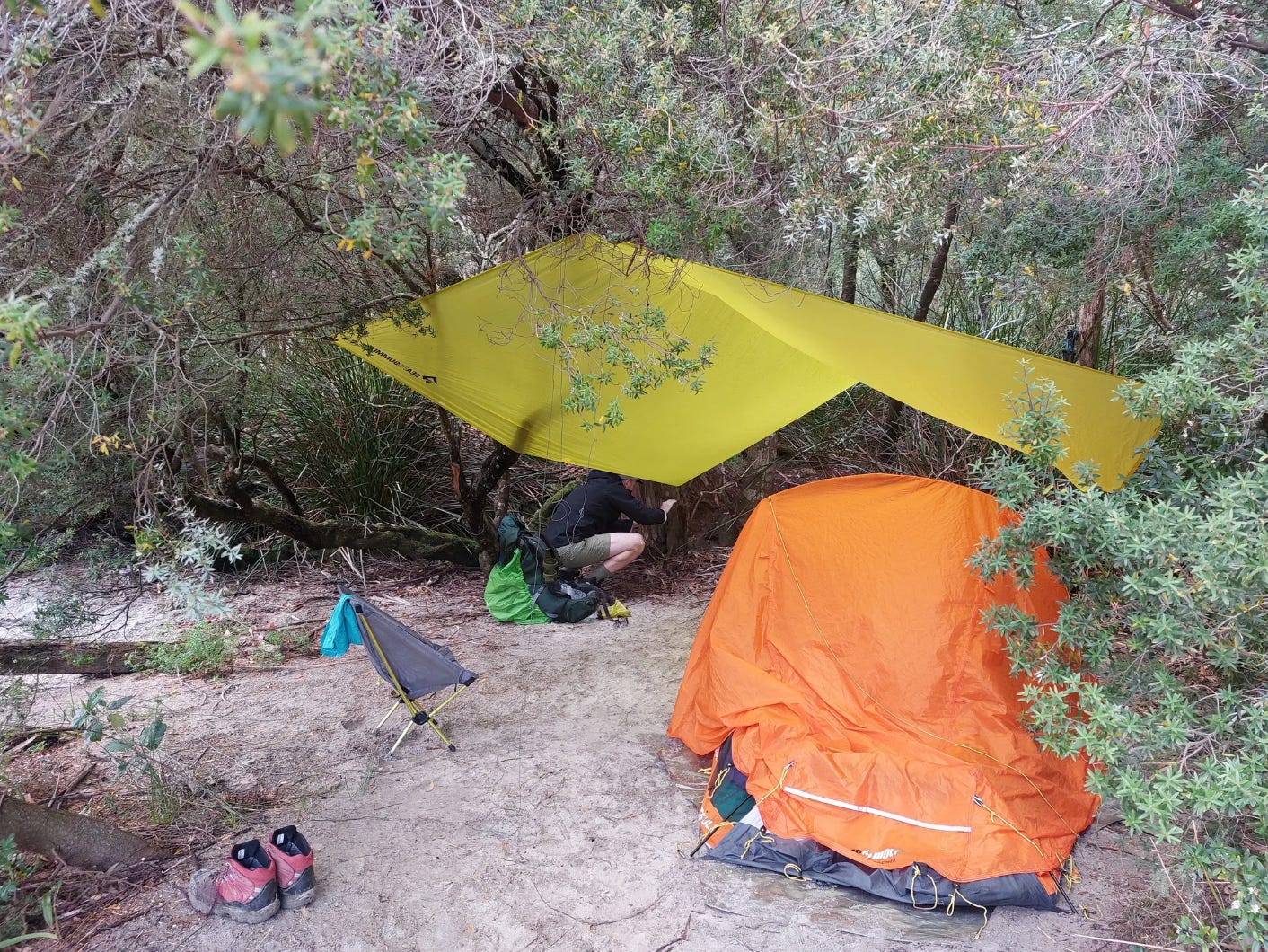
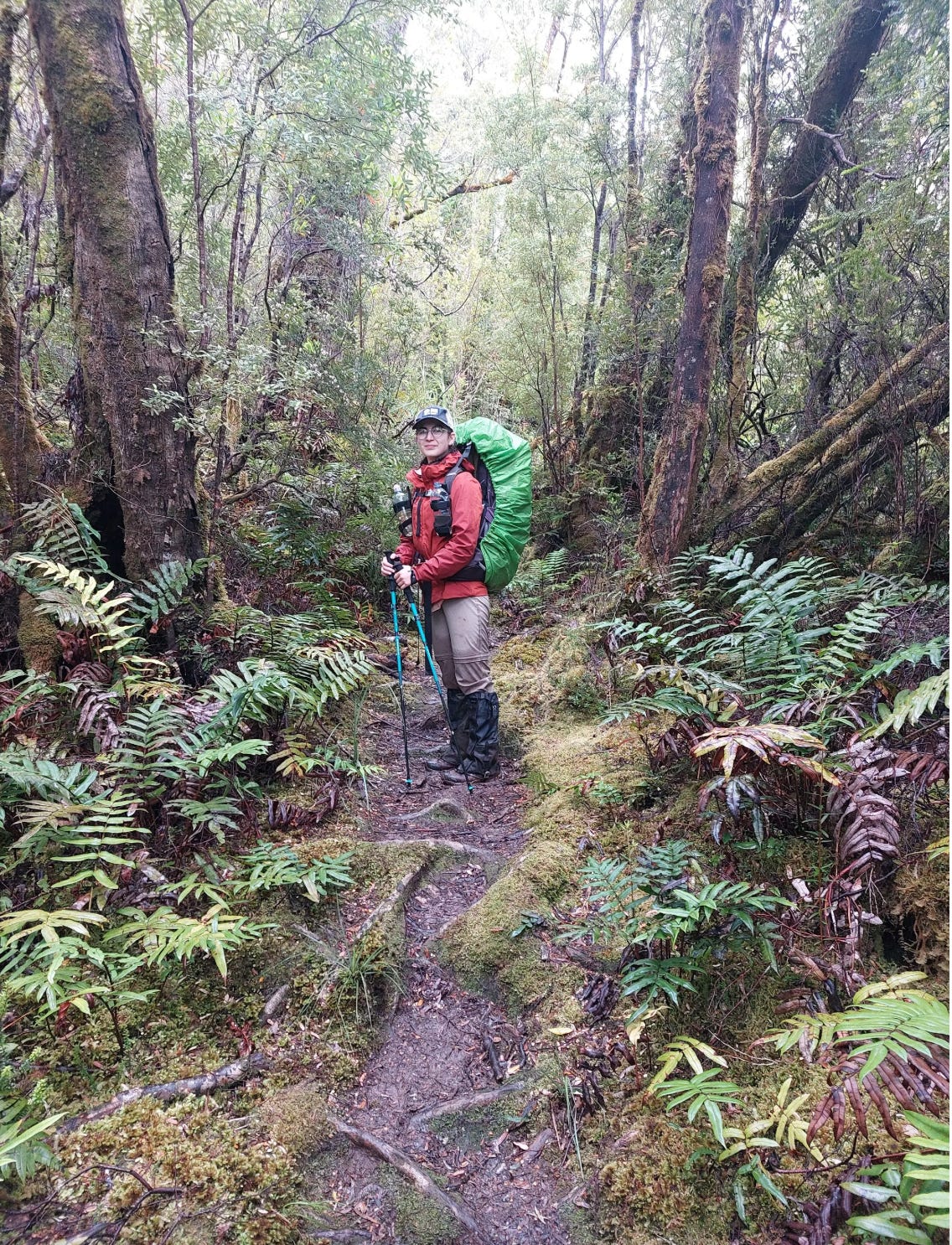
Day 1: Cockle Creek to South Cape Rivulet
11km, 4 hours
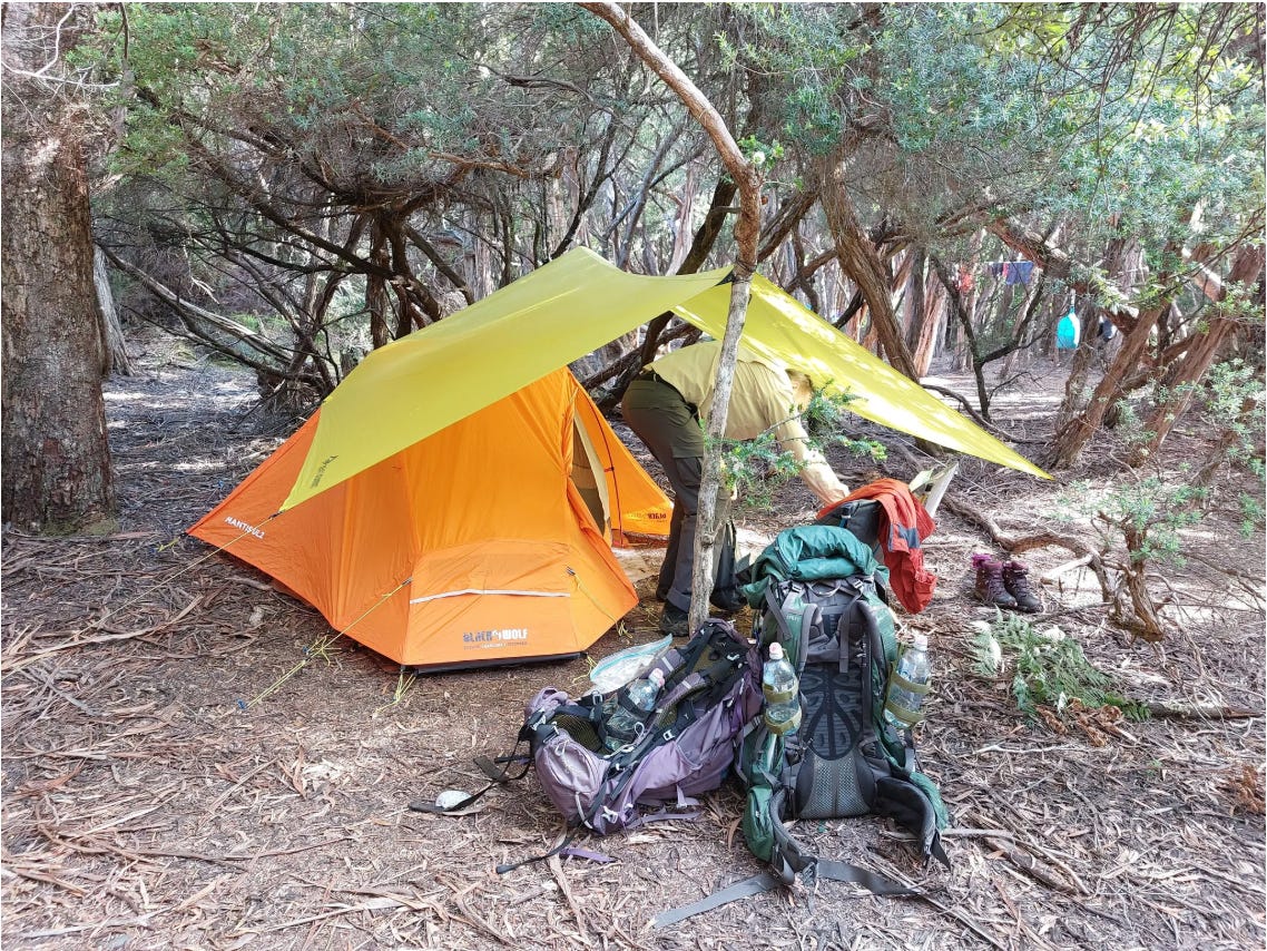
We were dropped off by the shuttle bus at 3 pm and had a late lunch (bread buns with ham & cheese) before our hike at 3.30 pm. The shuttle bus ride from Par Avion took about 2 hours.
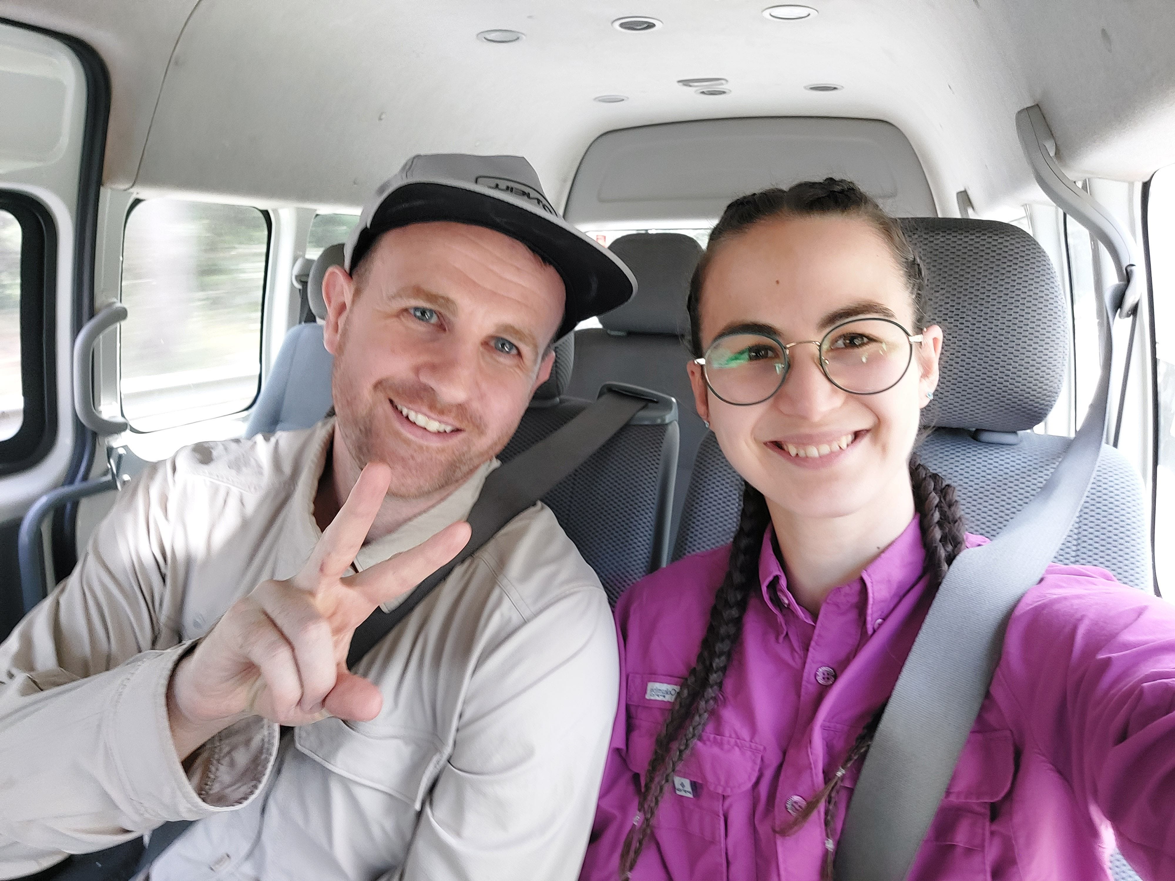
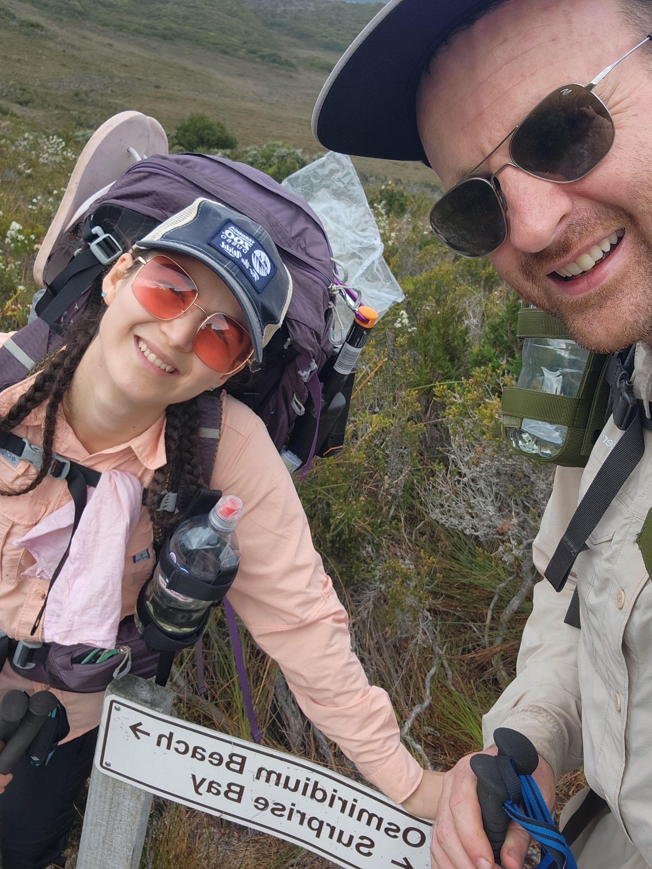
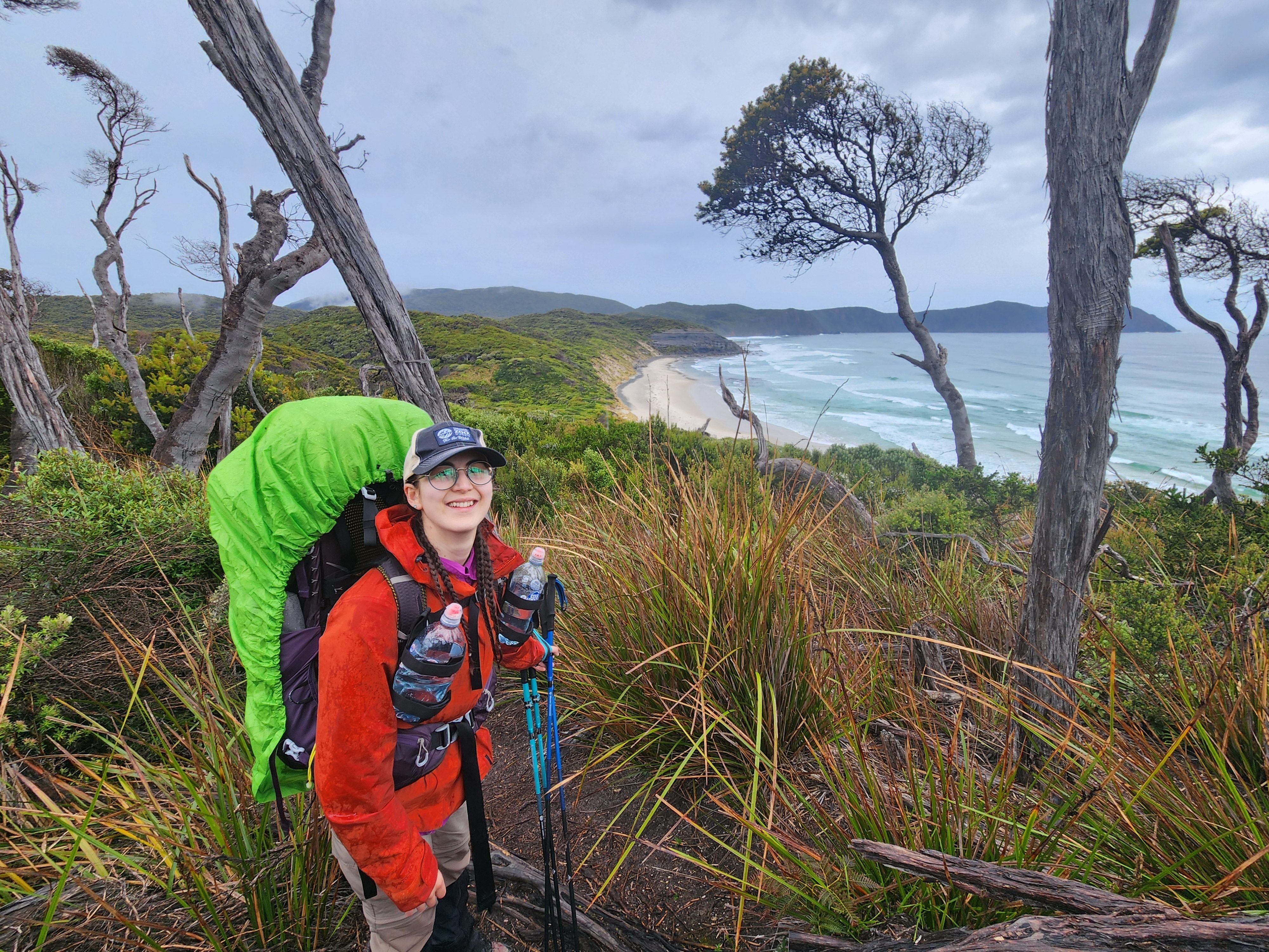
We look too happy to be tortured for 7 days. LOL.
The trail was wet due to the consistent rain over the few weeks leading up to the hike. I had a ton of excitement and a bit of anxiety, as we hadn’t hiked for over 4 days before and only had day-hiking experience in the Tasmanian wilderness.


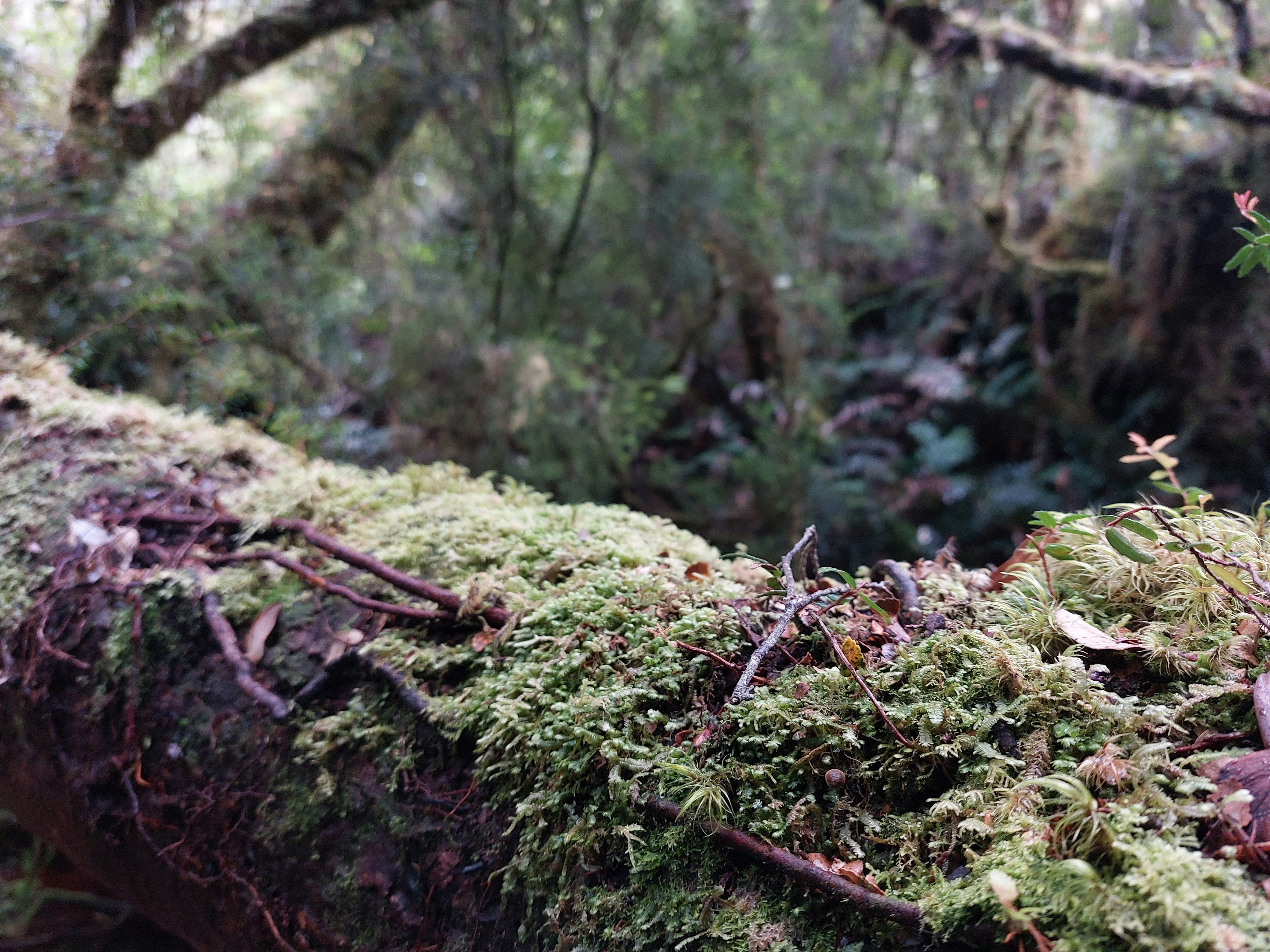
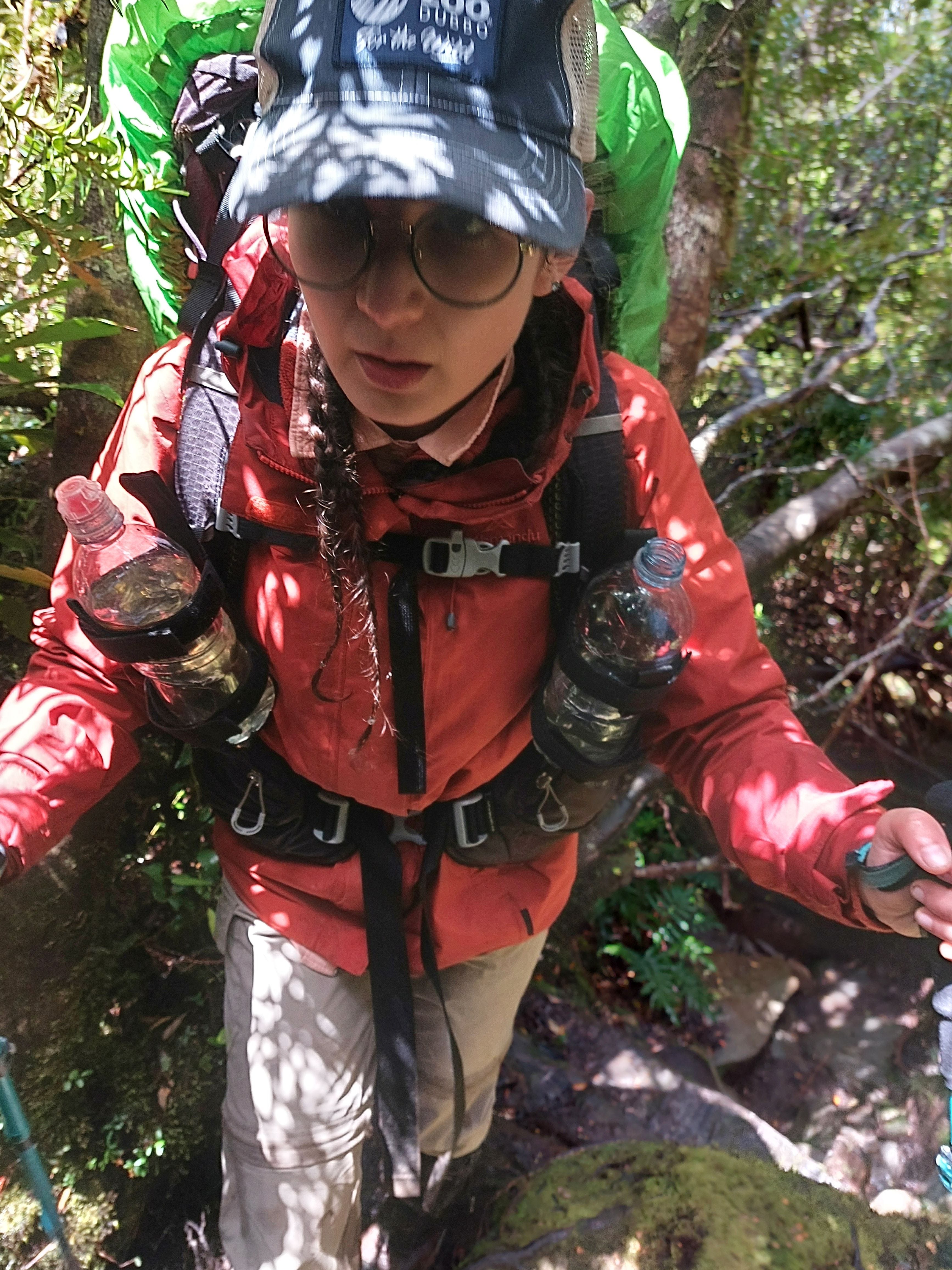
We were able to maintain a consistent pace throughout the track, which began with a forest walk, then some boardwalk in a rolling plain surrounded by alpine bush, and back into the forest.
I had an incident when a wasp flew into my shirt from the gap between my collar and neck and stung me three times. Lesson learned: put your collar up as you hike.
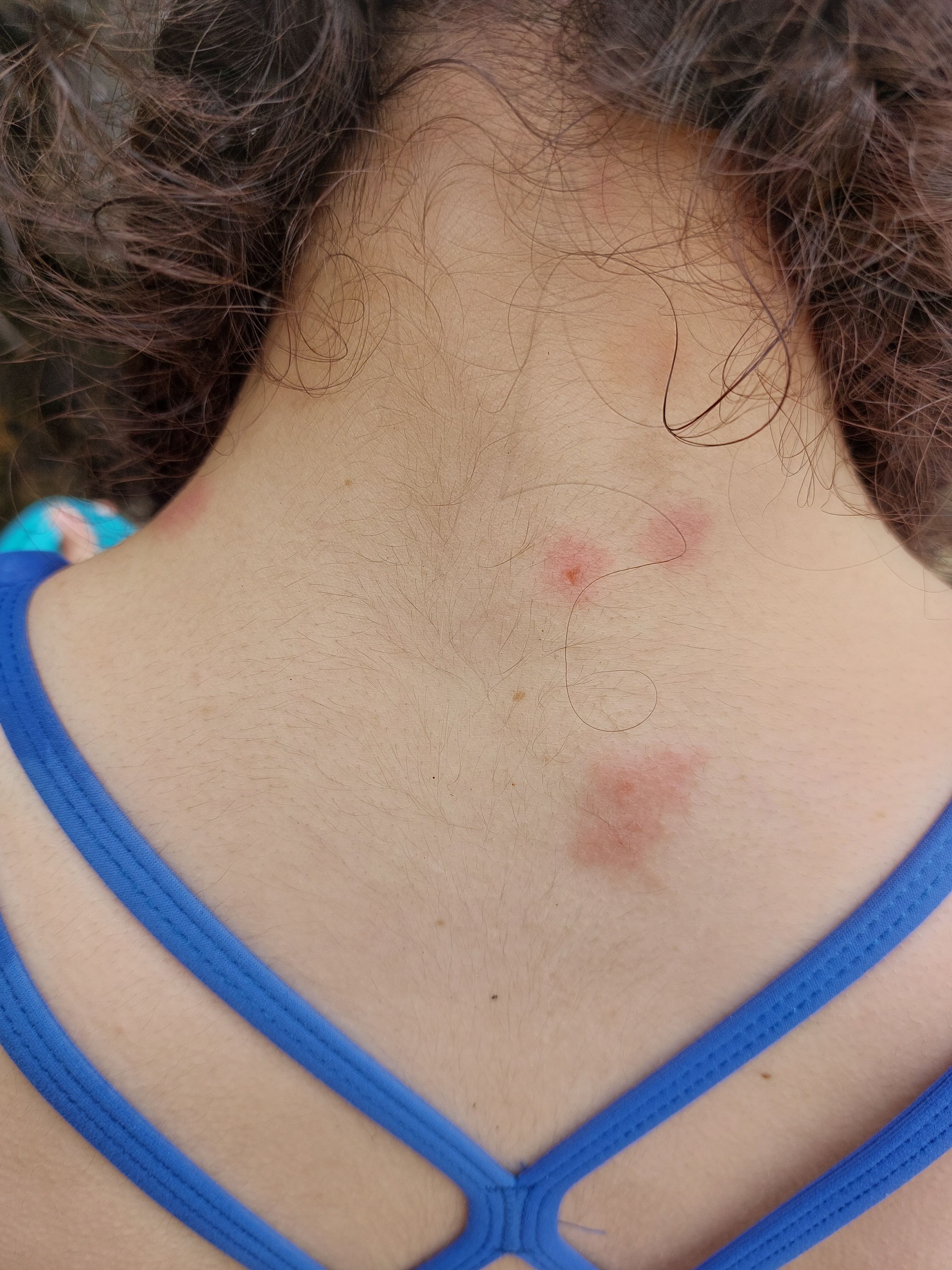
This photo was taken 4 days after the sting.
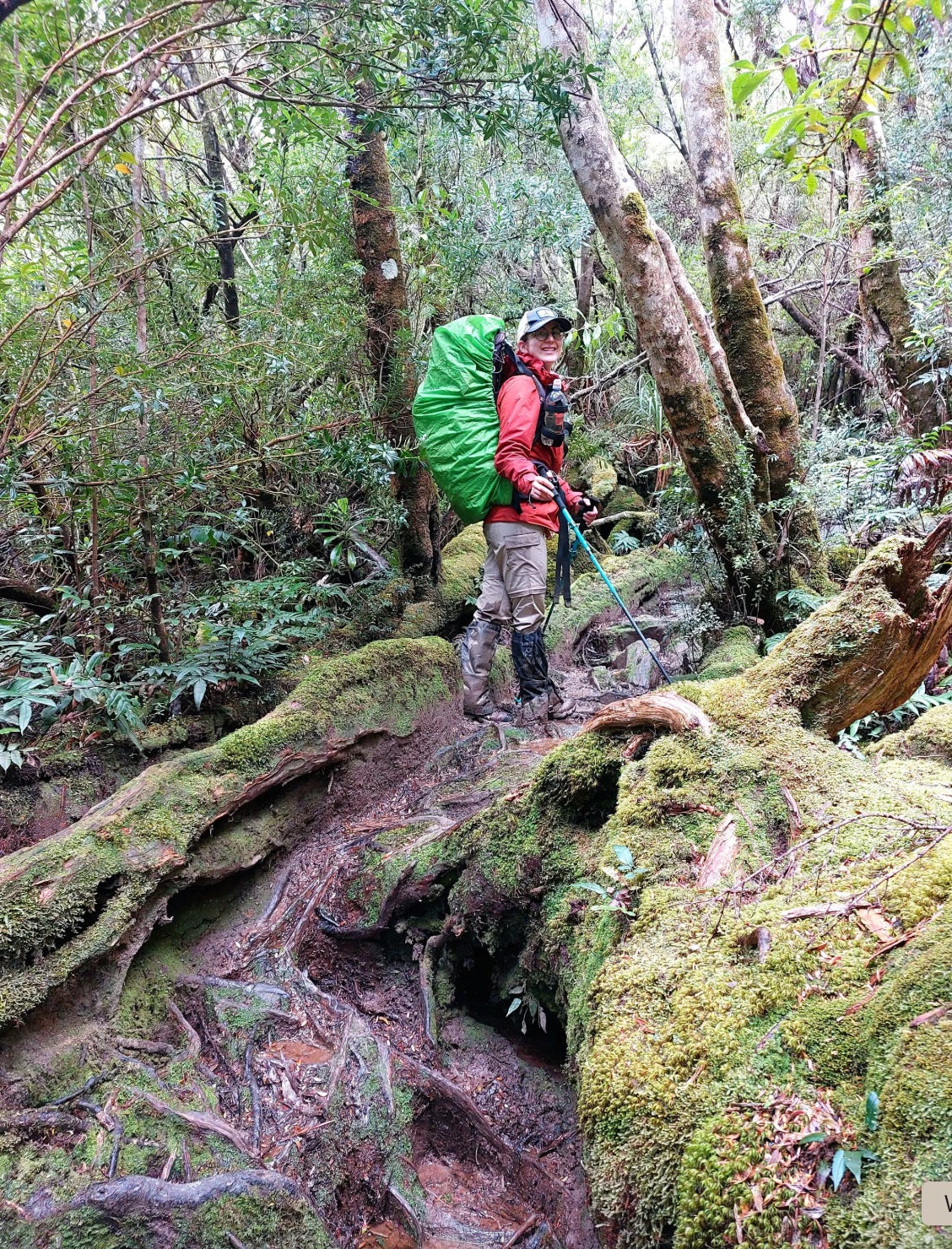
Going back into the forest section, we came across some mud and a bit of climbing. As we began the trail late, we pushed to arrive at the campsite before sunset through the ups and downs (rushing caused David’s calf to be hurt, so he wasn’t happy).


We eventually descended and walked along the beach. The old way curved to the left along the rocks (dodgy, as they get covered under water in high tide) and the new way curves to the right (much safer to follow).


The campsite is on the right before the inlet. Some spots are on sand, and some are on grass. It’s a lovely campsite with a pretty sunset view. We saw three pademelons at this campsite.


There is a long drop available. If you go up the inlet, it widens to a bigger creek, which is lovely to swim in. This is also where you can collect water. Dinner was the leftover bread rolls with ham & cheese.
Day 2: South Cape Rivulet to Granite Beach
9km, 10 hours
Hardest day on the trail (unless you love hiking through hip-deep mud).
Tip: start this day very early, so you won’t have to rush leading up to sunset.
The day begins with an inlet crossing.
Tip: check the tides before crossing the inlet. Not recommended to cross during heavy rain when the inlet is swollen and up to your chest, as strong currents are reported during such times. At low tide, the water should be around your ankles, so safe to cross with your hiking boots.
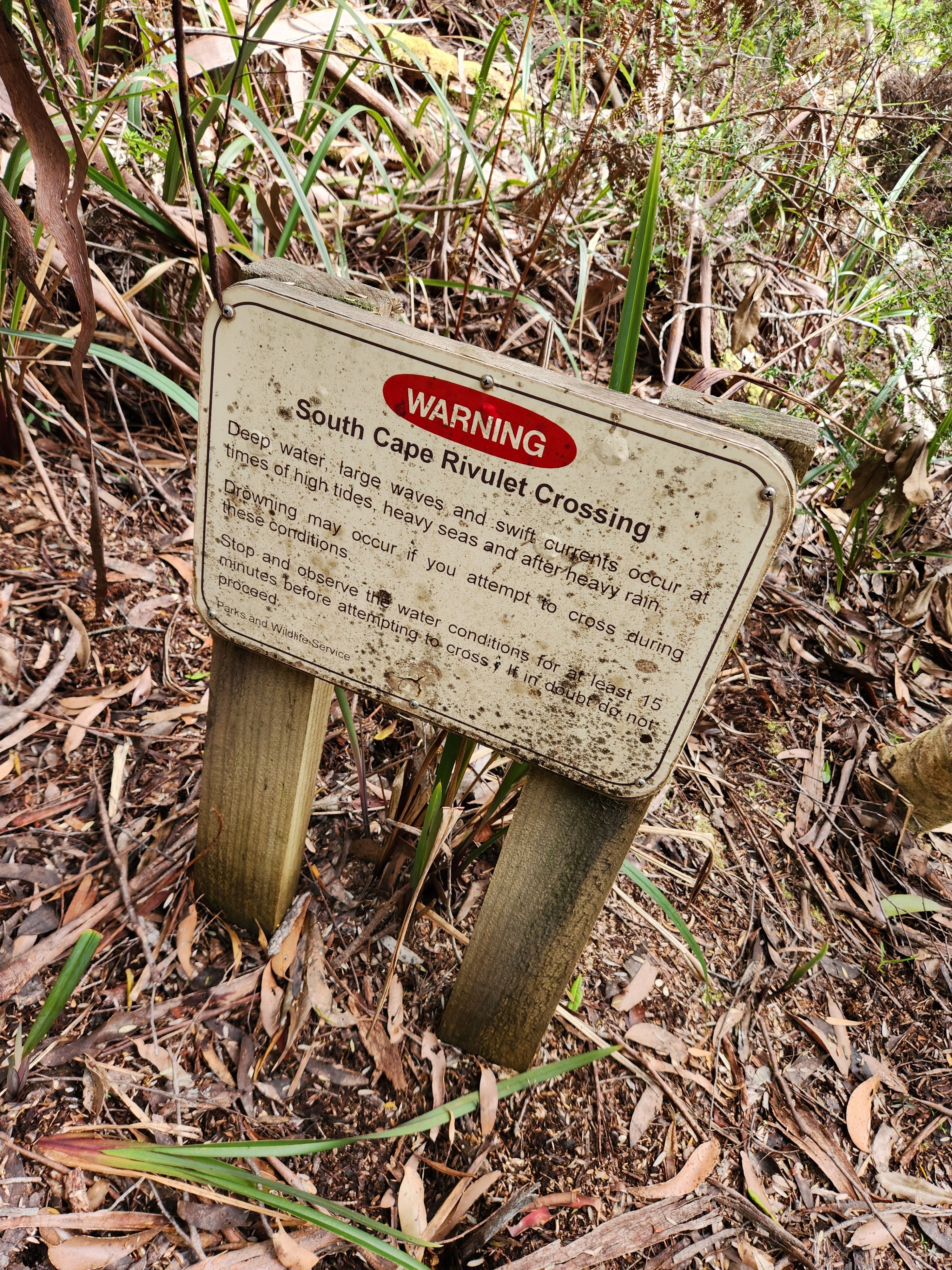
On that day, the high tide was at 4 am, and the low tide was at 7 pm. We were a bit of chicken to not cross at 8 am and get an early start, as the tides would have been ok then. We crossed at 10am instead. Freezing water woke me up. Low current. Butt-deep water for me (160cm) and thigh-deep for David (185cm).
First bit after the inlet crossing. 30 minutes before we encounter our mud adventure.
Not joking, this day was a nightmare. Very technical ascent through the rainforest with a ton of mud up to the knees. Slippery! Hiking poles saved us a few times from falling. Without the mud, the view was magical. Giant trees with roots extending downhill for metres and metres, rich shades of greenery growing over those roots, and fungus in unique colours. It was a scene from a fairytale, but we were sweating through our asses.
I tried to take pictures, but nothing could capture our struggle on this terrain. When the mud reached above the knees, it was raining on us and no longer safe to pull our cameras out.


Being short, I hated every time I came across another fallen log (chest height for me). I heard from the other women on the trail that they dropped their packs a lot, pushed and pulled their packs over some of the logs and tree roots. I was very stubborn to not take my bag off for the entire time so exhausted myself on the way up.


We were really hopeful that once we got over the ascent and reached the 3km flat section, we could take a break from the difficult terrain, have some lunch, and then start the descent. Little did we know that the standing puddles of mud were worse.
I can’t stress the psychological/mental element of hiking. It’s important to stay positive even when things don’t work out the way you hope.
Well, when I put my hiking pole in to test the depth of the mud and saw it almost disappear, the realisation kicked in. I felt sick with anxiety (as I didn’t know where I could put my foot) and disappointment. We also couldn’t have our full lunch or a good rest because mud and constant stop-start rain made it hard to put our bags down.
The next 3kms were a tragic comedy. It was horrible in the sense that stepping anywhere was extremely hard. Once you step into calf-deep mud, the suction of the mud on your foot is so strong that it’s an effort to lift your foot back up. Leeches were latching onto our legs.
Two steps - breathe - look around, test depth - leap - two steps - “sht!” “argh! crp!” - repeat the cycle.


I’ll call out that the Tasmanian National Parks put up a sign telling people to not avoid the mud, and step through it, as otherwise going around damages the plants. I’m not sure if they are aware that the mud was waist-deep in some sections and anything above knee height was impossible to step through. People have tried to go around the mud, bush-bashing, and widening the mud for their own safety. We were trying to follow their steps and laughing at ourselves. I guess some people pay for a mud bath - we got it for free. Tasmanian National Parks should really put boards through this section! Did I mention that gaiters are a must-have for this trail?


Being exhausted is one of the biggest risks for hikers on technical terrain. When exhausted, you lose focus and balance; that’s when the mistakes happen. I stepped into a mud pond up to my left thigh and it took David 10 minutes to rescue me.
First, he tried to pull me out, but the mud was so strong that it hurt my foot. Bad idea. Then he grabbed the mini shovel we brought for the bathroom matters and began to dig the mud around my foot. That worked (alternative use cases of the object). At that point (and knowing how late time was getting), I was on the verge of crying.
About 20 minutes later, after attempting to take another leap to a side trail, I slipped and fell into the mud pond sidewards. My body sank and my face remained outside — gave me a shock. That’s how I got a big bruise on my left arm. I panicked and tried wiggling myself out of the mud, which made me sink even more. I eventually unclipped my bag and David pulled me up. I was wet, cold, disgusting, shocked, confused and a little scared. I still had a sense of humour, so I laughed…and began crying. Yay SCT!
He was like, “young lady resting in the mud and crying, while I’m still working, shovelling the mud.”
Once the drama was over and we made it to the end of the flat section, we had a short break with some food. We were half-starved, hoping to arrive at camp for dinner.
Tip: for the difficult days of the trail, pack higher energy and some sugary food. It will cheer you up and help you push on.
Steep descent from there into Granite Beach, which wasn’t very hard and definitely not as muddy as what we’ve been through, but after the build-up of fatigue, it felt like a bad drag. We had minor slips (purely from exhaustion and losing focus) but no falls or anything serious.
Note: two days ago, a lady got airlifted out of this section after a fall and concussion. She was also fatigued and lost focus.


We arrived at the campsite around 8 pm, had quick dinners and laid down in the tent. My legs were aching from fighting off the constant suction of the muddy terrain. I genuinely doubted if we could finish this trail that night but no way we were going back on that trail. I was also anxious after hearing groups coming from Melaleuca talking about how bad the Iron Bounds was (even higher climb and “very muddy, slippery, took us 11 hours” etc etc).


Note: Iron Bounds is easier to tackle when going Northbound. The trail is nowhere close to being as muddy as this day, even after rainfall, which is what we experienced. The main challenge with Iron Bounds is the constant climb for half of the day. We were trained for uphills and climbing. But we were not ready for deep muddy terrain.
Tip: at this campsite, there is a waterfall to collect water and you can scramble down to the bottom for a lovely shower on the pebbles. It’s a great spot.
Day 3: Granite Beach to Osmiridium Beach
12kms, 7 hours
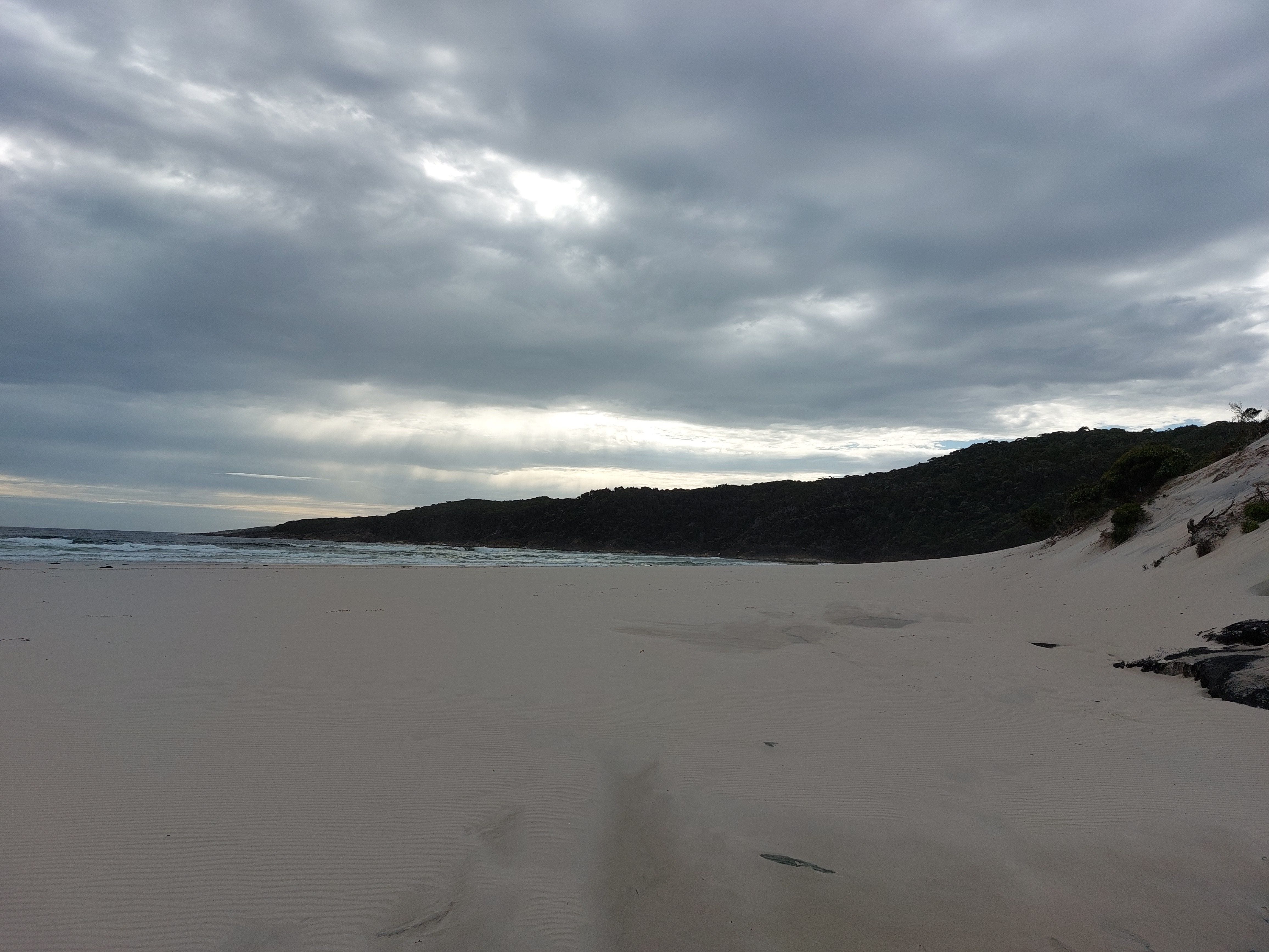
Scrambled down from the waterfall onto the pebbles (be careful here!), we began our day along the beach. Some nice forest walk afterwards. Definitely an easier day but yesterday’s fatigue carried on, so we moved slower than our usual pace.


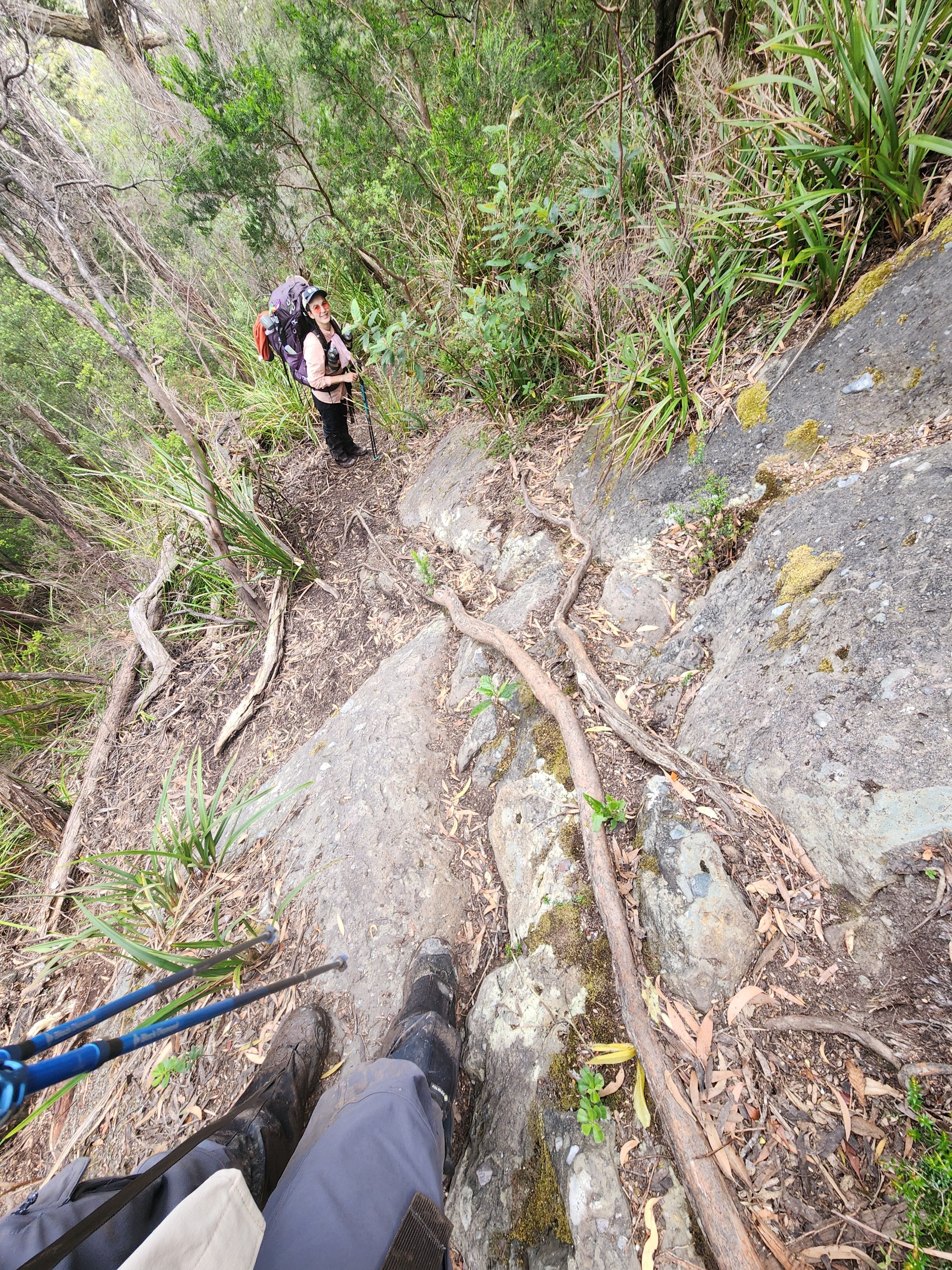
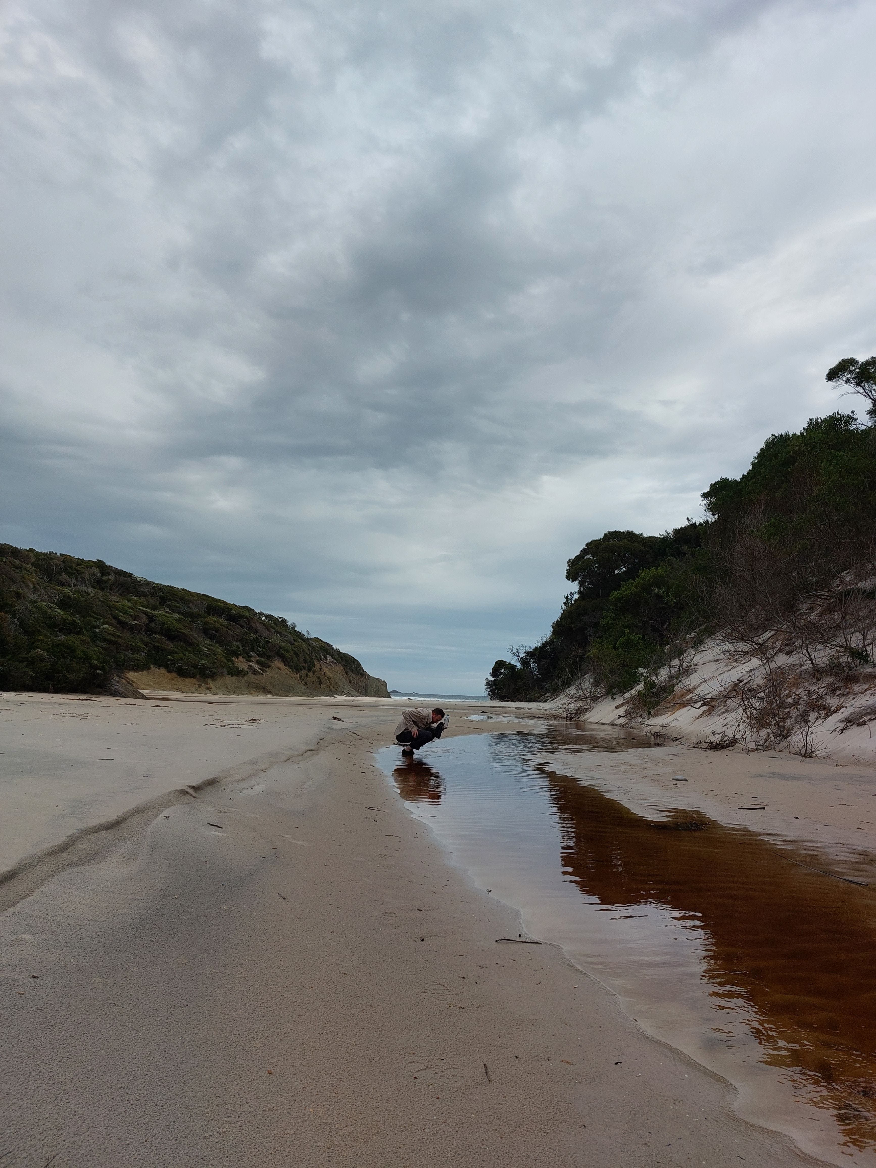
After the forest, there is a rocky section descending to Surprise Bay with a rope. It was a bit of an abseiling, and then we crossed the inlet (ankle deep) and paused for lunch.


Gorgeous beach and seeing nobody around, I felt like we were on an isolated island or the Jurassic World. Beach walk and back into the forest.


Note: Surprise Bay seemed like a cute campsite. It would have been a nice spot to camp if we were able to push on.
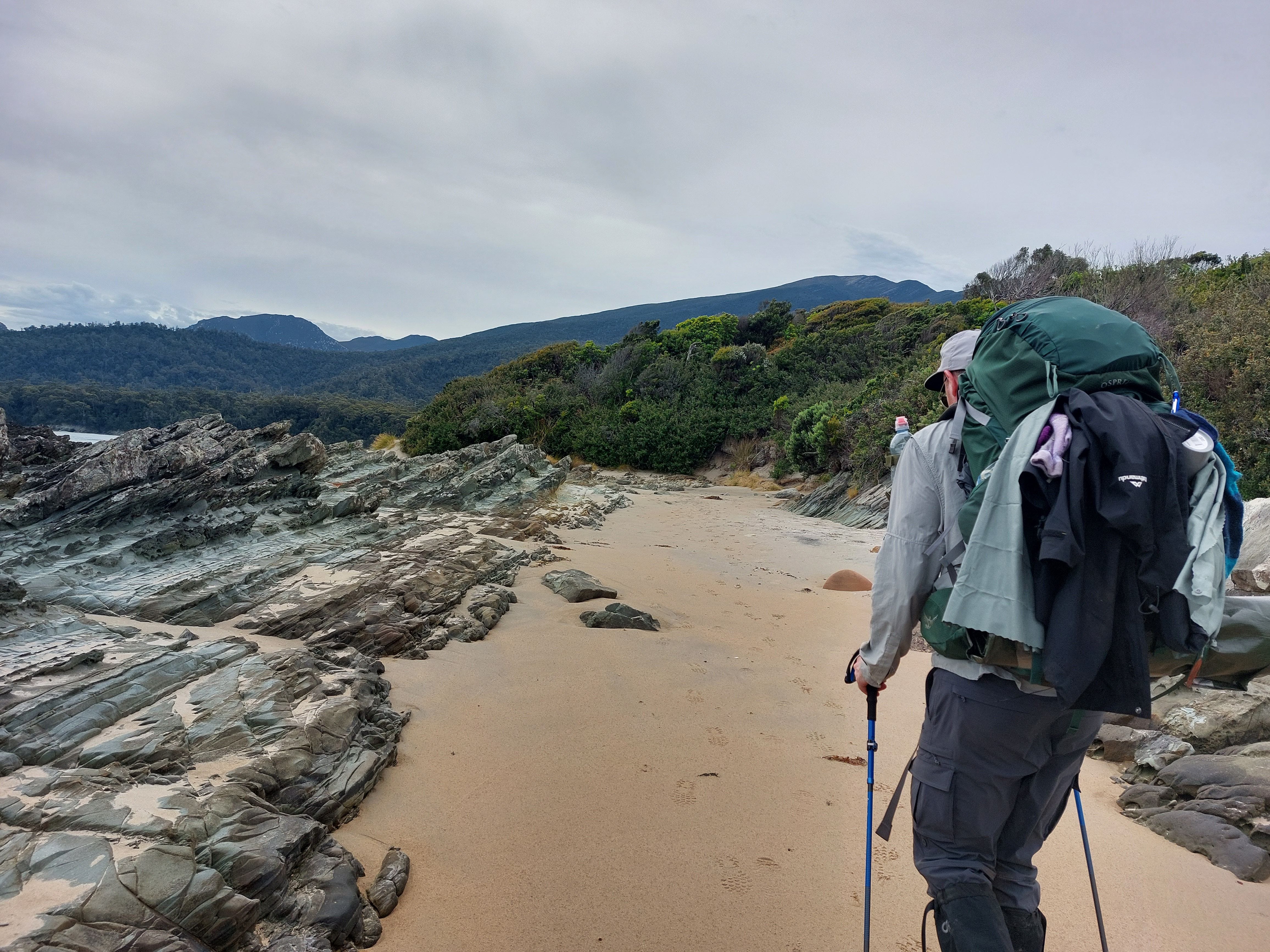
Climbing up to the forest from the beach.
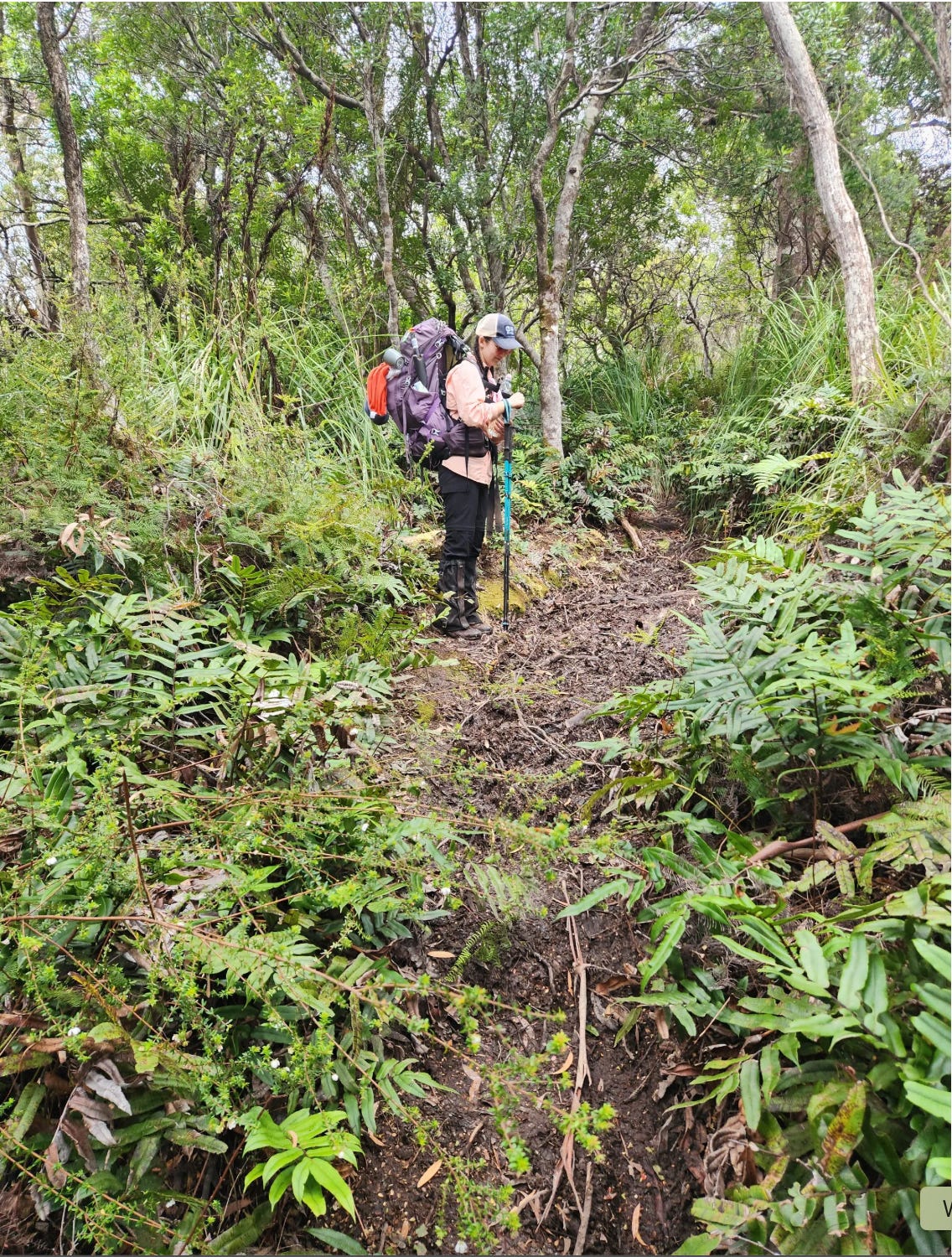
Heading towards the Osmiridium Beach, we came across a bit of boarded walk and a bit of mud (ankle and calf deep). It was not a difficult walk and mostly remained flat with some uphill sections. What made this section frustrating was the overgrowth. Cutty grass and spiky bush chest height and some even taller than me. The trail progressively got worse and worse, as we could not see where we were going, just pushing through the bush (even got off the trail a bit actually). Never thought it would be so tiring but the alpine bush is strong and we wrestled for an hour. At one point I said, “if we just stop here, no one would be able to see us within this bush; we could grow leaves and become a small tree ourselves.” I’m dramatic sometimes.


Tip: I really should not be saying this but saw two women on the trail with booty shorts. No. Please don’t. The bush really ruins your skin. Sunnies are highly recommended to protect your eyes.
Note: someone without hiking poles reported that there were a few muddy bits up to their upper thighs which they were not pleased to find out. We must have gone around them, used side trails, or skipped over.
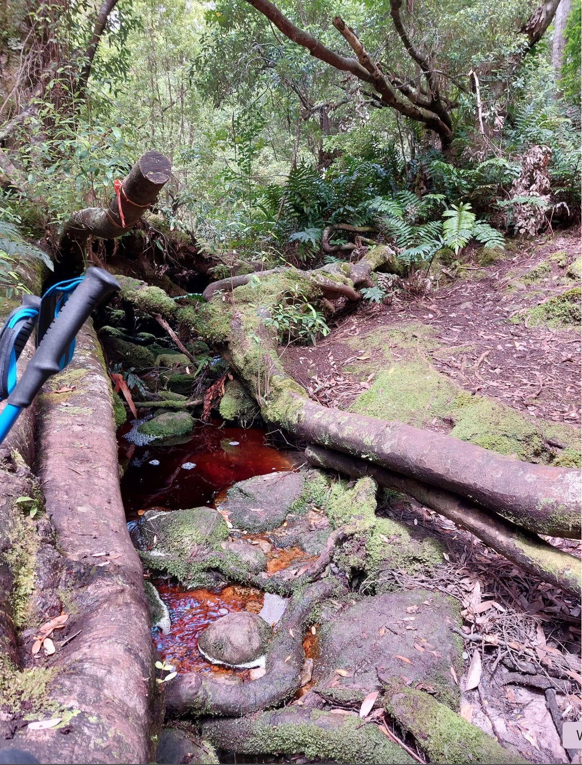
There is a little bridge along this trail with a tiny stream of running water. It does not look like the best spot to collect water but you will need that water. We made the mistake of thinking the campsite would have a water source, but when we arrived, we realised it was stagnant and poor water. We had to use filtration.
Note: make sure you have enough water for the following day. During the 9km following the trail, there is no suitable place to collect water.
Osmiridium Beach campsite is quite nice. There is a junction where you’ll need to turn left, more bush bashing with challenging navigation, then into a forest, creek crossing (ankle deep) and there it is.
We were glad to arrive at 5.30 pm. It gave us time to chat with the other hikers on the trail, collect useful insights, share stories, take a walk down to the beach (can’t swim there due to blue bottle jellyfish — they’re nasty), put our feet up, have a warm long dinner and take a good night’s rest.
Day 4: Osmiridium Beach to Little Deadmans
15km, 10 hours (1 hour full lunch break and 45 minutes at the boat crossing)
We began our track with bush wrestling until we made our way back into the forest. This was a relief. Lots of ups and downs throughout the day, some within the green forest and some over sandy bits. There is a bridge somewhere in the middle with nice stairs (a pleasant surprise).


Note: the running water under this bridge is salty from the beach. We heard that if you walk up the stream you can collect fresh water. We tried to do that as we were really thirsty, but it’s quite up the stream (and the water was already at David’s knees), so we gave up.
Overall, it was not a difficult walk, but we were out of water (our mistake from the previous afternoon) and it was a warm day. We were sweating and very thirsty for 9 kms. We could not even eat due to the thirst.
Note: if you are not confident of your water sources, try to have an alternative dinner that does not include water for cooking. Some of the water sources on this trail are influenced by the rainfall. A few days of sunshine can dry up the small streams and a few days of rainfall can create multiple new streams along the way.
There were lots of logs to jump over, branches to duck down (David crawled under) and a few bits were confusing to navigate due to overgrowth.
We saw a baby Carpenter snake on one of the sandy lookouts. Being thirsty put me on autopilot, and I saw two footprints in the sand, so I followed them. A very steep sliding sand and found myself at the bottom of a non-existent trail. It took me ages to get back up. We found out later that another thirsty couple got lost down there before us as they were rushing towards the water source.
We came to the boat crossing with stories from people about how they were lucky to have somebody on the other side, or how there were two boats already on their side. We were not one of those ‘lucky’ people on the trail.
This is a section with 3 boats for hikers to row over to the other side. Two boats always have to be on one side and one boat on the other. Very rarely somebody does not follow this rule (i.e. probably during a storm when it may be unsafe to make two trips). In that case, you may need to swim. If you are in a hurry, it’s swimmable but only in very good conditions (sunny and low tide), otherwise wait until somebody else comes back from the other side.
If there are two boats at your side, then you just row one boat over. If there is only one boat at your side, you need to make a trip to the other side, then tie two boats together to row the other boat back to the other side. Then row yourself back over. There are life jackets and rowing spoons/oars/blades (whatever they are called that you row with).
Note: do NOT cross this section during a storm with high tide. It’s actually dangerous (strong currents occur) and rowing even in calm waters is quite hard. This is another section of the trail with prior drowning cases.
I think people don’t talk about this part of the trail enough. This was tough and frustrating. Rowing a wide boat is very different from rowing a single boat or kayaking. Also, this boat set-up was heavy and a bit dodge (i.e. handles kept on coming off). There was a bit of a current happening and it was low tide which did not help our situation. When it’s low tide, the boats are up on the sand and dragging them down to the water is hard.
I love kayaking and had the chance to do some weekend kayaking in the Northern Beaches for a few months. I was of no use in this situation. David did 95% of the work and I only added additional weight for him to pull. This was just a difficult old boat to row across. We spent about 45 minutes on this section.
Then came the 4km beach walk. Lovely! Long and easy. We raced to the end as we knew that there would be a water source available. Saw a few baby seagulls along the way which were so cute.


At the end, the beach and a water stream connect into an inlet. We both drank a litre of water in one go. This was a perfect spot to have lunch. We swam at the beach, set our camping chairs, had lunch and rested for an hour.
The hike to Little Deadmans was easy from there. You’ll step back in the forest and go over slight up and downs. In the swampy section, we saw a medium-sized tiger snake. It was more scared than us.
You’ll come across a few streams and creeks to cross where you can collect more water. They’re very pretty as short rest stops. One has a tight rope you can hold onto for balance.
You’ll come back out to a beach section and reach the campsite after walking on the pebbles. There is another stream there to collect water too.


It was a fine day and the dinner was yummy, but when we laid down in the tent, I was anxious about the following day, Iron Bounds. We’ve been asking every hiker we see along the way about their experience. The average completion time was 10-12 hours (one outlier of 9 hours, one outlier of 7 hours, and a few people who couldn’t complete the trail stayed overnight at the emergency campsites there). We heard some nasty things about the elevation, very steep climb, lots of mud, very watery and slippery and overall an absolute killer, especially when raining. That night it was raining heavily and I had a short cry from anxiety.
Day 5: Little Deadmans to Louise River (the Iron Bounds)
12.5km, 12 hours (900m ascend/descend)
Despite bringing a solar charger to this trip, the start-stop of rain and travelling in the forest didn’t allow us to charge properly. David’s phone was flat and my phone was at 30% in the morning.
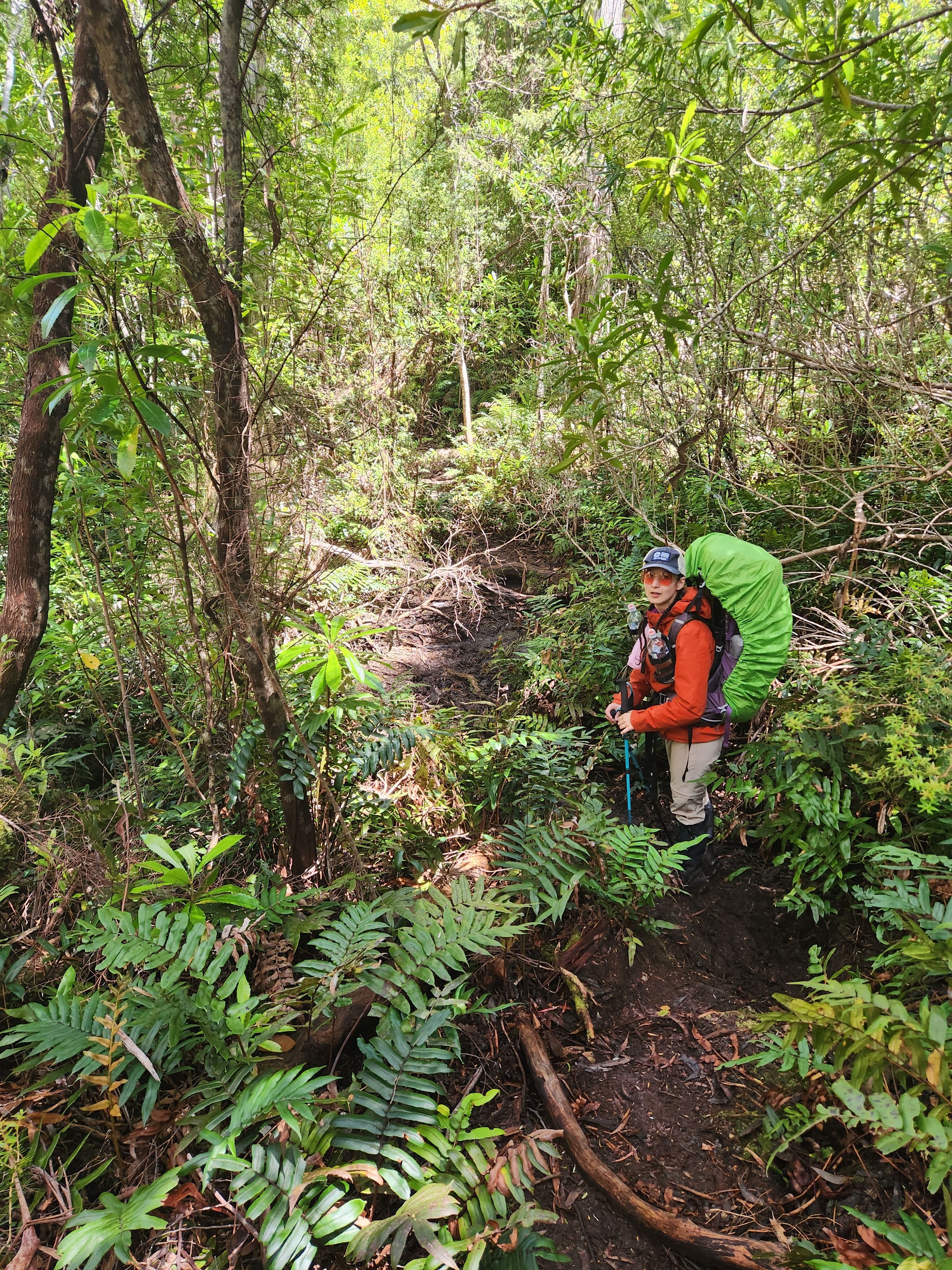
We began the day with a forest stroll (about 2kms). Constant uphill but nothing steep. A hundred different logs to jump over or crawl under. Honestly, by Day 5, regular hurdles just become your norm.
A few streams to cross over. Lots of new streams appeared due to heavy rain. As you climb up, you’ll notice a lot of rocky sections which have become waterways for the rain. Some of these rocks and slippery to climb on, some are not. Best to check.
There were two bigger stream crossings which have turned into waterfalls. These became very slippery with the rain. I slipped and fell on my right arm (got my second bruise). If my bag wasn’t there to cushion me, that fall could have ended as a disaster. I crawled out of there. A lady in front of us slipped and fell on the second crossing.
From there, the ascent became steeper and more technical with tree roots and lots of tall rocks to climb on. This is difficult for a short person like me. I used a lot of my upper body strength. In some places, I felt like I was either doing weighted chin-ups or weighted rock climbing. For people with longer legs, you’d be expecting to do a lot of high-stretched lunges. Overall, the ascend was not muddy and definitely not as difficult as what the other people had told us (even with the constant showers during the day).
On this trail, we passed two emergency campsites (Lower Iron Bounds Campsite and Mid Iron Bounds Campsite). They seemed like ok spots to camp at (no water source though) with 2-3 tent spots. Maybe a good option for people going Southbound (or if you just want to tackle Iron Bounds in two halves). I understand that most people just want to get it over and done with.
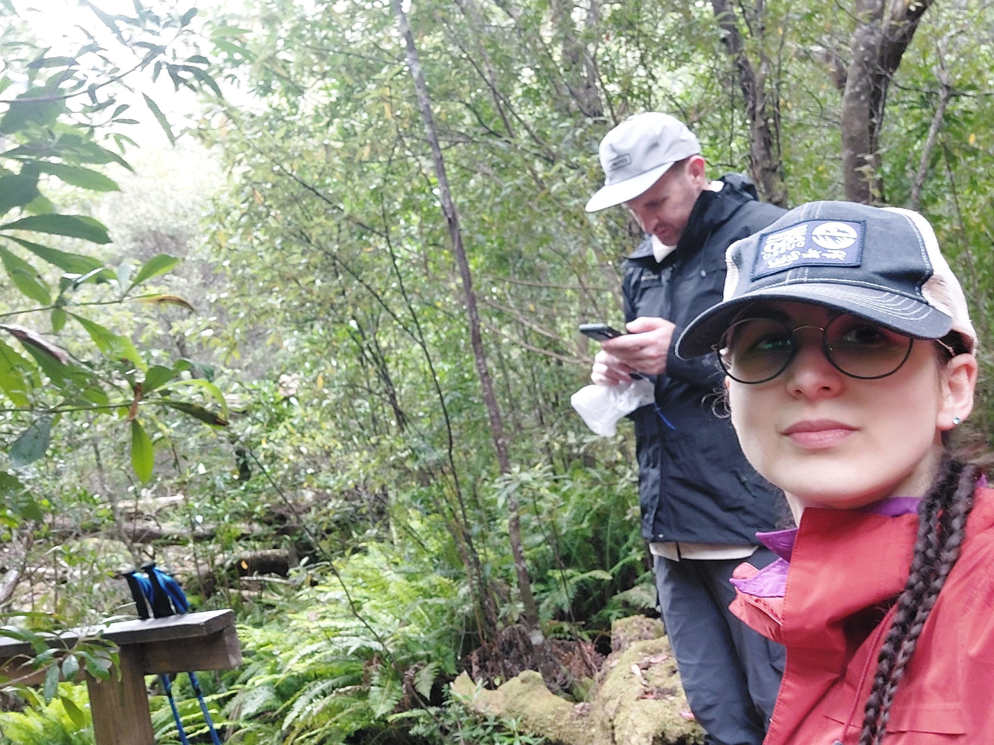
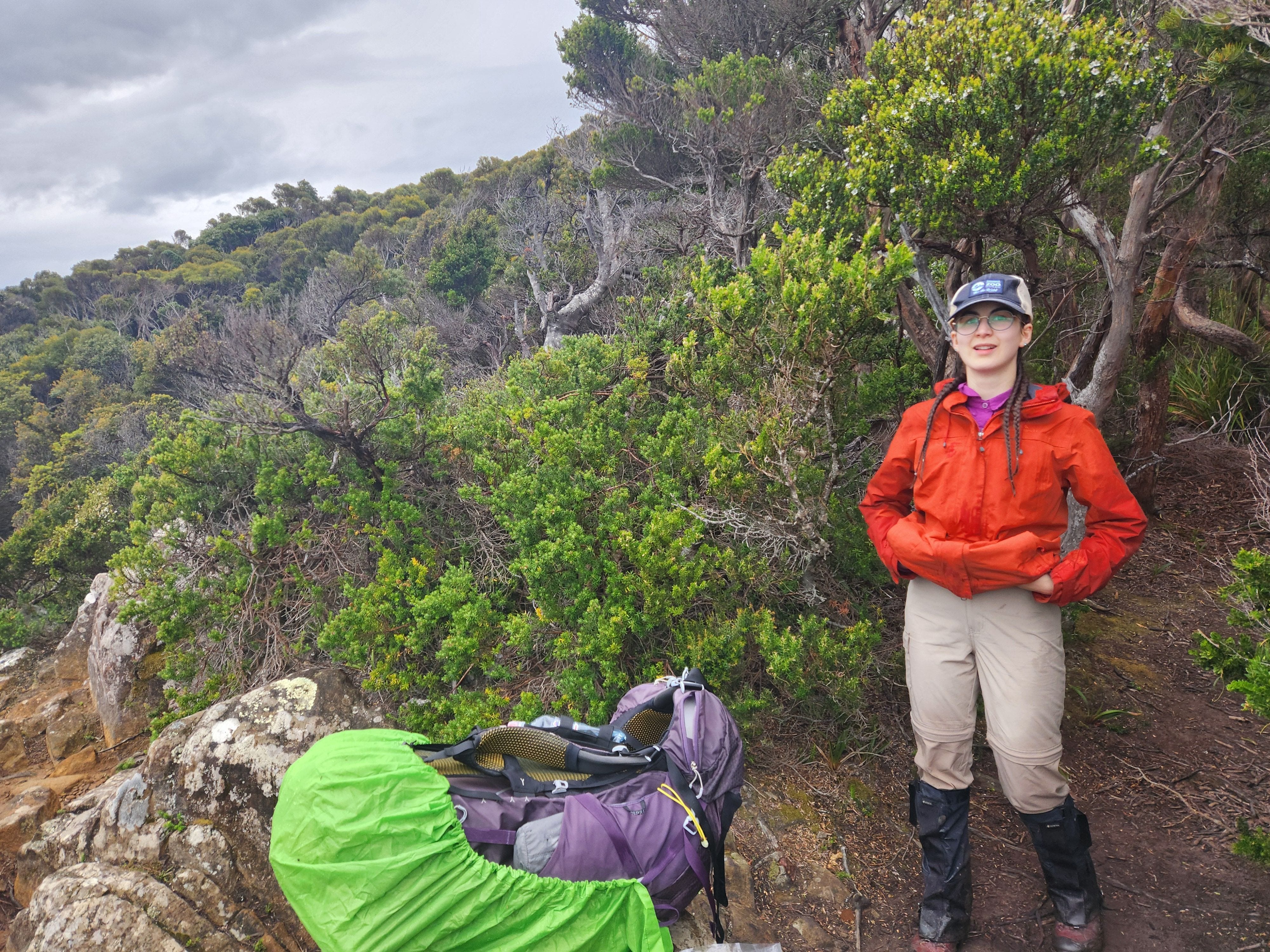
This photo is a real representation of how we felt during the climb up.
As we got closer to the top, the trail became very narrow and rocky. We took a lot of rest as we climbed. It also got cold suddenly. I began having trouble completing fine motor actions with my fingers (but we were so focused on climbing that I just assumed it was from how strongly I was gripping the rocks and my hiking poles).
Tip: if you don’t have the best blood circulation, bring a glove for the Iron Bounds. We made the mistake of not packing any, as we did not consider frostbite to be an issue on this trail.
Note: lots of leeches along the way. David had to crawl around a lot, so he got the leeches on his face and neck.
By the time we got to the top and exited the rainforest (around 2.15-2.30 pm), the weather closed in and it got much colder. We walked outside and I was ready to throw my hands in the air to call it “we’re on top of the Iron Bounds!” But a few seconds later a powerful storm hit us. I bent halfway down with that hit, then fell on my knees.
The storm came in so suddenly and it slammed us to the ground. I could hardly lift my face up to find David. He was looking around so confused. Don’t underestimate this section under bad weather. It can get really dangerous.
Him: “Go back!”
Me: “I can’t!”
Him: “There is no trail here! I can’t see the way!”
My instincts were telling me that this was not a 5 minute storm. This may continue for the next few hours, or even longer. If we went back, I knew that we would have to camp there. We dragged our bodies towards each other. David lost his bag’s rain cover in the storm. I was close to losing my hiking poles (but they were tight around my wrists). We got on our hands and knees, then laid flat on the rocks. That section gave David a big bruise on his left arm and left hip (where he hit the ground from the storm).
Pinned down on rocks that dug into my skin and watching bits and pieces of the bush being blown away, the grey clouds above us and feeling the rain, my mind froze into silence. David said my name a few times to grab my attention, which is when I looked to my right.
Him: “Are you cold? Hold my hands.”
Me: “Hands! Hands! Argh hands!” He touched my hands and I cried out in pain. “No, no, hands, they hurt!”
Him: “Sh*t. Close your hands, Doa. Can you close your hands?”
I could not close my hands. They were doing a pathetic bend at most. He grabbed my hands to warm them, and I cried from the pain. We stayed there for about 10 minutes, and David tried to pull my focus so I didn’t just shout out single words, but speak in full sentences. Soon, we realised that this storm was not going to stop or even slow down, and we were running the risk of hypothermia or frostbite on my hands.
It took us a bit of an effort to go on our hands and knees again, then we dragged our bodies (half bent down, half crawled) on the trail to find an exit. The relief of entering the next rainforest! There was a bridge over a waterfall, and that’s where we stopped to catch our breath and slow down our heartbeats.
Tip: come on the trail with a potential number of emergency cases planned and what you would do in those situations. You don’t want to figure out what to do about frostbite when you are in the superficial frostbite stage.
My hands were swollen (red and white) in so much pain (burning warm) and they were not able to close. My core was also getting cold. David tried to force my fingers to close which resulted in another cry. About a few minutes of confusion and trying different things (my brain was not functioning properly, it was only thinking about the burn of my hands), David pulled out his socks and slid my hands inside the socks.
Note: the treatment for frostbite includes covering up the frozen area with clothing or body parts to rewarm. To prevent frostbite when you are getting cold, wiggle your toes and fingers. Don’t force heating by heat pads, pouring hot water and rubbing in later stages of frostbite. Try to not walk on frostbite feet/toes.
After my mittens, we had some lollies and waited for another 10-15 minutes. That’s when I felt like my brain was more aware (working) and my fingers were able to close halfway, which was enough to get a loose grip of the hiking poles. It was 3.30 pm.
We came across the last emergency campsite there. This was a very exposed and wet area with so much wind. I don’t recommend anyone to use this spot unless they absolutely have to.
A short walk through the rainforest led us to the descent. This is not a difficult descent. Some of it was boarded, some had rocks as stairs, and some were a bit sharper in descent with small rocks (which aren’t good for feet and ankles) but still not too difficult. However, it was very exposed, falling would have caused serious injuries in some sections and we were attacked by the strong winds and rain. I thought it was hail for a while; that’s how hard and forceful the raindrops were hitting us).
We were very wobbly and half-bent as we hiked down the descent. For the next few hours (which felt like forever), we were in a rhythm of ‘8 quick steps forward — duck & hold steady for 3 secs — check safety — push on.’ Somewhere along here my phone died too.
About halfway down, I was finally able to hold my hiking poles properly under the socks and my core was warmer. However, being thrown around by the wind and not using hiking poles properly on uneven grounds for a few hours gave me foot pain. My right foot was aching about 5/10 and as we continued with the descent, the ache continued rising to 6.5/10.
Rest stop about 2/3rd into the descent (where we could see our campsite in the horizon and were a bit sheltered from the wind) for 15 minutes. That’s when we had a good late lunch. Would have been about 5.30 pm. Seeing our campsite on the horizon, moving out of the strong winds and eating a bit of food made me feel much better. Foot ache went down to 4/10.
Tip: move your snacks and quick food into a pocket of your bag that’s very easy to access. On very challenging terrain and steep ascends/descents, it’s easy to ignore nutrition as you want to keep pushing. These are also the worst times to keep yourself starved of energy.


Just before our phones died. No pretty pictures — just a girl who’s smiling, soaked and grateful to get down the Iron Bounds with all of her fingers.
We slowed down as we got closer to our campsite to not aggravate my foot any further. It was a 7.10 am-7.15 pm day. Louise River Campsite is pretty, but a bit small/crammed and does not have good spots to put up your tent due to the tree roots. There are spots to camp on the other side of the river as well. Unfortunately, we didn’t cross the river that night because our energy was drained.
Tip: cross the river and camp on the other side for both Northbound and Southbound travellers. Cold water will feel nice on your legs at the end of a hard day. For Northbound travellers, the following day will have two other river deep crossings which take a long time, so it will be one less river to cross. For Southbound travellers, river crossings slow down everything and you really want to start your Iron Bounds day as early as you can without wasting any time.
Tip: it’s a good idea to either take a rest day, a short day, or a late start of your day after tackling the Iron Bounds.
Day 6: Louisa River to Freney Lagoon
18km, 8 hours (1 hour spent on river crossings)
We had a nice, slow morning, as we deserved. Hot breakfast for the first time on the trail. I’ll note that the night before, my right hand remained swollen, unable to complete fine motor movements well, and very sensitive with pins and needles. In the morning, I was able to make a fist again, but my hand was not 100% recovered.
Showers and mild winds throughout the day. We were on the trail at 10 am, crossing another freezing cold Louisa River. It was wide, up to my upper thighs, but not too challenging as there was a rope to hold onto.
Nice forest walk, then came the Louisa Creek. Strong current and waist-deep for me (probably due to the non-stop rains). There was a rope to hold onto, but it was over my head, making this crossing a bit more challenging.
Note: there was a sign on the other side of the creek that warns hikers to not cross if the water is above knee level. Another place for drowning incidents in the past. One of the hikers the day before lost her grip on the rope and got carried with the current 2 metres down. Her gear got all wet and she was very cold.
More forest walk and some boardwalk walk, then came the Faraday Creek crossing. At this point, I was sick of crossing rivers/creeks and being constantly cold. My right hand began experiencing issues with movement again, but this time, we were more careful about avoiding frostbite. Similar strong current and waist-deep water here, but the rope is easier to hold onto.
The rest of the walk was rolling hills, slight ups and downs through long tundra, some boardwalks and some rocky paths, which were so lovely. It felt like we got an ice bath treatment and an easier walk after the tough Iron Bounds day. The rocky path is exposed, and having wind and rain wasn’t great, but I suspect on a calm day, this walk would be fast and fun to push through.
Note: be careful on some of the boarded wooden sections that are underwater. They are very slippery. I heard of other hikers who had a bad fall on these bits.
From the Buoy Creek campsite, it’s mostly a beach walk. We found the Point Eric campsite as well and continued to the Freney Lagoon campsite. Nice campsite but a bit windy. The last 1km I was feeling my foot again to a 6/10 ache.
Day 7: Freney Lagoon to Melaleuca
12.5km, 5 hours (45 minutes lost from being lost on the trail)
We woke up at about 5.15 am and left at about 6 am (phones continued to be dead) so we could make it to our 10 am flight.
There were two issues with this ambitious plan though. Firstly, my foot began the day already at a 2/10 ache. Secondly, it was pouring rain with heavy winds which blocked our vision and we got lost on the beach by missing the red arrow sign on the pebbles.
When we finally got back on the trail, I was still extremely determined to race back to Melaleuca and ready to fight the weather conditions. This part of the track is actually very easy. It’s boarded (80%), tundra and rolling plains. However, about halfway through, the weather began to beat us down (at times making it difficult to balance and stand up). Walking really fast also tired out my foot very quickly, so 7km in and I was at a 5/10 ache.
We were forced to slow down dramatically when the pain got to 7.5/10. I was using the hiking poles as crutches to complete this track. We got in about 11 am soaked all the way through and cold. I was sad thinking that we missed the flight. However, on arrival, we were told that due to terrible weather, the flight was delayed to 3 pm and the following day’s flights were cancelled.
I cannot even describe the emotions going through me when I saw the Melaleuca signs. Suddenly, all my pain disappeared. I was incredibly relieved and happy.
Me: “Oh, we made it.”
Him: “Yeah, we’re here.”
Me: “How did we make it? How did we do this?”
Him: “I don’t know. You’re just a crazy girl who finds 7-day tracks to walk on.”
Me: “Oh…oh, we made it. Oh, I can’t believe it.”
Him: “I can’t believe anything that happened in the last 7 days. Feels like a dream.”
Me: “It’s over. They’re going to pick us up. We’re going to have a hotel bed tonight.”
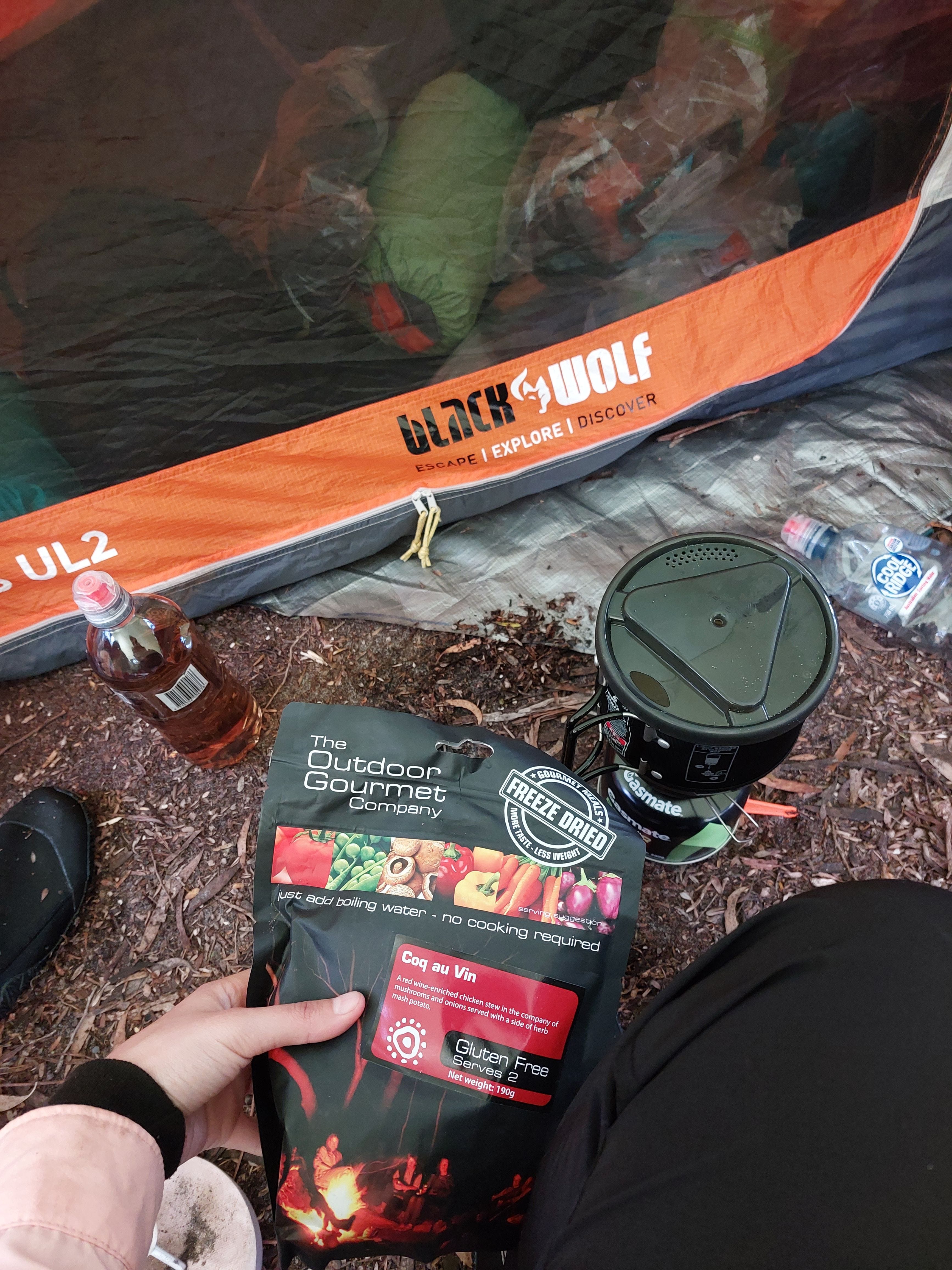
We walked up to one of the Walker’s Huts and found two other cold hikers sheltering. We had some laughter, some chit-chat about the trail, shared learnings and waited for the 3 pm flight. I got inside my sleeping bag to warm up and had lunch. My foot was much better after the rest.
It was my first time in a small aircraft. Very cool. We enjoyed the scenic flight (wish I could take some photos) back to Hobart.
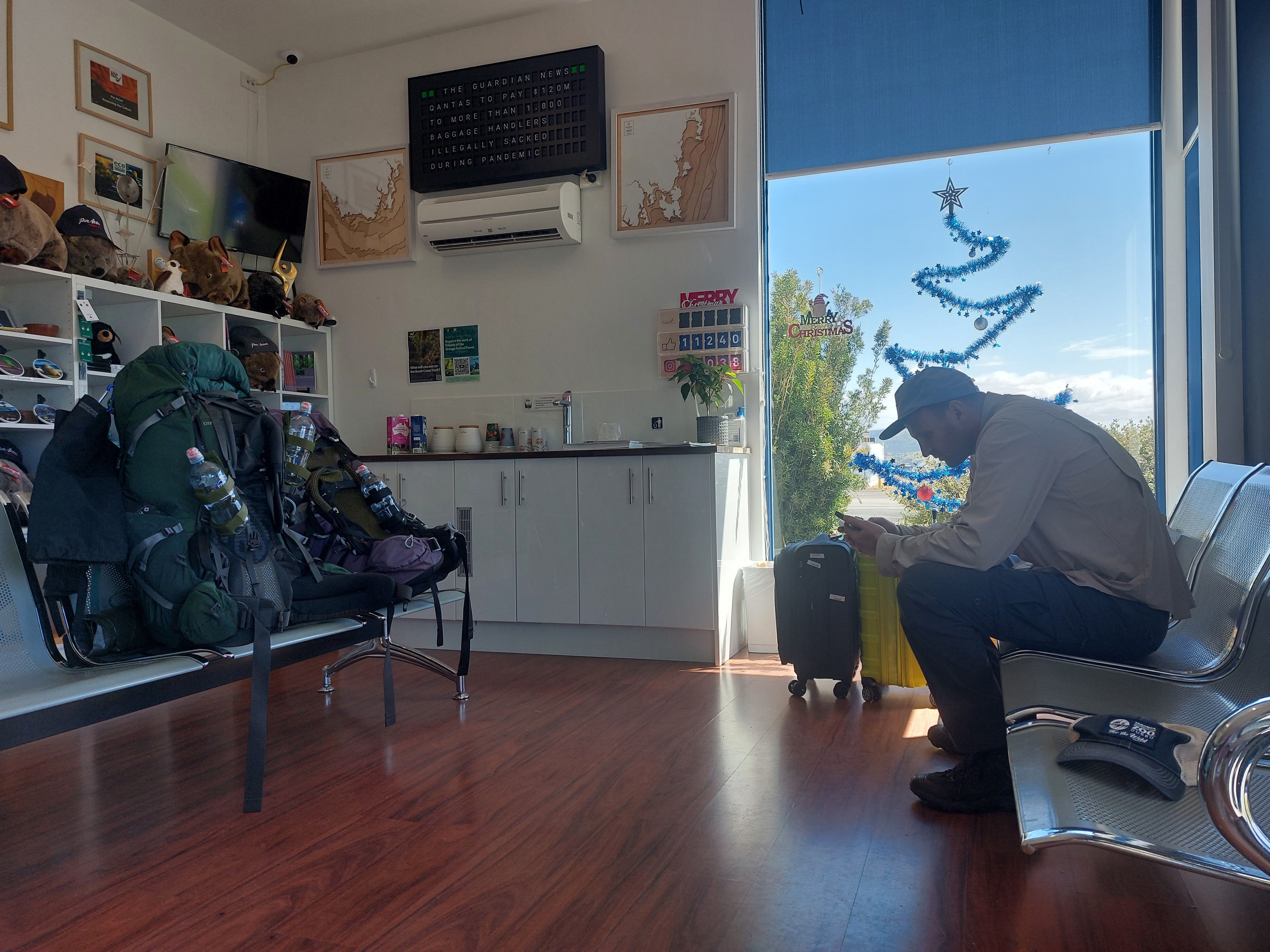
At Par Avion, we called a taxi to our motel, took a long shower and a hot bath. We ordered 2 double patty burgers, a large milkshake and 3 sides to share. I don’t think I ever ate this much in one go before. We demolished everything.
My hair after a week of tight braids.
Following Days in Hobart
We spent the 30th and 31st of December, and the 1st and morning of the 2nd of January in Hobart, mostly inside our motel, on the bed. We did some writing, reading, watching the tennis and Indiana Jones movies. We could not help but excessively talk about the hike and look through our pictures of the hike.
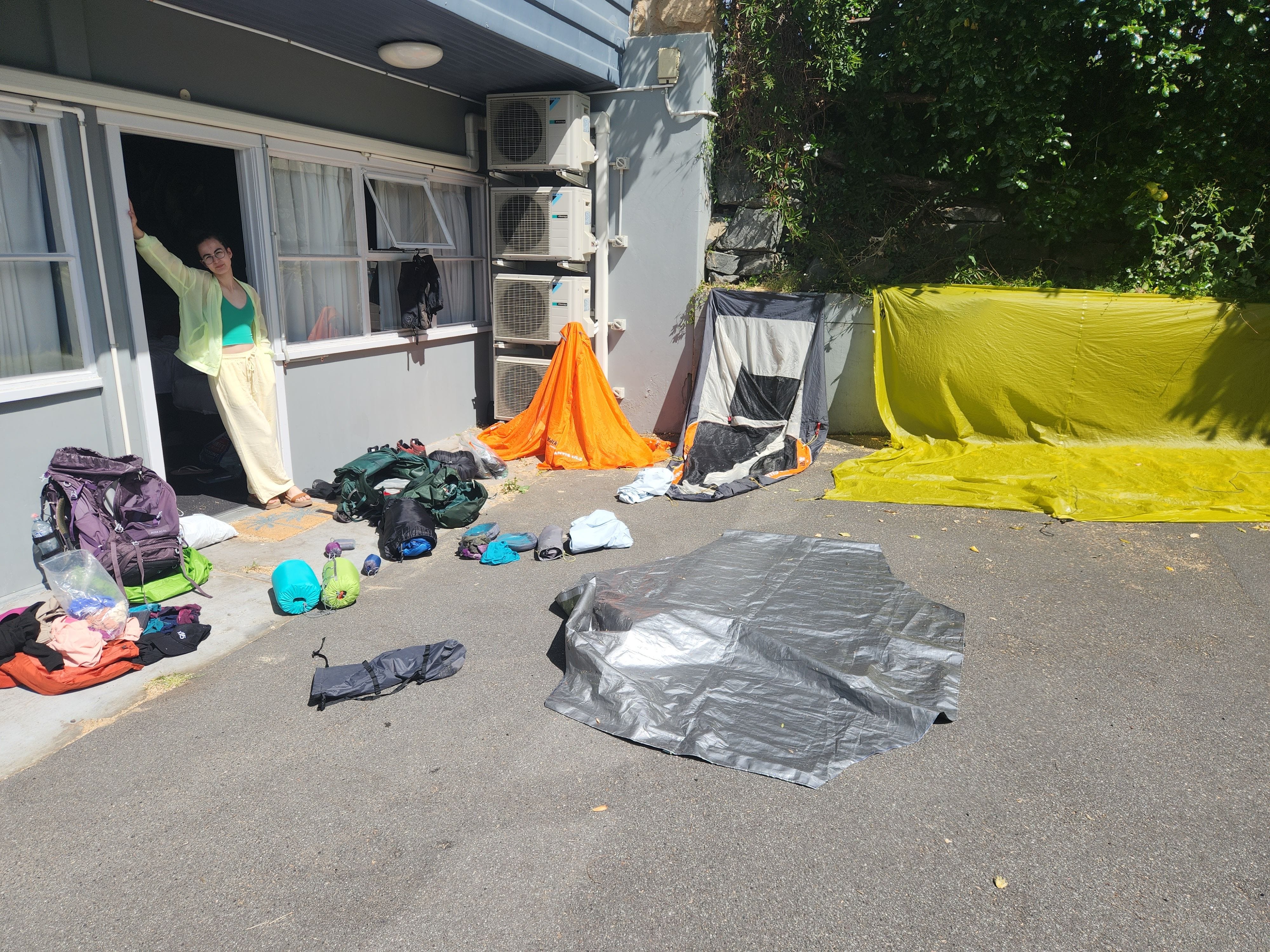
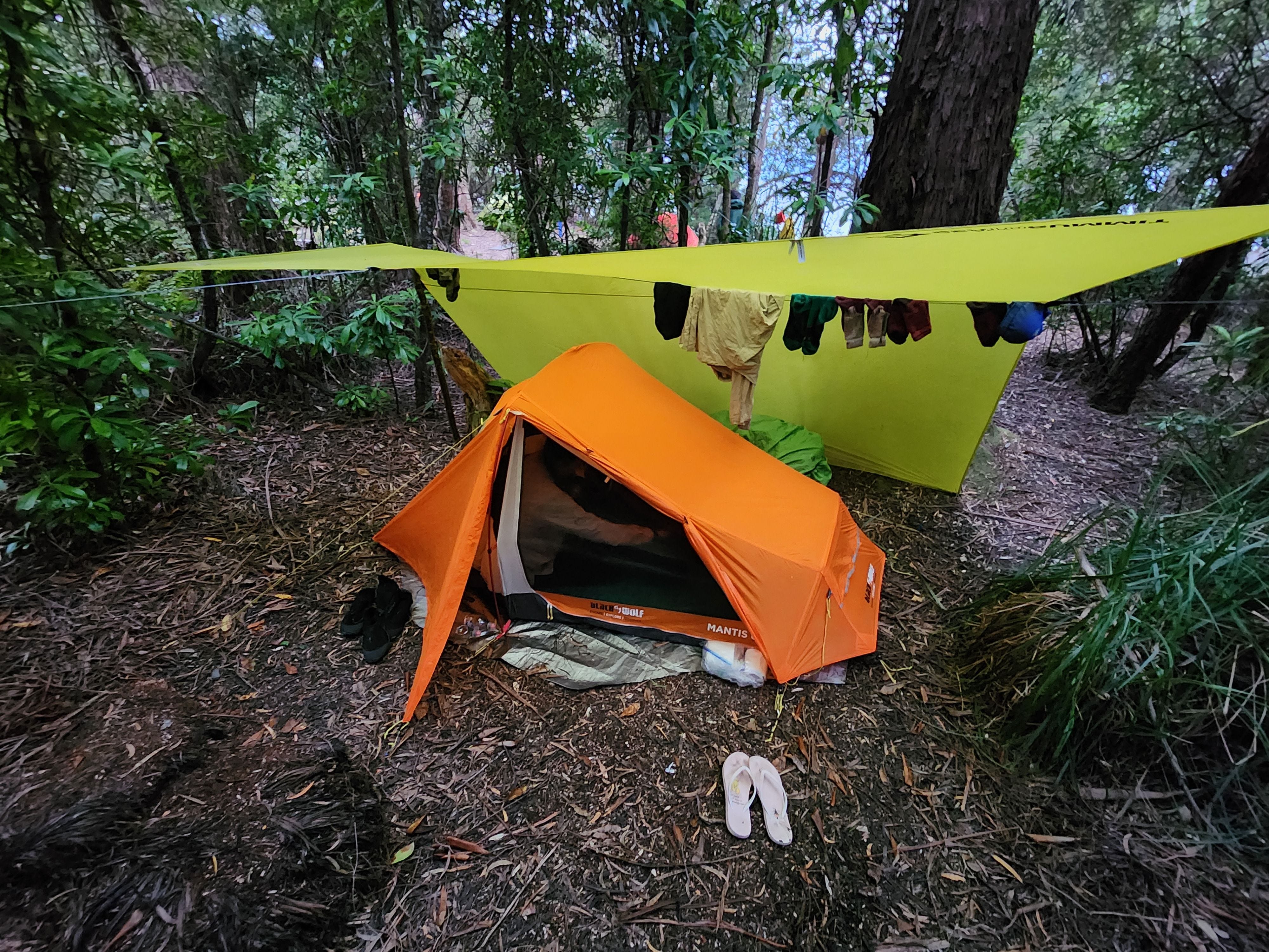
Drying our gear outside the motel room.
I took some short walks to test out the foot and booked a physio in case it’s something serious. We Ubered ourselves to cafes and restaurants. We had excessive hunger for the first 3 days after the hike. I was comfortably consuming double the amount of calories I usually have and still leaving the meals not feeling full.
Back in Sydney, my foot was only feeling about 1.5/10 and I could easily walk to the physio and navigate myself around the city. Overuse flexor hallucis brevis (left arch of my right foot) — nothing serious but need to take a week off from running (maybe two depending on how I feel).
Additional Thoughts
Flights may be cancelled/delayed according to the weather conditions. Make sure you bring enough emergency food to cater for this situation.
Talk to the other hikers on the trail. Don’t be shy. Trail conditions can change overnight, so asking people coming from the opposite side about what to expect and where to collect water can be very helpful.
Be spontaneous. You are out in the nature. If the mother nature wants you to cross a river, do it. If the tide is up to your neck, then wait until it’s safe for you to cross. Drowning incidents have happened in the past and there are warning signs along the trail for it. Don’t force your perfect plan if the weather or trail conditions are not allowing you to proceed. There is nothing wrong with taking a rest day.
Check yourself for leeches before going to sleep. You can remove leeches by holding them, twisting and pulling. If you light a match they will let go naturally.
On most campsites, you’ll notice ropes hanging from branch to branch. You can use those ropes or tree branches to hang your wet clothes up.
Do NOT rush. This trail involves steep descent, uneven ground and overgrowth. It’s either wet or muddy which creates slippery conditions. Move at a comfortable speed and get plenty of rest during the day, even if it means you arrive at the next campsite a little bit later than you had hoped.
It’s very reasonable to take a rest day on the trail. It will help your body to recover, reduce the risk of injury and enjoy nature a bit more.
You cannot take a gas canister on the plane to/from Melaleuca. You can purchase one from Par Avion. Plenty of people also left their full gas canisters with the rangers in Melaleuca if you want to take one.
If you stay a day in Melaleuca, you can explore the Deny King Heritage Museum.
At Melaleuca you can either camp or use one of the two walker’s huts (4 beds available in each). The walker’s huts will have a hiking logbook, magazines, books and sudoku.
If you still have tons of energy after the hike, you can continue on to the Port Davey track (takes about 5 days going North). In that case, you may choose to rest at the walker’s hut for a day or two before your next hike. You can also get food dropped off by Par Avion to pick up in Melaleuca.
Don’t make tight bookings around this hike (i.e. book your flight back to Sydney 1-2 days after the hike). We met with people who completed this track a day later than what they originally planned and weather conditions can really impact pick up / drop off from Melaleuca.
If you are not from Tasmania and your hiking experience is limited to the other states, you might get a bit shocked. Make sure you study the trail very well before attempting.
Questions: if you have any questions about my notes, drop a comment and I’ll reply.