
Rees to Dart Track (South Island, New Zealand) Walker’s Notes

We completed the Rees-Dart track on the 20th of April 2025. I wrote an overview of the trail in my previous post (includes a map, packing and training guide).
Note: pre & post hike notes are at the bottom.
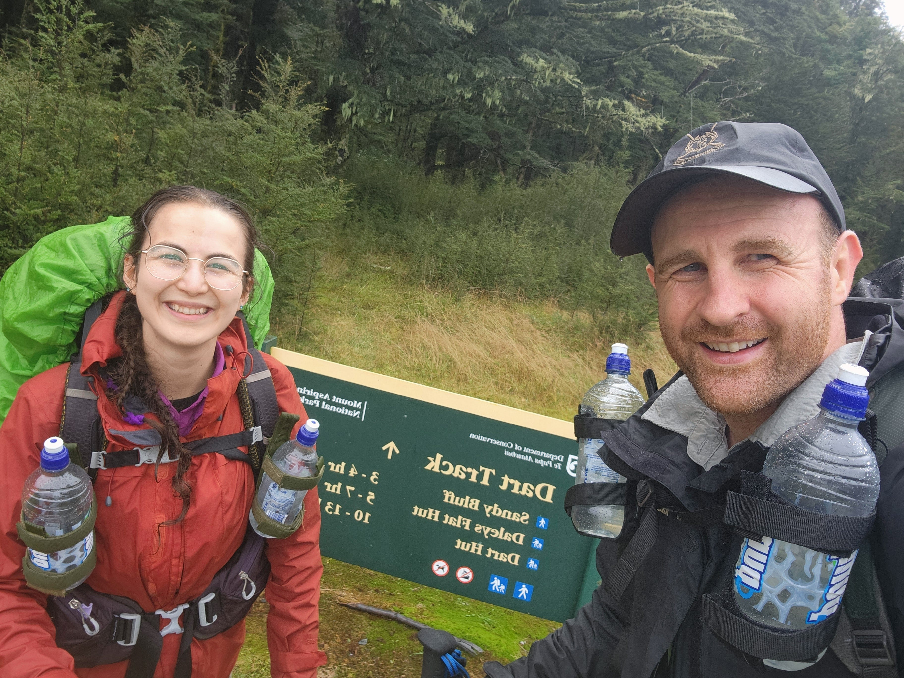
Day 1: Muddy Creek Carpark (Rees) to Shelter Rock Hut
21.5km, 6 hours 15 minutes
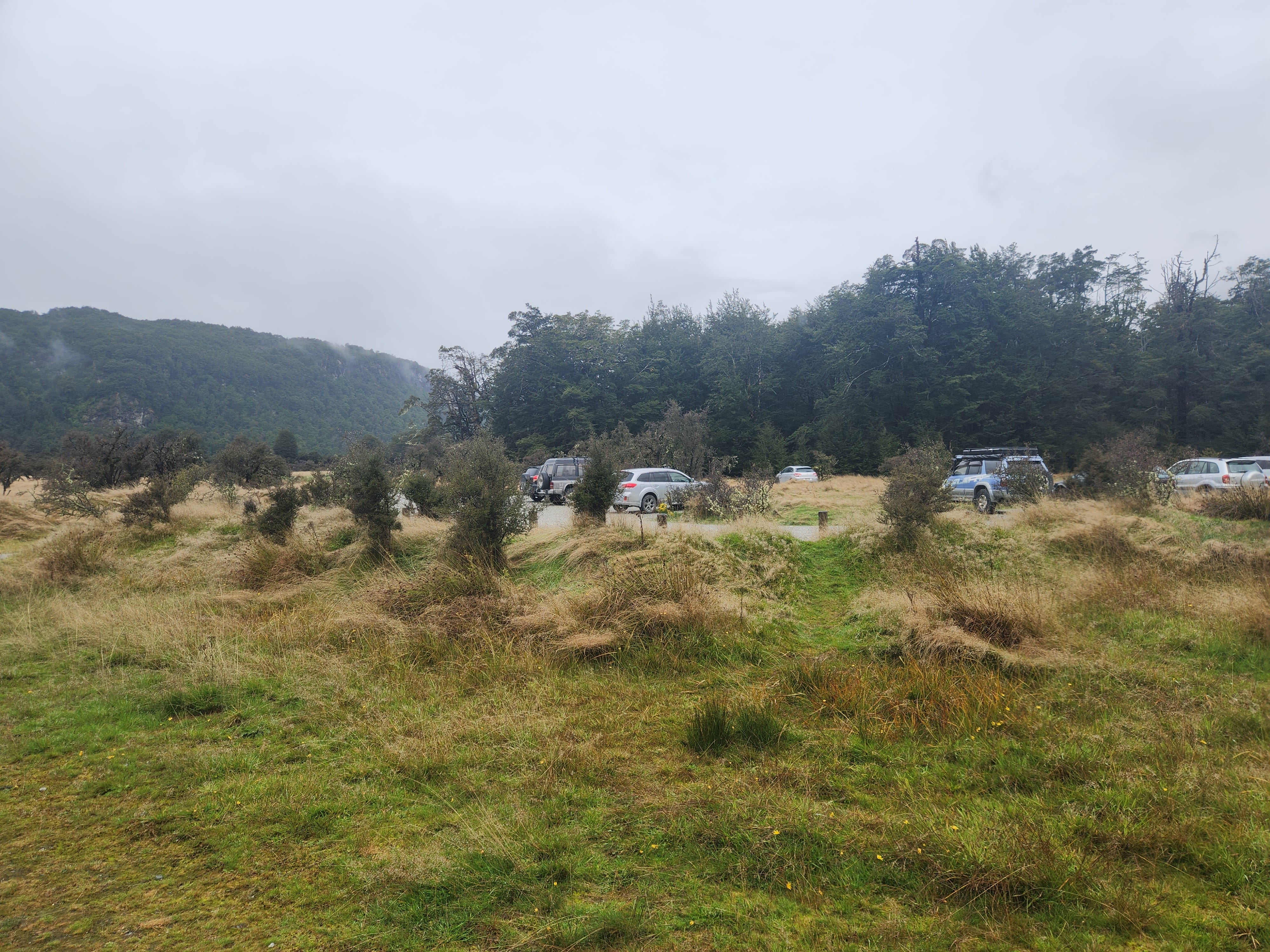
We had coffees, pies and shared an Anzac slice in the morning while waiting in front of the Info & Track office. I was fully rugged up with gloves and a beanie. We paid $10 per night per bag for storage at the counter. Apparently, you can also hire hiking gear from there if you’re missing items.
The shuttle bus (more like a van) departed at 8 am with only one other hiker. This was surprising given the large group waiting for a large bus for the Routeburn Track. Rees-Dart was definitely a hidden gem!
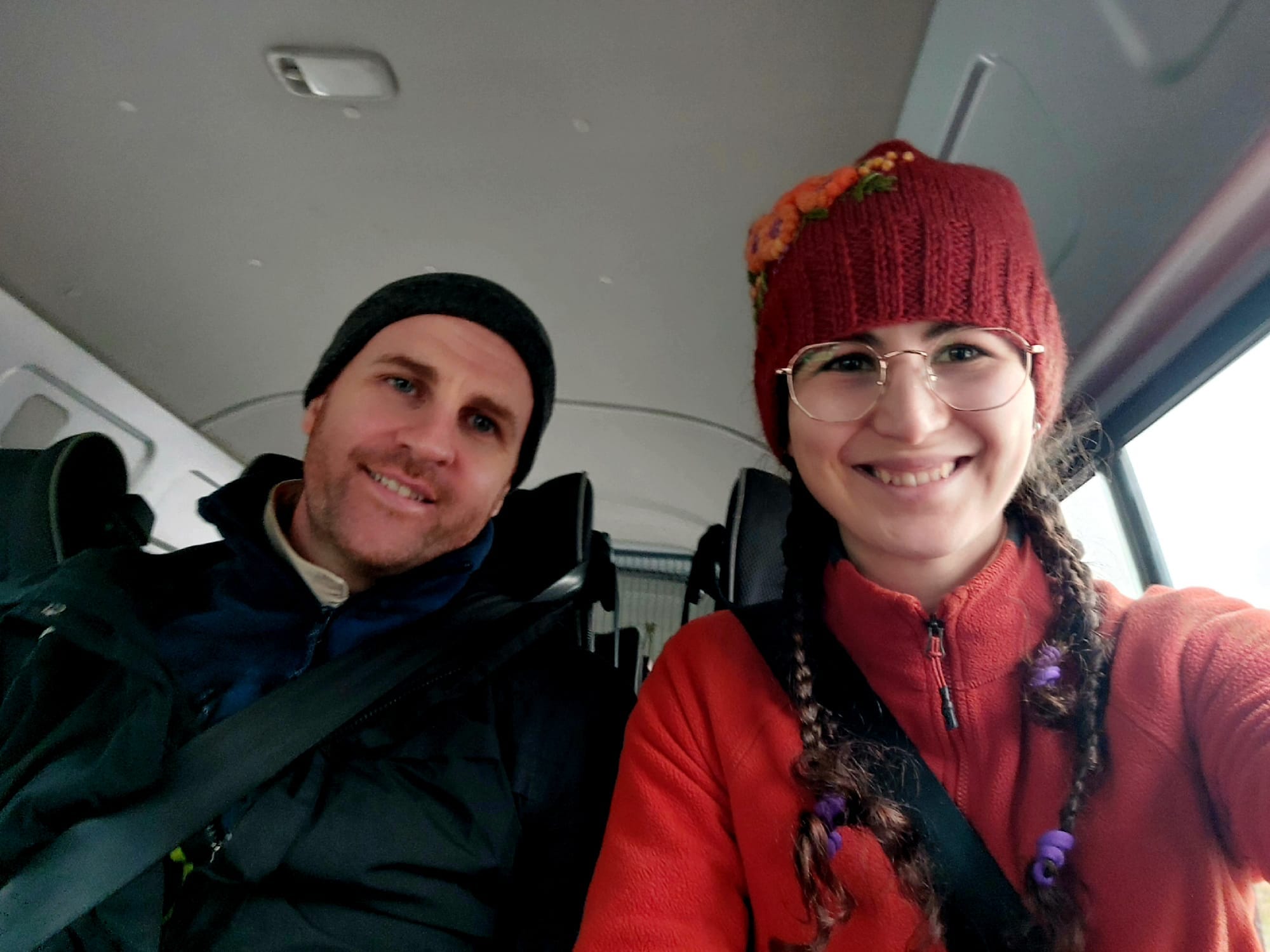
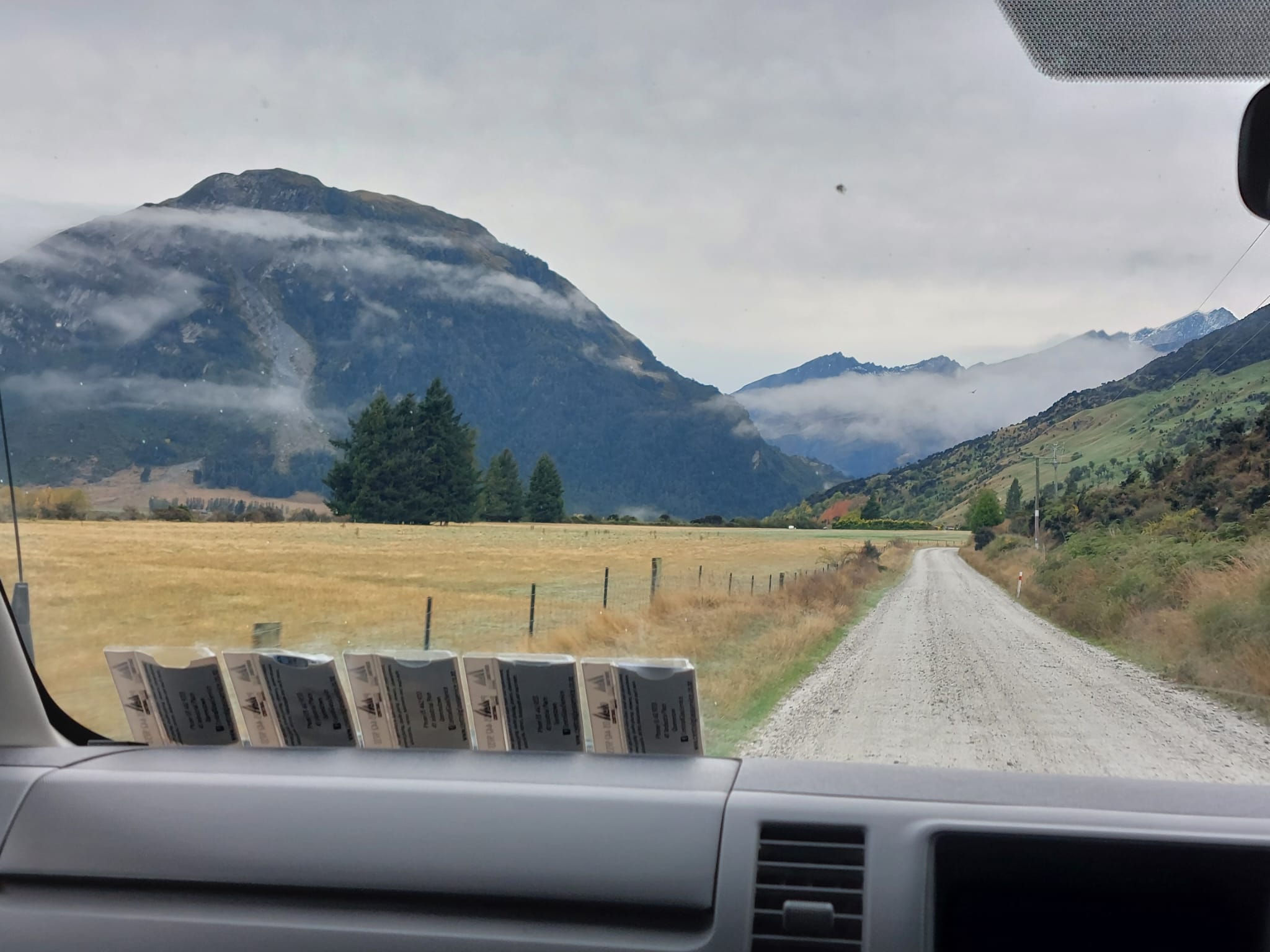
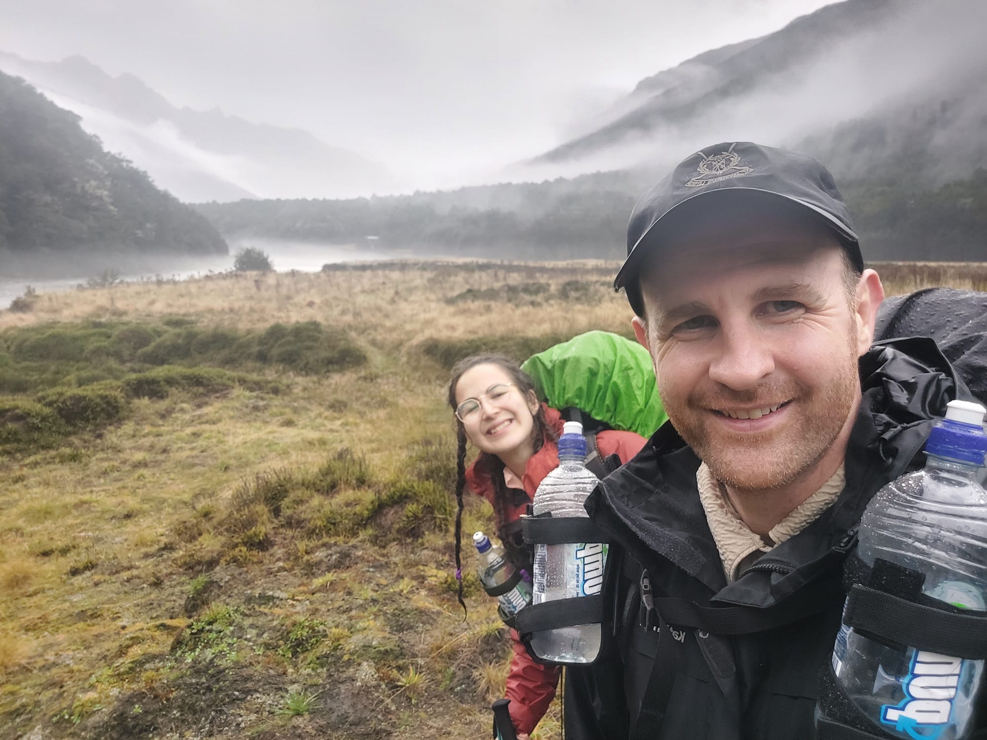
The ride took about 1 hour 30 mins and it was quite scenic looking out to Lake Wakatipu. On the way, we saw mountain goats, deer, wild rabbits and farm animals. We stopped at Glenorchy for a bathroom break. We took some pictures and kicked off our hike at 9.30 am exactly.
David was stressed about the 21.5km distance and sunset at 6 pm. “We’re between the mountains. It’ll be fully dark at 6 pm, we’ll also stop for a lunch break, we don’t have time” etc. I had almost no worries given that the elevation on the first day is very minimal, we are fast walkers and 8 hours is more than enough time. I guess one of us needs to be cautious in our hiking adventures (for safety).
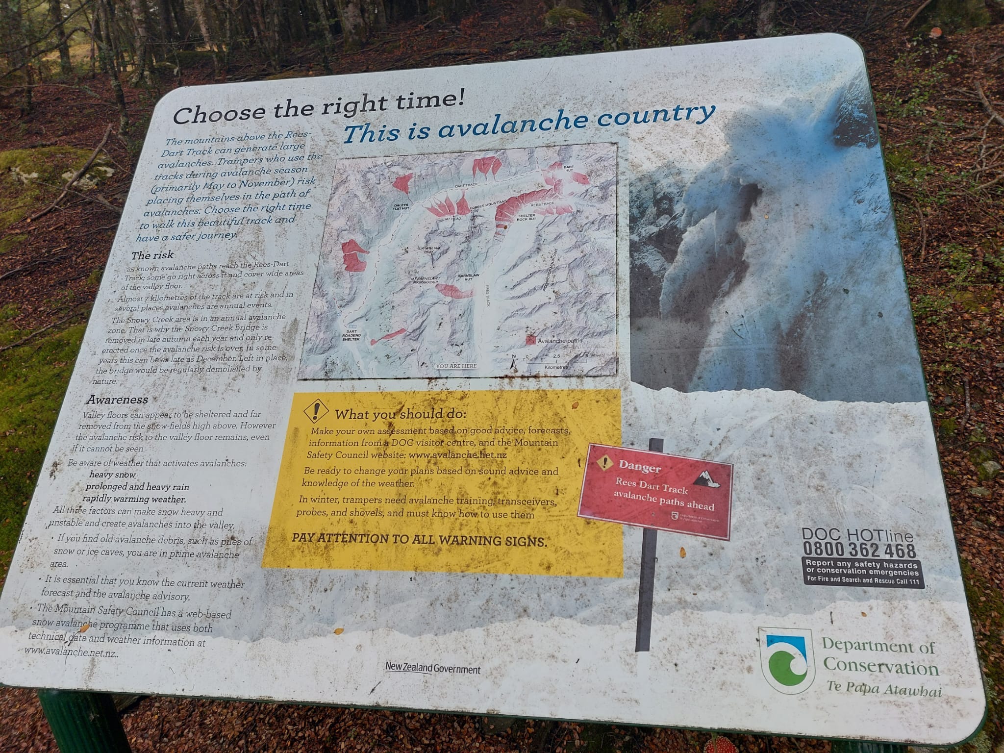
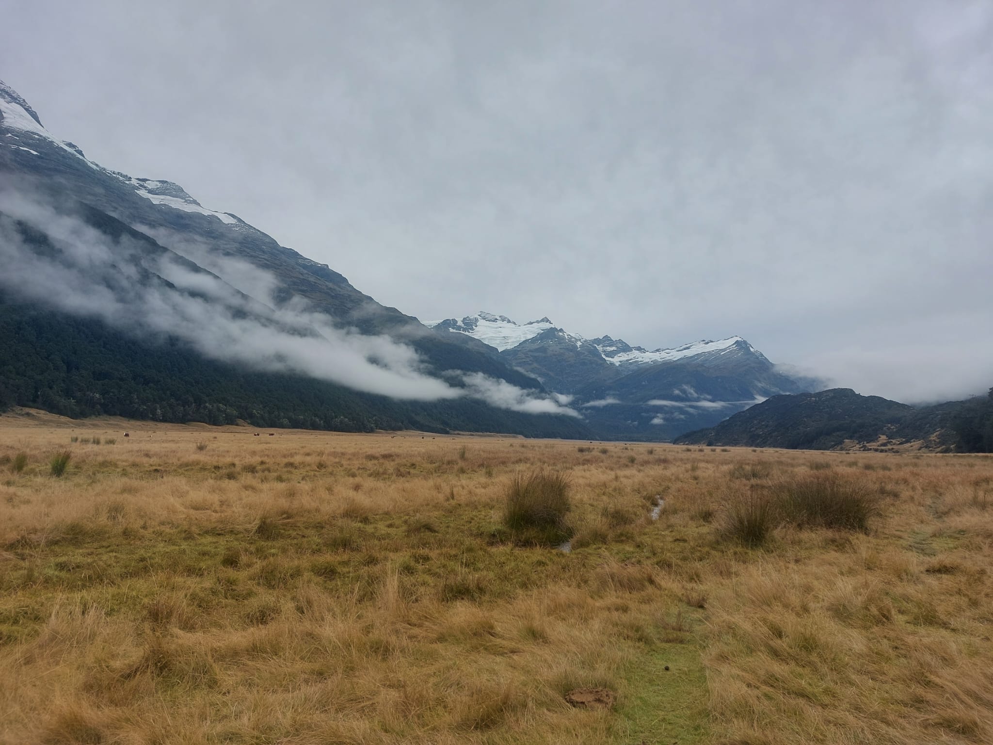
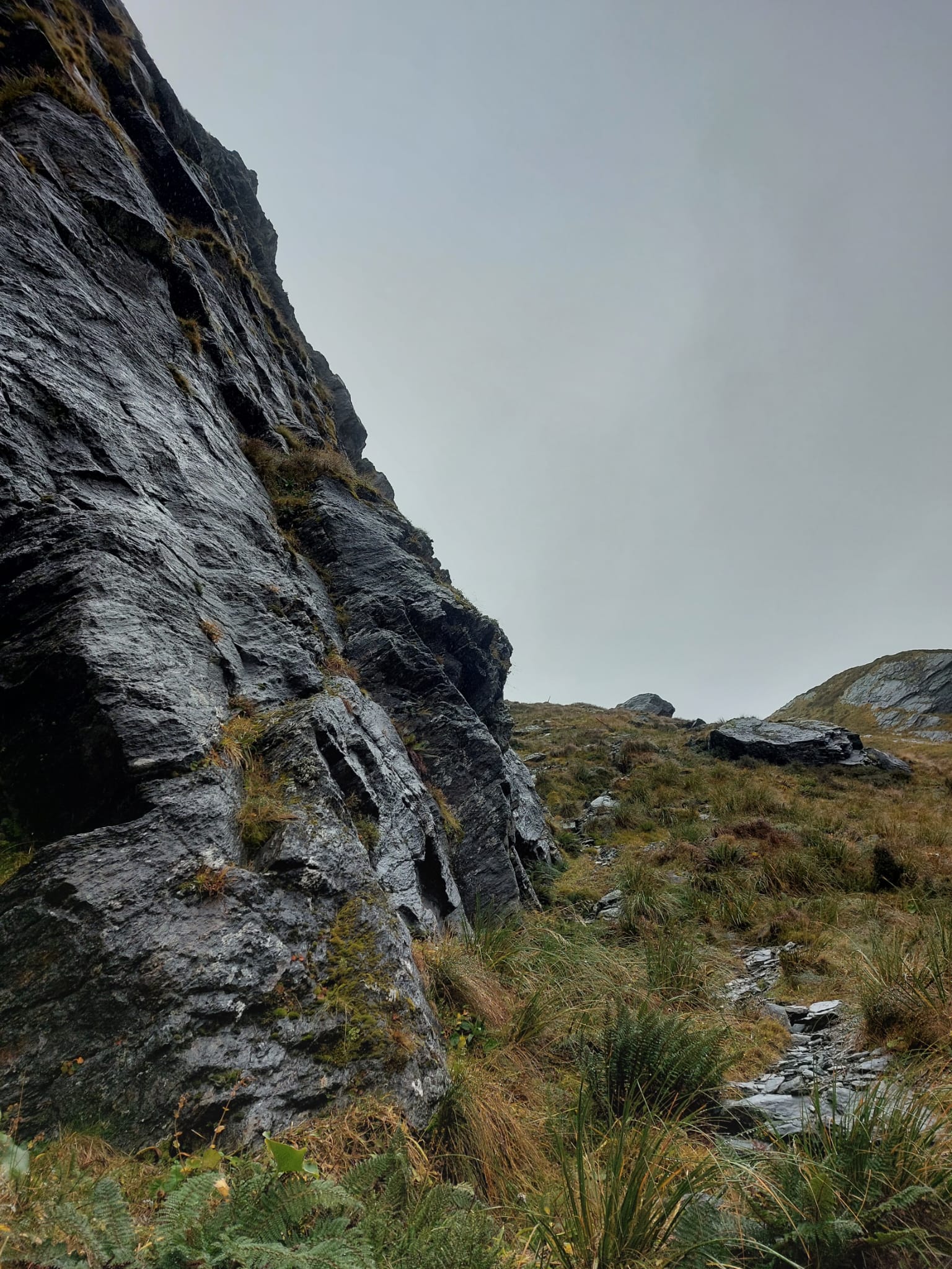
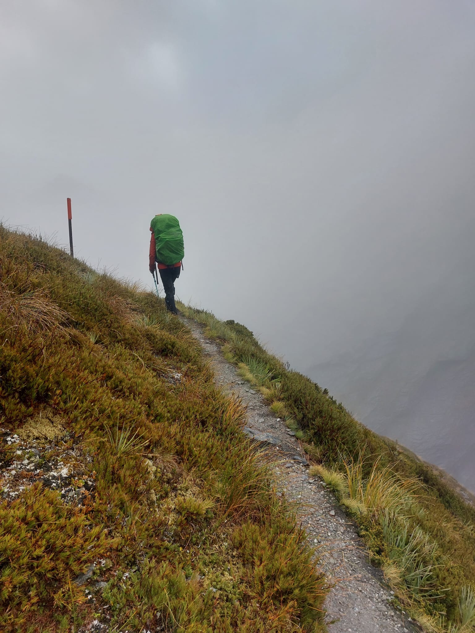
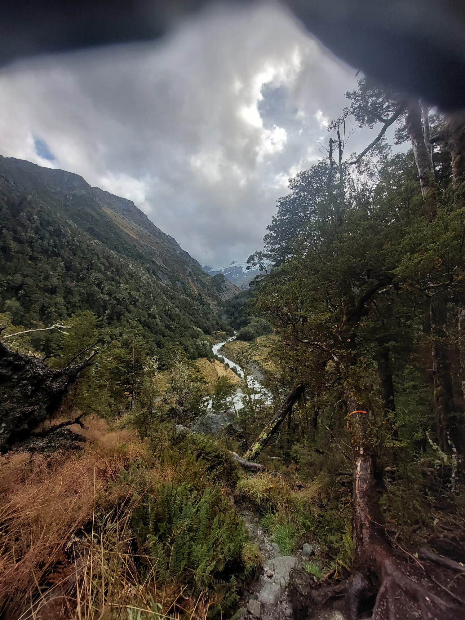
These signs are commonly found on several sections of the trail. While hiking in between the mountains, we could clearly see the avalanche zones and the landslips. I would not want to be hiking out of season or in bad weather there.
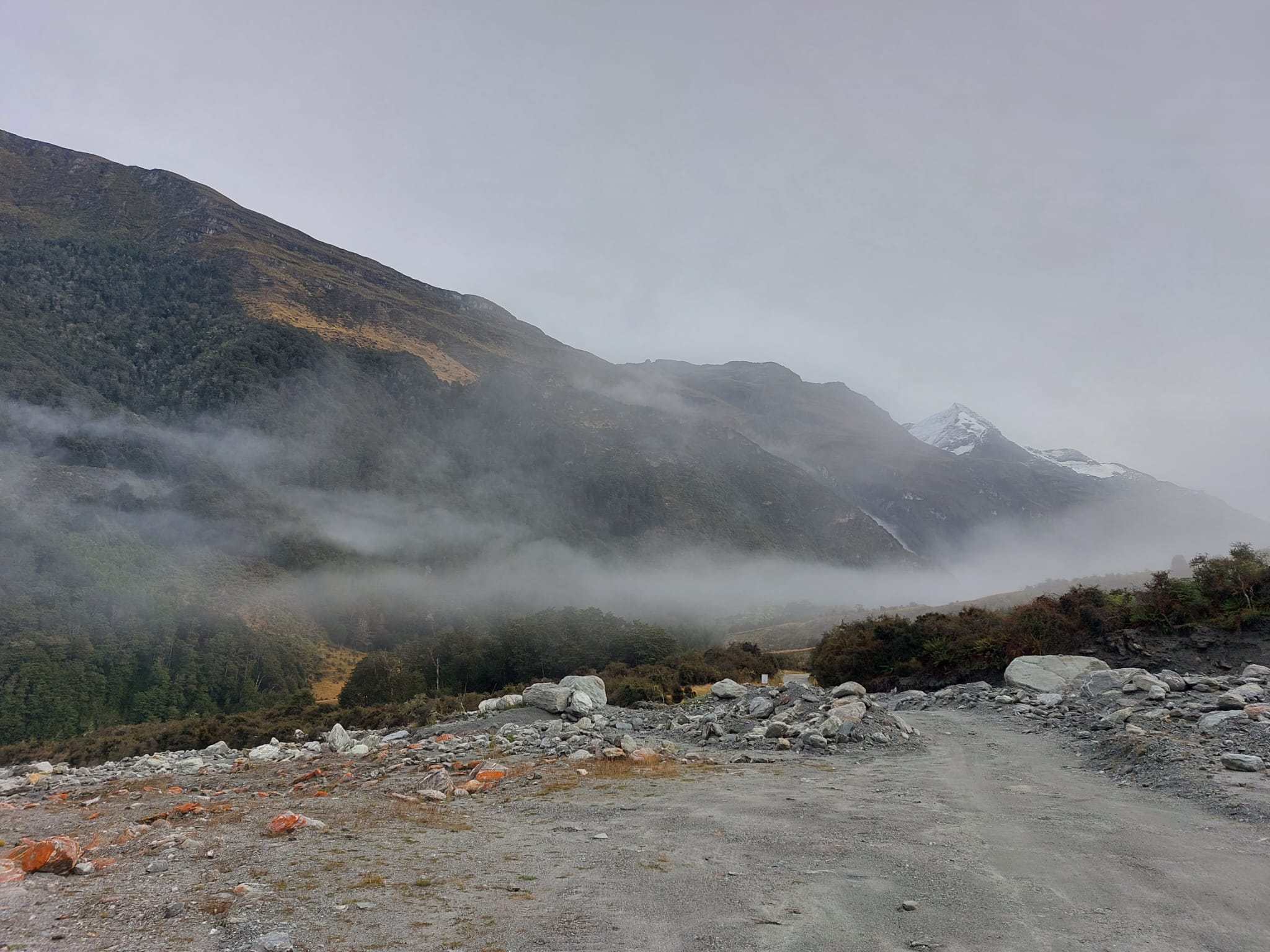
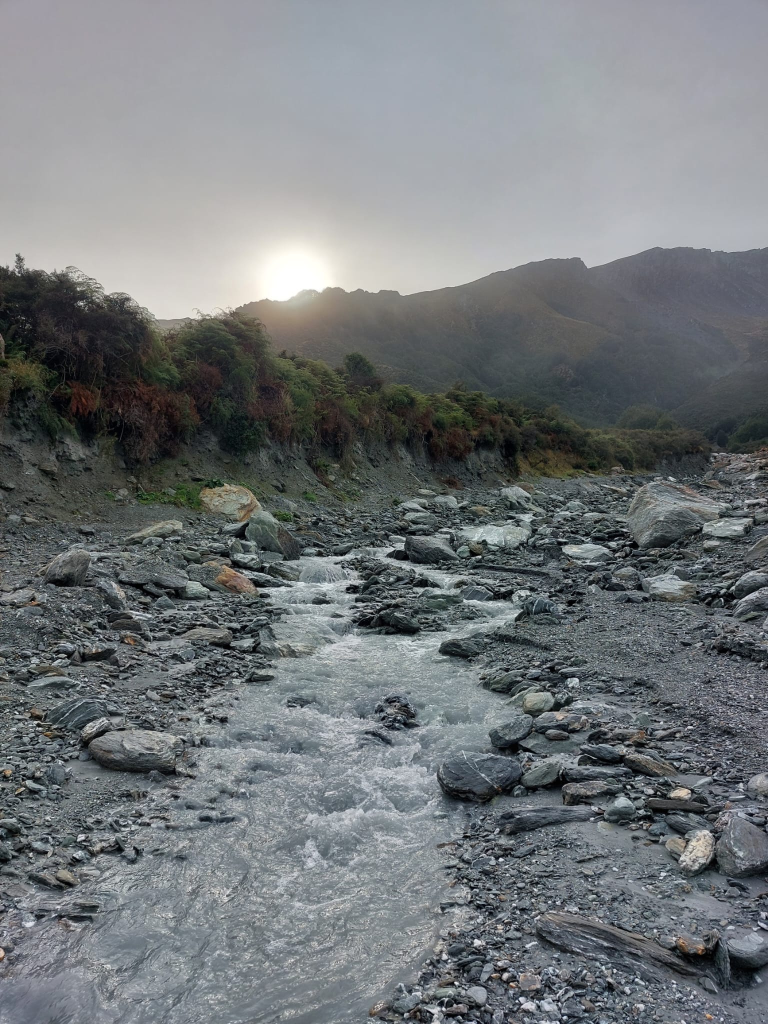
Rees-Dart trail is famous for being wet. Snow and ice from the mountain tops melt during summer and early spring, filling the river and creating waterways. I can confirm/validate the rumours. It is wet. Every day is wet.
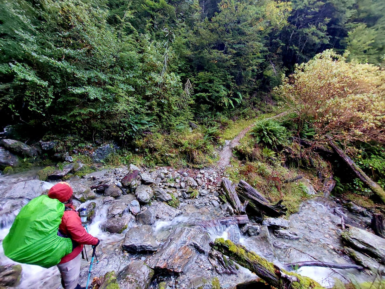
7 minutes into the hike we crossed a waterway ankle-deep. Good that none of the waters we crossed were any deeper than knee height, with the majority being only ankle-deep.
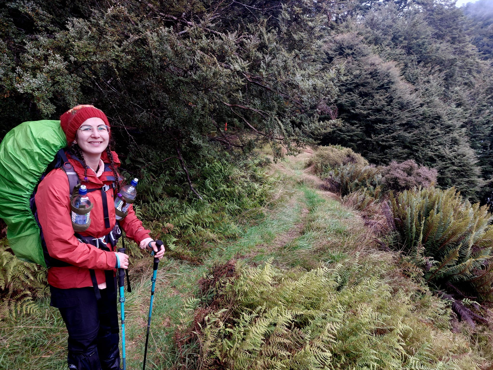
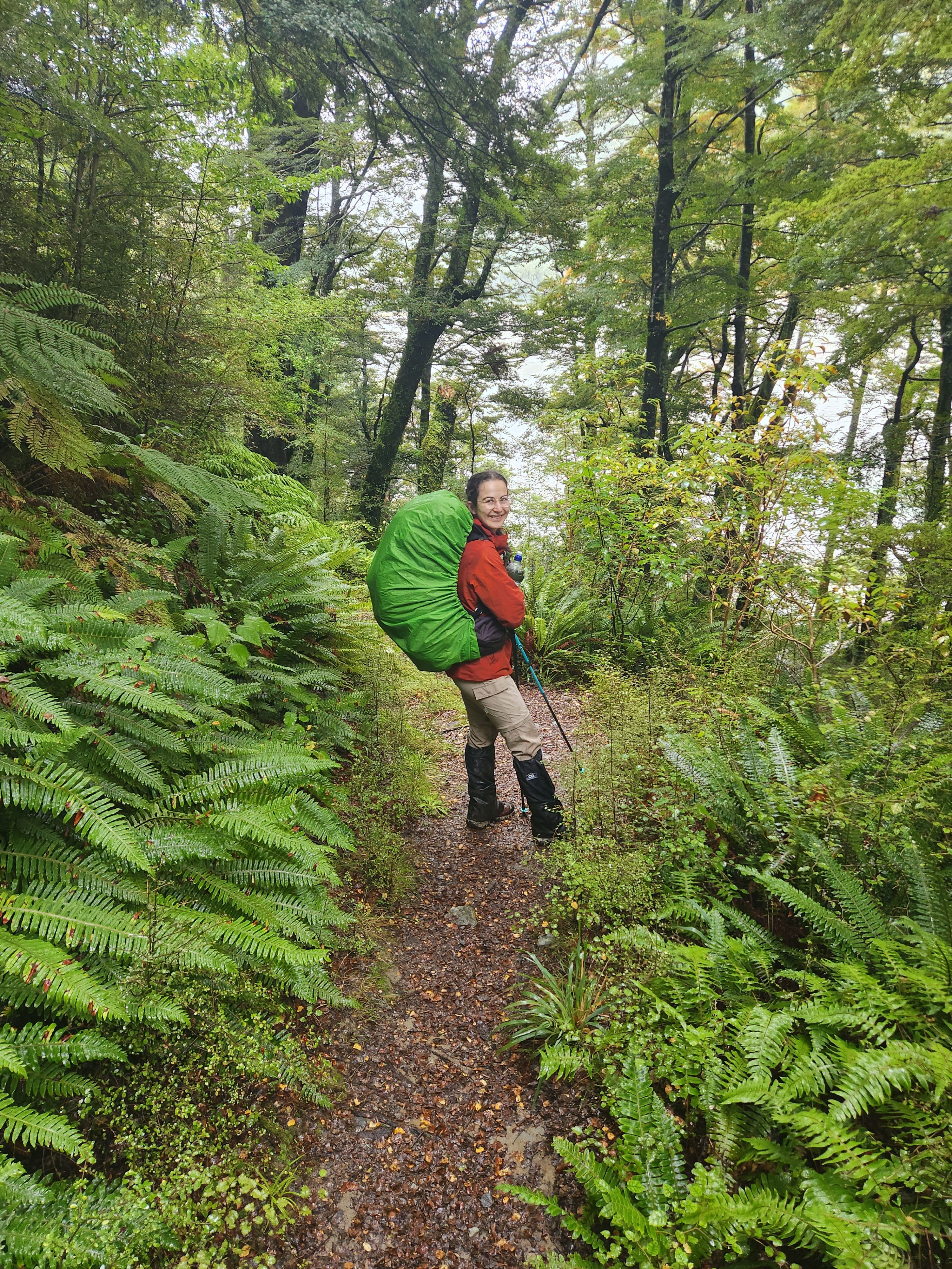
The recommendation for this hike was to wear hiking sandals on the first day, so your boots don’t get super soggy. I guess you could try to take off your boots to cross the Rees River, but we heard that the previous hikers got so sick of taking off and putting on their boots that they just continued hiking barefoot. We followed the recommendation and bought some nice sandals. However, it was like 8 degrees or something (so cold)! So we wore our socks inside our sandals. Yes, we looked a bit funny. But it worked.
Day 1 was full of small crossings where our feet got wet, then cold, and then dried out. We never hiked in sandals before (a bit dumb of us to try it out on this hike), and while they’ll put a lot of stress on the feet and ankles on difficult terrain, on the cattle flats they were great.
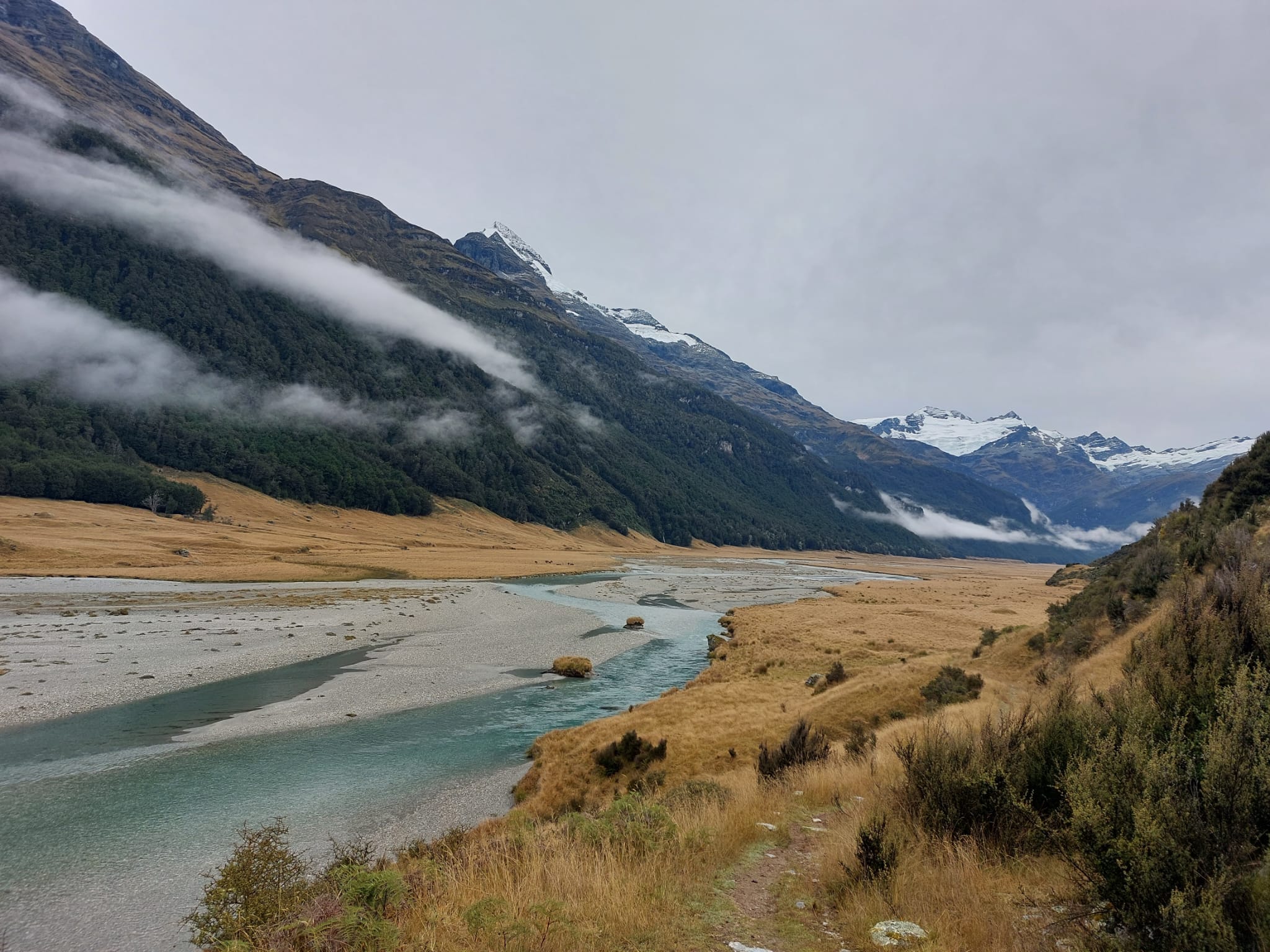
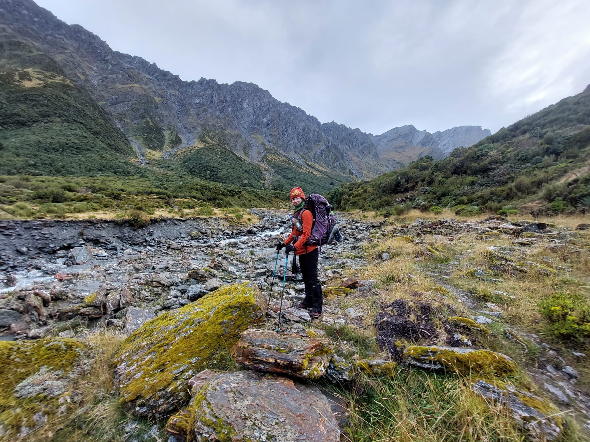
About 70% of Day 1 follows the Rees River. The first half of the trail is farmland where you can see lots of sheep and cows. I ‘baa’d at the sheep and they gave me a weird side-eye. Given the landscape, we hiked on yellow grass, fire trails or small rocks — all flat ground.
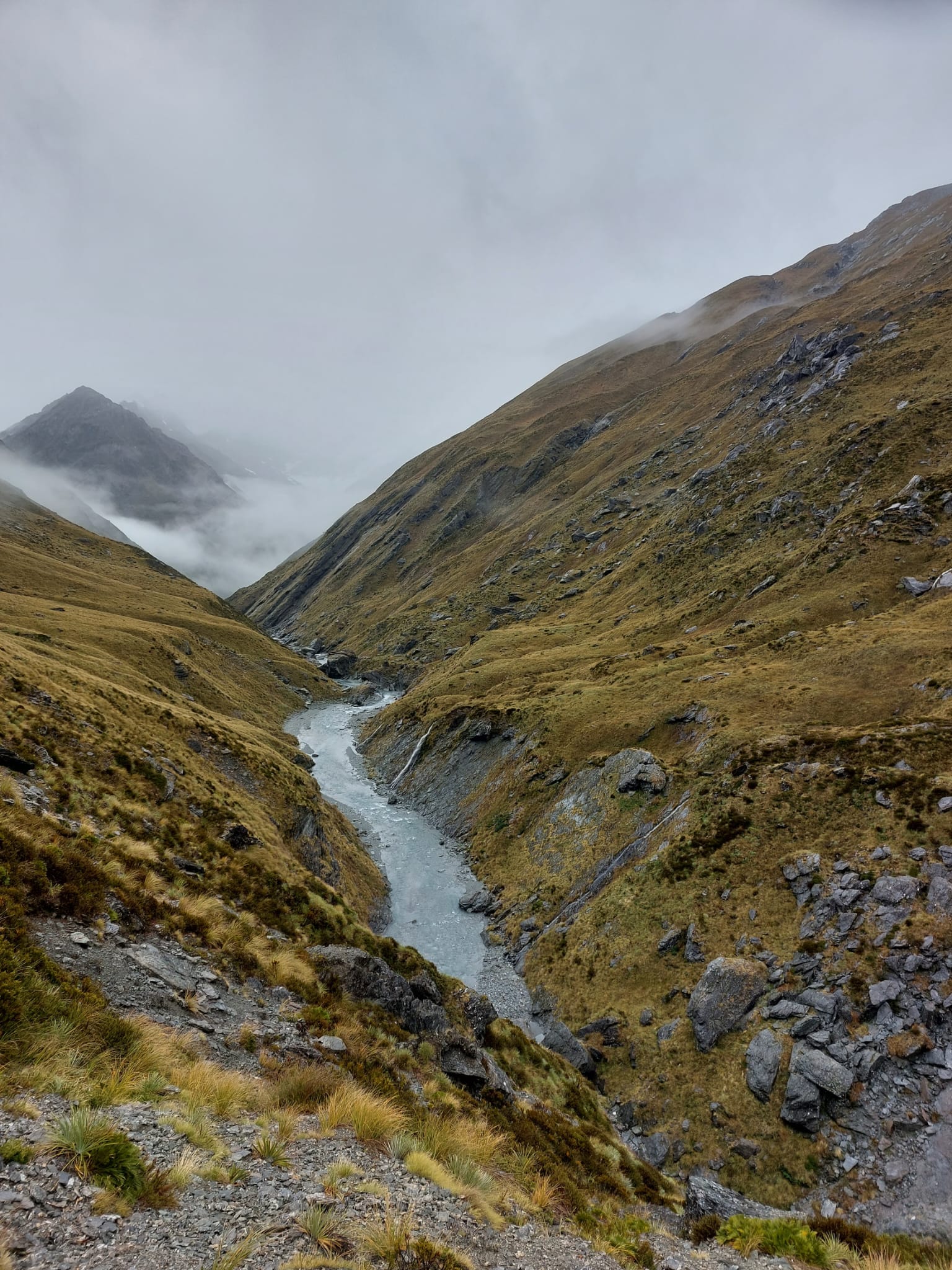
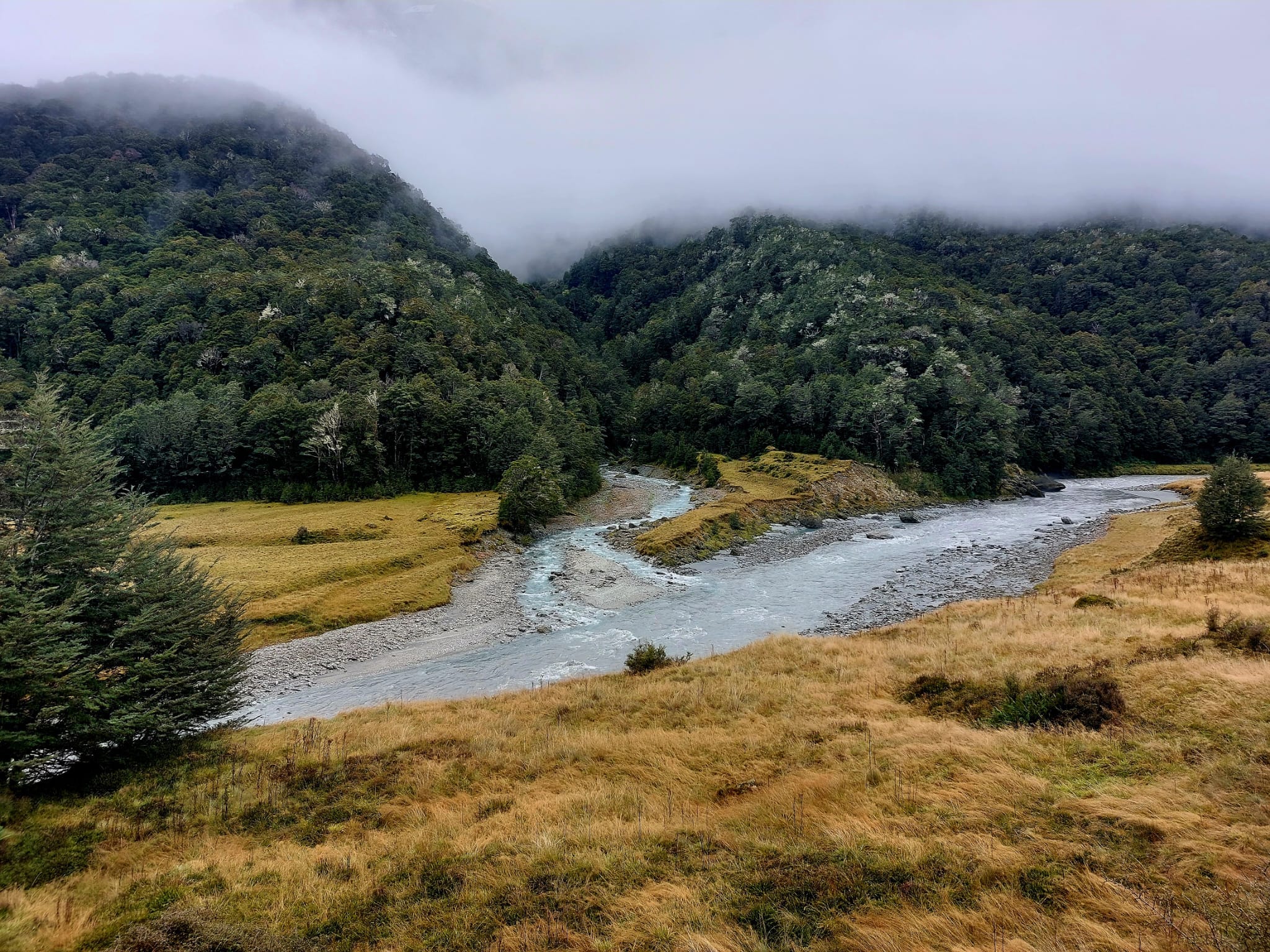
There is a 4WD drive route along the other side of the river which we saw two utes driving on. We also saw a few scenic flights and choppers above us. I can see the attraction. This is a very scenic spot. We were hiking at the bottom of a valley; mountains with snowy tops were on our right and left.Between each mountain was either a landslide (avalanche zone) or a thin but fierce waterfall, flowing down to the Rees River.
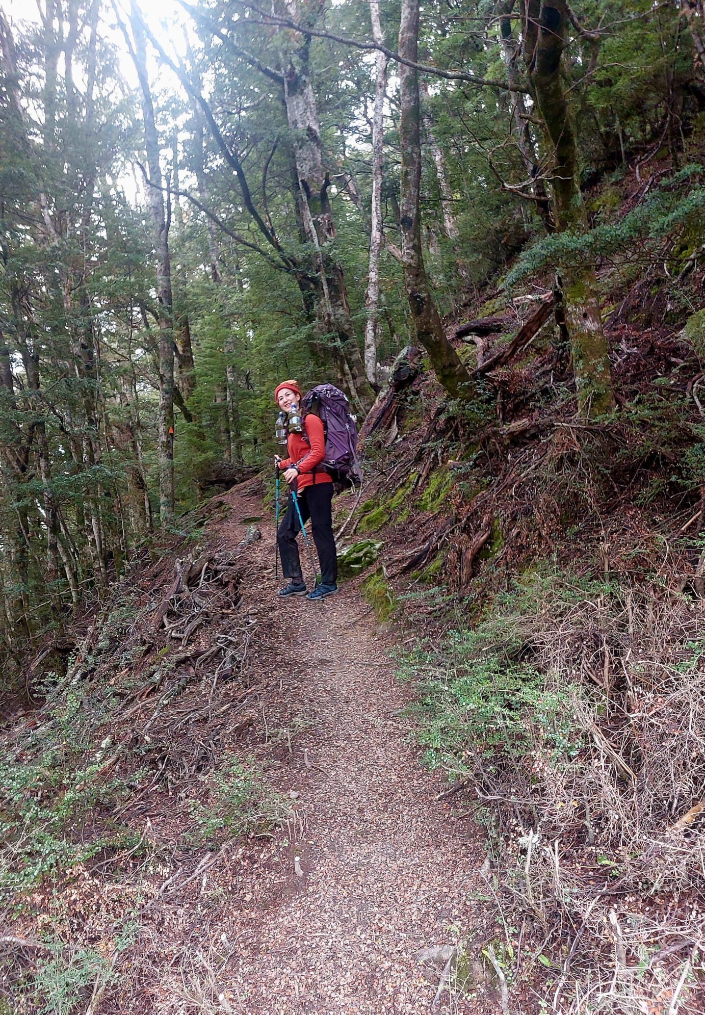
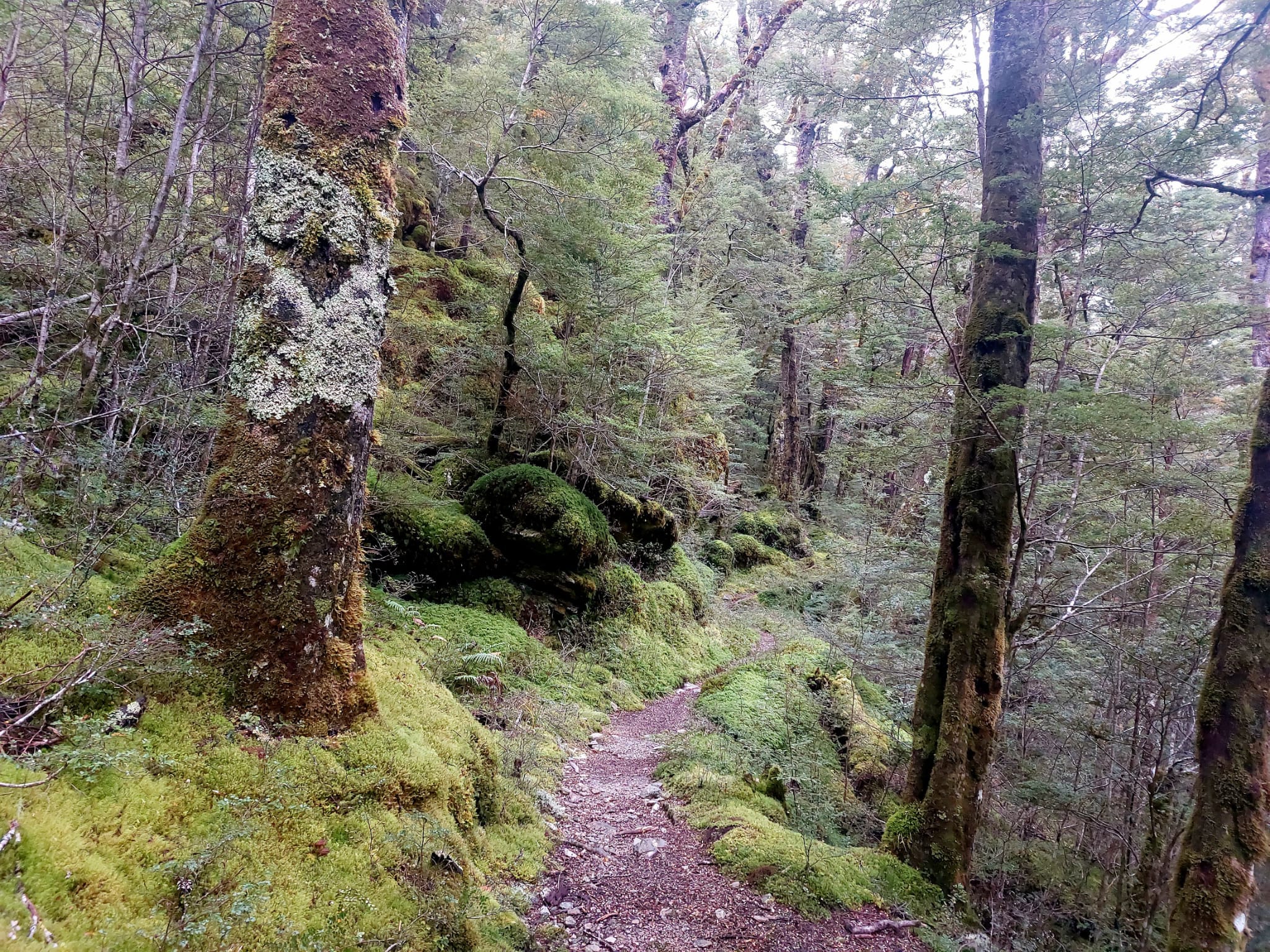
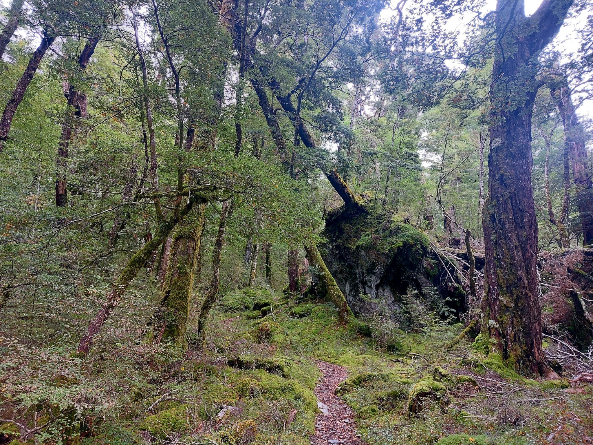
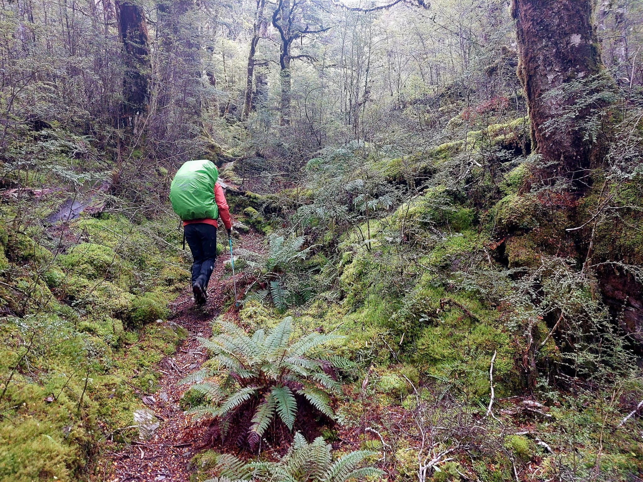
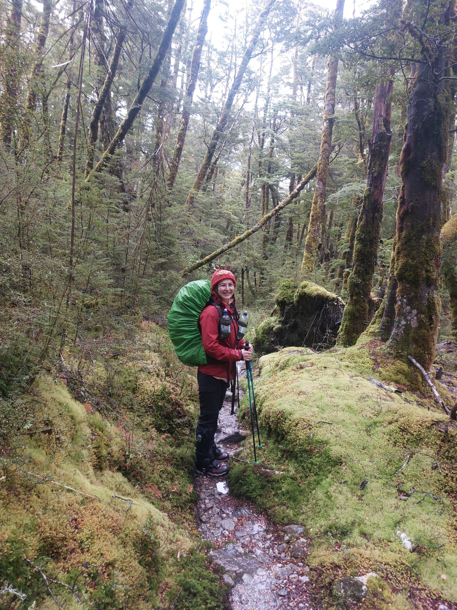
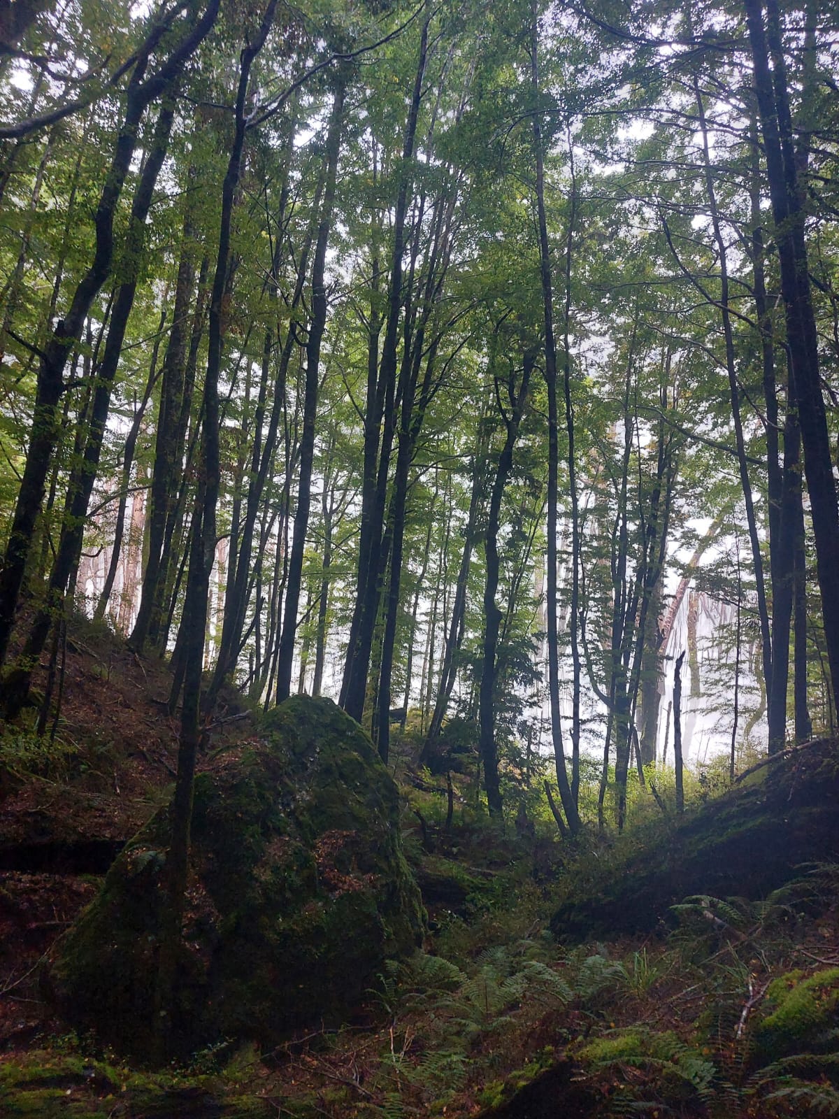
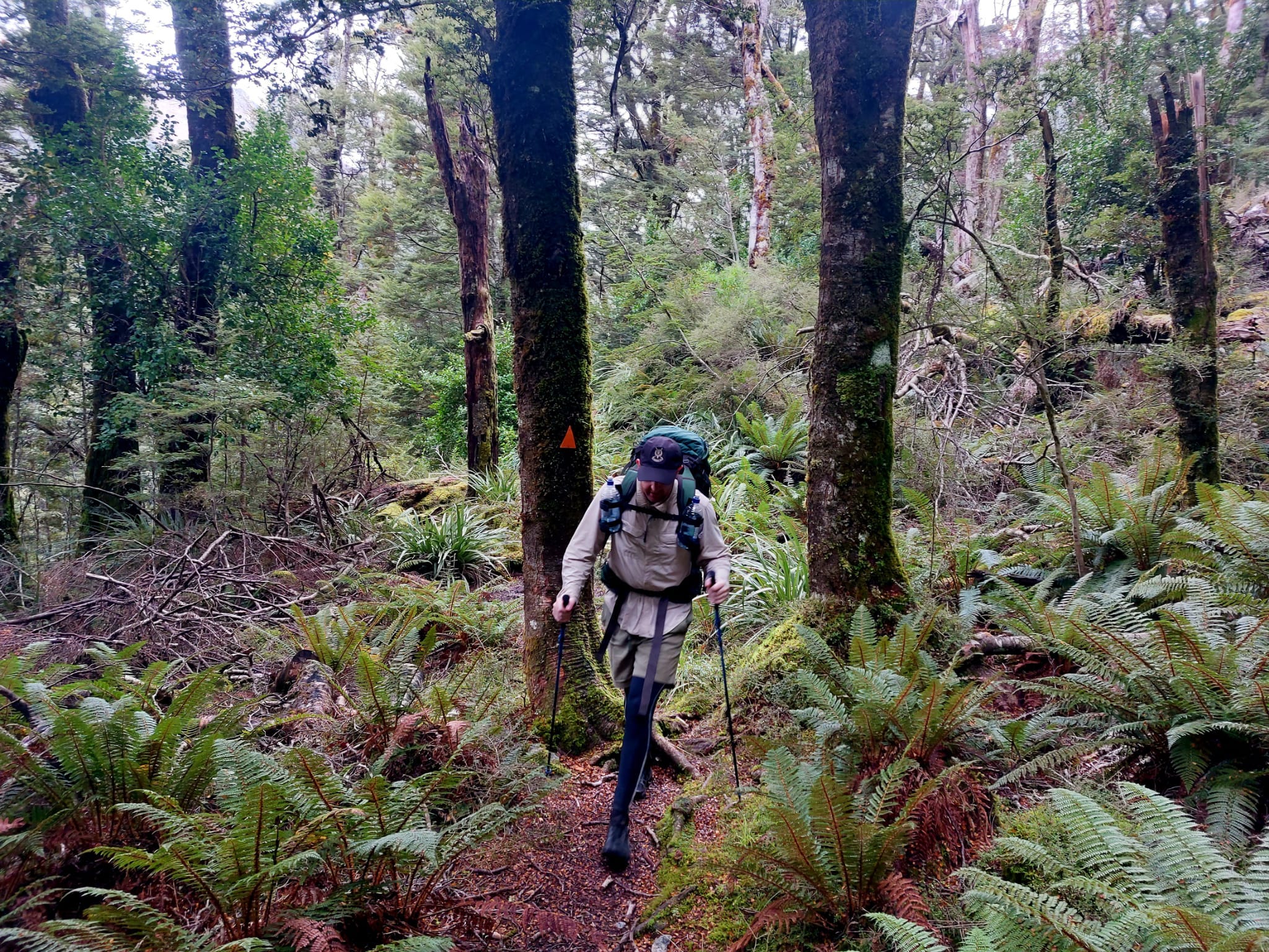
After a third of the walk, we diverged off into a rich green forest and began ascending. Clear pathway on soft soil with lots of gentle ups and downs. There were some tree roots to go over as well. We walked in and out of small forest sections a few times; entering/exiting these sections are steep ascends/descends. But overall, this trail is very well maintained.
Once we got back out onto the cattle flats, the ground was very boggy/mushy. Ankle-deep water and mud to go through for a while. It was a little slippery and lunging from one grass bump to another (to avoid the deeper mud) got our feet tired.
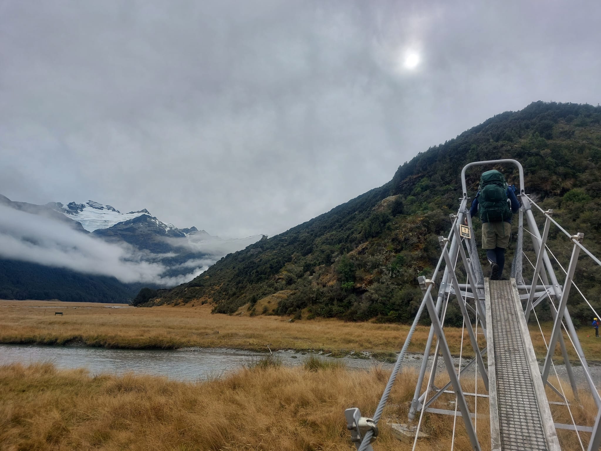
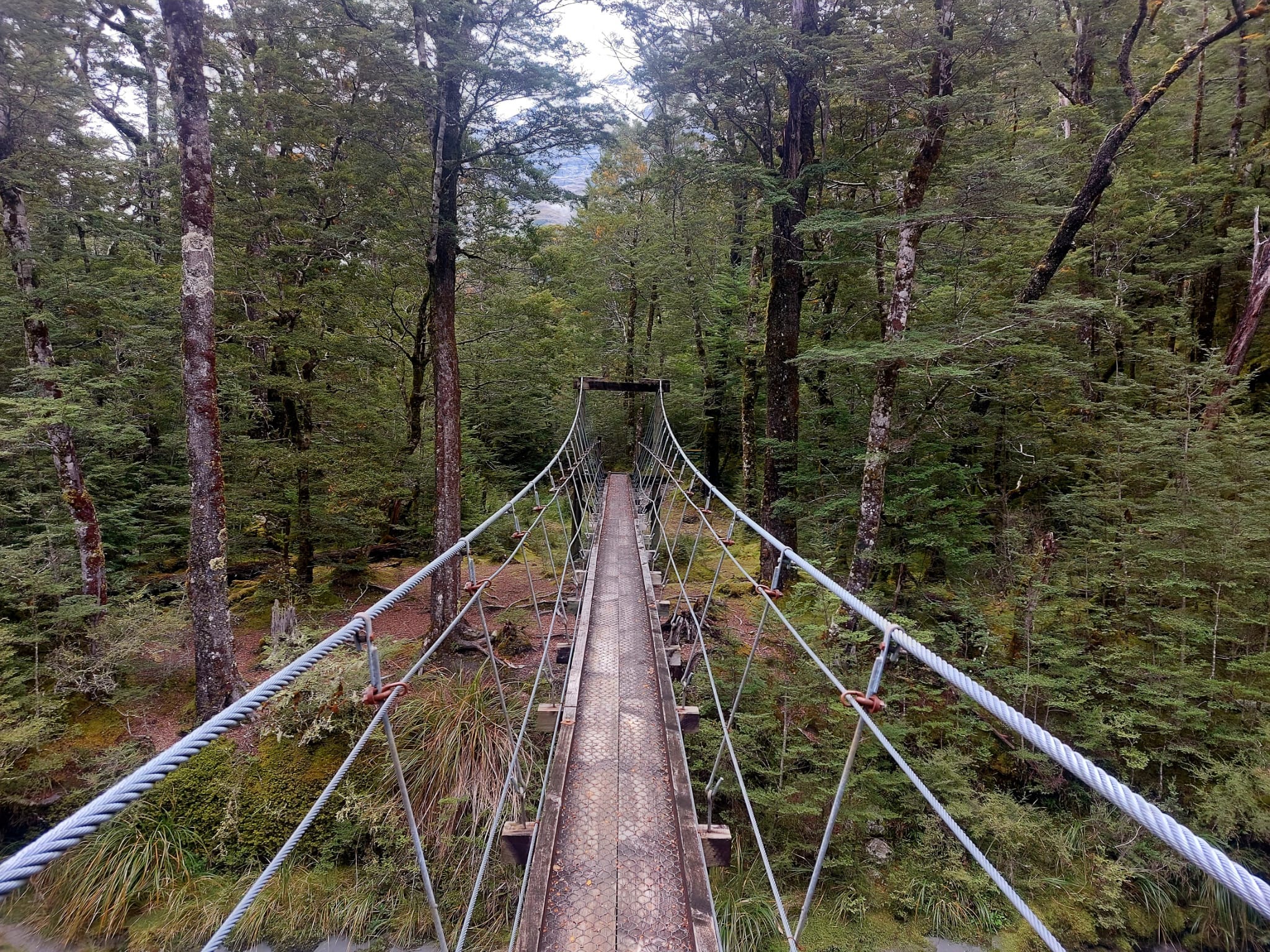
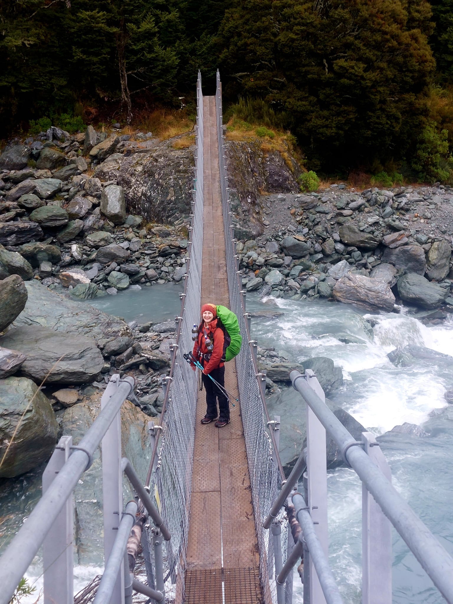
This led to a very nice, modern bridge. We crossed it and came across an excited trio with inflatable kayaks. They were probably going to catch the currents and kayak along the river. It seemed so much fun!
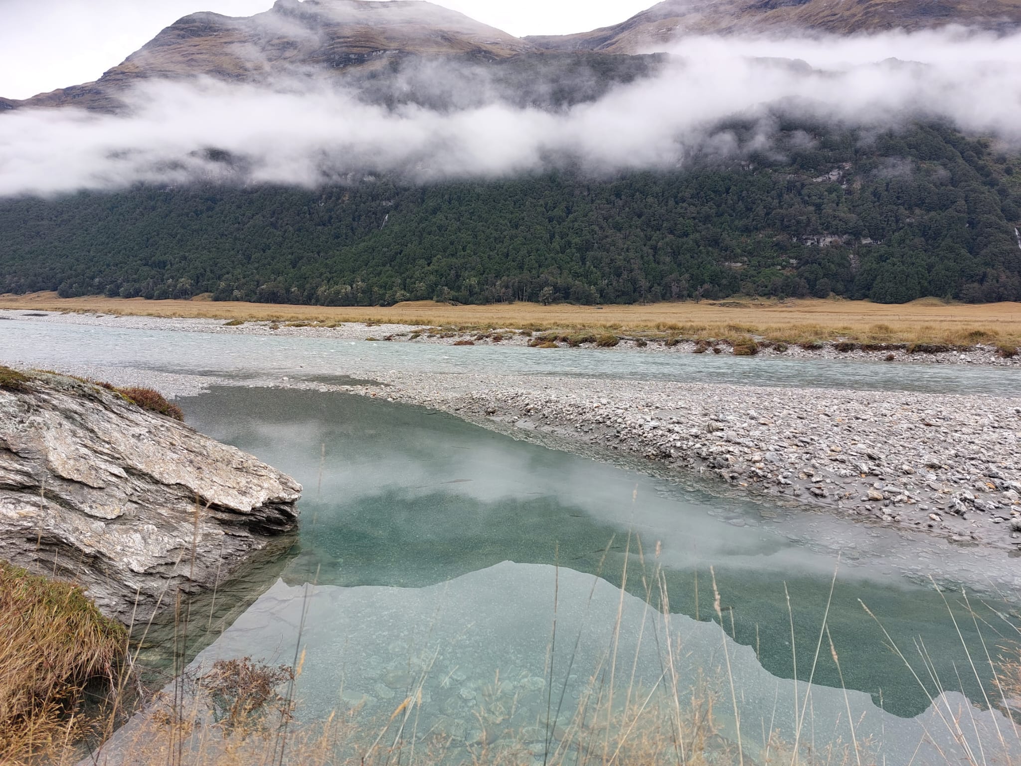
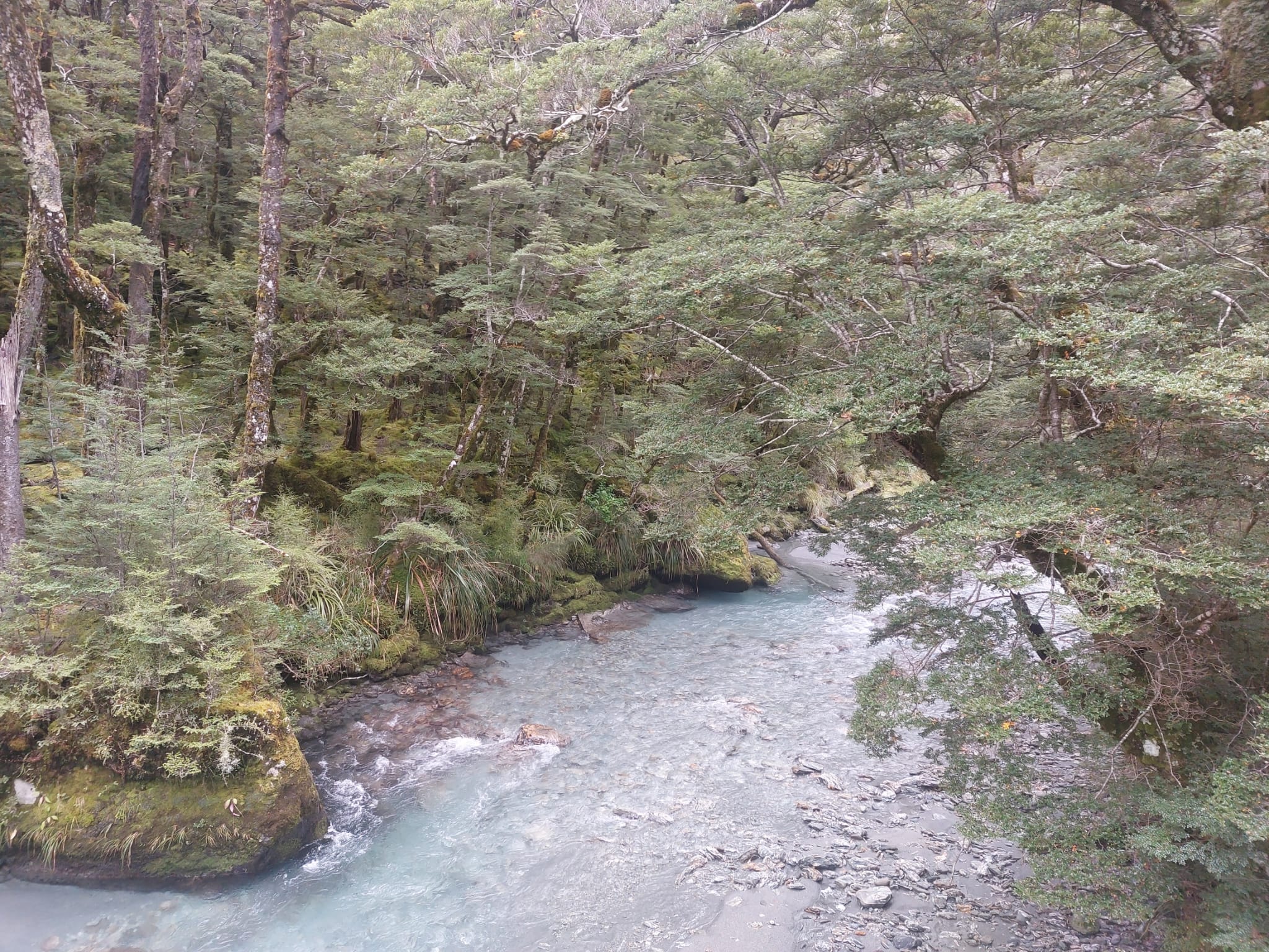
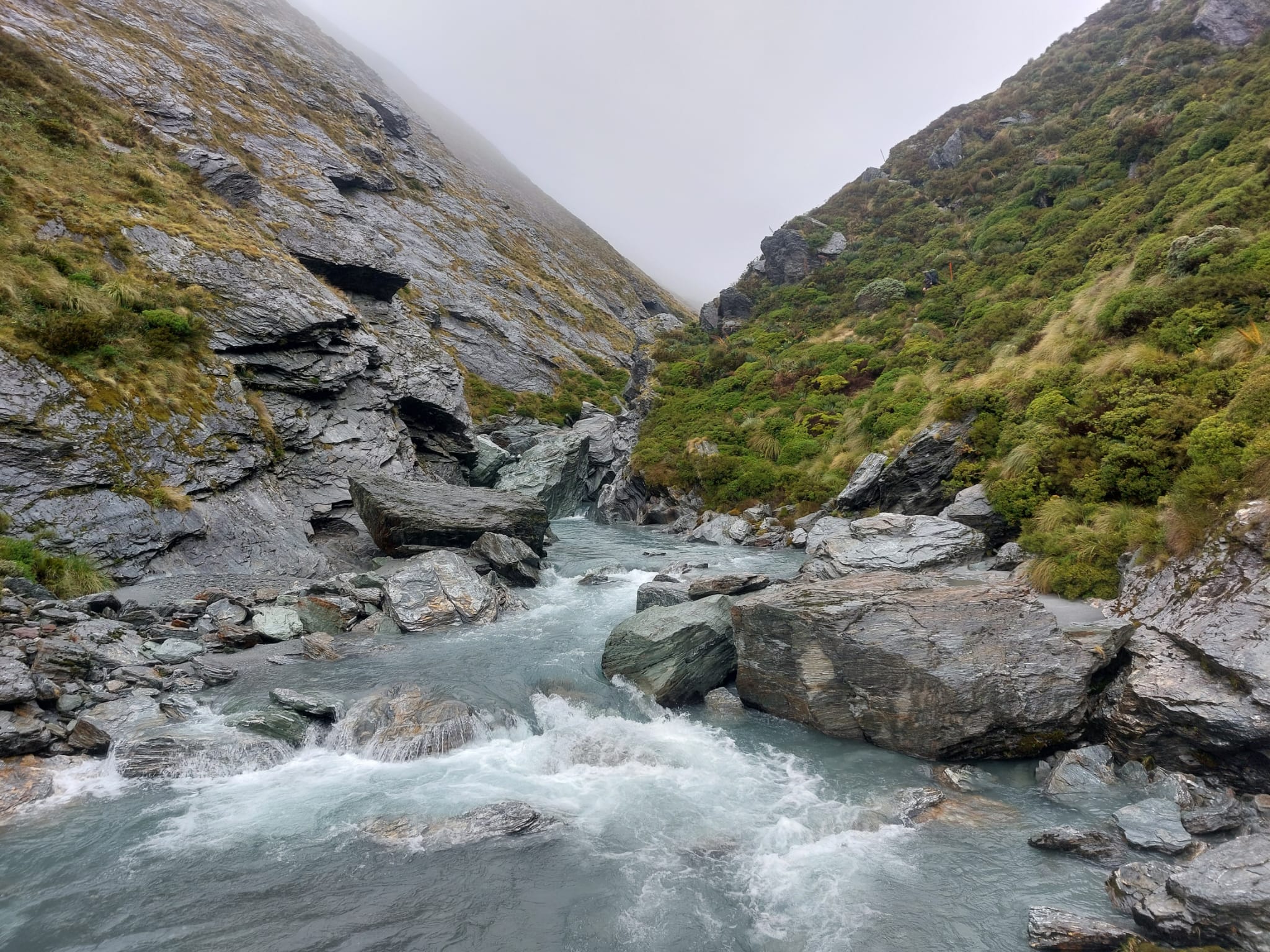
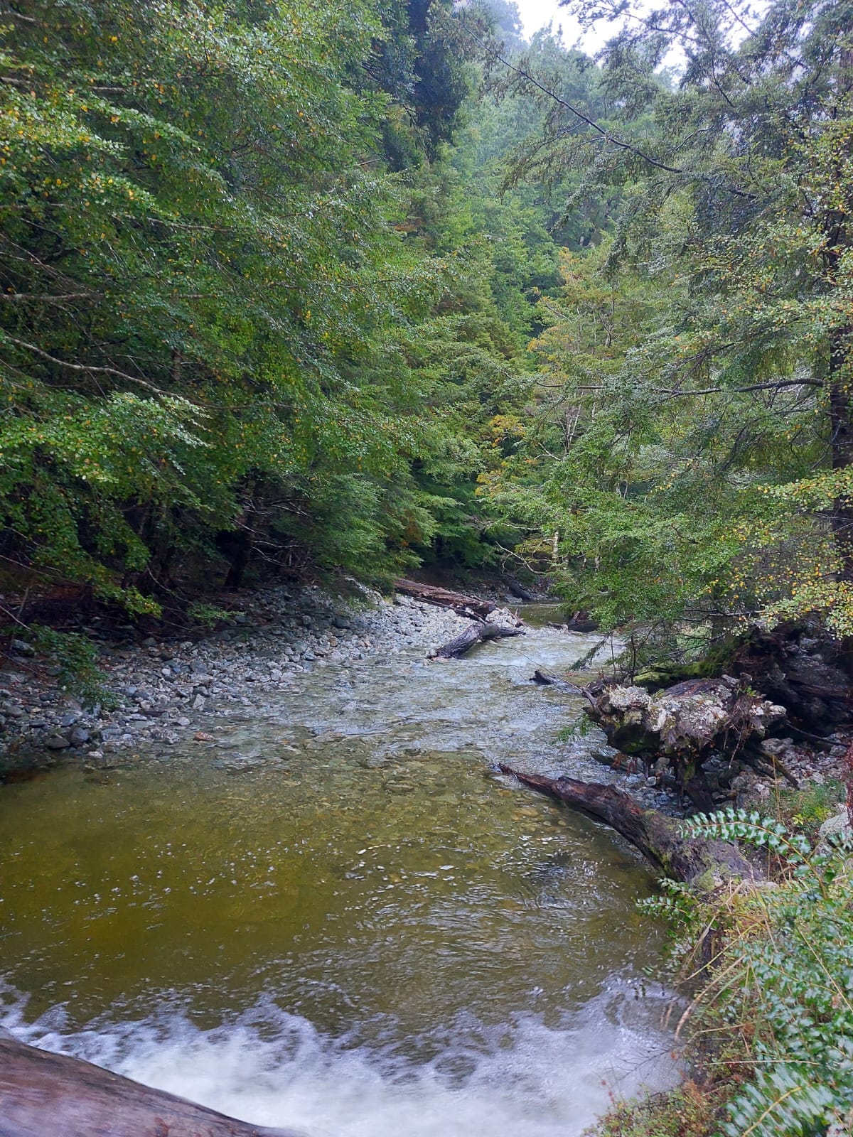
Also, why is the colour of the river so striking? Despite being close to shivering, I was tempted to swim. The water looked magical with some sections shining aqua blue, some aquamarine and some turquoise. David said it was the effect of the grey clay and the sunlight. Looks like a view from a fairytale. Except the princess is cold and has muddy, wet feet. But at least she was happy.
Then we came across a very long fence which followed the river. The trail goes along this fence and eventually leads back into the forest. I think we hiked through this section for an hour (excluding the lunch break), so it was probably about 4km long.
By the way, you will see that the trail is marked by rat traps with blue paint. These are to protect the native birds from rats trying to eat the eggs. I first thought that the traps had a potato in them, then realised that they were fake eggs with poison.
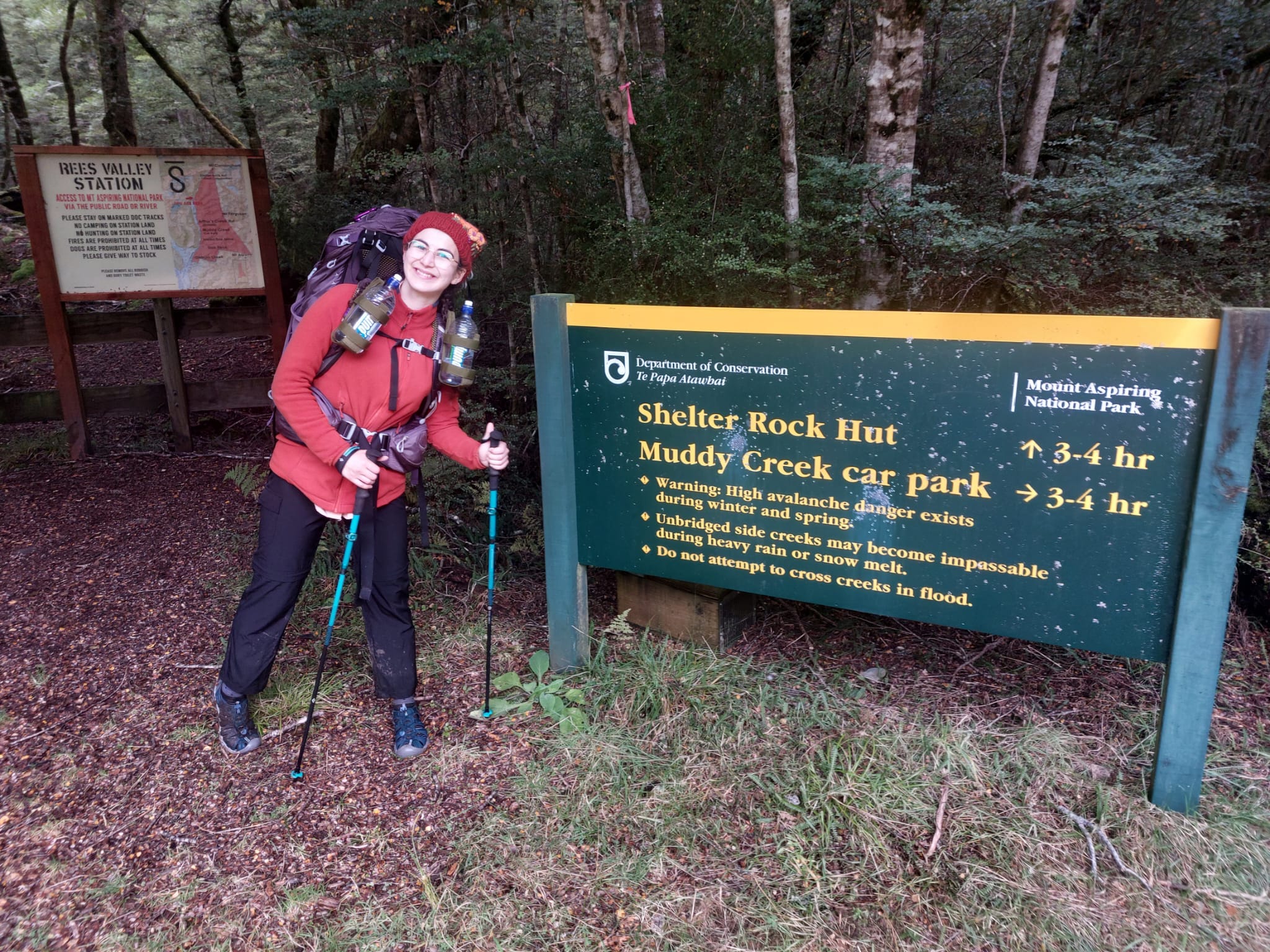
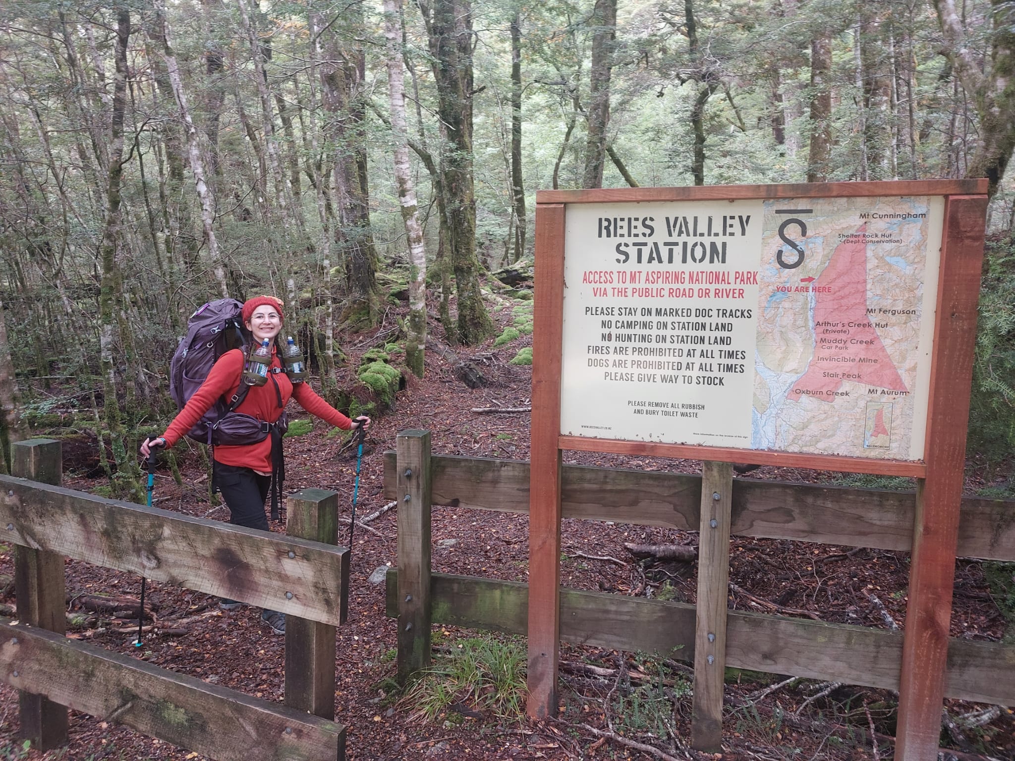
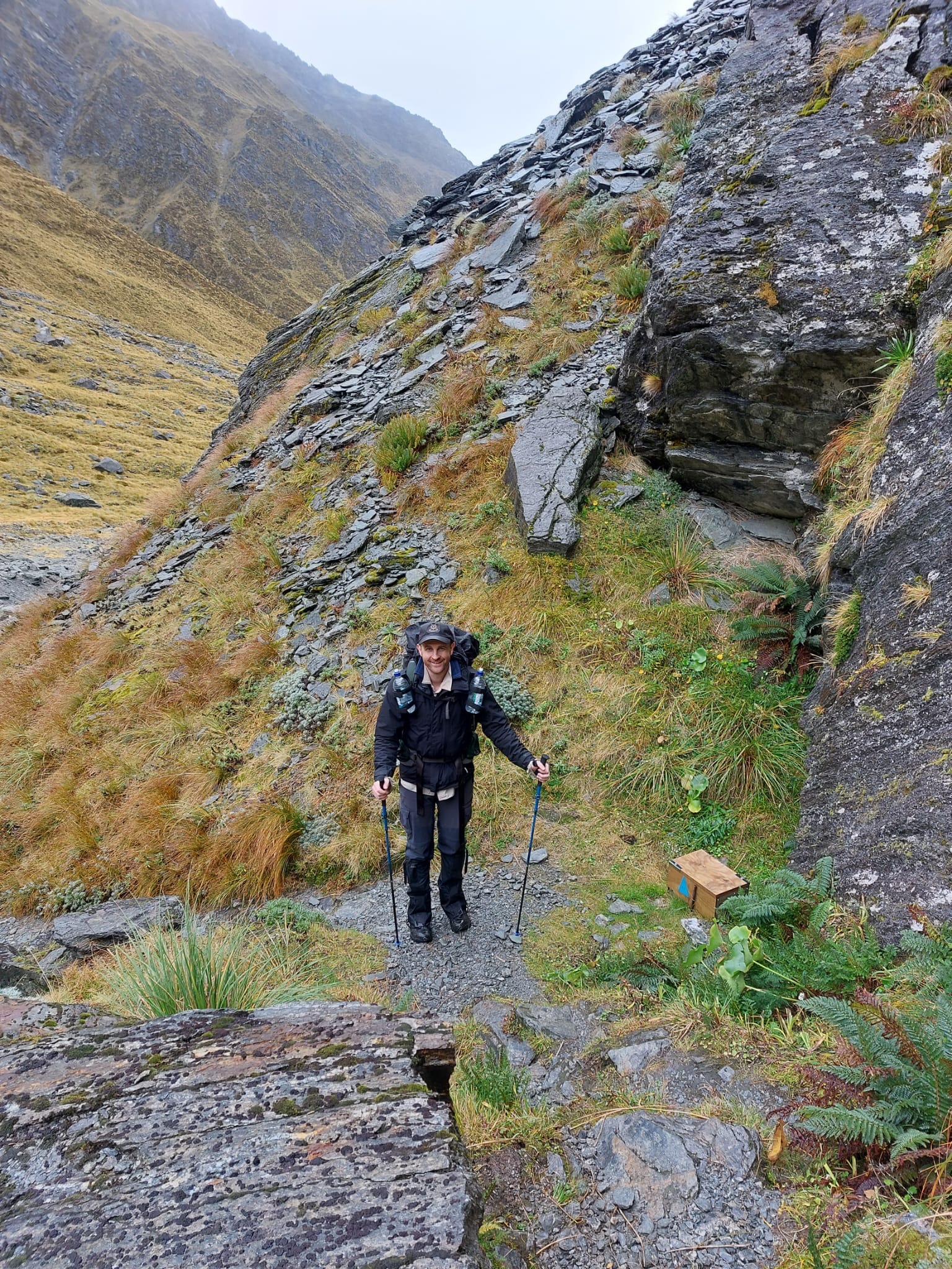
First, you’ll come across a big sign that says, “Rees Valley Station” with a wooden fence. This indicates the end of the private farmland where no camping is permitted. 12km is over - a little bit more than the halfway mark.
After hiking for another 15 minutes, we came across our second bridge. I must say, these are new shiny bridges which felt very stable and strong. On the other side, we found a log to sit on and had lunch looking out to the river as our view.
The water was so clear that we could see the rocks and a school of small fish at the bottom of it. We had some oat bars and chief meat bars before buckling up to finish our hike. We believe this point was about 60-65% of the way.
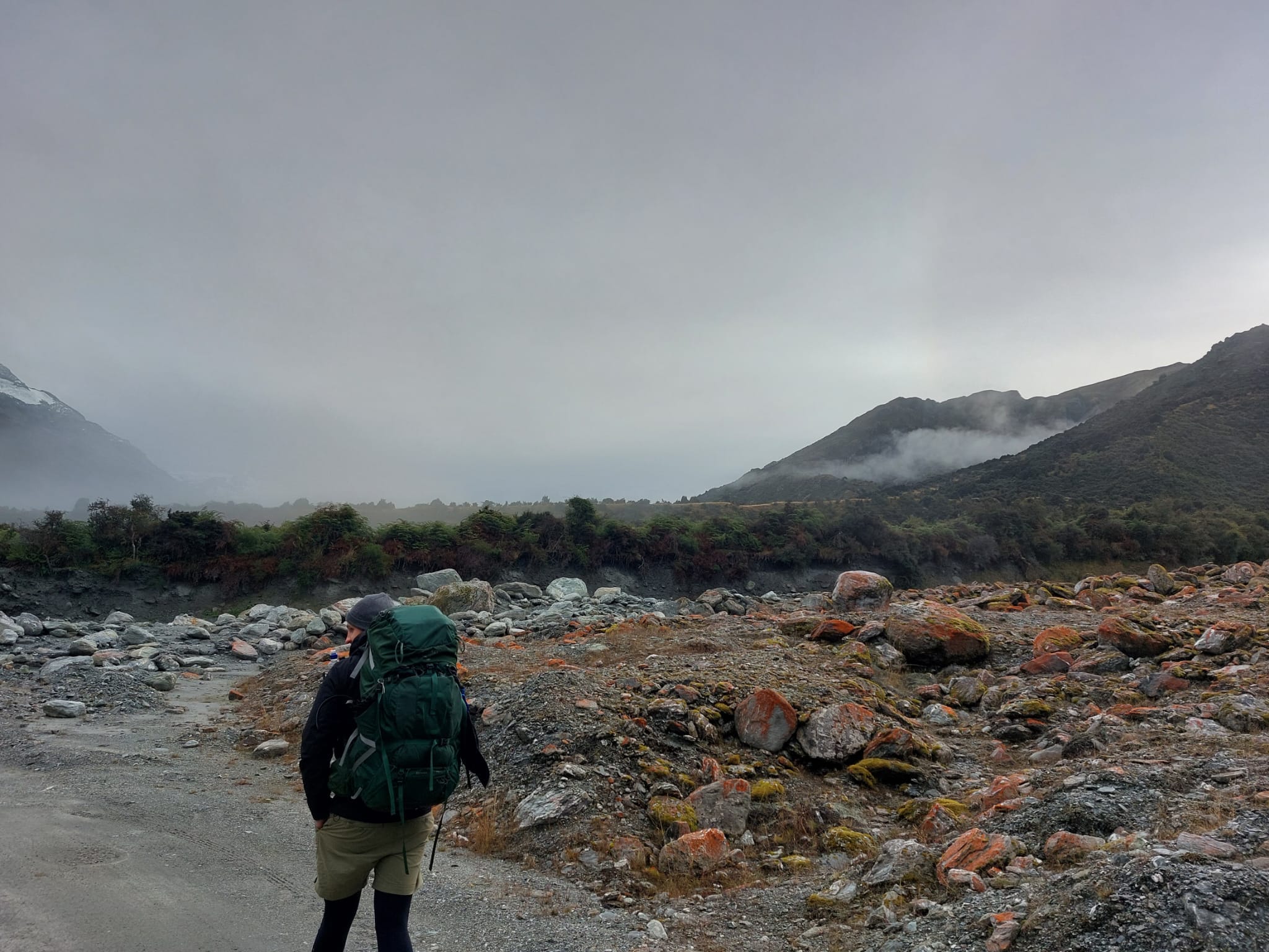
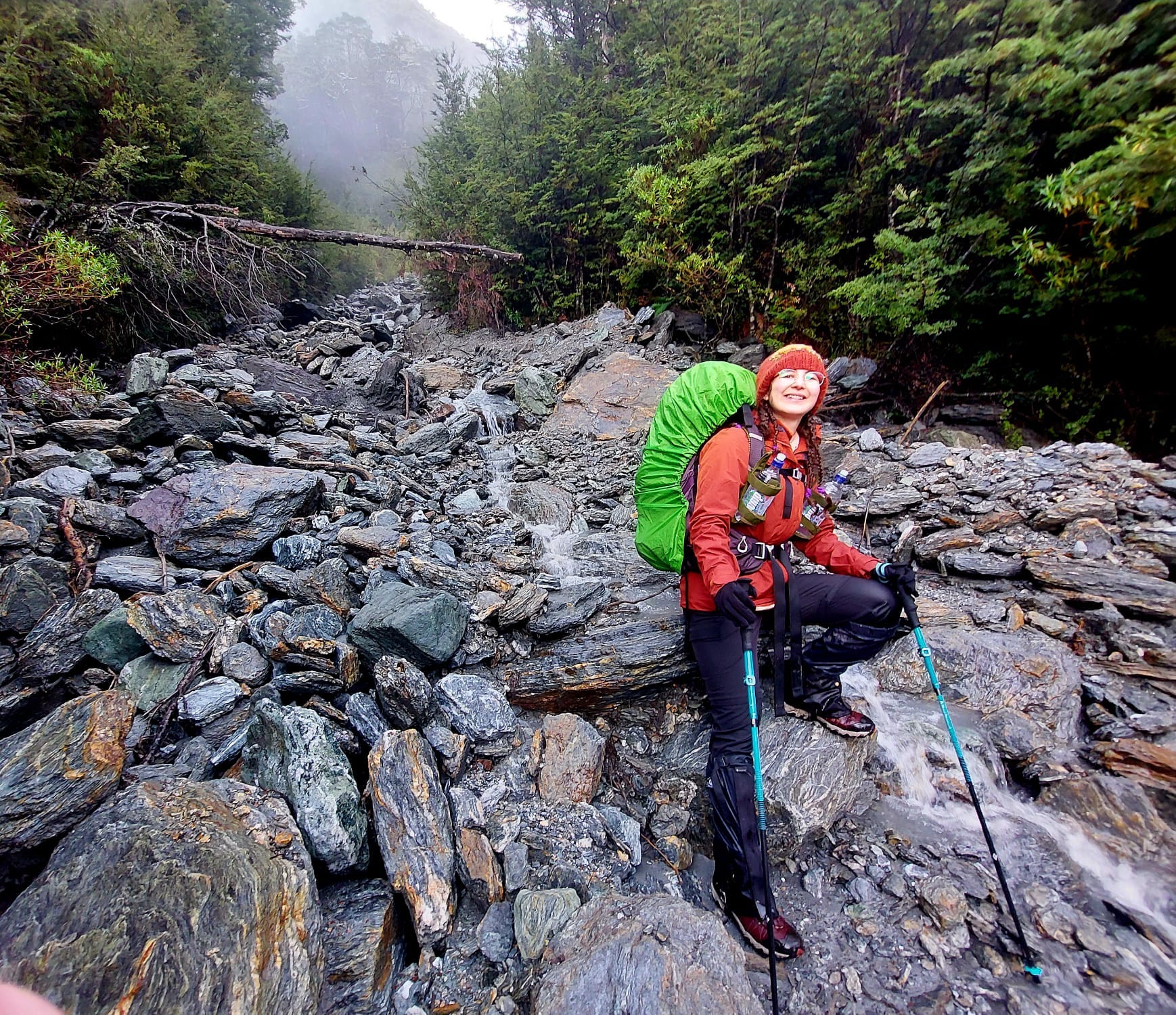
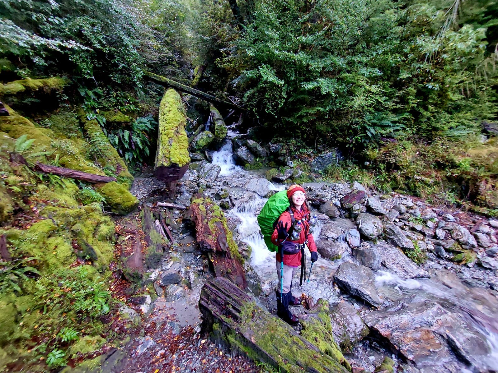
We hiked out to the cattle flats again and moved along an open field with yellow grass. Then back into the rainforest. This was the toughest part of Day 1 due to the rain damage on the trail. There were a few landslides that we had to hike around or over. There was also an old wooden bridge which collapsed. We had to hike down a slope, cross the waterway and scramble back up to find the trail on the other side.
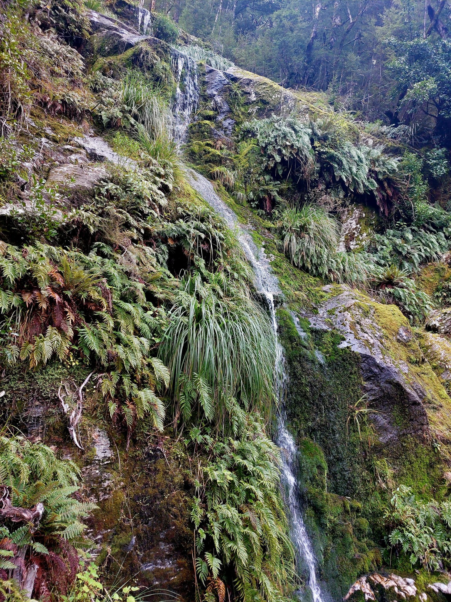
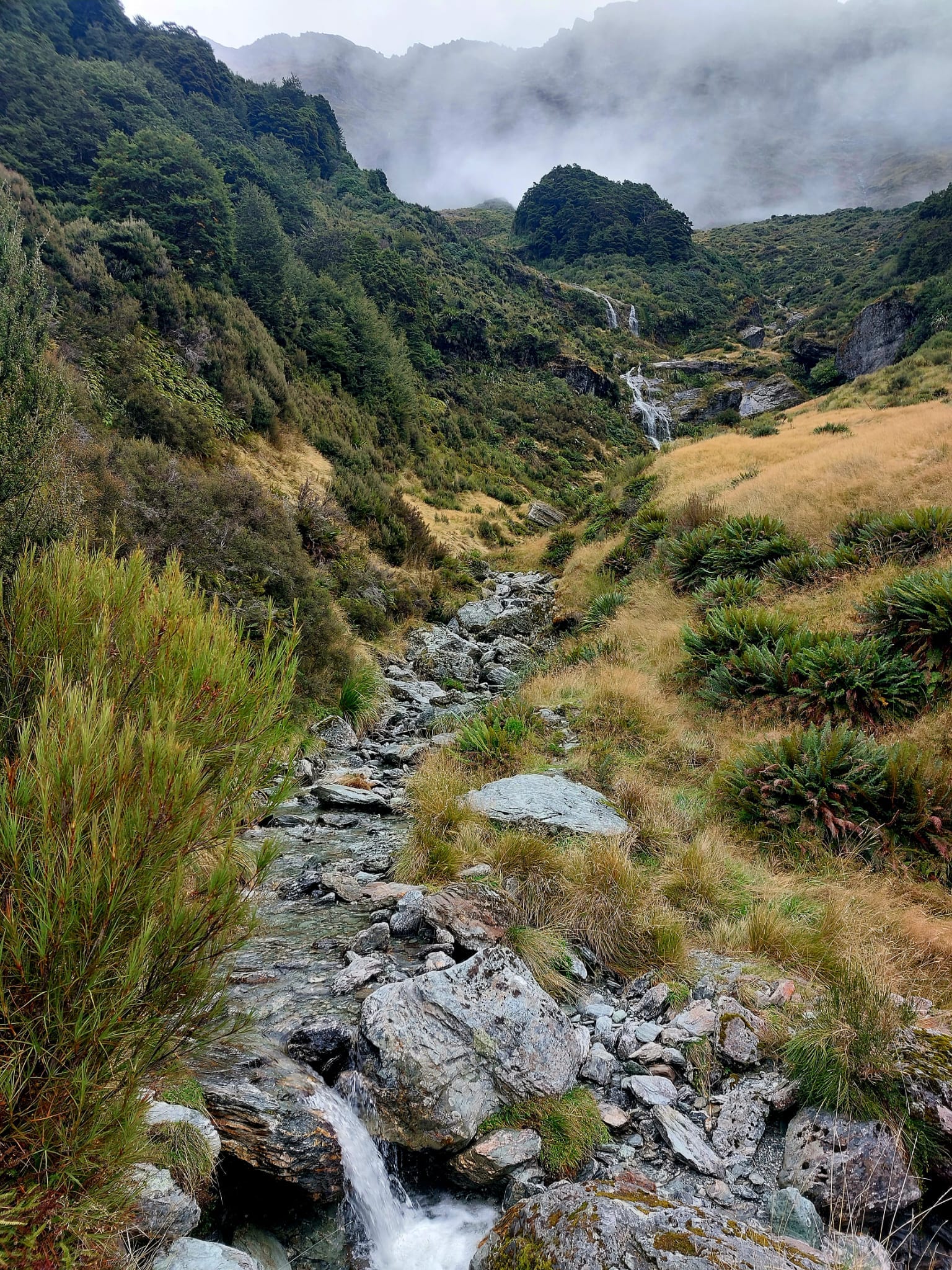
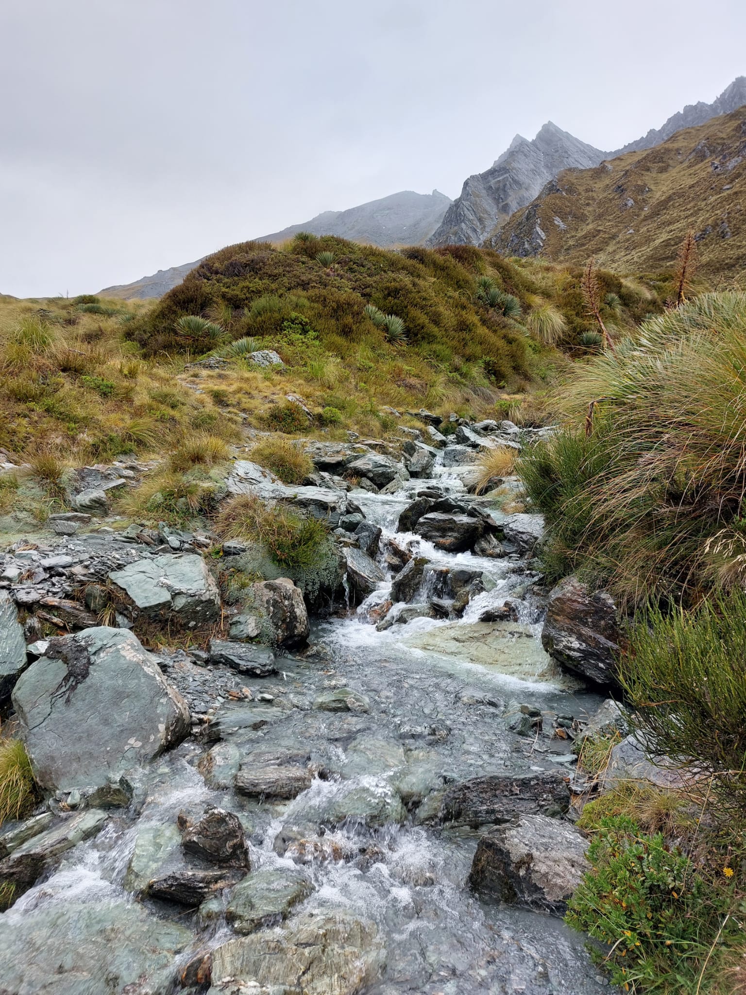
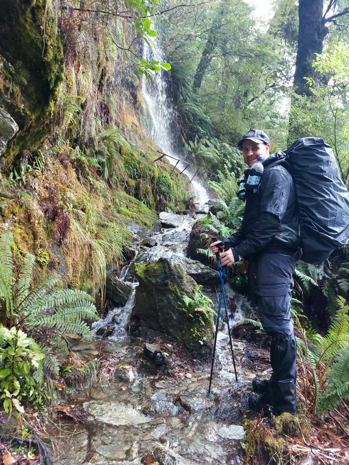
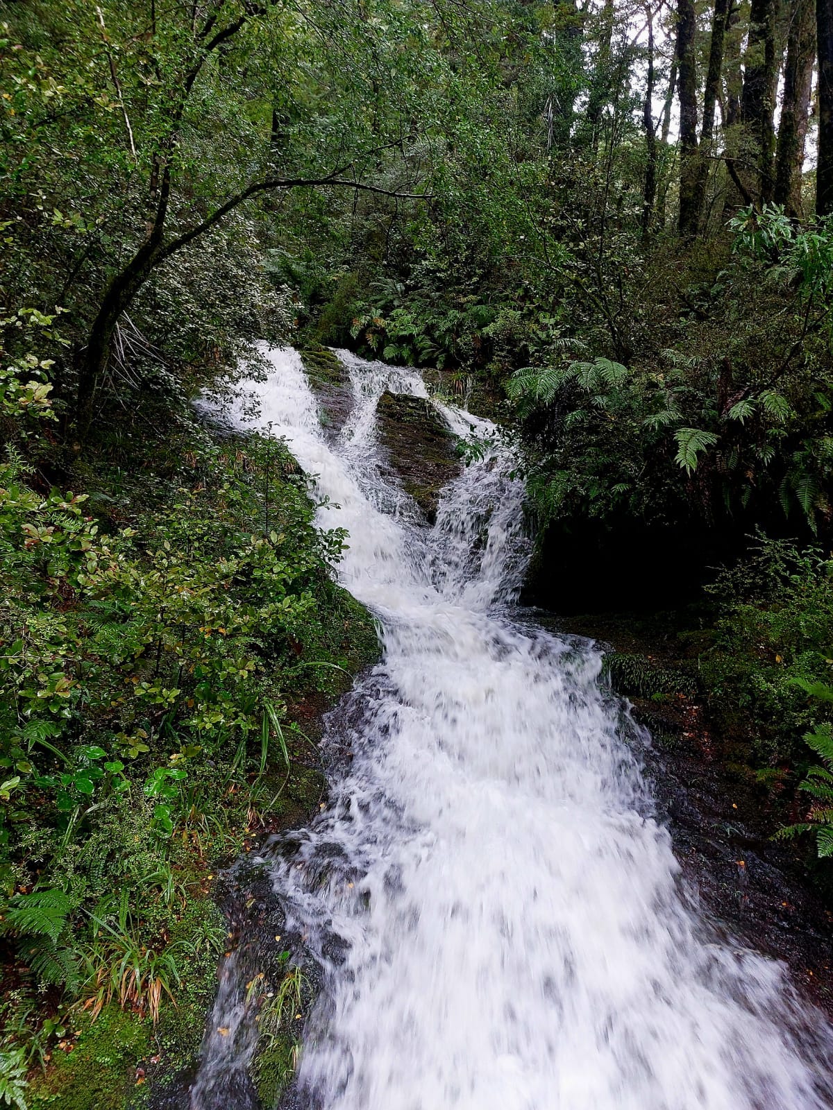
We came across our third bridge shortly after. Then began our constant climb. The slope was not aggressive, so we were still able to hike at a fast pace. During this part of the trail, we crossed 3 very tall waterfalls. So basically, hike down the rocks, walk fast across freezing water (and don’t slip), hike up the rocks, and back on the trail — repeated quite a few times.
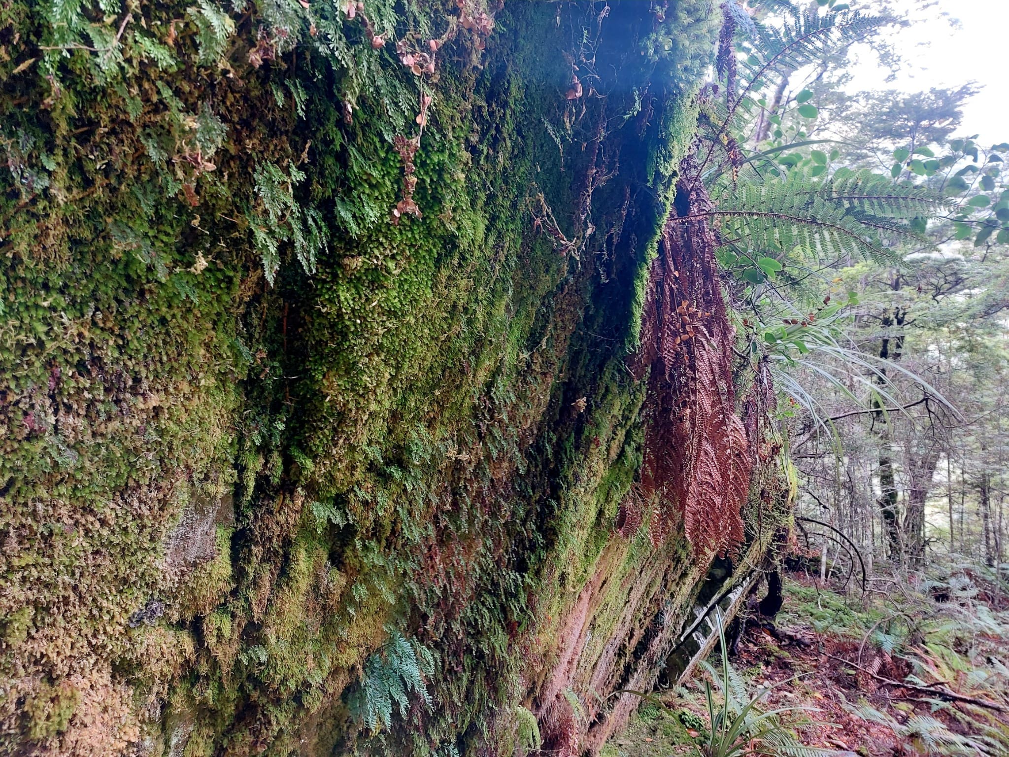
Moss on the grey rocks, ferns surrounding the trail, dark green winter trees and many different types of fungi. We were playing ‘spot the fungi’, counting how many types we could find on the trail. One of them was medium height, fat, and red with white dots — just like the home of the Smurfs!
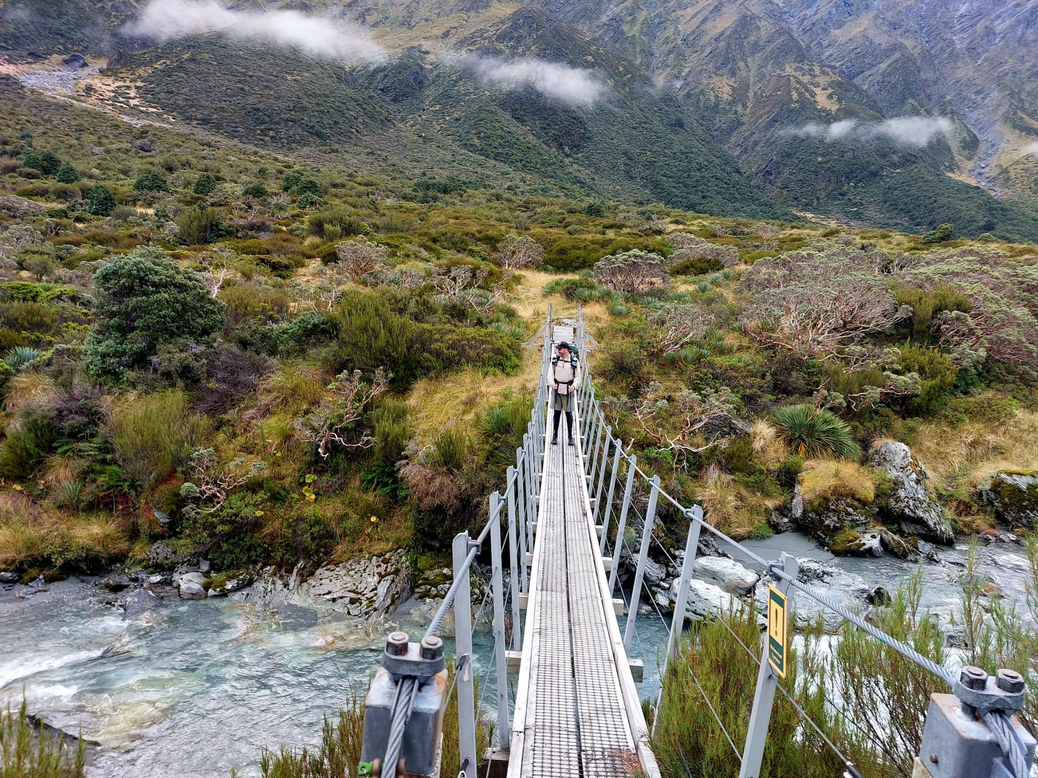
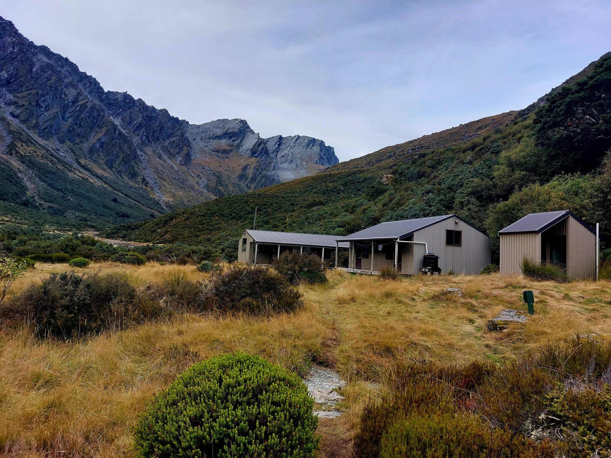
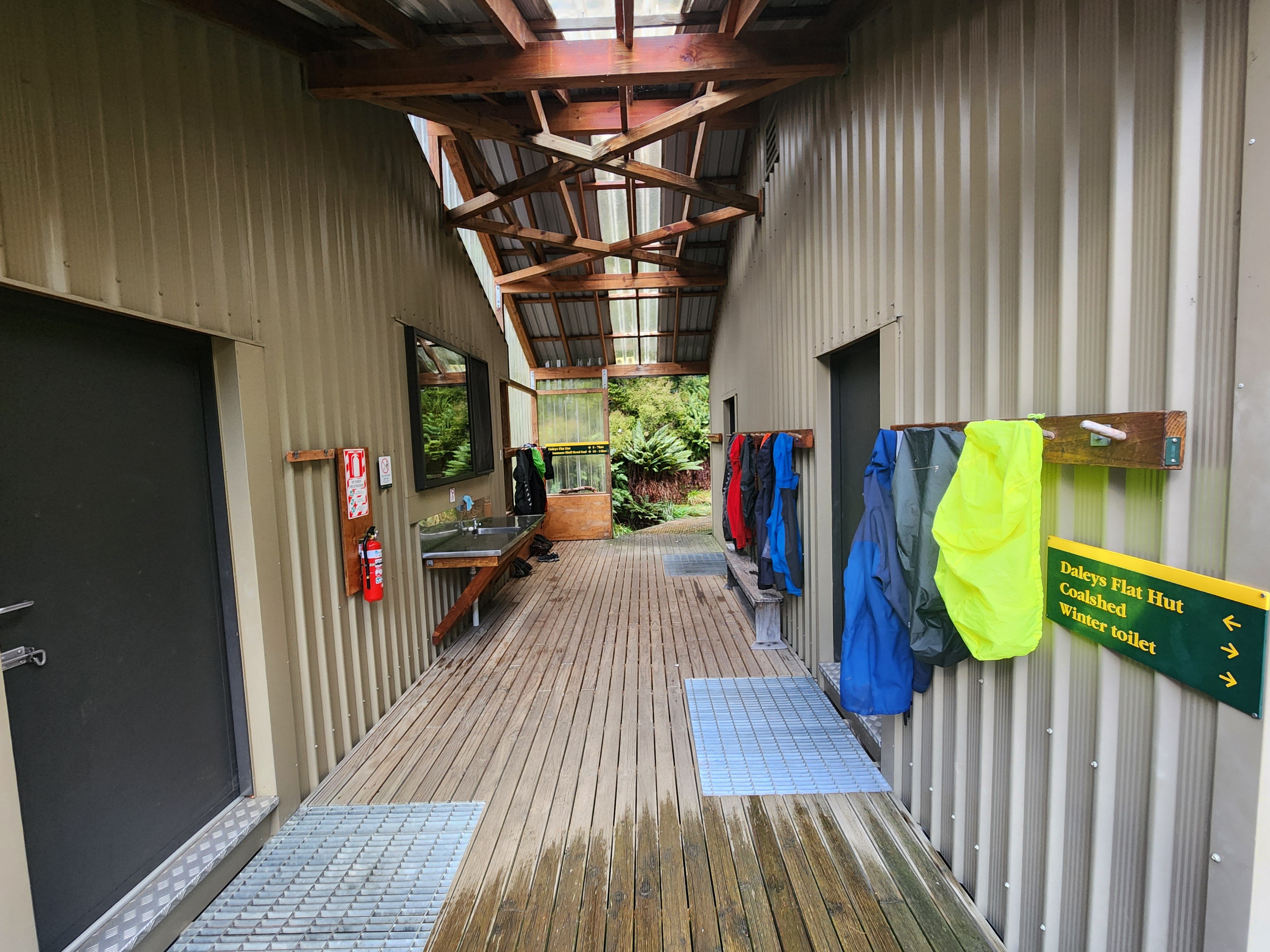
We came out to the cattle flats one last time (avalanche zone) and soon after, saw our fourth bridge. On the other side of the bridge towards our left were two huts.
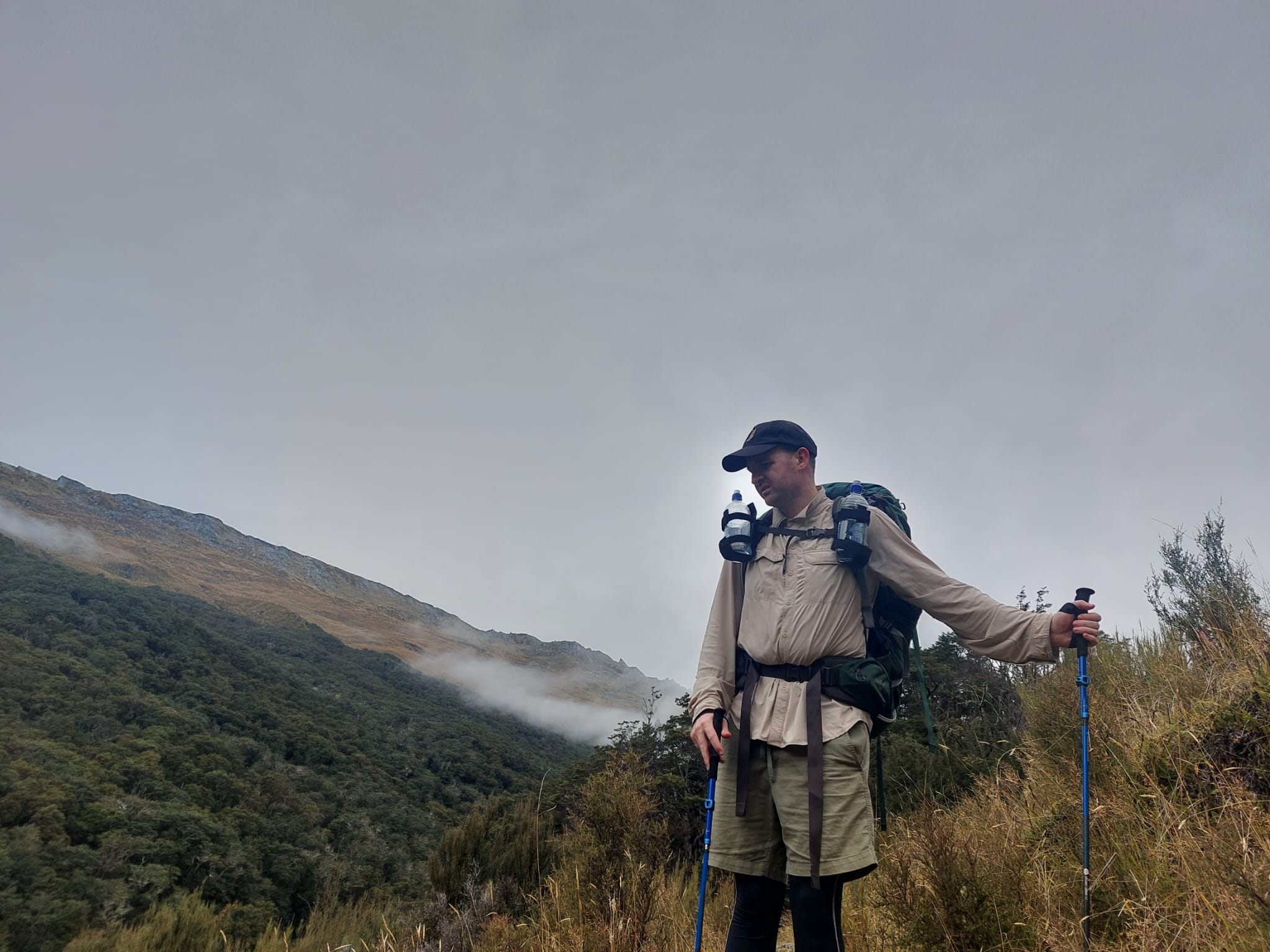
I hiked with gloves on until 11 am and a beanie until 1 pm. I had 3 layers of clothing (thermals, hiking shirt, polar jacket) for all of Day 1. David was ok without the gloves but he also hiked with 3 layers of clothing for most of the day.
Happy David seeing the huts in the distance.
We picked a hut, carried our staff inside, took out our wet socks and hung them outside to dry. We changed into warm clothes and got inside our sleeping bags. We both felt the pain of hiking in sandals all day. These shoes have less support so our feet were tired. After warming up and lazing around a bit, we cooked our dinner.
Day 1 felt special because we saw nobody on the trail. It was peaceful — just the two of us and the magnificent mountains. I felt so small among the giant and bold landmarks.
An hour later the solo hiker we met in the van arrived. Close to dark, a family of 6 arrived as well. They were fun and looked very happy to be outdoors. They also lit up the fireplace which made the hut very cosy.
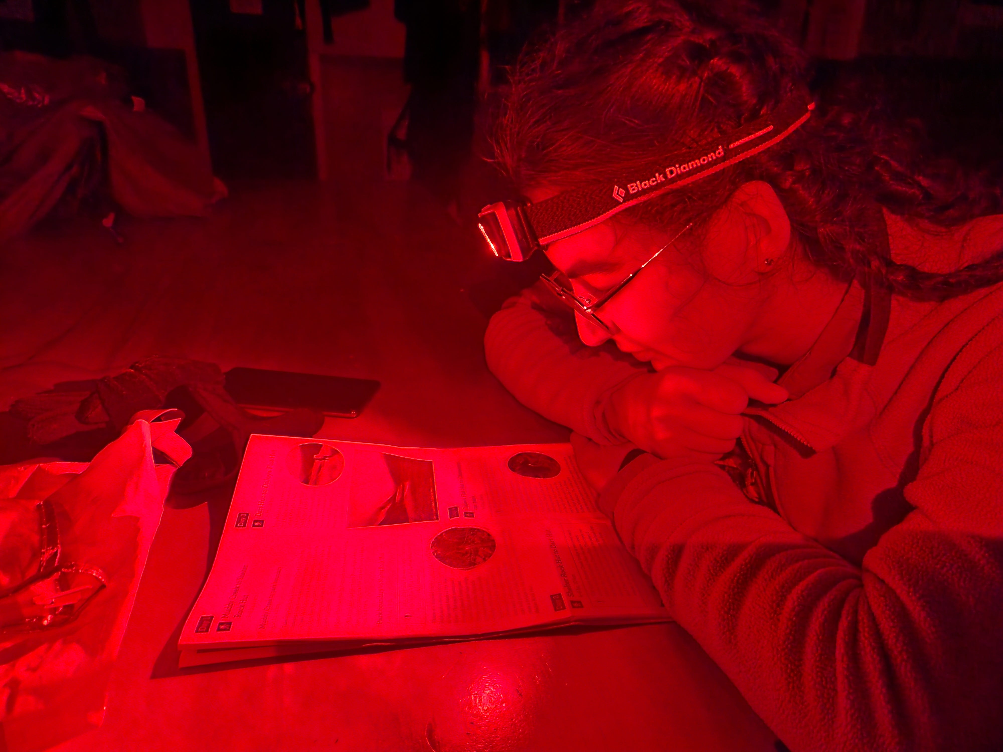
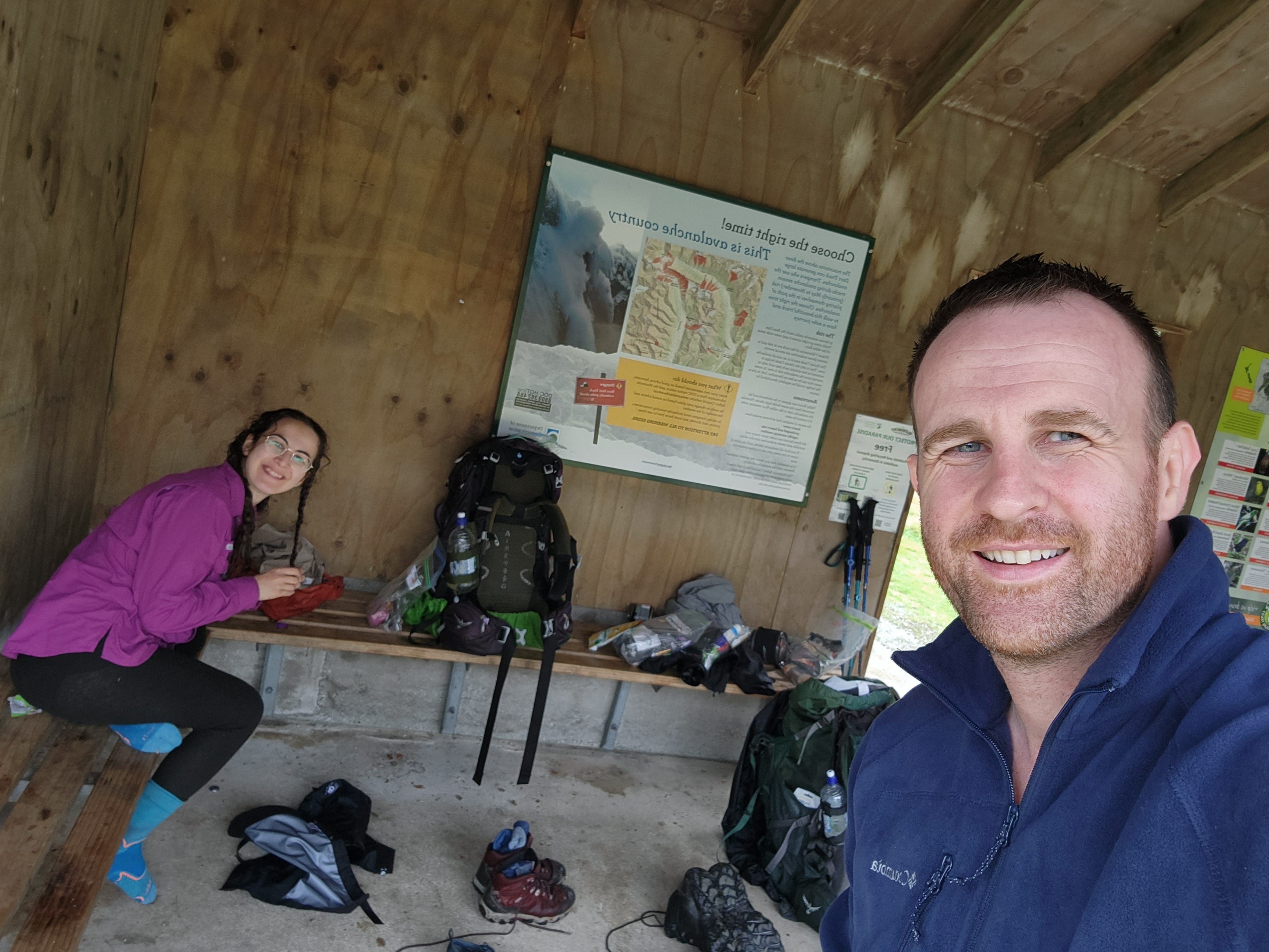
There were three big tables in the common area, a kitchen space, two long clotheslines, some books to read, wooden board games, and a fireplace. This area was also a hunting zone. There was plenty of time to write, so I was glad to bring my notebook and pens.
Honestly, if you want to get into solo hiking, New Zealand might be a great place for it. After hiking on well-maintained tracks, you have the security of arriving at a warm walker’s hut with good facilities and other hikers. This must be why I’ve been seeing more solo hikers in Queenstown compared to Tasmania or other parts of Australia.
Day 2: Shelter Rock Hut to Dart Hut
14.5km, 6 hours 40 mins
Light doesn’t get to the foot of a valley until about 7.30 am. I woke up at 5 am (such a morning person), wrote some poetry and did some journalling in my warm sleeping bag.
Me (whispering): David, you awake? David?
Him: Now, I am.
Me: This sleeping bag makes me feel like a caterpillar in a cocoon. I’ve been thinking about it.
Him: (sleepy) Yeah.
Me: When can we start the hike?
Him: When it’s light.
Me: (cheery and fidgety) I’m a caterpillar. When the light comes up, I’ll become a butterfly.
Him: (sighs) Help me. Woman, go back to sleep.
At about 6.30 am, I began to make breakfast and got just enough light to take a picture of the outside. It was freezing outside.
I was so excited to start — felt very impatient, waiting for the sunlight to appear. David on the other hand had a slow and lovely morning, telling me to calm down cause today was only going to be 10km.
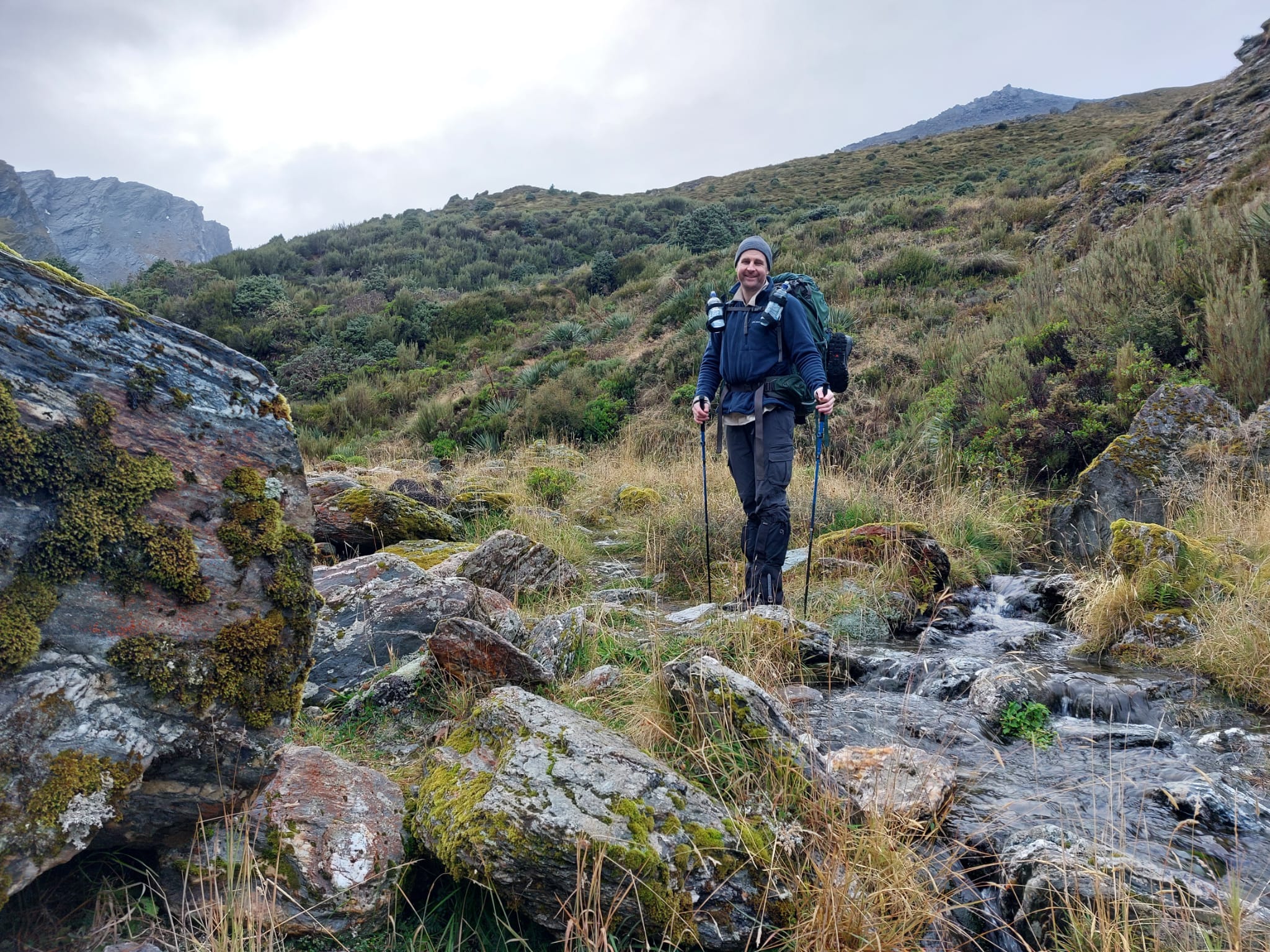
The day began with a long, continuous climb along the river on rocky terrain. The slope was never too steep, but David said that it was still tiring to be constantly ascending, which is a fair comment.
The river currents were much stronger and the size was much wider and deeper on Day 2.
After a short river crossing, we diverged away from the water and continued hiking on the open fields, which were up and down, rolling hills.
Not a popular opinion, but I find the alpine vegetation quite pretty. Dull in colour but it gives a calming simplicity to the heart.
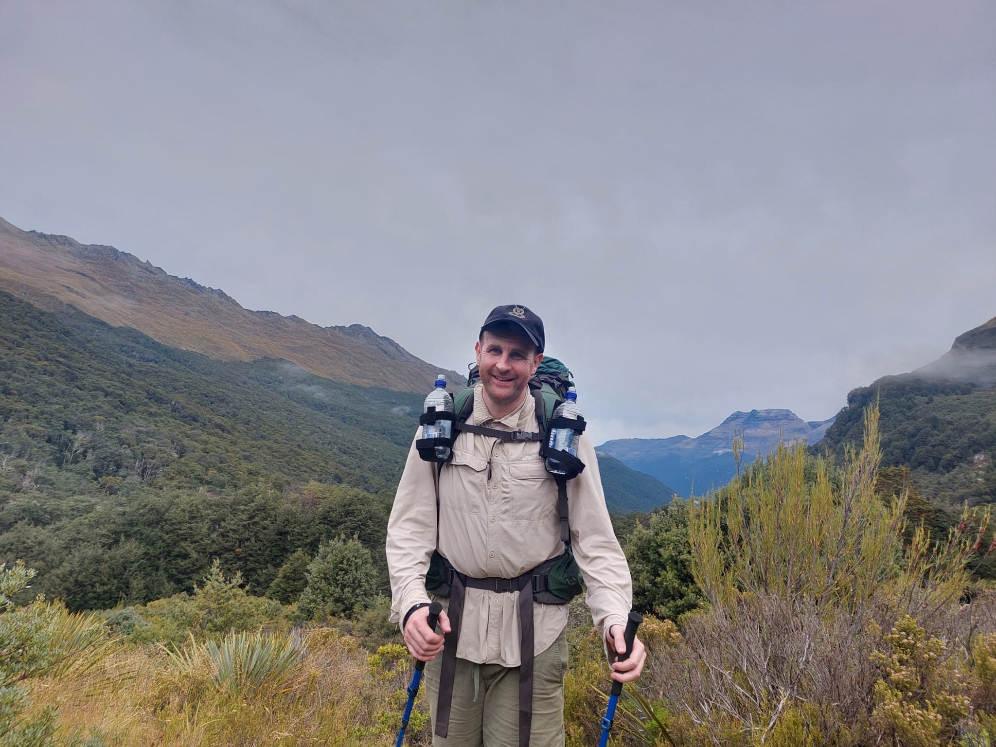
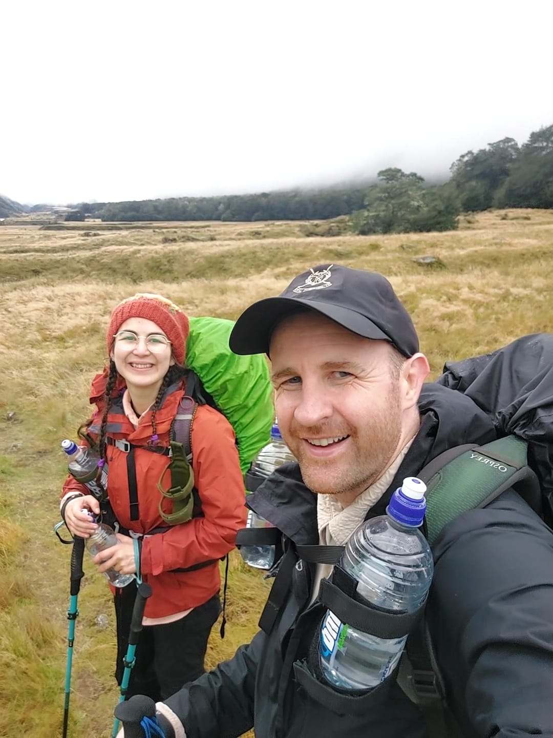
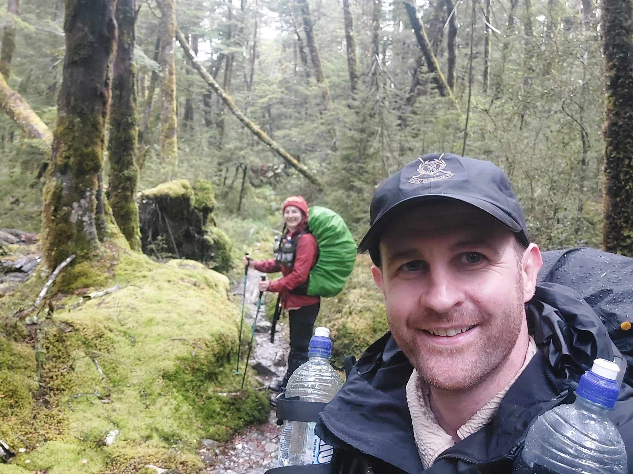
Given my enthusiasm, for the first third of the day, David let me bounce off and pace ahead. He followed a slower pace. I stopped every five minutes, turned back and checked on him. Also took a lot of pictures of him walking towards my direction.
David’s not impressed face about being left behind.
We crossed the river once more. This was a wider crossing which would have been quite difficult if the river was full/flooded.
Despite the forecast showing cloudy with no rain, 45 minutes into our hike, rain began. The rest of the day saw on-and-off rain in varying intensities (but never too heavy), making us soaked.
After a bit more uphill, we had a short rest with morning tea (Health Lab’s cookie dough balls) before starting a very steep and tall climb up on the Rees Saddle.
Lol — the differences in our energy levels. Wish I continued filming.
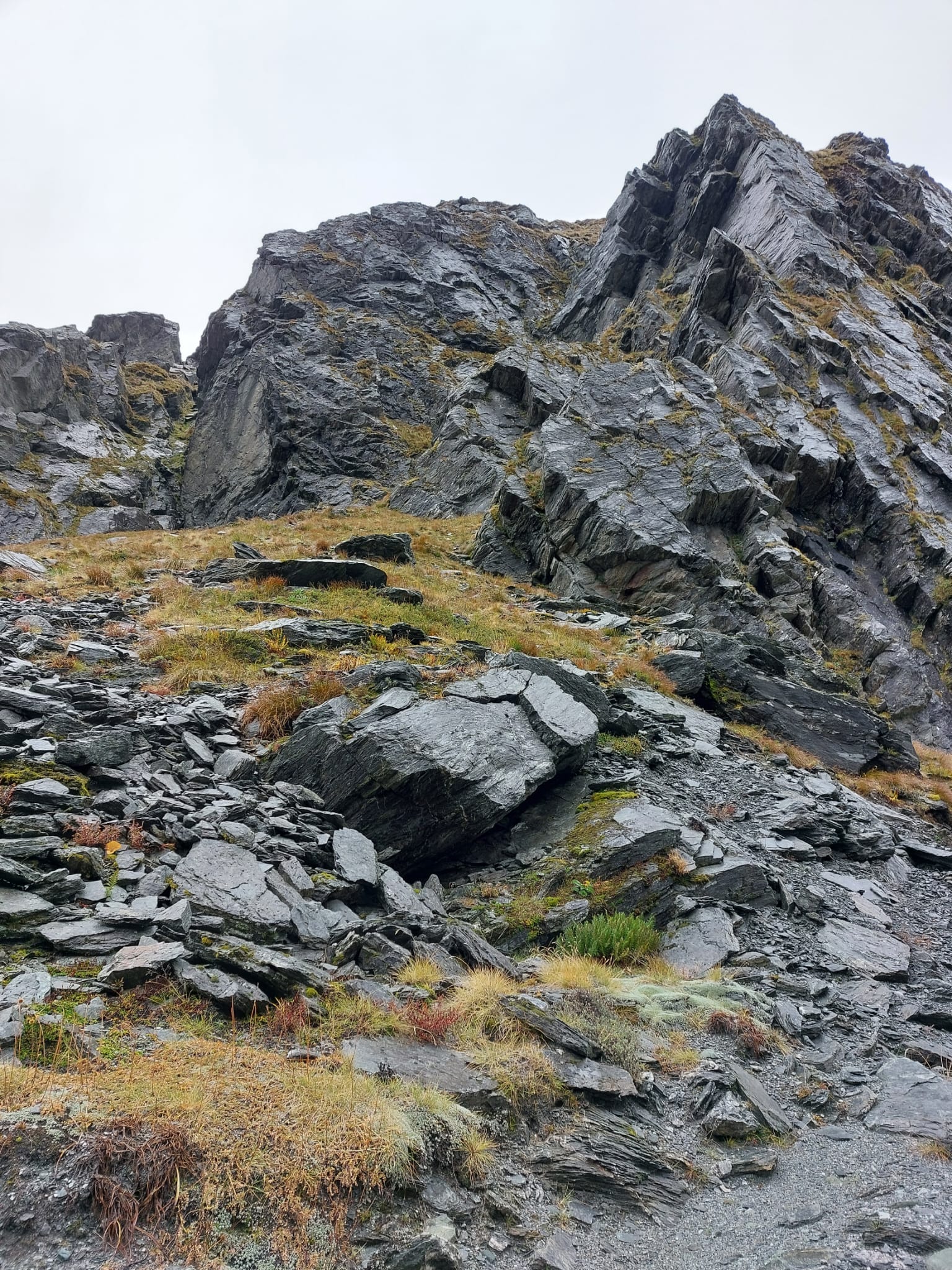
I read in the information book that these giant rocky mountains were formed about 220-270 million years ago from ancient sea floor sediments which have been altered by heat and pressure. It is incredible that we got to climb one.
The next section of the trail was a very steep and narrow climb on a slightly slippery surface. One needs to be extremely careful here and consider not attempting under heavy rain, as it can be quite dangerous.
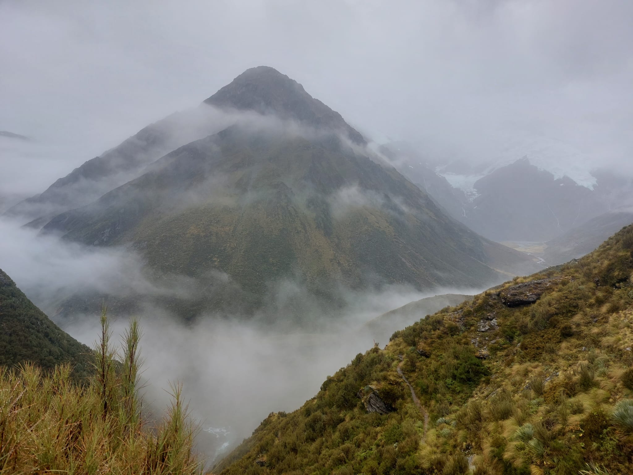
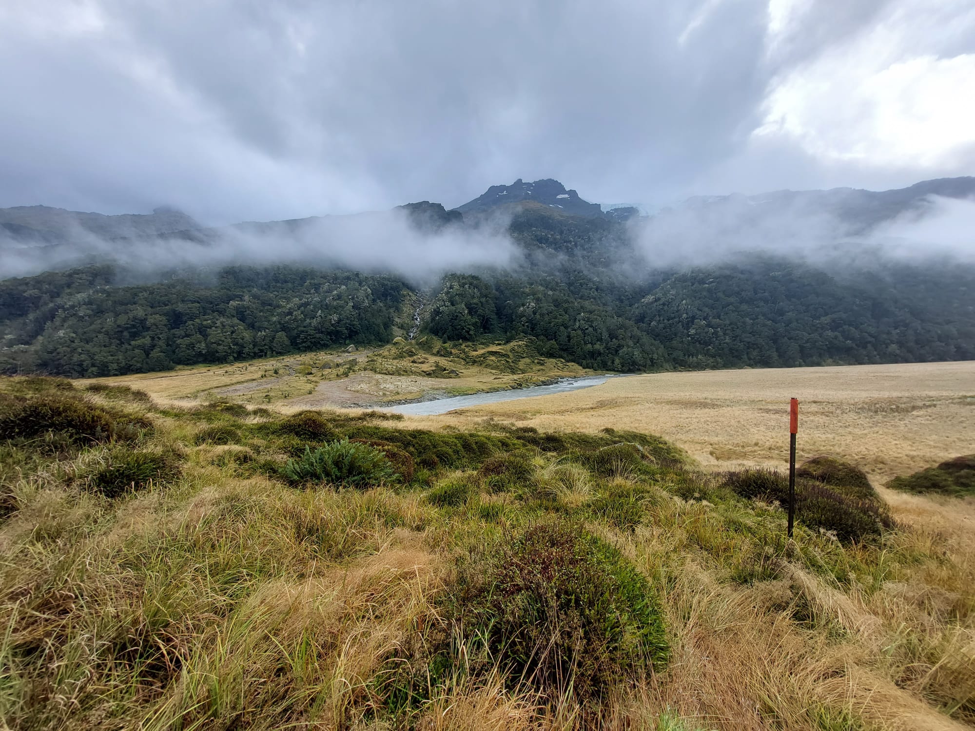
The views have been spectacular. It’s humbling; makes you want to kneel down and say, thank you. A layer of cloud is floating about 2/3rd of the way to the top of the mountain; the silver top pokes out and the middle is blanketed.
You will know when you climb over halfway because you’ll be surrounded by clouds. It reminded me of Ed Sheeran’s song lyrics, “Oh, misty eye of the mountain below…” You also know when you’re at the top; the river and everything below vanishes.
We spotted a cave in another mountain. That was very cool. It looked quite large.
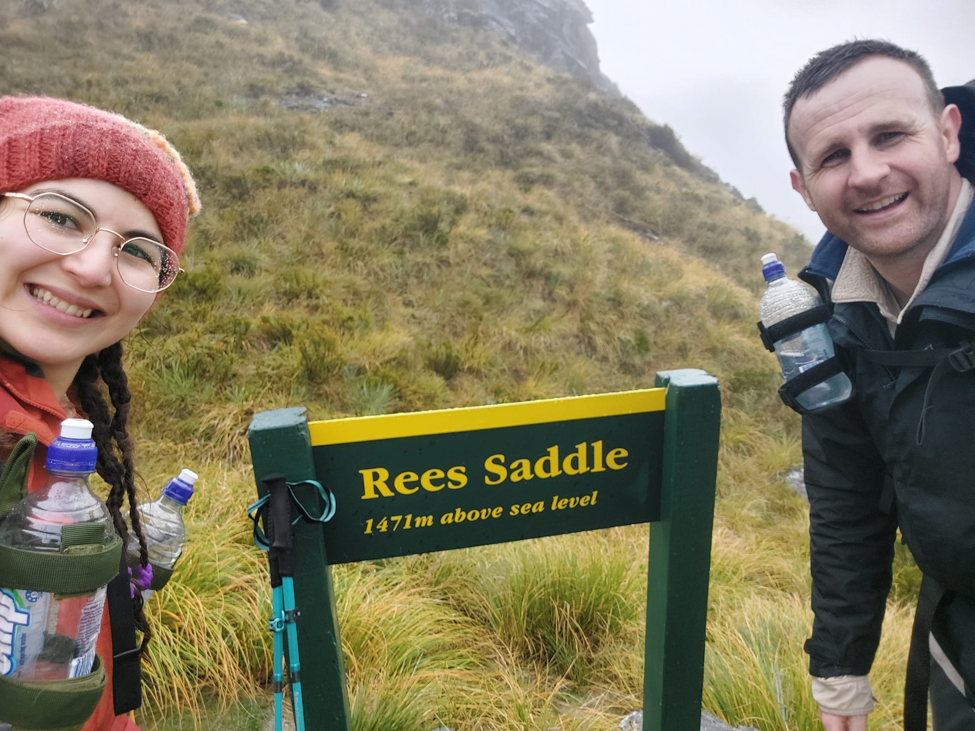
Anyway, at the top, you will see a wooden sign that says, ‘Rees Saddle. 1471m above sea level.’
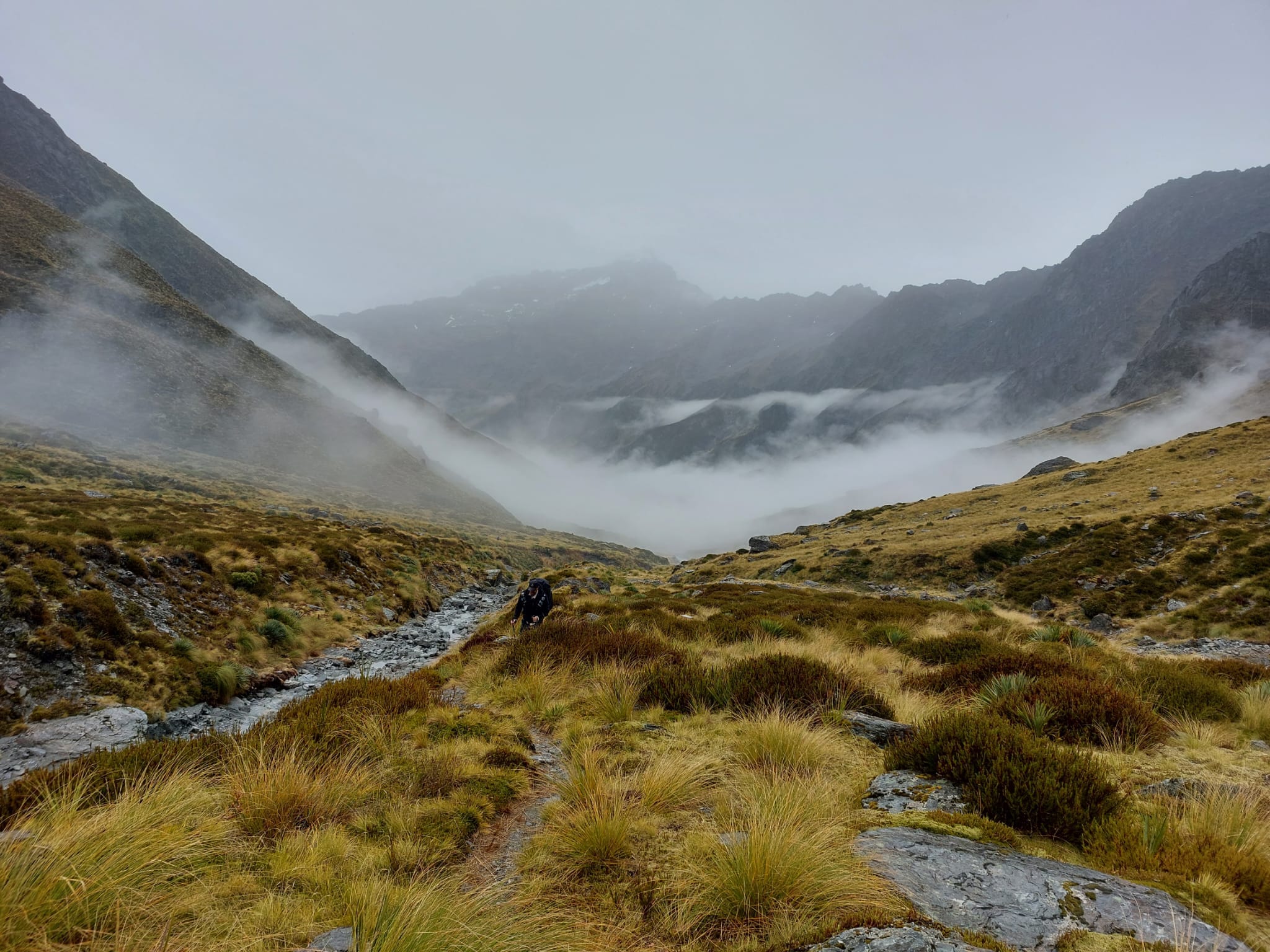
As we assumed that Day 2 was 10km, we thought all we had left to hike was a descent. We needed to have our lunch, but we estimated to arrive at the hut in an hour. Little did we know that we had a few kilometres to hike along a cliff edge in the rain with random sharp ascends and descends, crossing more waterways and landslips.
This section had poor visibility (could not see more than a few metres ahead) and seemed to never end! The fact that the trail curved around the mountain did not help with visibility. We really hoped the rain or the wind would not get stronger.
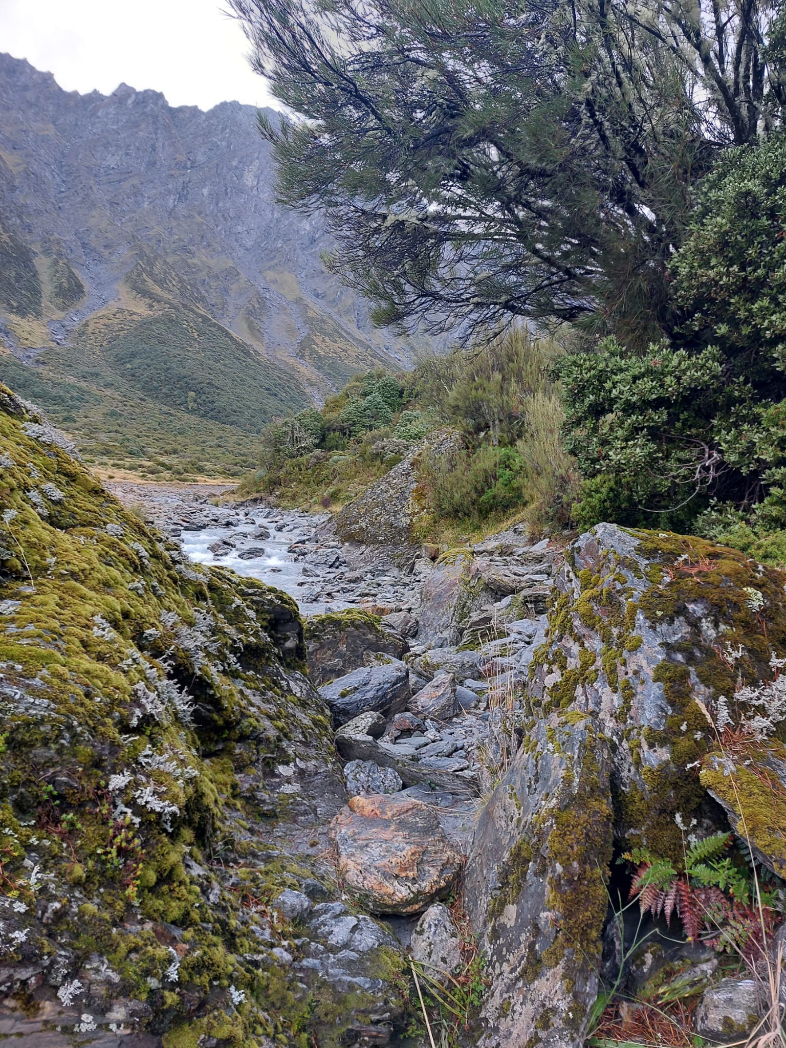
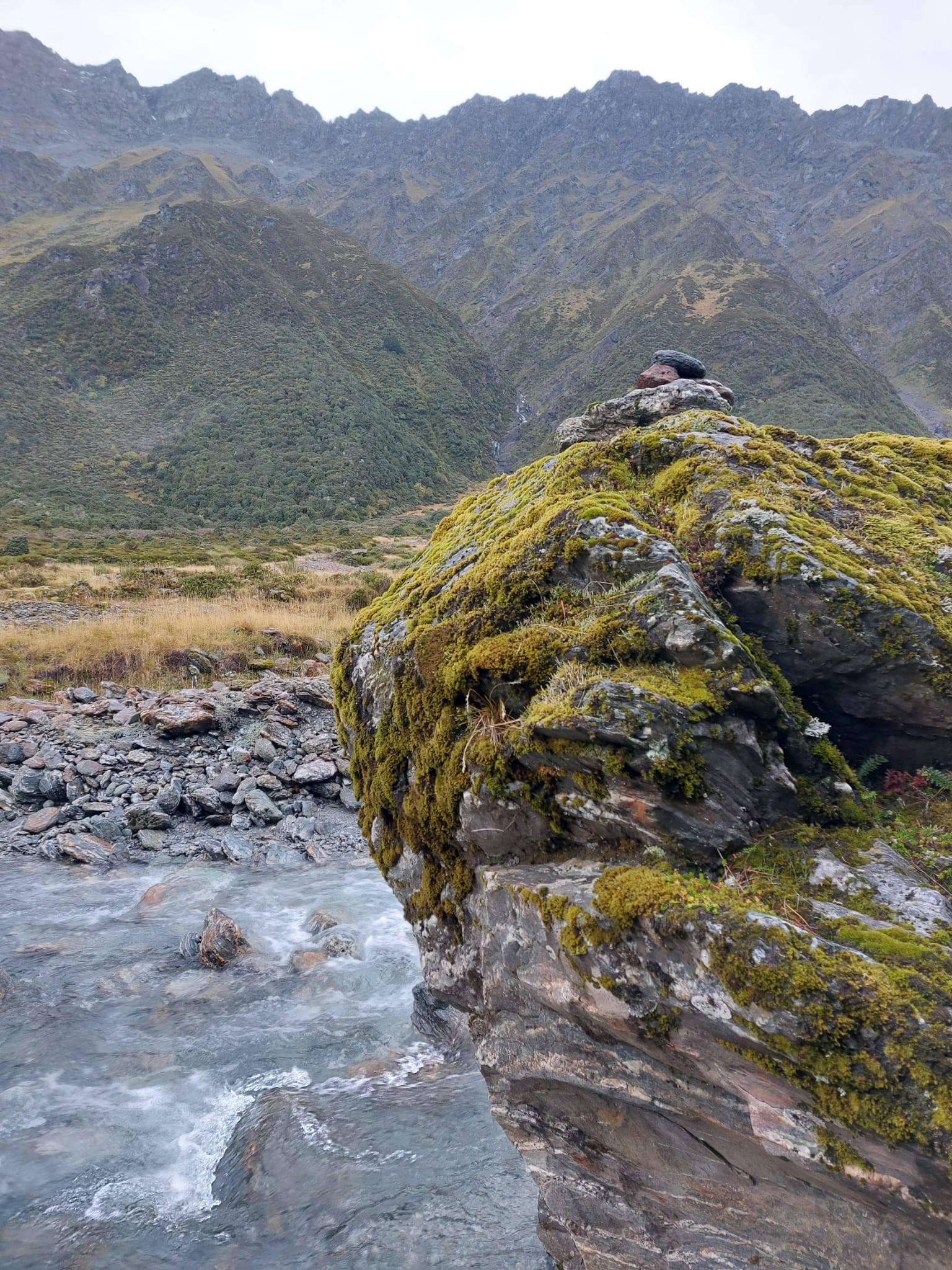
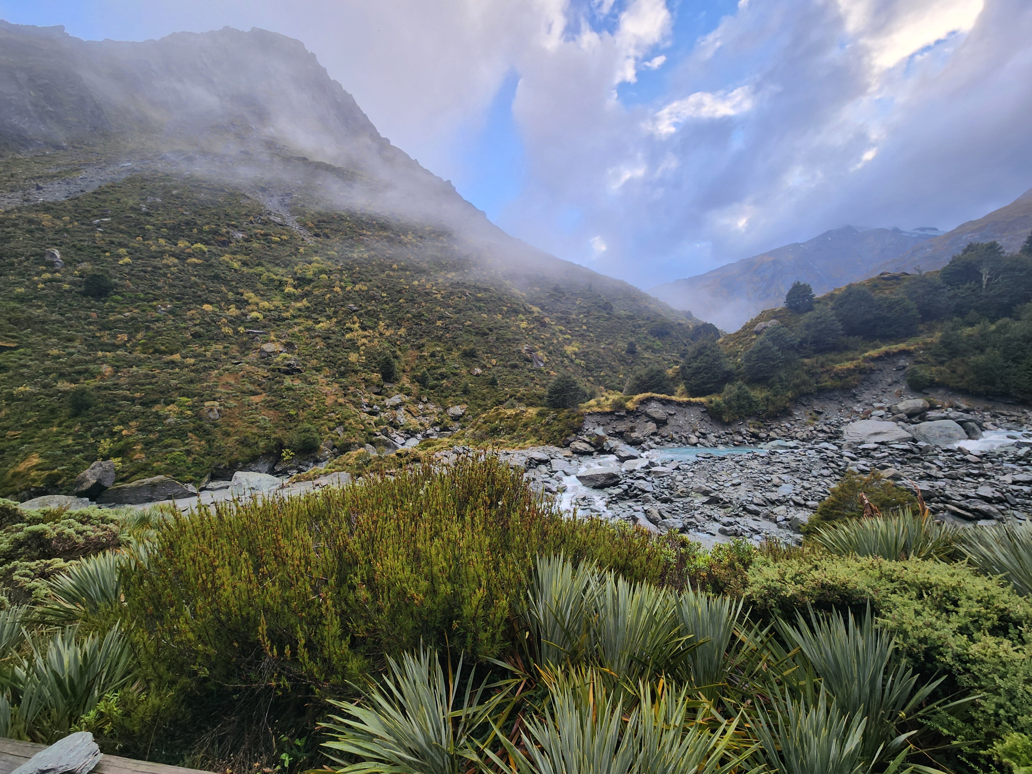
Once the visibility cleared up, we could see the powerful river pushing through. It was fierce! We could hear the sounds of the waves crashing from such a distance. Again, the colours of the water - it was almost glowing!
After about 30 minutes, we finally saw a bridge in the distance. That made us so happy, as we thought it was a sign that we were close to the hut.
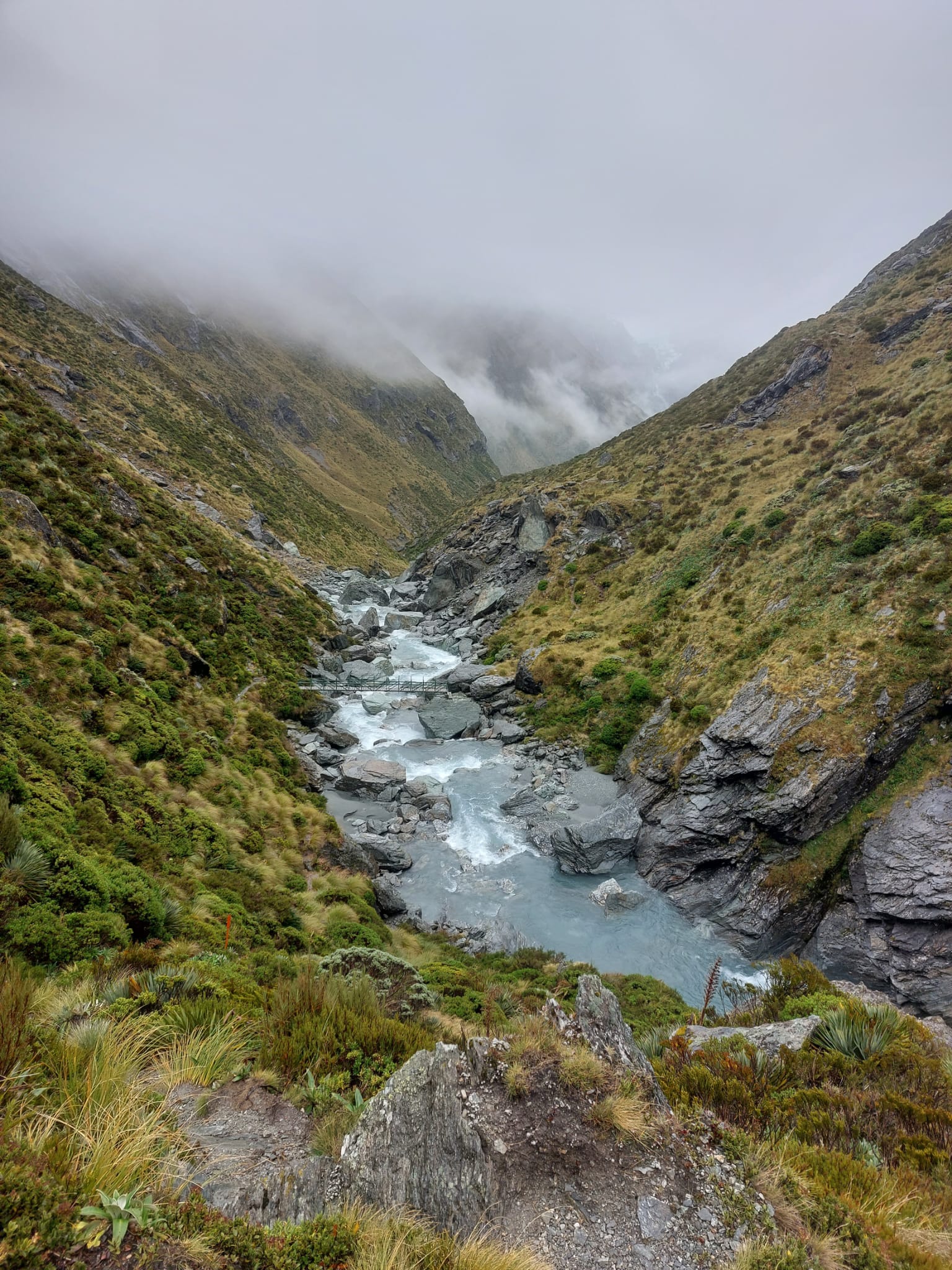
That’s the bridge we needed to descend to.
David’s eyes sparkled when he saw the bridge. What a relief!
The following hour and a half was just frustrating. At that point, we were also convinced there was something wrong with the estimated distances between the huts. We were clearly past 10km, had no one around to fact-check that we did not diverge off into some random side trail, and had no idea how long we had to go. We weren’t tired (ok, maybe a little bit), but we were hungry because we’d been holding off lunch to have it in the hut which was impossible to see. All I could see was a sharp descent that required me to drop my hiking poles and get low on the ground. In some sections, I actually had to slide on my bum because the rocks were very tall to climb down from.
I began complaining halfway down and demanding a lunch break. I literally cannot deal with hunger. At least the rain stopped by that point. While having our dried strawberries and meat bars, we finally saw two of the young family members from the group of 6. That was a relief. Passing by us, they were also confused about where the hut was but were very keen to arrive as soon as possible due to the approaching rain.
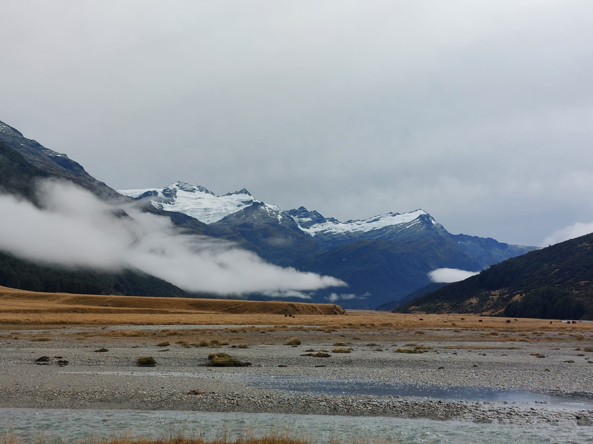
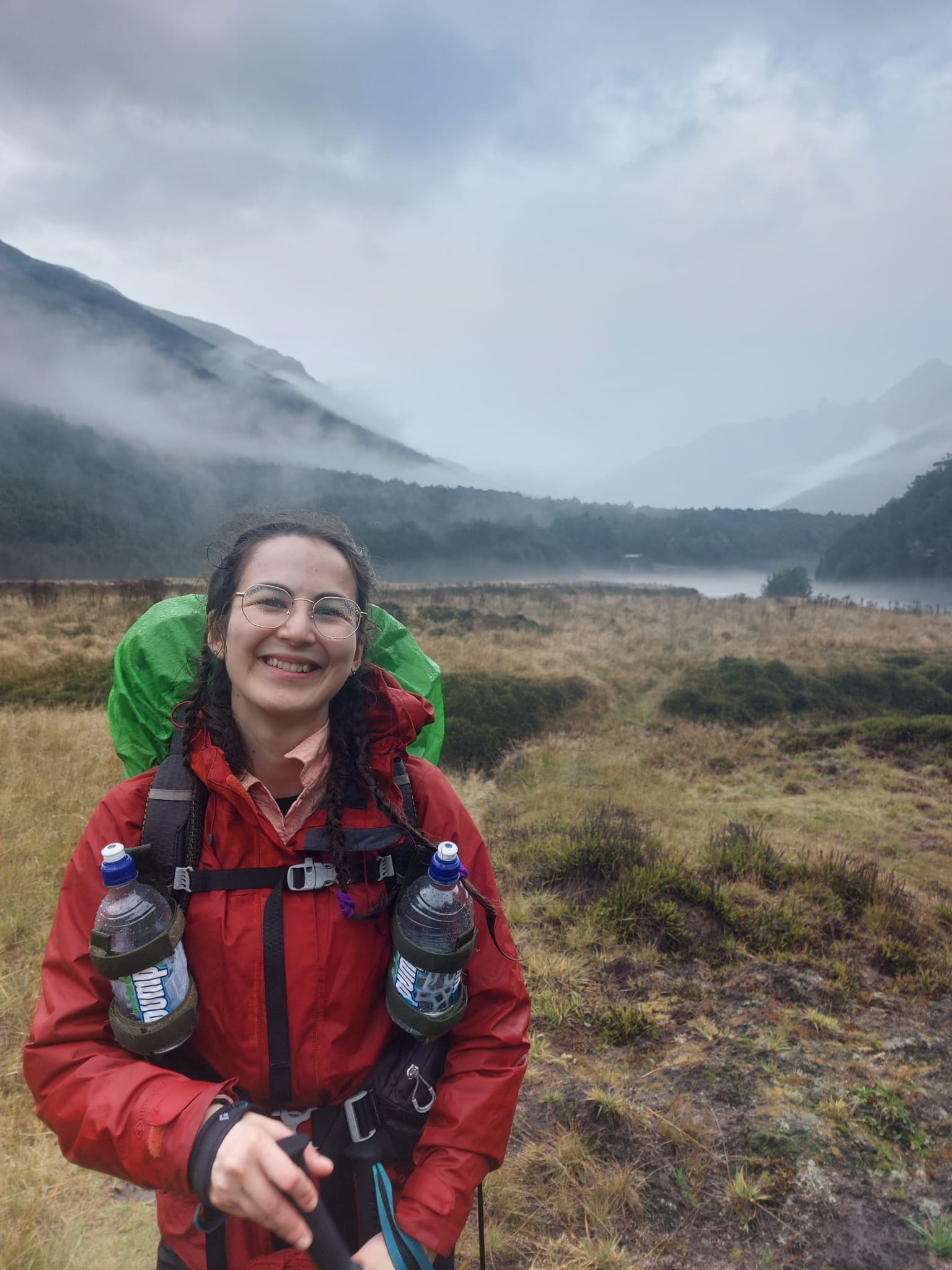
We packed up soon after, also determined to miss an ugly storm while on steep slopes and sharp rocks. One thing that made me very happy, other than the food, was spotting patches of glaciers between snowy tops at the horizon. Icy blue glaciers shining. I tried to capture it with my phone.
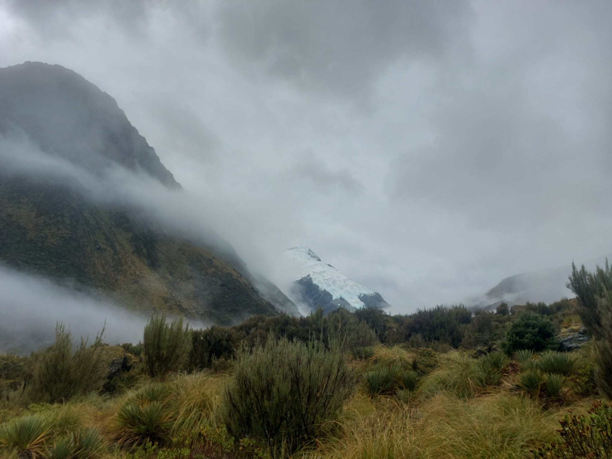
At the peak of the Ice Age (~18,000 million years ago), this was all part of an enormous glacier system which extended out to Lake Wakatipu (about 135km long). Now these glaciers are all pulled back, so far! I was still grateful to get a view.
Again, be careful coming down these rocks, especially when raining. A few of the sections felt a bit dodgy. After about another 40 minutes, David began pointing somewhere with excitement. Glad one of us has good eyesight because I just saw clouds. Turns out, he spotted another bridge and the two huts.
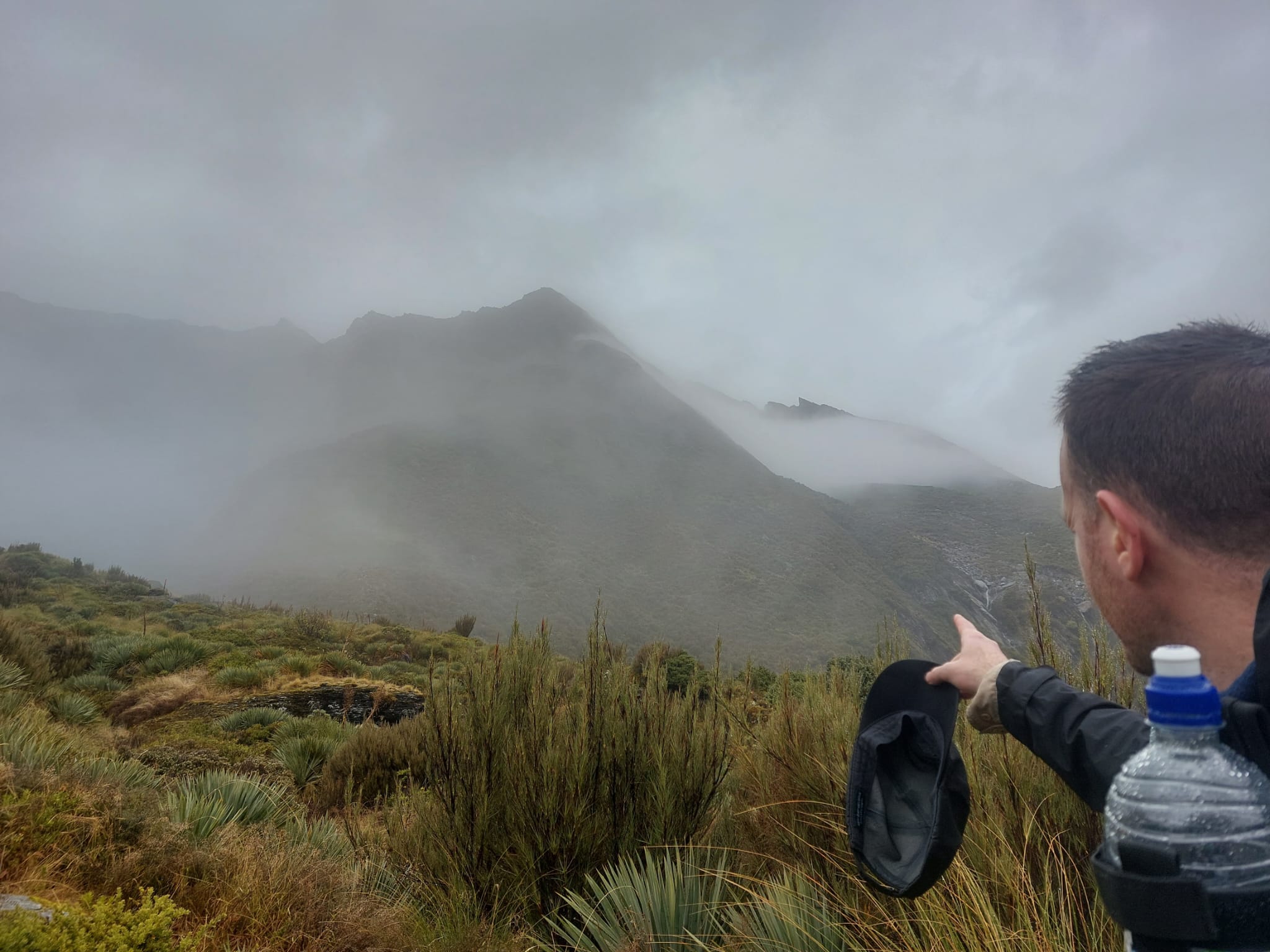
I had to see it with my own eyes; clearly, I was getting a little skeptical with this part of the trail. But when I saw the bridge too, I think I jogged with excitement.
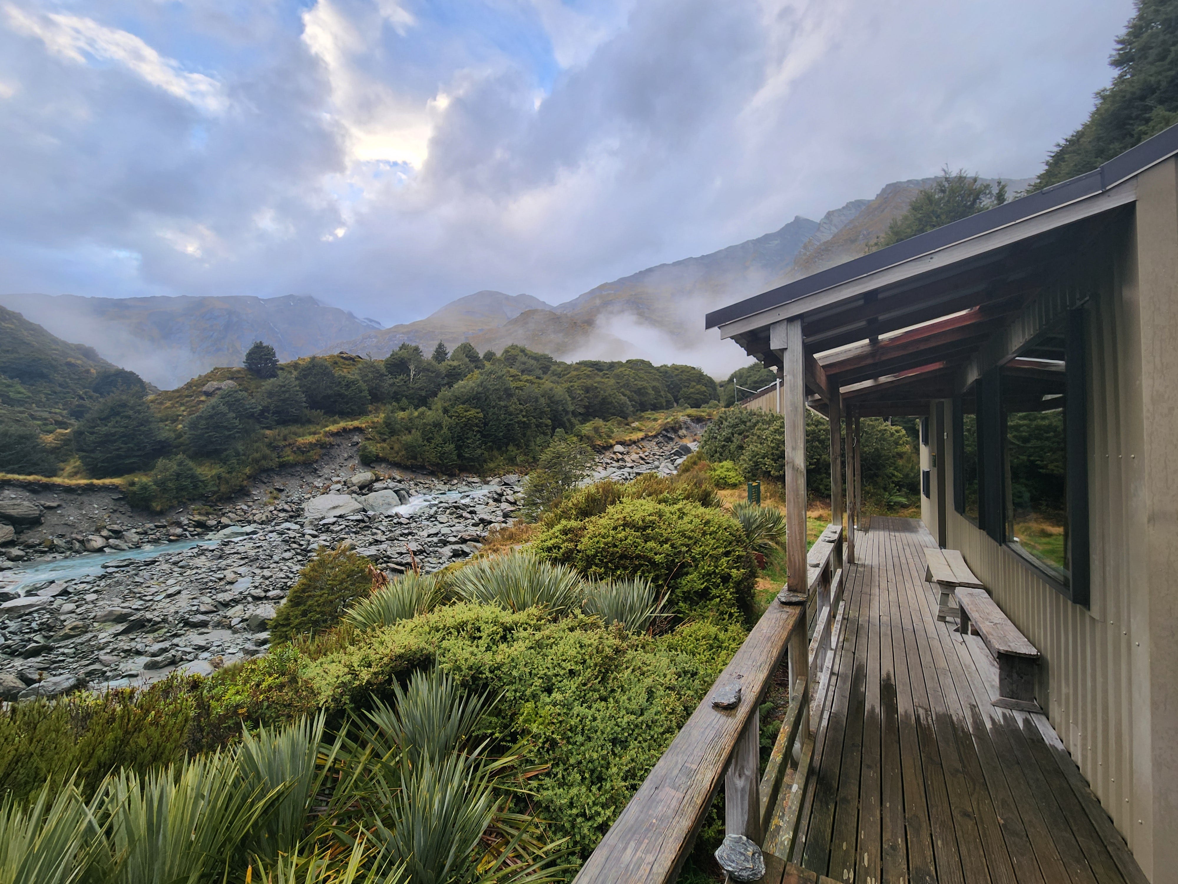
First, I found an empty cabin. There were 3 cabins in total. Dart Hut is the biggest hut on the trail. Then I pulled off my shoes and socks and turned them upside down. My feet have been moving inside a pool of water for half of the day due to the rain. We changed into warm clothes again and moved into the common area to cook something. By then, the storm began.
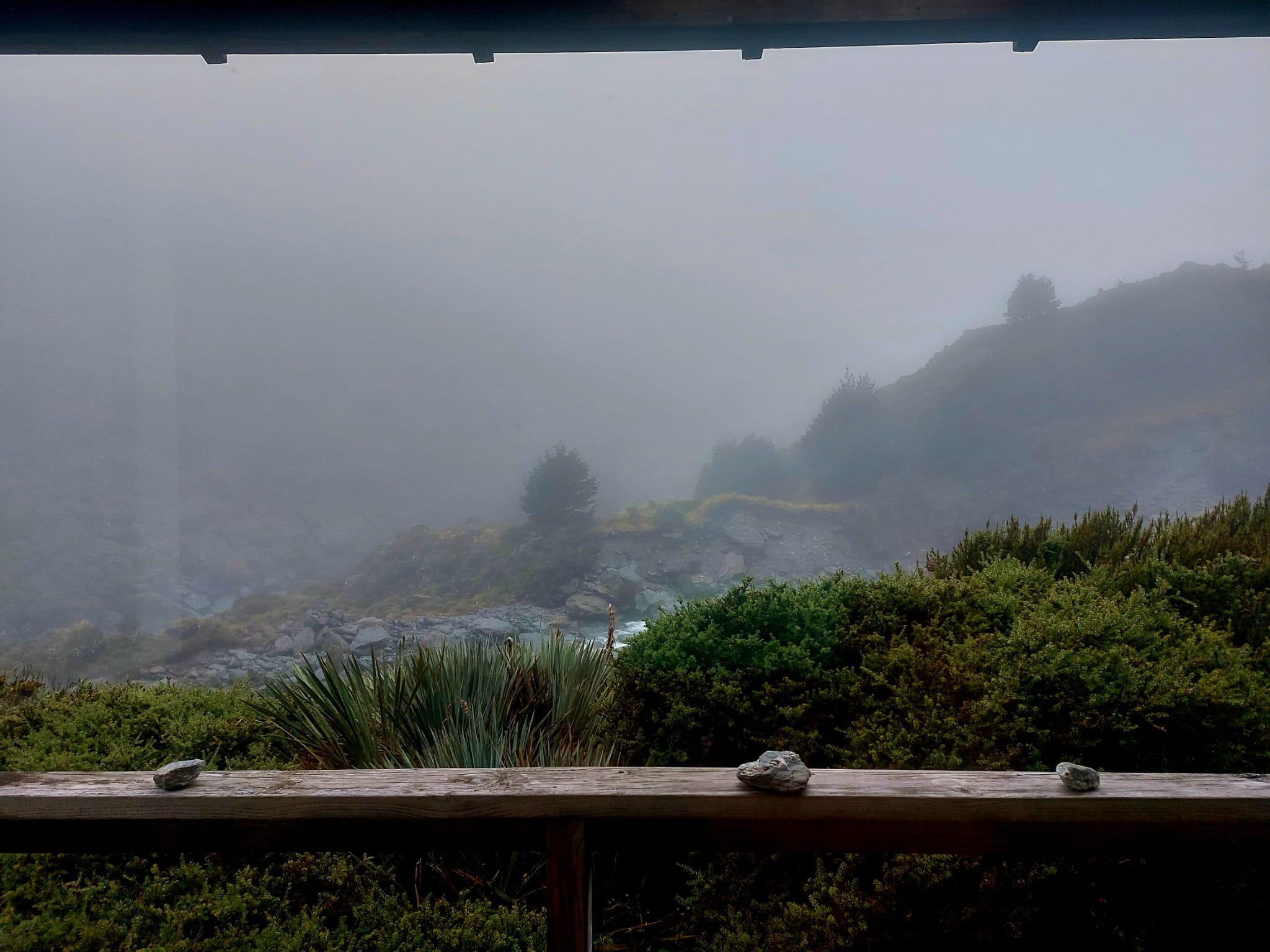
Rain was falling down faster and stronger; the wind also picked up. There were 3 other hikers left behind. We all sat near the window, watching the rain pour and keeping an eye out for the 3 others. We also found the whiteboard where the ranger wrote the weather forecast for the following three days. Rainfall was showing 8x more for the next day. That was when we decided it was not worth attempting the Cascade Saddle side trail.
Grey clouds sat lower. There would be no view if we tried to go up the side trail the following day. It would also put us at a high risk given how exposed (follows cliff edges) and technically difficult Cascade Saddle trail was. Something hard that I had to learn during my hiking adventures is that when nature does not allow you to pass, you do not force it. Nature will act the way it wants, whether you’re there or not. You can’t fight against it. You can only be grateful for the experience.
The 2 other hikers arrived soaked and safe after 30 minutes and the last one arrived after 45 minutes. One of them had a Garmin watch to track the map and the distance each day. We were all curious to know what she recorded. “
Almost 15km,” she said. “Maybe 14.5km. Not 10km. When my watch showed 10km, I looked around, walked further, looked around more, and there was nothing but the clouds. Nothing for another 5km.”
She was clearly disappointed and very tired. Later, we researched what other hikers recorded on Google and it’s quite accurate to approximate Day 2’s distance to be 14.5km.
“Day 1 was like that too. 21.5km. Not 19km. I’m worried about the following 2 days because I have a shuttle bus. I don’t know what to expect.” Fair point. This also concerned us.
“We’ll need to leave an hour early and pretend like it’s an additional 4km the next two days,” I concluded.
To be honest, knowing incorrect distances is dangerous. It’s deceptive of time. We arrived close to 3 pm and it was showering at 3.30 pm. If we left 1-2 hours later thinking this day was only 10km, we would have done the entire descent and some of the walks on cliff edges under slippery, wet and windy conditions, and may even have to put on our headlamps.
We hung out in the common area for a while. At 6 pm, the ranger arrived to collect our names and tickets. We had some conversations about going up the Cascade Saddle. He called out that even our journey from the Shelter Rock Hut today was a bit risky (due to the poor visibility and rain). We asked if he could make a call on our behalf to the shuttle bus service and request to pull the pick-up date a day earlier. Given the situation, it made sense to keep going and completing the trail a day earlier.
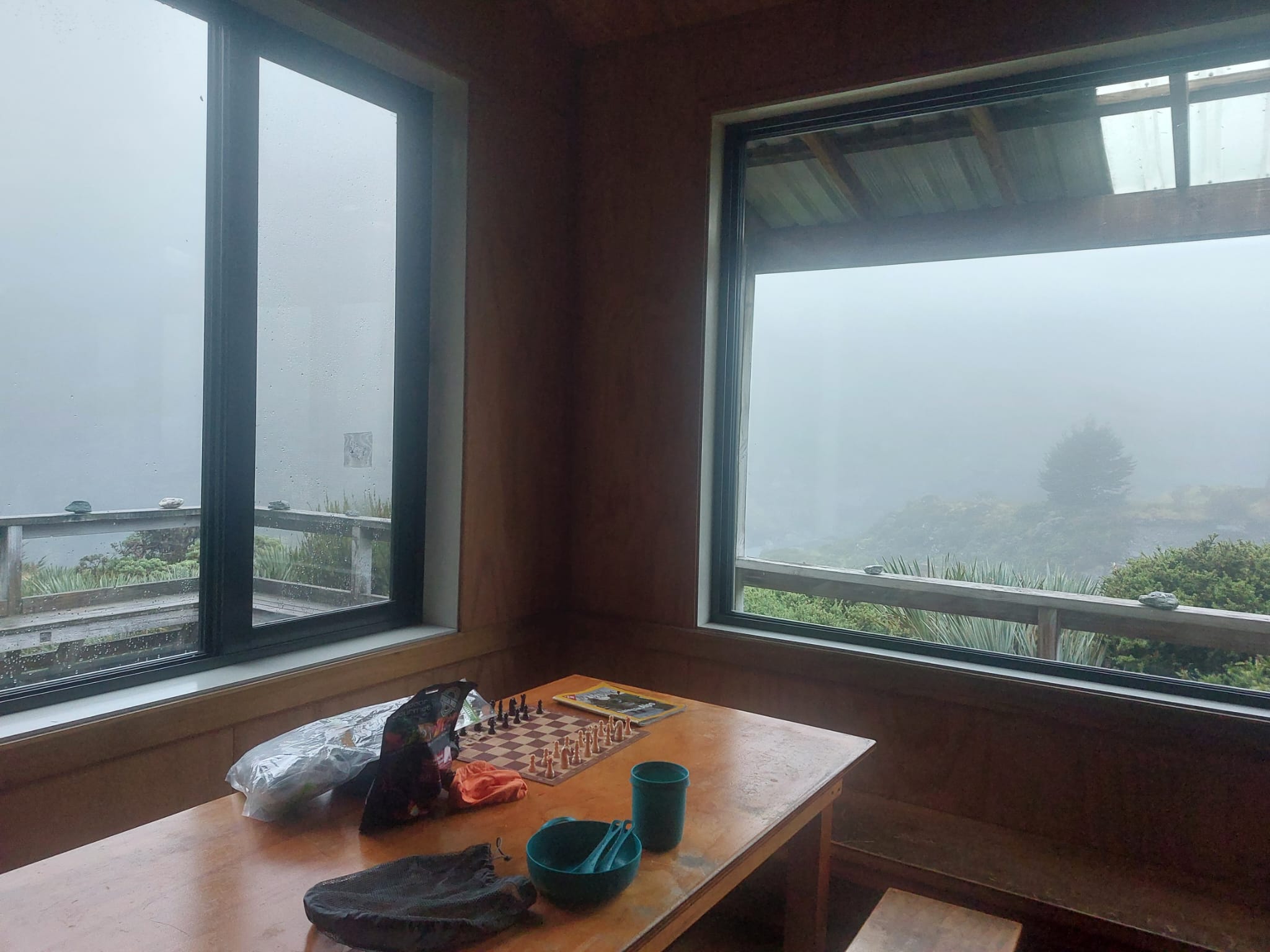
We had a plan: we have breakfast early tomorrow morning, pack up, and wait to hear back from the ranger. Depending on the outcome of the shuttle bus pick-up service, we would either push on to the next hut or play chess, journal and read on Kindle.
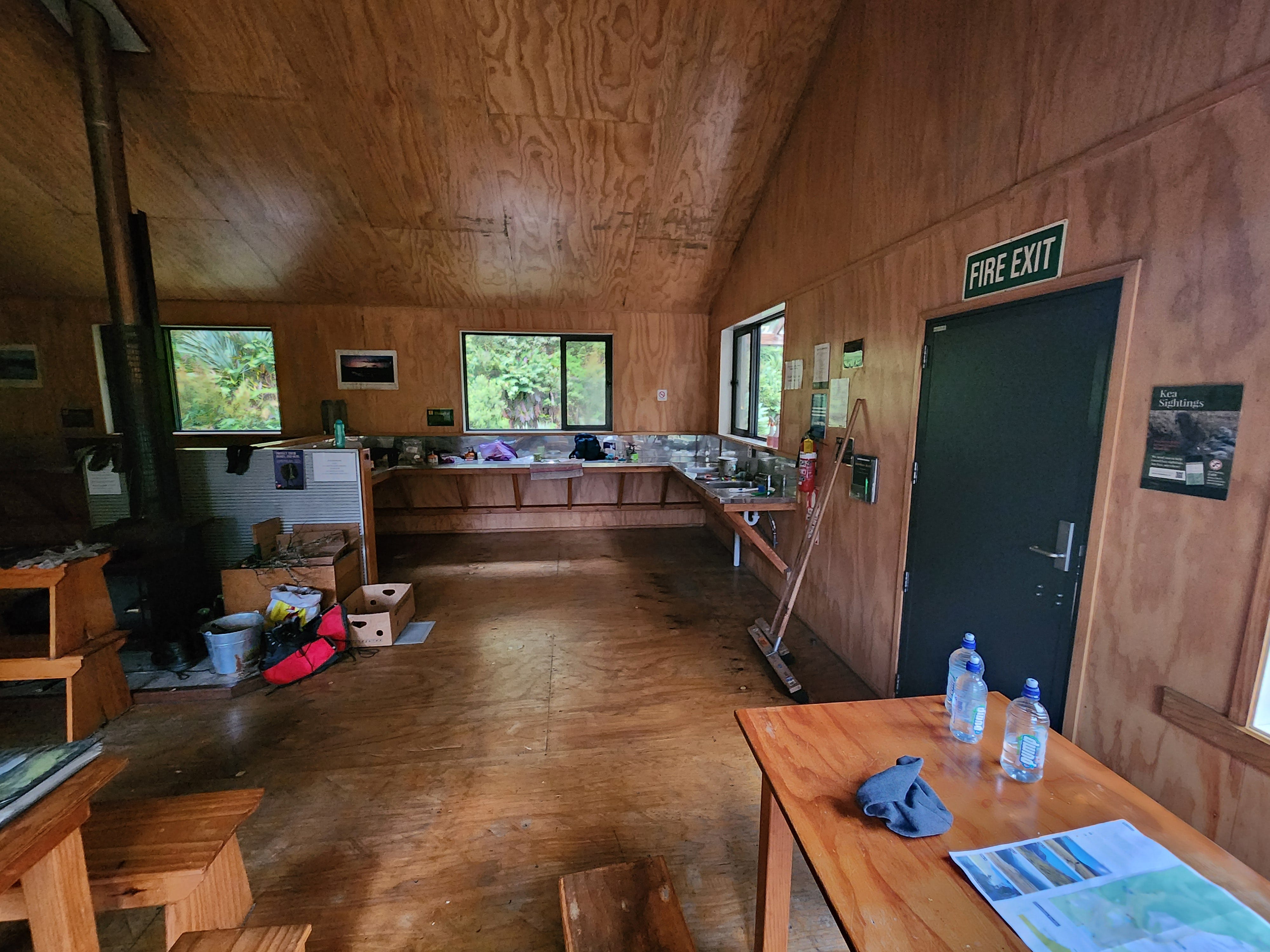
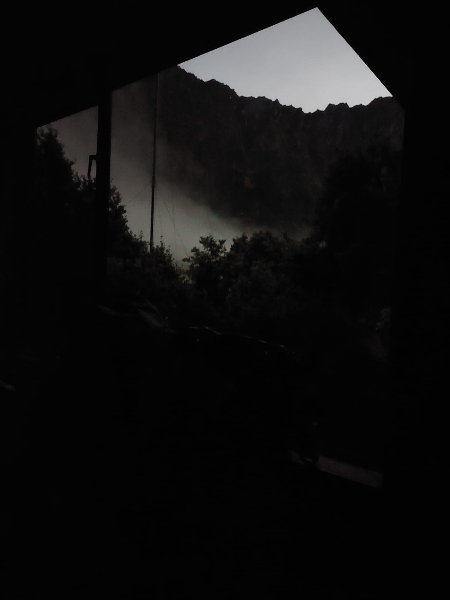
Images of the Dart Hut were taken the following morning.
Day 3: Dart Hut to Daley’s Flat Hut
18.5km, 6 hours 30 minutes
We woke up early and got ourselves ready as planned. Around 7 am, the ranger called the shuttle bus service and confirmed that we could pull the pick-up a day earlier. That was great news for us. Additionally, we found out the updated weather forecast — rains in the afternoon.
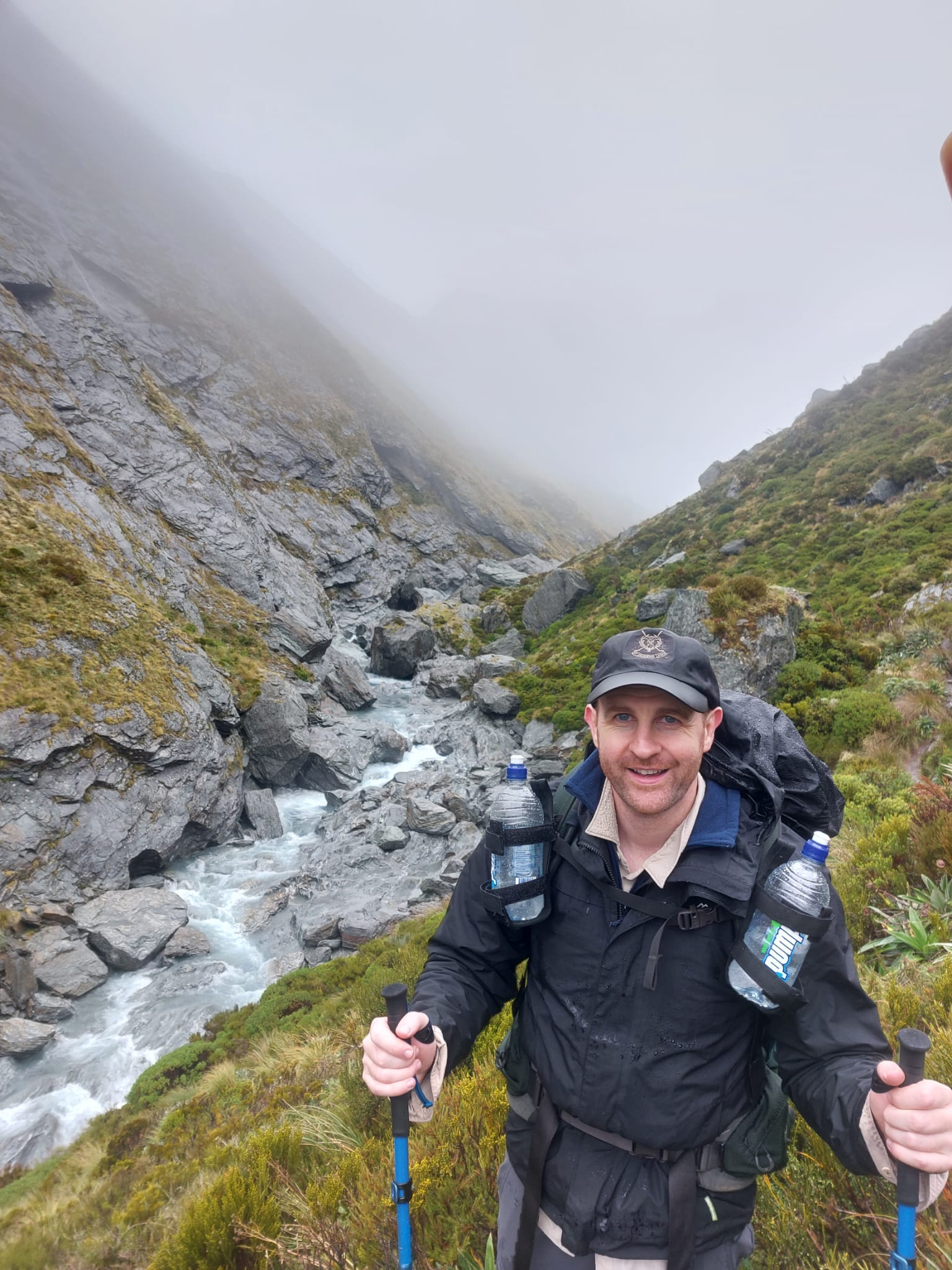
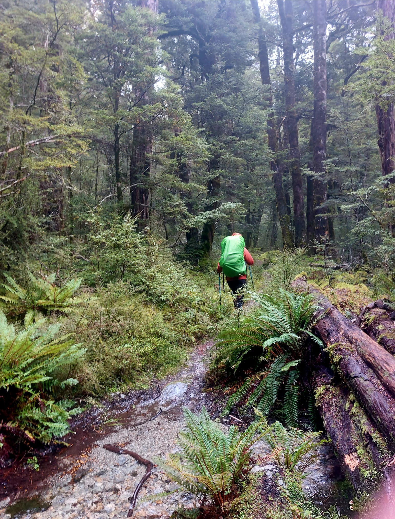
David’s feet were aching (about 2 out of 10) which wasn’t good news. His legs were also feeling quite stiff, so he wanted to ease into the hike rather than starting with a blast. I took the opportunity to take a bunch of pictures of the rainforest.
Majority of the day was a rainforest walk. Certain sections were rocky and others had brown soil as the ground. Constant ups and downs. Beautiful scenery within the different shades and tones of greens.
There were some minor waterway crossings on our trail. Drips of rain fell from the leaves above. Mosses made the rocks slippery, so we had to be careful in a few of the sections.
This is where I saw two deer. They were gorgeous, but our footsteps scared them off, so they galloped away fast.
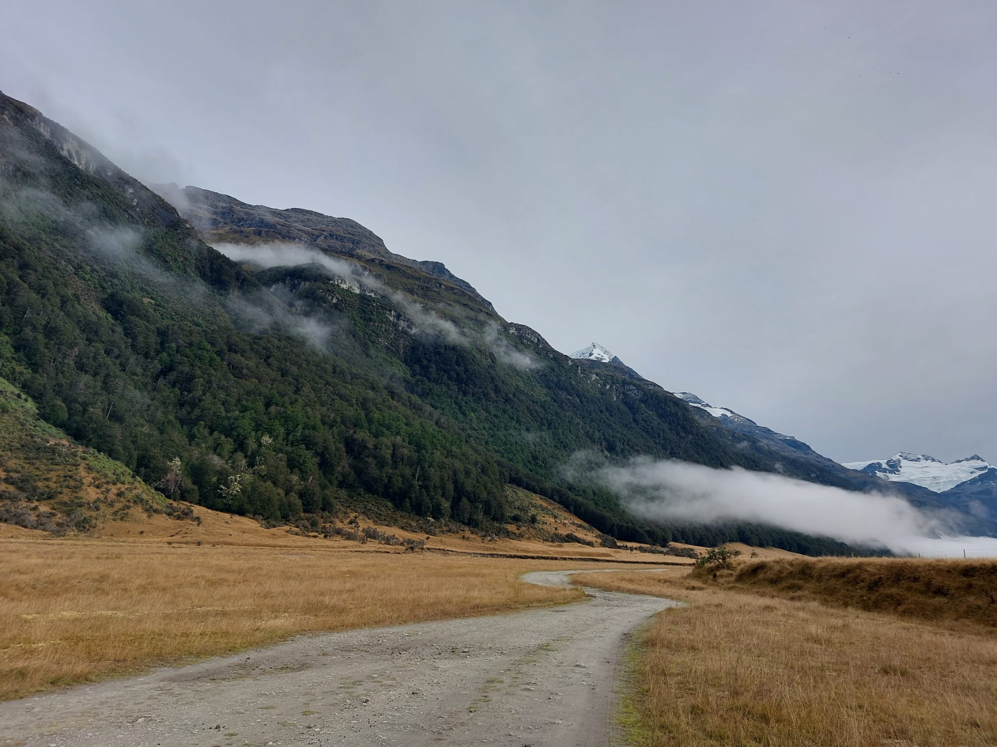
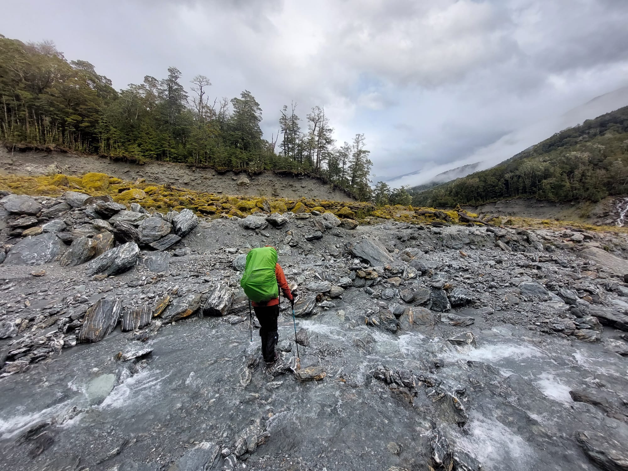
Eventually, we came out onto the cattle flats. This time, calling the trail ‘flats’ was a bit of a joke. ‘Cattle hills’ would be a more suitable name for the area.
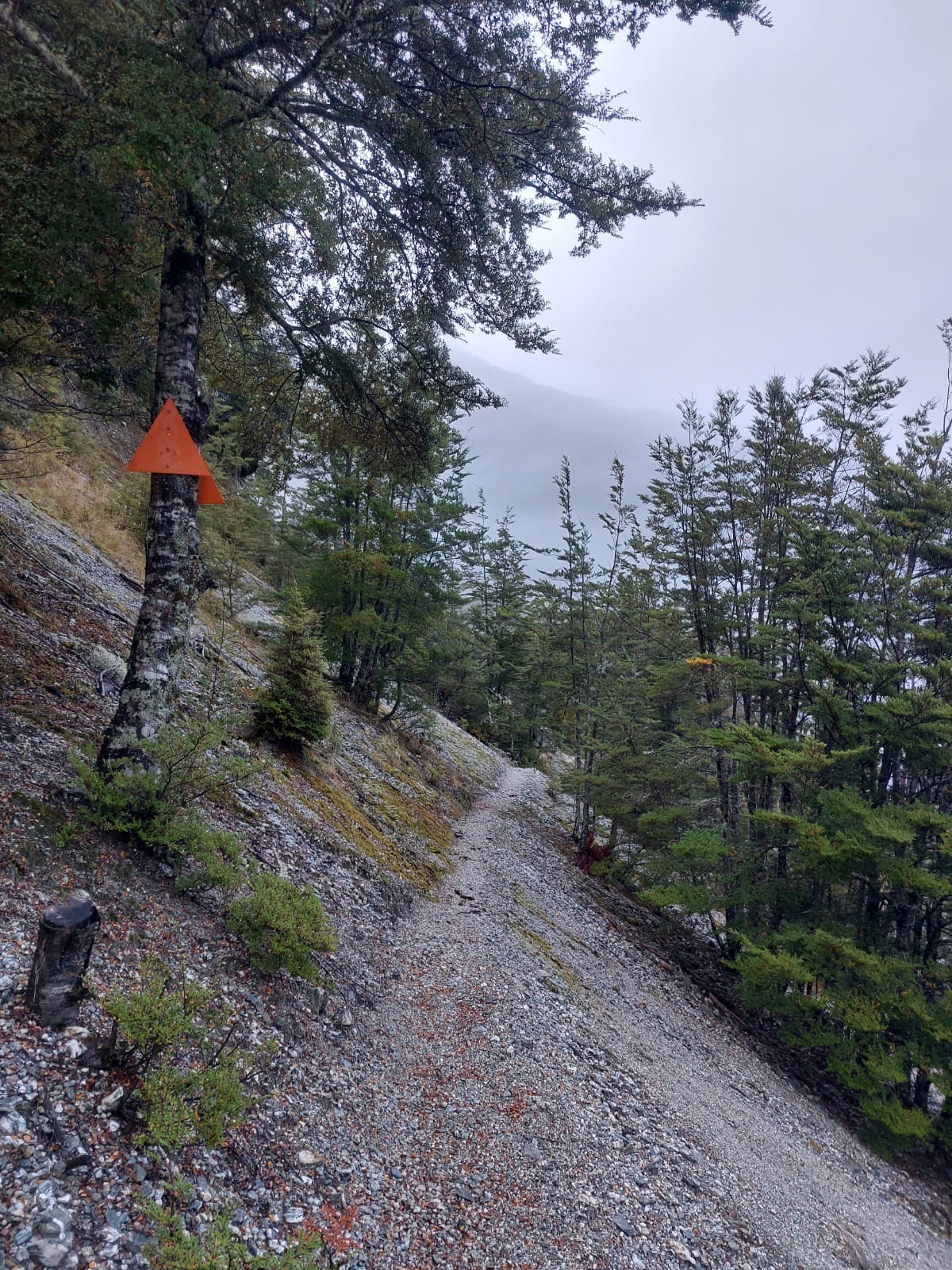
This is also where we saw a side trail curving to the right with a bridge. This was not on the map, so we did not expect to see anything. We were told to follow the orange sticks, so that’s what we did.
This part of the trail had a lot of rabbits. Fluffy cute brown rabbits fattened up for winter bounced away so fast that I couldn’t take a picture of them.
Me: I want to bounce like them.
Him: Please don’t. You’re already bouncing too much on this trail.
It wasn’t long before we hiked back into the rainforest. Then back out onto the open fields. Back in — back out. You get the picture.
When we exited the forest for the last time, Dart River was very close to us. We crossed it at a shallow section. I was surprised that there were still some calm streams given how powerful the main river was. It had strong currents and a loud roar. It was much wider than the Rees River.
We walked along the rocky section to the end, before climbing back up to the cattle flats. At that spot, near the river, we had our morning tea. It was lovely, but we came across a few sandflies and didn’t stay long.
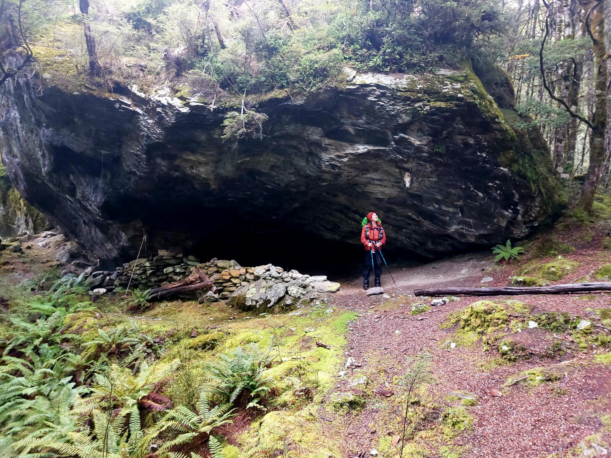
After continuing on the open fields for a while, we came across a large crossing and a sign. It pointed to a crossing if we wanted to continue on the trail, and to a picnic area (5 minutes away) up the rainforest. It was lunchtime, so we took a short side trail to check out this picnic spot.
That was an excellent decision. I would never have guessed how cute this place was. A massive cave crafted into a shelter with seats made out of wood and stones, a fire pit and extra wood, and a clothesline. Under an emergency, this would make a great camping spot.
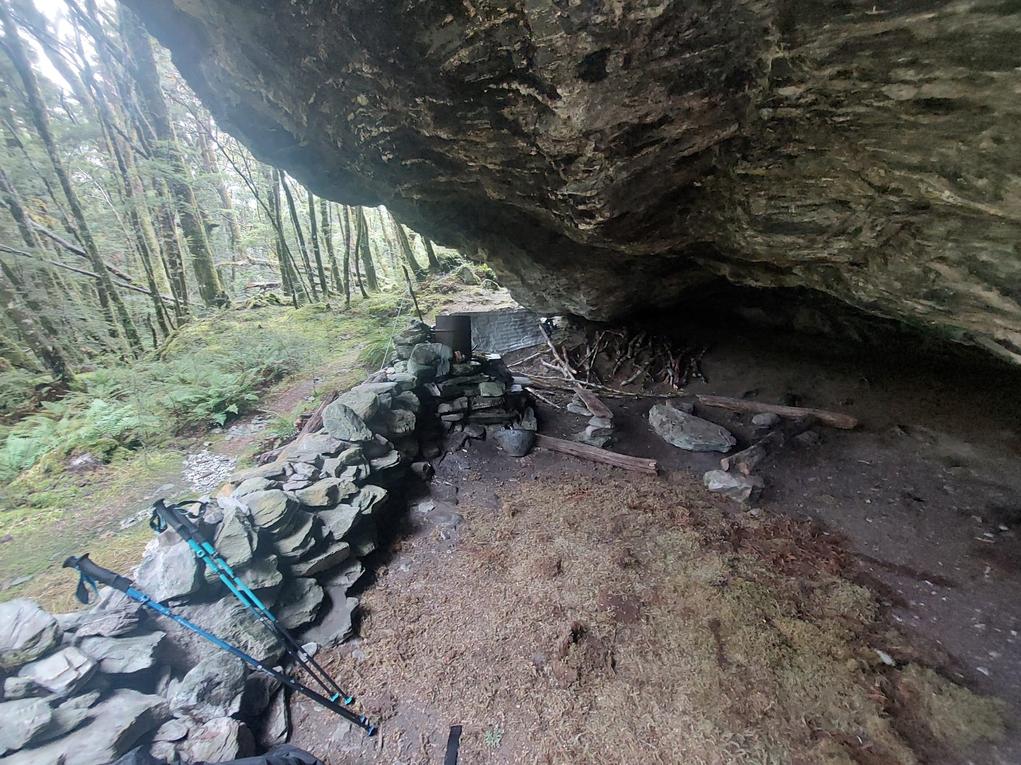
On the cave walls, a bow and arrow, and a mountain goat’s skull were hanging off.
By the end of lunch, it began sprinkling. We had a hard water crossing. I wish we took a picture but rain didn’t allow us. This was a wide crossing with strong currents and knee-deep water. The water also flowed down steeply. So falling in was not really an option. There were two big rocks in the middle of the waterway which the hiker was meant to use to cross without getting half of their body wet. The issue was that these big rocks were a little slippery and a bit too far apart. So I could not jump it, and also could not perform the splits. Something inside me resigned and sighed at the reality of being short. I chose to try to perform the splits.
I stepped onto the first big rock and stabilised myself. I did the squats and stretched out my left leg as far as possible to touch the following rock. Only my toes made it. I changed tactics and decided to be a big cat. I did not leap. I tried to…by stretching and eventually throwing my hands to the big rock. I formed a bridge between the two rocks and wanted to laugh at myself. But this was a serious moment. I lunged forward with my right foot, almost performed the splits, then pulled myself up onto the second rock.
The circus act was over. I stepped off the second rock. Then I watched David take two steps and cross within a few seconds. No comments. 🙄
We went back into a long rainforest walk. The pathway was mostly on running water (with rocky ground) or mud, making our feet very soggy. We slowed down a bit to avoid slipping.
The last bit of the rainforest was very rocky with lots of back-to-back small water crossings and two major waterfall crossings.
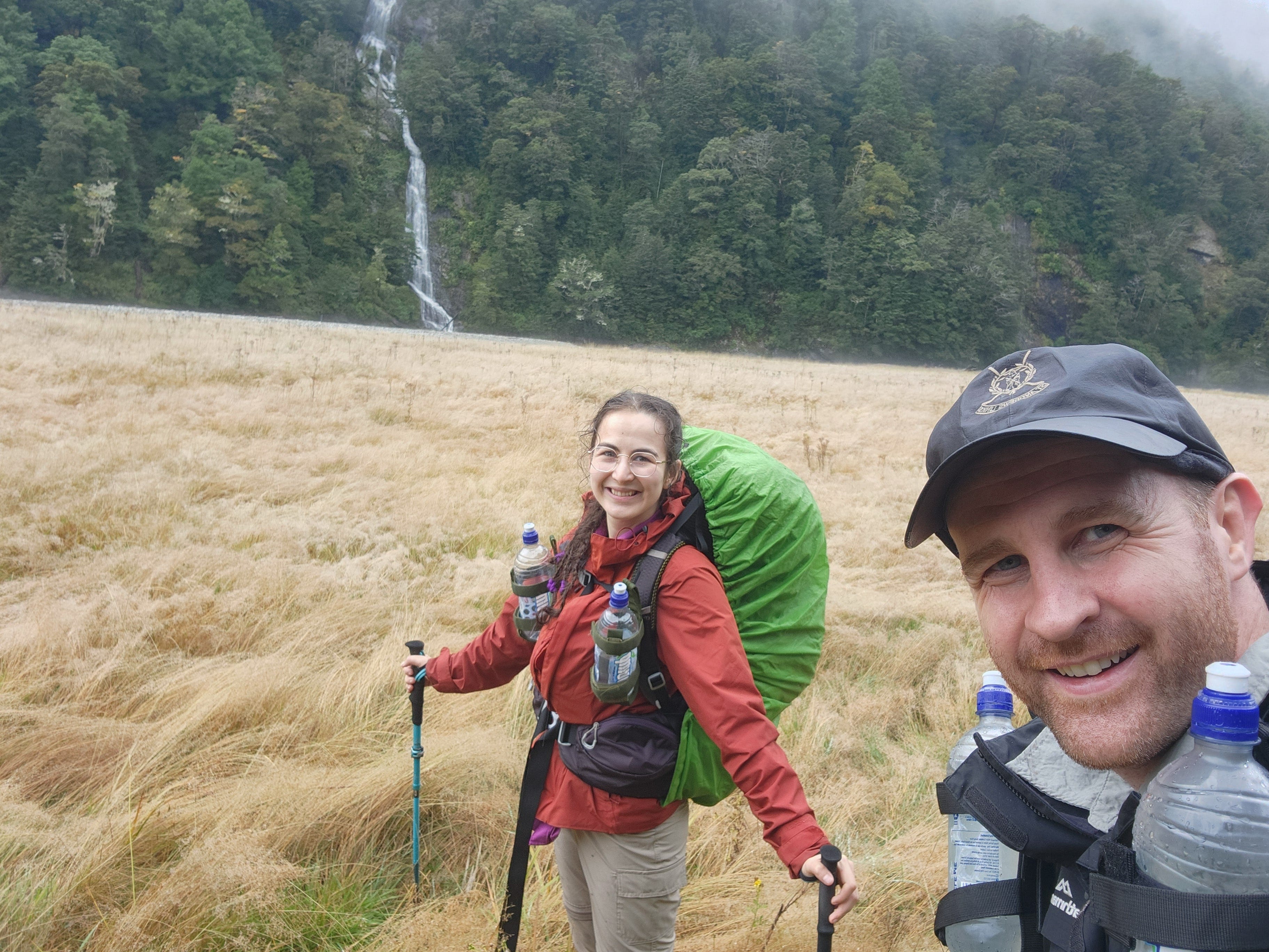
Eventually, we got back out onto the cattle flats. This was the final section before the hut. So I was very excited. The rain temporarily stopped and the clouds began to clear away a bit. We were able to see the tall waterfalls falling down from the mountain tops into the river.
Admiring the waterfalls. This trail had the tallest waterfalls I’ve ever seen in my life.
The young ones from the family of 6 passed us, speeding ahead. One of them had a bright orange/red bag cover which I really enjoyed following. I was like a cat jumping to catch a red light, chasing after the moving target. Dreamy, excited and focused, I didn’t realise how fast I was going until David began to yell after me.
“We can’t catch them, Doa. I can’t go any faster. Please don’t torture us. Let them go.”
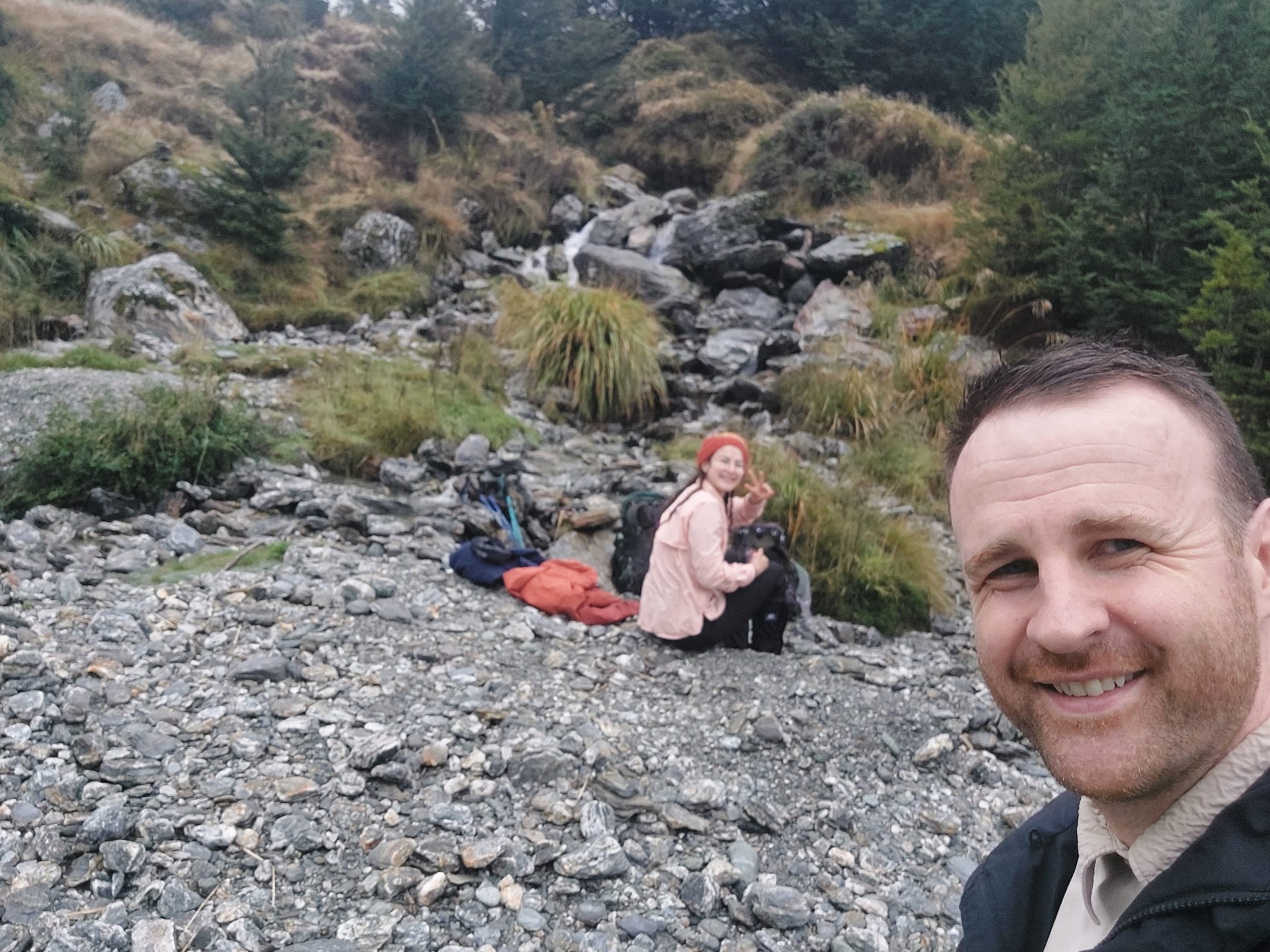
So we had a selfie break.
10 minutes later, we could see the walker’s hut near the Dart River. I was so happy. It felt like arriving home. Second time in a row, we missed the heavy rain by about 10-15 minutes. Lucky us!
After settling in, warming up and making myself comfortable near the fire place, I realised that my ankles, calves and tibialis were quite tight and sore. I took the next half an hour massaging the muscles and joints.
We shared some food and dessert. Then I did some journaling. This was our final hut. I was looking forward to the finish line but also would have loved to hike for a few more days. This has been such a fun journey.
Reading about Day 4 in the hut.
Day 4: Daley’s Flat Hut to Chinaman’s Car Park (Dart)
20km, 6 hours
Big day. We had to get an early start. Woke up with an alarm, packed up the bags in the dark, had breakfast and left after sunrise. Given how deep our location was buried in the forest, it was still dark when we kicked off our hike. We put our head lamps on for the next 15-20 minutes.
David put some ground rules: warm-up/ease into the hike first, then steady moderate pace, and no rushing. I wasn’t super energetic that morning and also wanted to take some pictures, so this worked out well for both of us. I think even regular hikers start to feel accumulated tiredness on day 4. Usually slowing down will help.
Shortly after we got out to the cattle flats — only for a few minutes — and had to cross two waterways back to back. This section was a bit sandy. We had to take our boots off, as the crossing was a little above knee-deep. The sand is a bit of an illusion here as when you step on and put your weight on it, you also sink into the sand very quickly.
After drying off and shooing away the sand flies, we continued into the forest. We spent a long time hiking on relatively flat but rocky terrain with some ups and downs. We were able to pace through this easily.
On the way, we counted the different types of native birds we’ve come across. They are all very small, like the size of my palm/hand. So far, we’ve seen some Riflemen (Tititipounamu, messengers to the Gods), South Island Robins (Kakaruai) and Brown Creepers (Pipipi).
Eventually, the terrain became a bit more challenging with tree roots to climb over and a few random steep drops. I was warmed up and had a good energy going on. This was when David began calling out for me to slow down.
We had our first water crossing (rocky and easy), then a second water crossing (wider and less rocky). The second crossing looked like a cool spot for picnic/morning tea and it had spots to sit down too (flat rocks, clean logs etc).
We kept going and came across a split in the trail, both sides showing orange arrows. It was a little bit confusing at first glance, but after a bit of inspecting, we realised that this area is prone to landslips and flooding. It seems like the original trail was destroyed by both as the orange markers disappeared into the Dart River. So we took the left trail and began our constant climb.
Walking on landslip sections is very cool. You look up to see a steep cliff with exposed tree roots that look dodgy; you look down and see another steep cliff with fallen trees leaning into the river. On a narrow path made out of little crumbly grey rocks and surrounded by clouds, I wanted to admire where we were and also get through this section fast. This was when I got my second warning about moving too fast.
We hiked in and out through these sections and as the clouds began to disappear, we realised how big the Dart River was. Maybe the rains of the past 2 nights caused it to swell, but this looked like a wide, deep and wild river eating the land away. Trees and little hills were sticking out in the middle of the river’s path like little islands. The waves were crashing into the rocks, splashing with sounds which we could hear from high up.
We also passed a few waterfalls which involved steep but short descends and ascends. This was when I got my third warning. In my opinion, it’s easier to move fast through steep terrain, as you get it over and done with (rather than making it drag on, which is harder).
We climbed up a few tree roots and eventually came across a sign, pointing to a 200m steep climb. It began sprinkling. This is where we had our morning tea. Apple pie nut bars - yum!
Me: Ready?
Him: Yes, but you’re not going in front anymore. I’m leading. Clearly, your legs are fresh but mine are tired. I want to hike with you, not alone.
Me: Oh, sorry. I’ll follow you.
Unlike the implication of the sign, I didn’t think this was a difficult climb. It had a handrail on the side and wooden stairs! After the ascend, unfortunately, the clouds covered our view again.
We were under the assumption that once we saw the other sign about the 200m climb (indicating the end), we would not have further ascends. But the following hour was a constant climb. The pathway was interesting though; it had multiple wooden stairs. Felt random to see a man-made pathway in the middle of nowhere. It was probably due to the risk of further erosion of the land. Day 4 of the hike was full of landslip sections.
Between the wooden stairs were the water crossings formed by overflown water from the tall grey rocks and trees covered in moss (above our heads). Imagine multiple thin streams of water overflowing. We were eventually hiking on long water streams with slippery rocks underfoot, while also getting splashed and rained on by the overflowing water above us. Bit of a weird wet and messy scene. Some of these crossings have handrails to hold onto.
In one of those crossings, a thick tree branch fell into the water between David and I. That stopped my heartbeat for a second as it splashed in front of my eyes. If I was a step ahead it would have knocked me out. So walk through these sections safe and fast, as the water really rots away the parts of nature it touches.
Here, you can see the wooden stairs.
This one was one of the stronger waterfalls we crossed with handrails.
We read on the trail guide that there would be 2 bridges back to back (one destroyed by the landslips and the other was a newly contracted one). But we never got to see the collapsed/destroyed bridge.
I’ve called out, “this is probably the broken bridge” to every handrail we’ve come across. Eventually I gave up.
Instead, we saw a wooden bridge over a waterfall. This was lovely to cross. After about 20 minutes, we saw a trio of wooden bridges, also going over a waterfall. I believe this indicated about 60-65% of the way to the end.
We continued for about 45 minutes inland and crossed another waterway before we got to see the river again. The trail curved around following the river, before exiting out to an open rocky field.
Short hike over this section before seeing another newly constructed bridge. At that point, we were confused (not sure if the map did an accurate job representing the landmarks on this trail).
Most bridges only allow 1 person at a time to cross.
We hiked to the end of the open field and came across a water crossing. We collected some water from here. This is where the family of 6 caught us up. Surprisingly, I saw the mum first.
Me: Hey, you guys caught us.
Her: Yes, I think everyone’s taking today a bit easy though.
Me: Yeah. Where are the young ones? They’re usually the first ones we see.
Her: I know! They raced ahead every day leaving me behind. So this morning, I unpacked my bag and distributed the load to all of them. (Her eyes sparkled with a cheeky grin). Look who’s the speedy one now.
David and I had a laugh at that. She looked proud too. Clever. I was very keen to find the finish line, so took over the lead again.
This section transitions into another rainforest walk that curves around, staying close to the river. We counted the mushrooms/fungi on our way; we’ve probably spotted 11 different types on this trail over the past 4 days, if not more. My favourite one was the flat black fungus (called ‘common ink cap’ if you’re curious).
For the second last time, we came out onto the cattle flats and saw multiple tall waterfalls on the mountains ahead. Quick picture time.
This is also when we began meeting a few groups of hikers coming our way. It was about 12 pm and while we were happy to see others (so we can ask them, “how long do we have left”), I also felt a bit concerned. Even if you have experience hiking with your headlamps on through the dark, please don’t start your hike late. It’s safer to hike during the daytime. Especially in a forest buried between the mountains, it gets dark earlier than the sunset time Google shows.
Majority of the hikers mentioned we had 1 hour 30 minutes more to go. Both a relief and an annoying desire to run towards the finish line. I was also getting hungry as we didn’t have lunch. We went along the cattle flat for a little while, then stepped back into the forest.
Long, muddy and curvy pathway with logs and some small dead trees on the side. I got the sense that this section floods during spring.
Honestly, after spending so much time in the rainforest, everything starts to look the same. So counting things helps me to stay sharp. After the mushrooms, I began to notice and count the numbers on the orange markers/arrows. They were descending. We were in the early 50s, descending down to the 40s every couple of hundred metres. It was quite exciting to follow, as it gave a sense of accomplishment and progress (like a big countdown).
The last 40 minutes were a bit of a drag because I ran out of energy. So we took out our dried pineapples by Nibblish, which were delicious. That made me happy. The following 25 minutes was a constant climb curving around and around. It wasn’t too steep but definitely tiring.
Once we began descending, I knew that we were at the end. I could even see a few families having a picnic near the Dart River at the distance. That’s when I picked up the pace, determined to find the Chinaman’s car park.
The trail flattened out and we came across a muddy section with lots of fallen logs. We walked around this section to avoid slipping and getting too muddy. There was the last bit of cattle flat. At that point, it felt like a joke not seeing the car park. We hiked for another 5 minutes, past 3 tall dark green trees in the middle of yellow grass (they look oddly placed, so you’ll notice them), hiked for another 5 minutes, and saw the car park.
1.10 pm. We made it!
Feeling of relief, a proud hug, happy clap, then we dropped our bags under the shelter. We changed into warm clothes and had lunch while waiting for the shuttle bus. This is when we got attacked by the sandflies. No injuries from 4 days of hiking 74km, but many little ‘wounds’ on our hands and feet from scratching the sand fly bites for the following few days. They defeated us.
We had a nice scenic ride back to Queenstown. I was falling asleep towards the end. We arrived late afternoon just before 4 pm and collected our luggage from the storage.
We grabbed dinner from the town centre and found our accommodation. After a long hot shower to get rid of the dirt, we fell asleep pretty quickly.
Questions: if you have any questions about my notes, leave a comment and I’ll reply.
Thanks for reading! Subscribe for free to receive new posts and support my work.
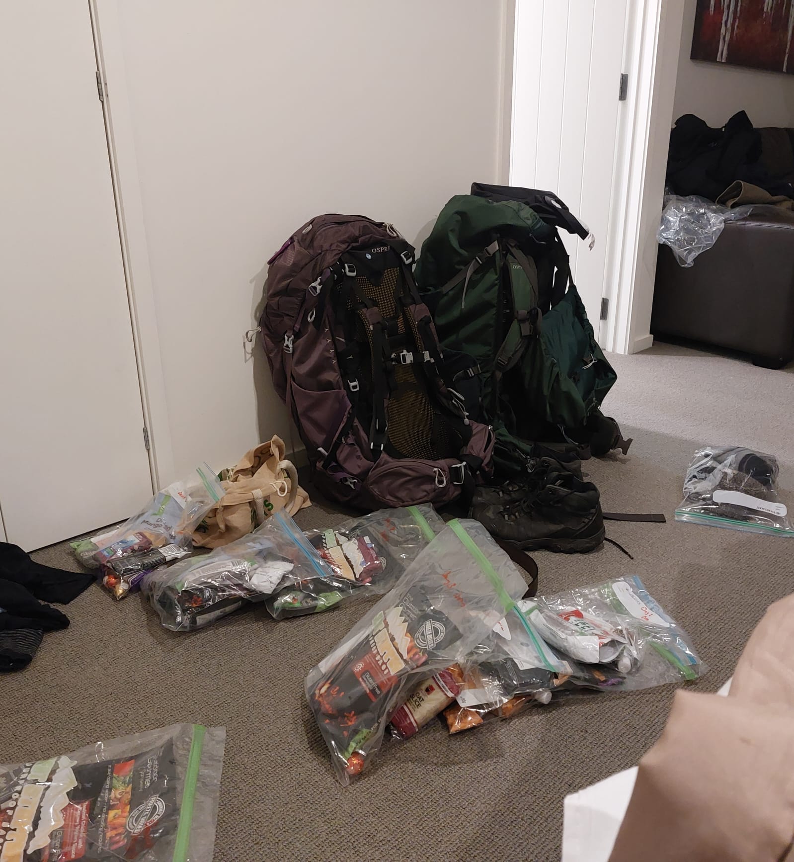
Pre-Hike (Preparation)
This was our first big hike after the South Coast Track. Leading up to the adventure, we had to address the SCT retro action points.
A ton of time strengthening feet and ankles, along with building lower body muscle and cardiovascular fitness
Refining our packs and taking out unnecessary items (i.e. tent, sleeping mat)
Researching alternative foods and electrolyte sachets to pack
3 months in advance, we booked a shuttle bus to pick us up from the Info & Track office in Queenstown on the 17th and drop us back into the Queenstown Centre on the 21st. We could only leave this “to the last minute” because the walker’s huts don’t need a booking for this trail (which is rare in New Zealand). Yes, this was a “last minute” arrangement by New Zealand standards as the hut tickets for the more popular tracks (i.e. Kepler/Routeburn/Milford) were sold out by the end of November (5 months in advance).
We bought a new charger for our phones, as the solar battery was not helpful on the SCT. We also bought hiking sandals for this trail, as recommended by other hikers.
After declaring that we carried hiking equipment and food at the airport, we were pulled to the side for an inspection. Turns out, the officer inspecting our backs was also a regular hiker who’s completed the Rees-Dart track 3 years ago. Nice coincidence! At the same time, my diligent packing and organising of the daily foods were messed up because every item was carefully inspected. They take this seriously in New Zealand (so they should be). Please do your research (attached is the link I got my info from); dried-freeze products involving pork will be thrown out immediately.
We also had a few things to do in Queenstown before departure. On our first day, we bought walker’s hut tickets and a gas canister from the Department of Conservation (Visitor Centre). The workers knew so much about the trail, so their insights were helpful. You can also find trail maps and photos, which are cool to look at.
If you need to buy more food for hiking, Queenstown is the place. This is an outdoor adventure town; you can find dried-freeze foods in regular grocery stores like Woolies, Fresh Choice, or Four Square, in visitor centres, or even in some of the smaller convenience stores.
Lastly, I braided my hair tightly the night before hiking to avoid the curls getting tangled up during the hike.
Post Hike (Recovery)
Firstly, if your way crosses Queenstown, my recommendations for food would be Balls & Bangels (for soft and fresh bagels), Ferg’s Bakery (for rich comfort pies), and Bombay Palace (for strong flavour and spice).
If your way crosses Auckland, try out ginger slices (it’ll make you love ginger), savoury cheese & bacon scones (so soft, why doesn’t this exist in AU?), Hell’s Pizza (for a gourmet experience), and Luna’s Bakery (if you’re from AU and drink coffee, this may be the only place that can satisfy your coffee cravings — I’m serious).
Anyway, the day after arriving to Queenstown, I woke up at 6 am and decided to test if I could still walk. I watched the sunrise and ducks outside as I walked through Saint Omer Park to Queenstown Bay Beach. Ankles felt a bit stiff but the rest of the body felt good. Grabbed us coffees and a hot cross bun, then walked back.
Having an additional day for recovery was great because the post-hike admin is tiring. Finding your accommodation, researching a laundromat nearby, carrying all of your stinking wet and damp clothes for a wash, waiting around, then drying those clothes, waiting around more, also washing your muddy gaiters, laying out the rest of your damp gear (i.e. boots, bag, hat) under the sun to dry (hopefully it’s a sunny day), buy some food, and more than half of your day is gone. You’re still tired. You still need to lie down on the bed and read a book or watch a movie so your body parts fully recover. So that’s what we did on our first day back.
On our second day, my upper body was ready for a workout, so I found the small gym at the AirBnB and did as much of my ‘pull day’ as possible. I also tested the ankles, calves and tibialis again by doing some light movements, like walking on my toes and heels, single-leg balance movements and squatting on my toes). They felt better but still quite stiff. We were in bed most of the morning. I wrote a lot, collected pictures from the hike and had a warm, creamy and comforting berry & almond butter porridge. By lunch, we were both energetic for playing disc golf. Going up and down the park’s slopes, and running after a frisbee was definitely a workout for our lower bodies. Once tired, we headed over to grab some ice cream, then walked back to our AirBnB about 15 min away.
On our third day, I felt 75% back to normal. After another upper-body workout (push day), I tested out the lower body with light jogging for a few minutes and some animal movements (cat, crab, frog jumps). We had a half-day ‘fly, cruise, fly’ tour of the Milford Sounds, which was a lovely scenic trip.
On our forth day, I was 85% and on our fifth day, I was 95% back to normal with my lower body strength and flexibility, good for running again.
I cannot compare our speed of recovery to the South Coast Track (2 full weeks of rest for the lower body and 1 week of rest for the upper body), as both tracks vary in their degree of difficulty (even though they were graded the same). However, it was still incredible to see how quickly one can bounce back into their routines when they are well-trained. I attribute that to the level of fitness and mobility we built leading up to the hike.
Questions: if you have any questions about my notes, leave a comment and I’ll reply.
Thanks for reading! Subscribe for free to receive new posts and support my work.