
Part 3: Exploring East Royal National Park (Guide to the Day Hikes)

This is the 3rd and the last part of Exploring Royal National Park post. The following trails lie along the well-known Coastal Track we completed in August 2024. If you are training for that trail, exploring these routes beforehand will be very beneficial.
Tips:
Routes to the beaches get very crowded during summer with families, so parking becomes challenging.
During the whale and dolphin migration seasons, keep one eye out on the ocean. I spotted a few whales in the past.
Some trails will be very windy, even in summer. Don’t wear loose items. Secure your hat tight around your head.
Wattamolla to the Eagle Head Rock
This has been our regular training route during 2023 with heavy packs, although we went further than Eagle Head Rock. Point-to-point, easy to remember, up and down, and with a gorgeous view of the ocean.
It’s a 9km out-and-back journey (takes 2h 45 mins - 3h 45 mins) with a 336m elevation gain. Here is the link to the All Trails map if you would like to check it out - https://www.alltrails.com/trail/australia/new-south-wales/wattamolla-to-eagle-rock
The trail starts from the Wattamolla car park. This was renovated a few years ago; it now has quite a large parking space, toilets, showers, water filling stations, BBQ stations and the lovely intersection of Wattamolla Beach and the waterfall. Highly recommend you to swim there if you haven’t done so before.
This might be one of the most popular trails of Royal National Park. It will have hikers, families, groups with picnic baskets and binoculars almost every weekend of the year. If the weather is right, there are a few picnic platforms along the route with lookouts (so I recommend you extend your journey a little longer).
Once you pass the toilets at Wattamolla, head towards an open grassy area. This is where the trail officially starts. The trail is very well maintained, with lots of manmade footpaths, like the stairs that you’ll climb on, after having a nice view of the beach (lovely spot for pictures).
Once at the top, you get to admire the orange, cream and white marbled (or layered) rock formations that are up and down (like waves). Most of the pathway will be on a metal platform which elevates you from the rocky terrain. During winter, the gaps and holes between the rocks fill up with water and small patches of moss appear.
As beautiful as this part of the walk is, there is a chance of being blown off by strong winds. Some days, it feels like you are walking against the will of nature up there, fighting with the winds. Over many weeks of hiking along this part of the national park, we came up with a handful of jokes.
“Better zip up the rain jacket, or you might turn into a kite without a string.”
“If we bring our bed sheet here and hold the corners, do you think we can fly straight back home?”
“I think we’re only alive due to the chickpea cans inside our bags.”
We once saw a family attempting to conquer this part of the park during winter. Oh, no. The toddler had her first dose of lifetime trauma. She was so shocked that she could not step forward. She was wearing one of these bags with a leash and David said, “that’s what we need for you, or you’ll blow off here like her.”
Jokes aside, the section isn’t too long and the winds are seasonal. So just check the weather. The trail goes up and down most of the way and passes through some bush. This part has its own beauty, as we spotted many black cockatoos and different butterfly species in the past.
Heads up: “eagle head” rock does not really look like an eagle’s head. If you try to engage your imagination and observe the rock formation from a few different angles, you might understand the resemblance. But if you think that you’ll arrive somewhere and think, “oh, that’s the end point of the trail with the eagle head rock,” that is not going to happen.
You will actually have no idea that you came to the point, but will instead continue walking to a lookout (a viewing platform). On the left, you will see a pretty waterfall, and straight ahead, you will see the rock formation. That is technically the end of your hike.
I’ve seen people go back to the waterfall section, and sit around it with picnic blankets, food and a reading book. Such a lovely place to be!
Curra Moors Track
We discovered that this part of the Coastal Walk could be completed in a loop in August 2023 and came back for it a year later.
The trail is 9.7km long with a 300m elevation gain; expect to hike for about 3 hours (a few short stops for pictures along the way). I recommend starting your hike early as there are limited parking options. You can see on the map how this trail starts from the road - https://www.alltrails.com/trail/australia/new-south-wales/curra-moors-loop-track-2
There is construction work to maintain the trail — stairs are being put in. But it’s nothing new, to be honest; I feel like every time I walk through that part of the national park, there is some repair. It’s mostly because the soil (ground) gets muddy and mushy easily.
The first half of the trail (about 4.5km) is on a gradual downhill (about 195m). Expect a bit of mud until you reach the metal platforms along the coast and be careful to not slip after a rainy day. The stairs are light brown (greyish) bulky stones that are spaced out; they’re fun to walk on. Along this part of the trail, you can find echidnas (so cute!) and black cockatoos.
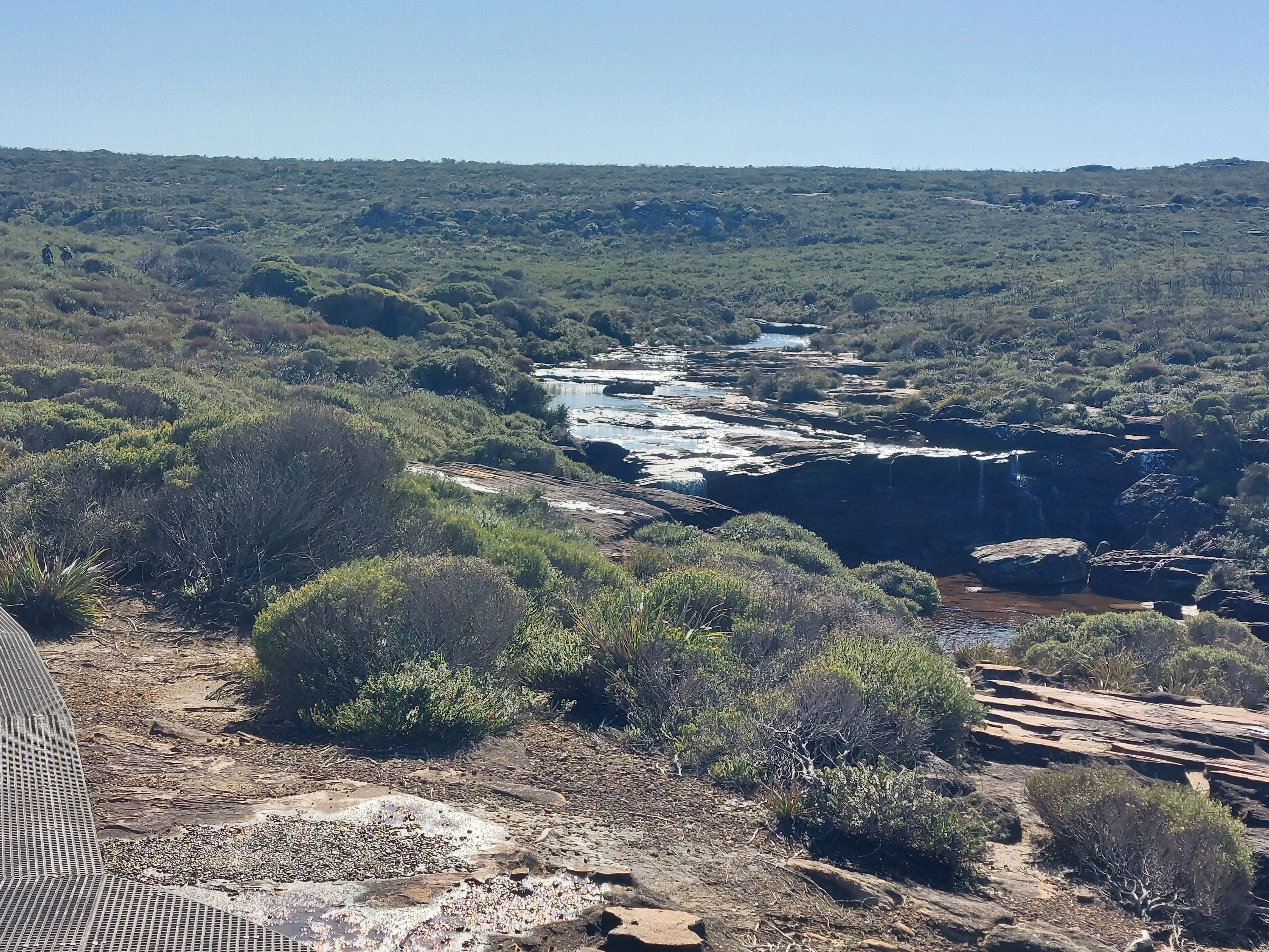
The Curra Moors fire trail will eventually lead you to the Coastal Track and the ocean views. As you come out, there will be a waterfall on your left and a viewing platform to stand on. This is where you can see the Eagle Head Rock, take pictures, have a snack, and try to spot a dolphin or a whale.
Take a right and continue your hike on metal platforms near short green shrub. Soon, you will see the Curra Brook forming into a pretty waterfall with two levels, then flowing down to the ocean. This is my favourite place to take pictures — on the iconic Curra Brook blocks (or stones). Blocks have been dropped along the water to allow people to step and cross to the other side. About 500m later, you’ll see a similar sight.
You’ll hike for about another 1.5km before the trail splits off. That’s the time to take a right turn and travel inland to complete the loop. The rest of the way back to the car park is slightly uphill. There are lovely seasonal wildflowers along this path too.
Figure 8 Pools
I bet most Sydney siders have seen the iconic picture of the Figure 8 Pools but had no idea that they could hike to it in the Royal National Park. It looks too exotic to exist in a big city. We had to discover this magical sight.
You can get to the Figure 8 Pools in a few different ways, but the easiest route starts from the Garrawarra Farm car park. It’s 6km out and back with about 260m elevation. If you can, enjoy the pools and take your time; this is not a walk you want to rush. Here is the map - https://www.alltrails.com/trail/australia/new-south-wales/figure-8-pools
Before I get into this trail, some warnings (sorry, I’m going to sound like a mum)…
This is not a trail you can attempt just because it looks sunny outside. This is only a trail you can safely attempt if the tides are low. So check the tides.
Even when the tides are “low”, surprise waves can come in, so pay attention and don’t walk too close to the edge.
The rock formations are slippery, and have holes and cracks in them. A housemate who was daydreaming along the path tripped, slipped, and then crashed onto the rocks. Her partner helped her out because she was bleeding and got big bruises on her knees and arms. It was not the only time I heard that story.
Check the map. We thought the turn-off was not very clear. There was a sign pointing right, but then all the other signs disappeared and somehow we still missed the turn-off.
The trail begins with a 200m descent. The first 1.5km is mostly down the stairs (metal footpath) through a green forest; the trail is very well-maintained. At dusk and dawn, there are possums, frogs and wallabies.
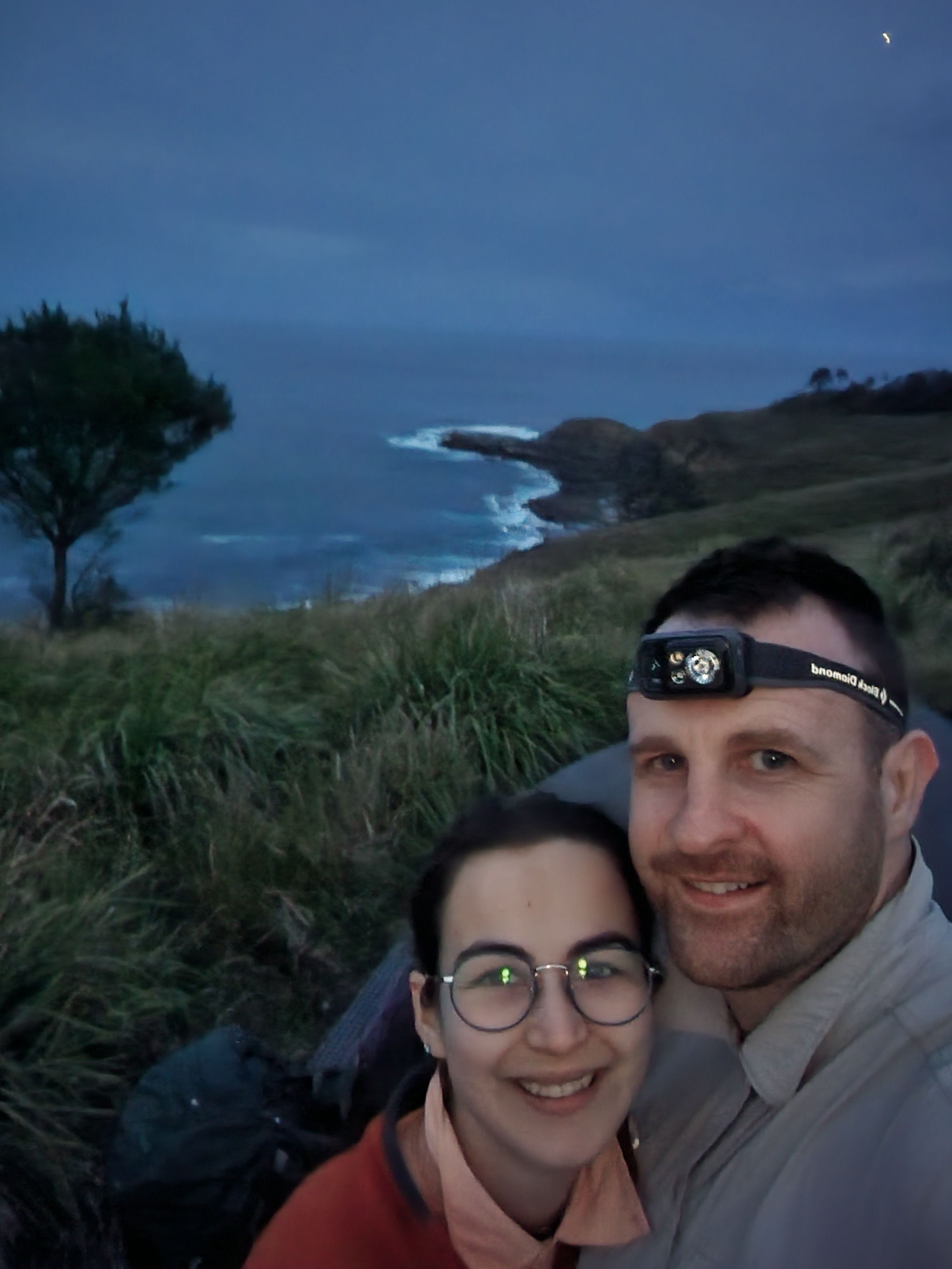
Been there, done it at both dusk and dawn.
Once you come out onto the Coastal Track route and see the ocean, there will be information signs showing the map of the national park, where the Figure 8 Pools are, and the nearby beach.
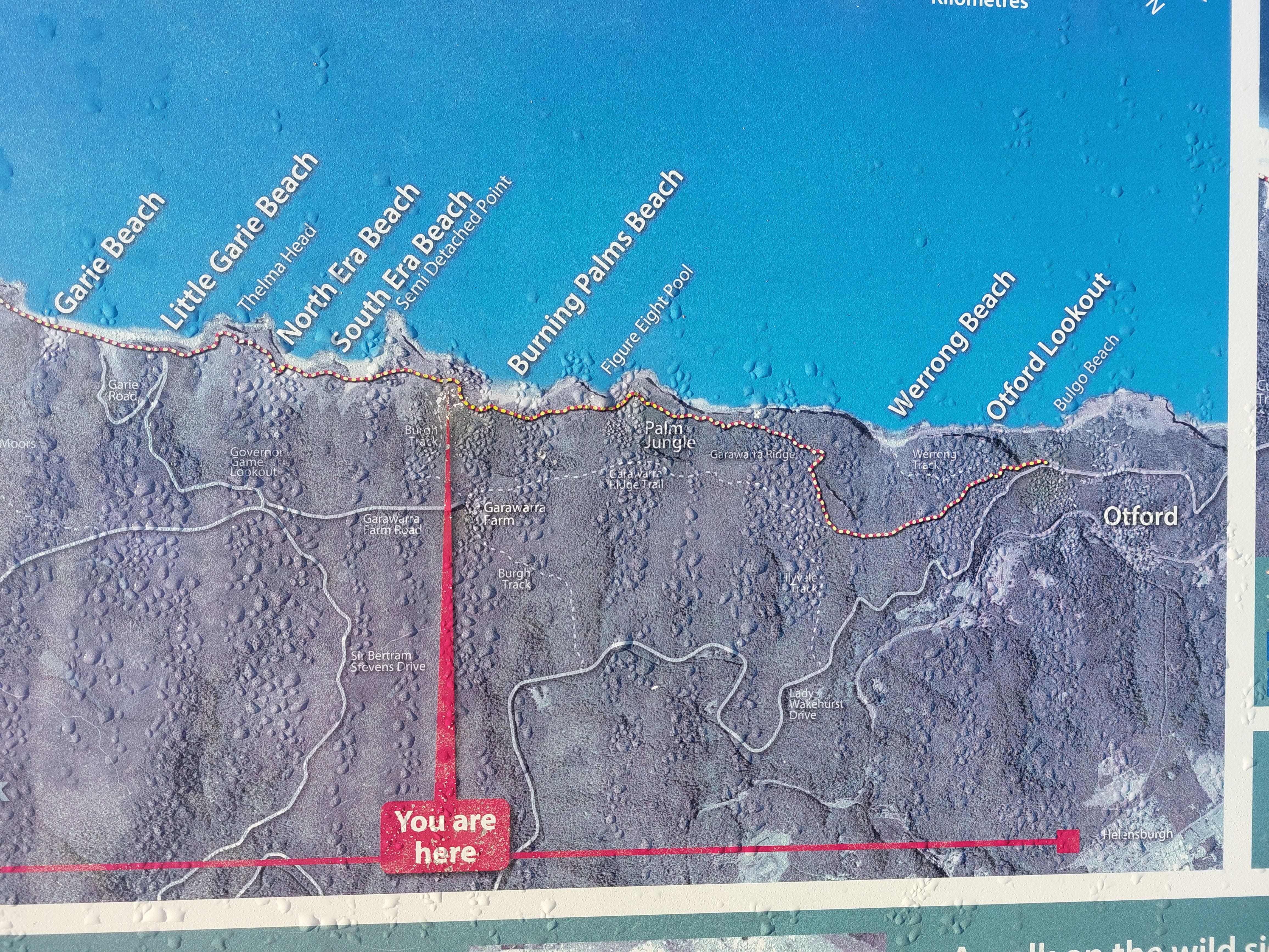
Take a right. You will soon (about 400m later) see a split off on a grassy area going down to a beach. This will lead you to Burning Palms Beach, which is where you want to head towards. You might come across surfers here as well.
The path leads to rock formations, which may not be intuitive to follow, but the natural pools are on the rocks. We came all the way up to the rock formations and realised that the tide was coming up. Urgh! We had to trace our steps back due to poor planning. It was really sad because these pools take you to a magical world.
The photos do not reflect the depth of those circular pools, nor how the sun leaves its glitters on the water's surface. Shades of blue and hints of green, depending on the time of day — this is totally worth the trip.
Palm Jungle Loop
The name captured us. Who doesn't want to hike through a palm jungle?
NSW National Park classifies this hike as a 10km long Grade 4 trail with 4-6 hours of suggested time. IMO this is more like a Grade 3 that you can complete in 3 hours if you want a nice walk with pictures.
Anyway, here is the map — https://www.alltrails.com/trail/australia/new-south-wales/palm-jungle-loop-track — it also shows the way to the Figure 8 Pools but that’s just a detour.
We first completed this trail in 2022 when we were not fit, then reattempted the track after my knee injury (to see if my knees could handle the stairs), and one last time during the Coastal Track (just a section of it). While my body was not in good condition during any of the times we attempted this loop, I still enjoyed the scenery.
The loop starts from the Garrawarra Farm on a flat rocky fire trail with tall trees on each side. The first 3km is both easy and a bit boring. Then, the trail splits off (there is a sign, it’s obvious). If you continue straight, you’ll end up in Otford. Take a left and head down towards the coast.
Note: I am not sure if the construction work finished at this part of the trail. In August 2023, there were signs telling people to not continue down the path (which we ignored at our own risk). Check the NSW National Parks website for any warnings.
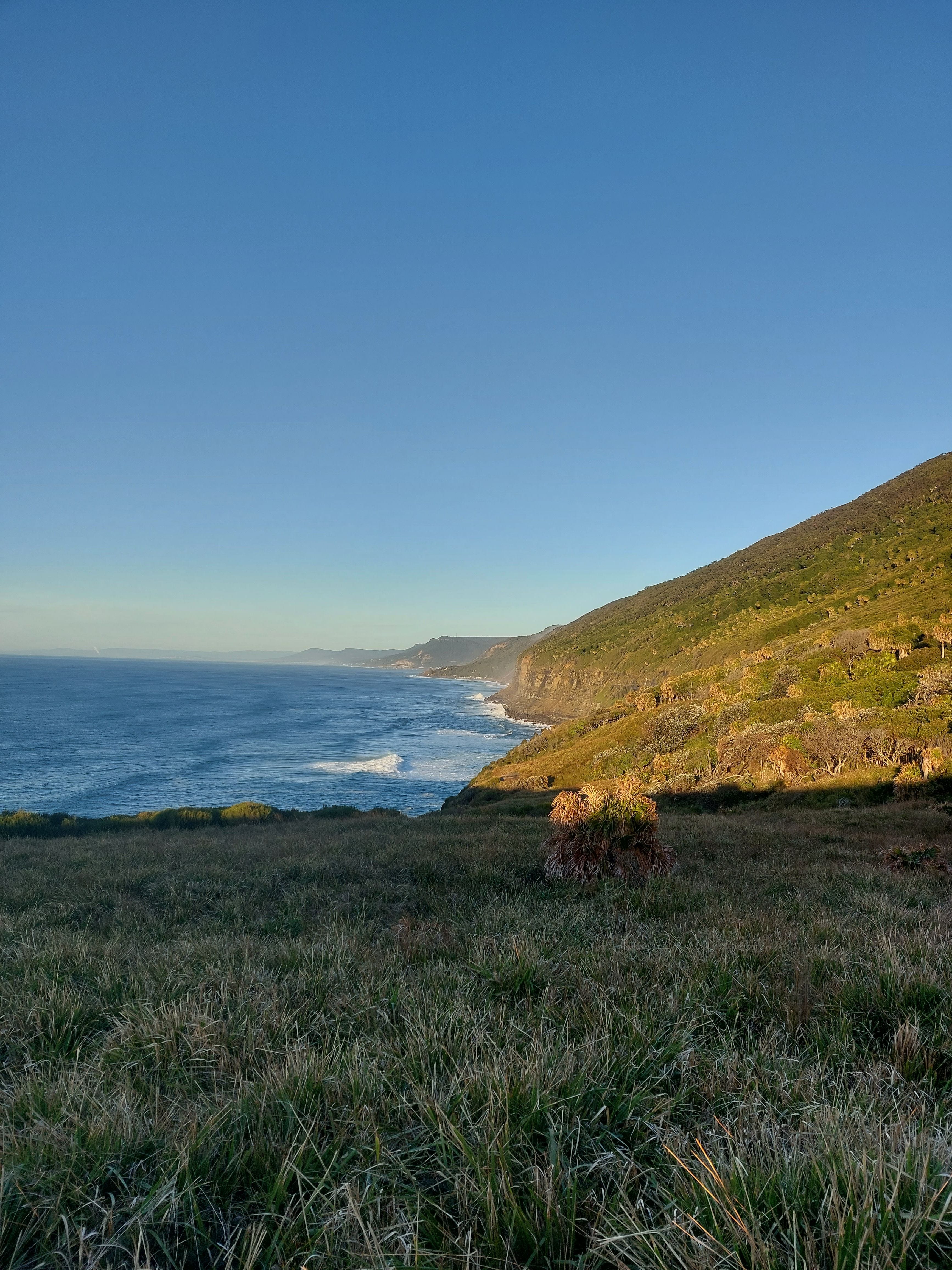
It’s a 200m descent from there over the next kilometre, most of it is on white-greyish blocks/stones forming stairs. We hiked down a beautiful dense green rainforest during sunrise and the views were stunning. Golden glows from the sun peeked through the large dark leaves of the trees. As we hiked further on, we could see patches of the ocean appearing.
Somewhere along the way, we also crossed a little creek flowing down. There was a cute little wooden bridge, so our feet didn’t get wet. Between the stairs, which were uneven (some with short and some with tall drops), there were patches of mud which was a bit slippery. I was unsure if it was due to the construction happening or not.
The trail continues on a metal platform along the coast and it’s quite flat. You’ll get to see the Burning Palm’s Beach. You might see some surfers or people jumping over the ocean waves there. If you want to make a kilometre detour, you can also check out the Figure 8 Pools (but make sure it’s low tide before exploring there). This is also a lovely spot to have snacks or a picnic.
The way back to the Garrawarra Farm car park is on a metal platform, up the stairs for almost a kilometre. The 200m elevation sucks if you have sore knees, calves or ankles, but for everyone else, it’s not a challenging climb. There are also plenty of places to pull to the side, rest, and admire the greenery.
This trail gets busy during a sunny day for a good reason. Highly recommend it for a day trip.
That’s the end of my ‘Exploring Royal National Park’ series. I absolutely love this place and feel grateful to live relatively close to it.
Questions: as always, if you have any questions about my notes, leave a comment and I’ll reply.
Thanks for reading! Subscribe for free to receive new posts and support my work.