
Part 1: Exploring Mid-West of Royal National Park

Royal National Park has been our go-to spot for hiking training over the last 2 or 3 years. It’s easy to access (entry points via Bundeena, Heathcote, Loftus, Waterfall, and Otford) compared to most national parks due to its proximity to most Sydney suburbs. The national park is well-maintained for visitors and some sections have BBQ facilities, flush toilets, and picnic areas. You can find plenty of swimming spots (beaches, waterfalls, waterholes and creeks), go on a kayaking adventure, or surf.
On inland trails, watch out for the leeches. The park is home to possums, wallabies, and a wide variety of bird and butterfly species. This is also a great place to play, ‘spot the fungus’ — I’ve seen very interesting types during our hiking adventures.
I realised that David and I completed almost all the hikes in the Royal National Park. So it's best to split this post into a few parts. This post (Part 1) will focus on the ‘inland’ hikes that are not on the well-known Coastal Track, especially the ones that start from the Waterfall Station.
Couranga Walking Track
Grade 3 - 10km return - suggested time is 3-5h by the NSW National Park website. https://www.nationalparks.nsw.gov.au/things-to-do/walking-tracks/couranga-walking-track
As it's a point-to-point track, you can either start from the Waterfall station car park, or the McKell Avenue. We completed this track twice starting from the Waterfall station end (recommended) in 2024 and starting from the other end in 2025. Yes, I normally don't complete a hike twice unless it's a training route. But we couldn't be bothered driving too far that weekend and I had already declared that this trail was my favourite at the Royal National Park.
During the first kilometre, the trail follows a narrow bush path then a fire trail, which is the beginning of the Uloola Track. Quite an easy and flat start which will eventually join the official start of the Couranga Track. You’ll notice the change immediately; the path will become narrow and you’ll be surrounded by dense bush.
We did not expect to find ourselves in a green forest. The landscape is unlike most Aussie bush trails. It was much more interesting. Expect overgrown bush, a wide variety of fungus, and to step or jump over some fallen logs.
Just as we got used to the environment, the trail descended steeply and the terrain became rougher. With the descent and the trees blocking the sun’s rays, I was feeling colder. Then, I had a beautiful realisation; we were heading towards a rainforest. This was a lovely surprise.
Rich rainforest, orange glows of the sun peaking through the leaves of tall trees, ferns surrounding your feet, a kookaburra singing, and a few wallabies skipping around — this is a spot to pull out your phones for the Instagram shot. Peace radiated through the forest.
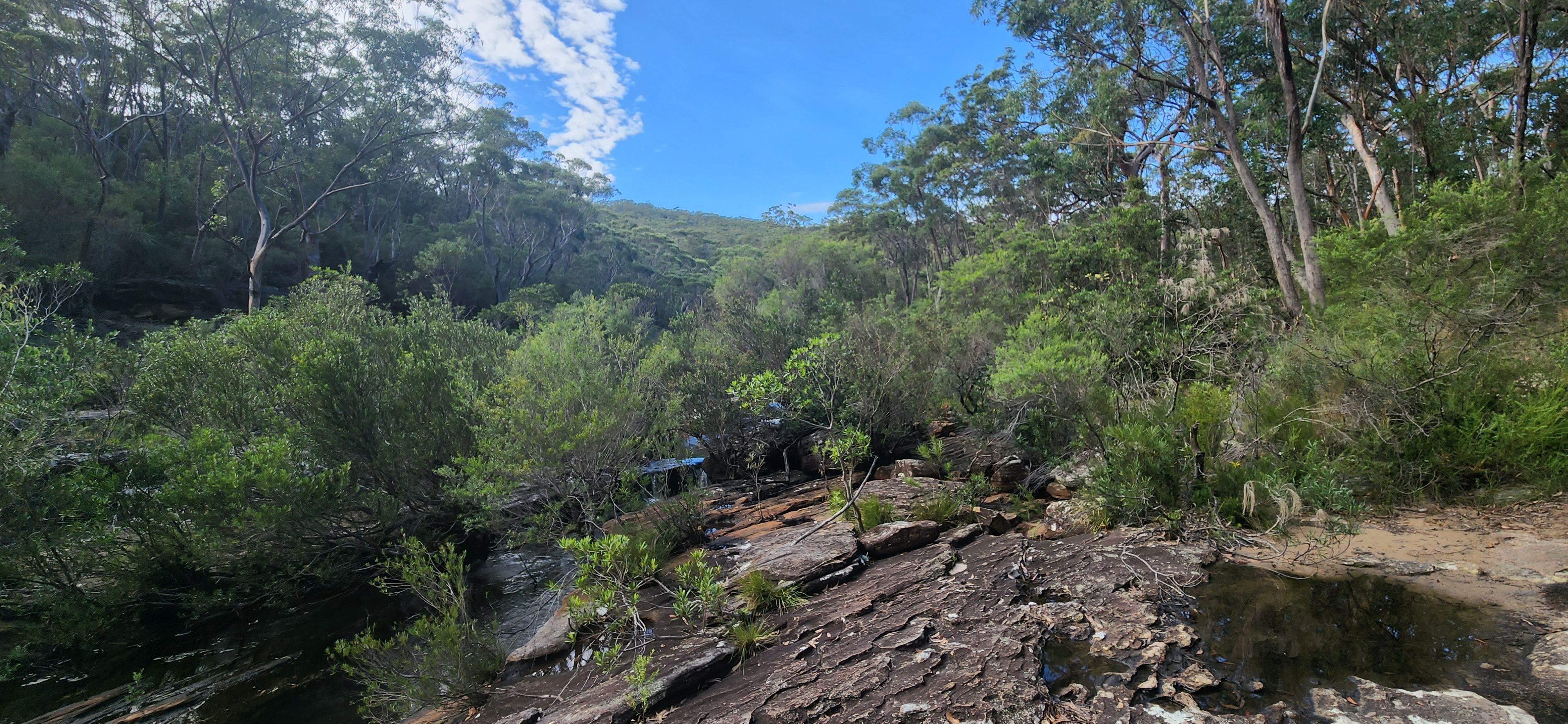
After 1-2km on the damp dirt trail, we saw a creek. It looks small at first, but as you hike more, the creek widens; its gentle flow makes you want to take a dip. The trail moves away from the creek into the dense forest, then eventually, takes you back to an easy creek crossing. This is a very picturesque sight — another spot for an Instagram shot (or in my case, a Substack shot).
I remember bushbashing and a bit of a climb afterwards, all the way to the end of the trail. Strangely, this is a lesser-known track (perhaps a hidden gem), so don’t expect to encounter many other hikers. In 2024, we saw one other person on the trail, and in 2025, we saw nobody but spotted some footprints (possibly somebody completed the hike early morning). You may have a much higher chance of encountering leeches, so either bring a matchbox or be ready to pull them off your skin. David got 3 latching onto him and I pulled out one.
You’ll come out to a main road with a very small car park (fits 2 cars). There is a big log to sit on and have lunch or snacks at the end. We took 15 minutes of rest here and returned back to our starting point.


Uloola Walking Track
Grade 3 - 22km return - suggested time is 8h - 12h by the NSW National Park website. https://www.nationalparks.nsw.gov.au/things-to-do/walking-tracks/uloola-walking-track
As it's a point-to-point track, you can either start from the Waterfall station car park, or Audley (where the visitor centre is). I highly recommend starting from Waterfall station, so your halfway mark (lunch spot) can be at the cafe looking out to the Hacking River. This is a full-day trail, so you may want a treat in the middle.
During the first kilometre, the trail follows a narrow bush path, then a fire trail. Quite an easy and flat start which will eventually split off into two ways. Taking a right will lead you to the Couranga Track and taking a left will allow you to stay on the Uloola Track.
The fire trail continues for a while on a constant slow descent. Over time, the regular Aussie dry bush landscape becomes greener and more dense with wildflowers. Somewhere on this part of the trail, David came close to stepping on a medium-sized black snake. Watch your steps people.
At the 6km mark, you’ll see the Uloola Falls Bush Campground. This is quite a pretty picnic spot. I expected to see more people on the trail (only came across 2). I wish we had taken some pictures! Layers of silver rocks were stacked up, leaves poked between the cracks, and water gracefully fell onto Uloola Brook. If you have a good camera, bring it on this hike.
About 3km later, you’ll see a trail split. Towards the right is the Wattle Forest Track, so stay on the left. About a kilometre after that split-off starts your steep descent. 100m drop within 1km, all the way down to the Hacking River. This was an exciting section for me, especially because I could see the river from the distance. During this descent, you’ll come across another split off to your left; keep your eyes on the map and ignore any sharp left turns.
I love Audley. I’ve been down there for picnics, hikes and kayaking before. No matter how busy the place gets on a sunny weekend, I still love stepping on the green grass, taking a stroll under the tall trees and looking at the river.
To get to the food and smoothies, we crossed the bridge. The 30-minute stop was well-deserved and fully worth it. One mixed berry smoothie for me, one mango smoothie for David, and our remaining snacks to share were satisfactory.
Off we went on the trail again, retracing our steps back. I wouldn’t describe this trail as spectacular, but it’s a good one for hiking training and a rewarding one with a cafe at the halfway mark.
Forest Path
Grade 3 - 4.4km loop - suggested time is 1h - 1h 30 mins by the NSW National Park website. https://www.nationalparks.nsw.gov.au/things-to-do/walking-tracks/forest-path
This circuit starts from the stone gates on Sir Bertram Stevens Drive. It is an easy, fun, short and beautiful hike through a rich and dense rainforest. Given how the national park is known for its coastal walks, this trail has a surprising scenery. If you have done the Couranga Trail, or read my notes on it, imagine this circuit to be a smaller/condensed version of that. So, hint; you might want to bring your camera on this journey.
Yes, this trail also has a lot of determined leeches (bring a matchbox or be prepared to pull them out of your skin). Yes, this trail also has spectacular picnic spots. I’d recommend saving your lunch/snacks to the Bola Creek picnic area; you'd have the pretty Bola Creek as a view.
If you’re hiking clockwise, the trail follows the Hacking River for the first half, then the Bola Creek during the second half. It’s quite up and down, but the elevation gained is so low that this trail would actually make a great spot for running (if it wasn’t so popular).
If you have more time to explore, I’d recommend checking out the other hikes nearby. Couranga Track would be a wonderful one if you’d like to continue with the rainforest scenery. This isn’t my 2nd favourite hike because it’s too crowded for my liking and not challenging enough to get me excited.
Karloo Walking Track
Grade 3 - 10.2km return - suggested time is 1h 30 mins - 2h 30 mins by the NSW National Park website.
https://www.alltrails.com/trail/australia/new-south-wales/karloo-walking-track-2 - linking All Trails so you can check out the other optional trails from the map
Optional to add an additional 3.4km (there and back) to check out the Olympic Pools. This is the trail we followed.
Optional to shorten the trail to 5km if you just want to swim in the Karloo Pools.
The trail starts from Heathcote train station car park, which is super handy if you don't have a car. There is a petrol station across the road, so we grabbed Gatorades before starting the hike. Given it was a sunny Saturday, there were quite a lot of cars parked around. This trail was definitely a busy one!
Quite an easy start to the trail with a 130m descent in the first 2.5km. This part of the national park has a lot of greenery and large grey flat rocks which may become slippery over multiple days of rain, but otherwise seem solid. The trail is not overgrown but also not ‘man-made’ with stairs and metal platforms — it’s nicely preserved in its natural shapes and forms — lovely to walk through.
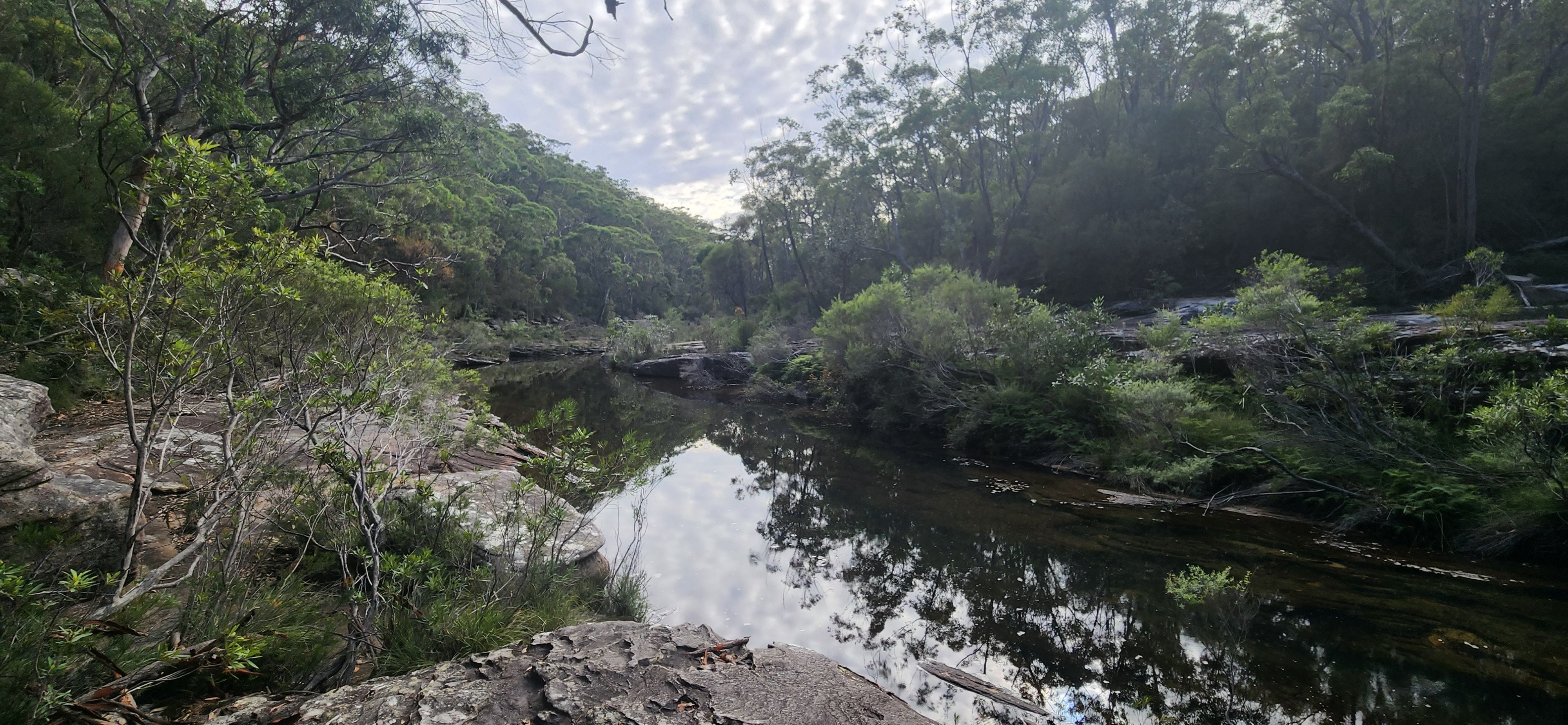
After the descent, we crossed the Kangaroo Creek and saw the Karloo Pools. It was spread out with varying levels of depth, surrounded by rocks. The sun was glowing and the trees reflected their shades of green on the water, giving it a beautiful tone of colour. It looked like a fairy pond, a magical sight from an 1800s oil canvas or a children’s book. It just missed a picnic blanket and basket with fruits, and two caucasian children wearing long white dresses with laces and red ribbons to hold their braided blonde hairs. And a gentle background piano composition of the Nocturne in E Flat Major Op. 9. You get the picture.
Well, the pool had a few screaming kids running up and jumping in, splashing water around, parents who carried bottles of beer and chips with them treating themselves, a few young ladies trying to get a summer tan, and a couple making out intensely. And background music of pop music from a Bluetooth speaker of a group of young men. ‘Cause it’s the 21st century.
Anyway, people were having fun and on the way back, so did we (took a quick dip and had snacks). This is really a beautiful place to go for a swim and a picnic. A peaceful sight that I’ll remember.
Be careful with navigation here. There are 3 other trails leading to this rock pool, so it’s easy to get lost. When you face your back to the way you came from, take the 2nd exit. The 1st exit follows the Kangaroo Creek, so don’t follow that.
On the right path, we climbed 100m into the forest. The trail flattened out soon after and we had a nice view of the greenery. About a kilometre later we saw the Uloola Falls Bush Campground. As mentioned before, this is quite a pretty picnic spot with a waterfall view, and less busy than the Karloo Pools.
We retraced our steps back until the Karloo Pools, then took a right turn. This would have been the 3rd exit (or going straight) from the original way we came from. Sorry if that description is confusing; just check the map and it’ll make sense. This part of the trail follows bits and pieces of the Kangaroo Creek for 1.8km and gets progressively more challenging (definitely a grade 4).
The map does not actually lead you to the Olympic Pools, but only to some flat rock. You then have to take a left turn and follow the creek for about 10-15 minutes (with some rock hopping and bush bashing) until you have an ‘aha’ moment. It’s a large rectangular rock pool, which looks strange to exist so perfectly in nature, hence why the fancy name. This is where we had lunch. No one was around, so I guess this part of the trail was not popular.
The Olympic Pools could have been swimmable as well but it did not look as clear as the Karloo Pools water; it may have gotten more branches and mud mixed in due to the recent rains. I heard afterwards that if you complete this hike very early in the morning, you can spot the local platypus. Cute!
Overall, the trail was cut out in a way that one did not need to look out for markings (pink ribbons or arrows); the oncoming traffic also helped. We retraced our steps all the way back to the Jeep (with a short stop at the Karloo Pools for a dip). Highly recommend this hike. It was a lovely Saturday.
That’s all for now. Part 2 will focus on the trails between Loftus and Grays Point (North West of the Royal National Park).
Questions: if you have any questions about my notes, leave a comment and I’ll reply.
Thanks for reading! Subscribe for free to receive new posts and support my work.