
Kangaroo Valley Loop Walker’s Notes, Morton National Park

Access the trail overview and map here.
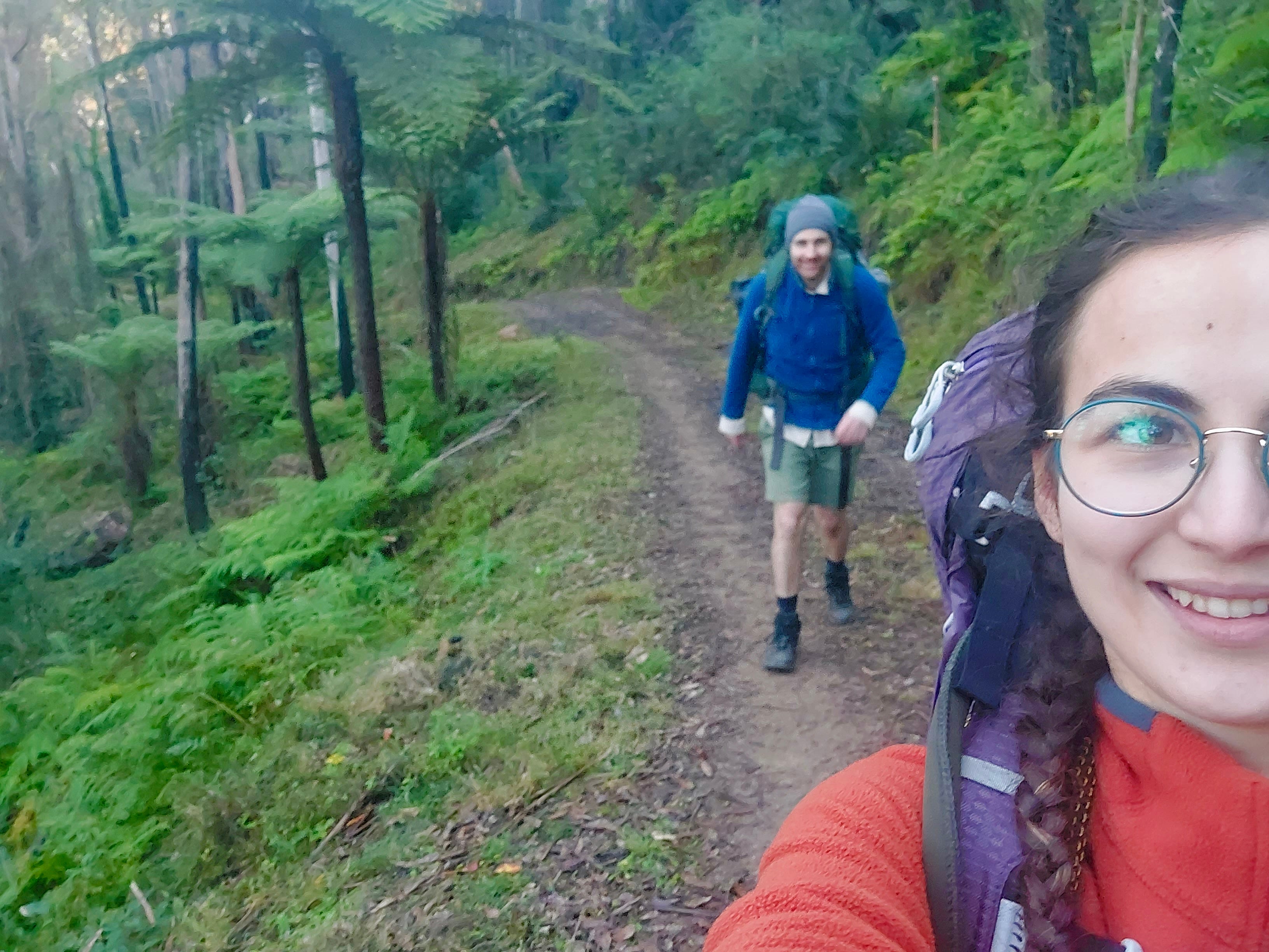
We discovered this hike in 2021, when exploring the Fitzroy Falls, and got the courage to attempt it 1.5 years later. It’s about a 1 hour 45 minutes drive from Sydney.
Day 1: Fitzroy Falls Visitor Centre to Glade on the Trail (a few km before Jacks Corner Road)
10 km + another 6-8km, approx 6 hours (we got lost by missing a turn off in private land)
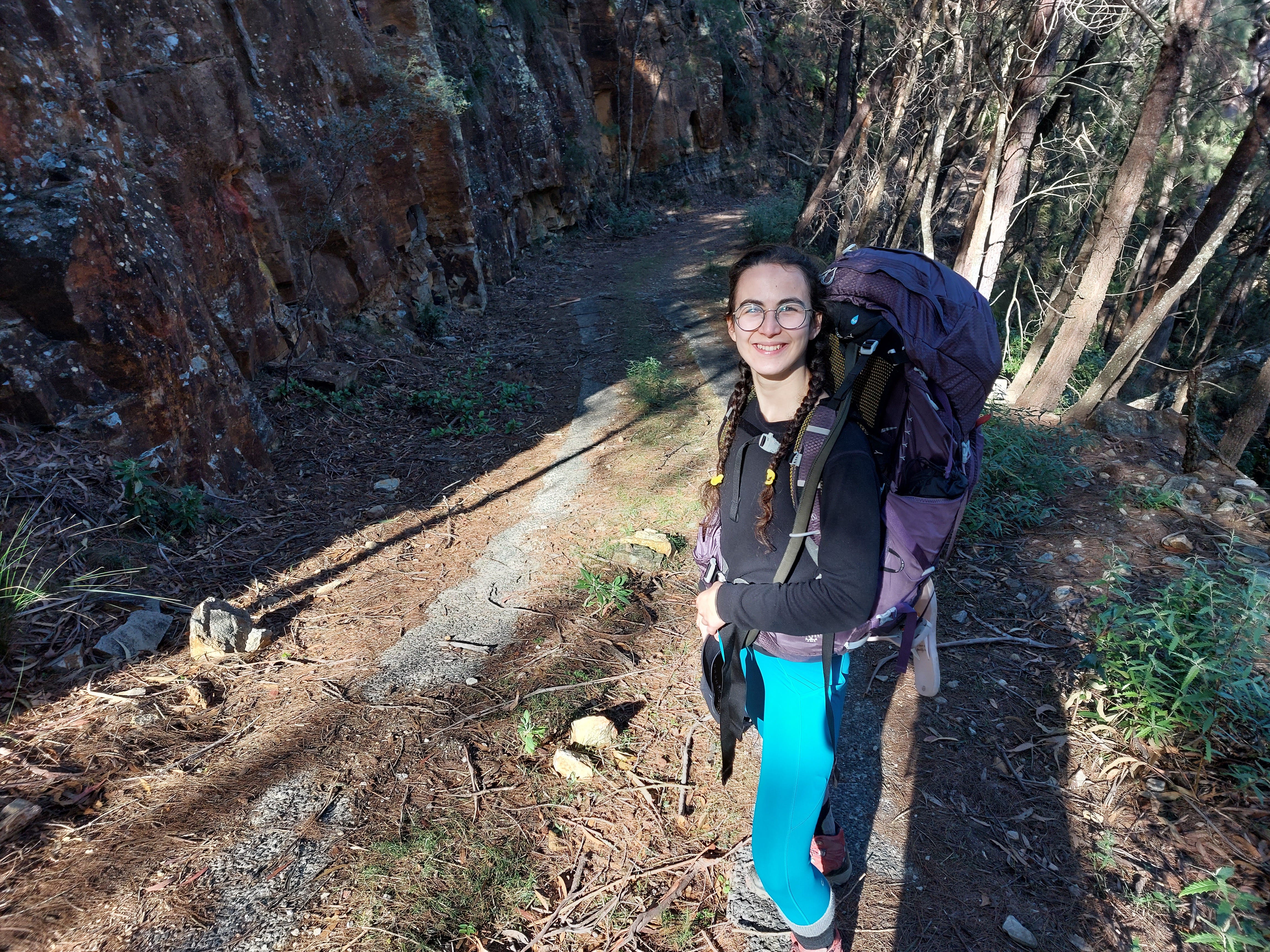
We began the hike at 9 am from the Fitzroy Falls Visitor Centre. Apparently, this is an award-winning centre. I just remember seeing Aboriginal Cultural Walk tours, detailed information on the native plants, and coffee with treats.
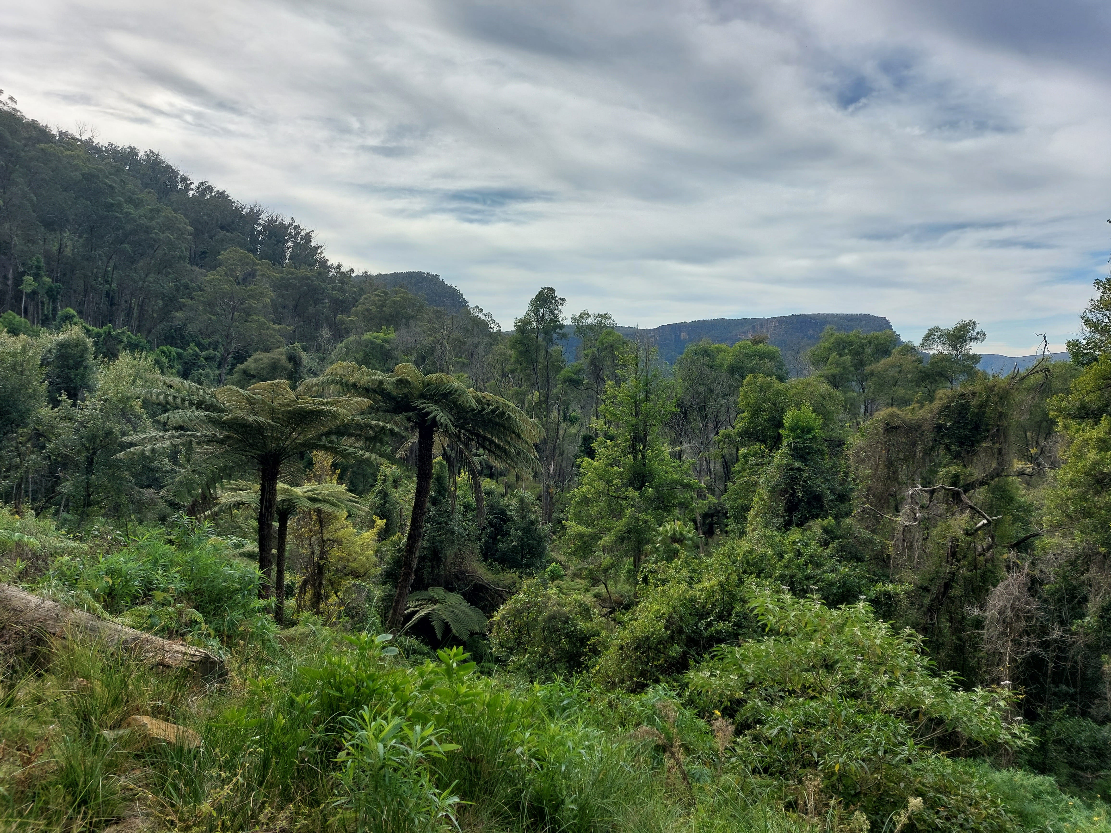
We completed this hike clockwise (if you are following the All Trails map). On All Trails, the road mostly follows the Nowra Road. We got advice from other hikers to follow the East Rim Track instead, which is a popular day hike. This was a great decision as we walked past 5 beautiful lookouts to the Yarrunga Creek. You’ll see giant mountains covered in tall trees and streams of waterfalls filled by the autumn rains — take some pictures here.
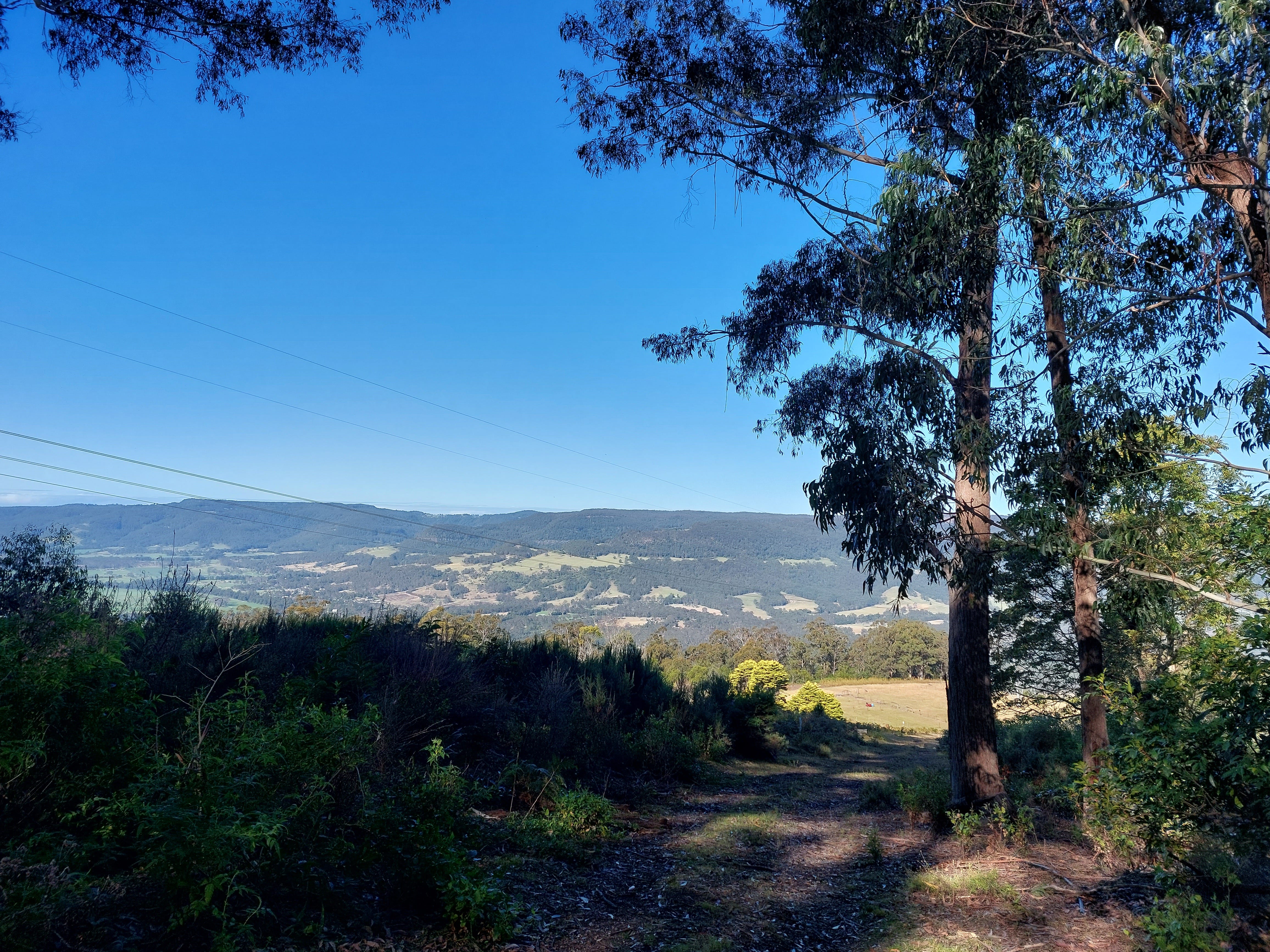
It’s quite an easy trail with some ups and downs due to the well-maintained track, which eventually joins back to Nowra Road for 2km. Watch out for the passing cars (don’t turn your back on coming traffic). This is private land, and once you leave the main road, you’ll notice signs saying ‘Promised Land Trail’. This is the fire trail you’ll be hiking on.
This part is a little boring. Dry ground, a few small rocks, strangely hot and sunny day after a week of rains during winter — classic Aussie bush and fire trail. We lost our connection here and were no longer able to follow the All Trails map. We’ve been relying on it heavily due to the lack of trail markers on the path. So we pulled out our backup option, which was a printed map.
For your information, this map shows a few squiggly paths. The first one is quite gentle with its curve and comes on your way soon after you start the Promised Land Trail. The second one is quite a big and wide curve, which is easily noticeable without the need for trail markers. Be very careful about the third squiggly section, as it’s actually a turn-off (so you’ll need to step off the fire trail) and difficult to spot.
I’m warning, as this is where we got lost. We didn’t have a GPS watch at the time, and this experience actually led to our purchase.
I remember walking on and on, looking to our right to find a turn-off, confused, looking back at the map, even more confused. There were just no indicators of a turn-off, and the fact that the fire trail continued in a nice condition made us believe that we were on the right track.
Eventually, we steeply descended to a beautiful farmland. This is where we spotted a herd of mountain goats.
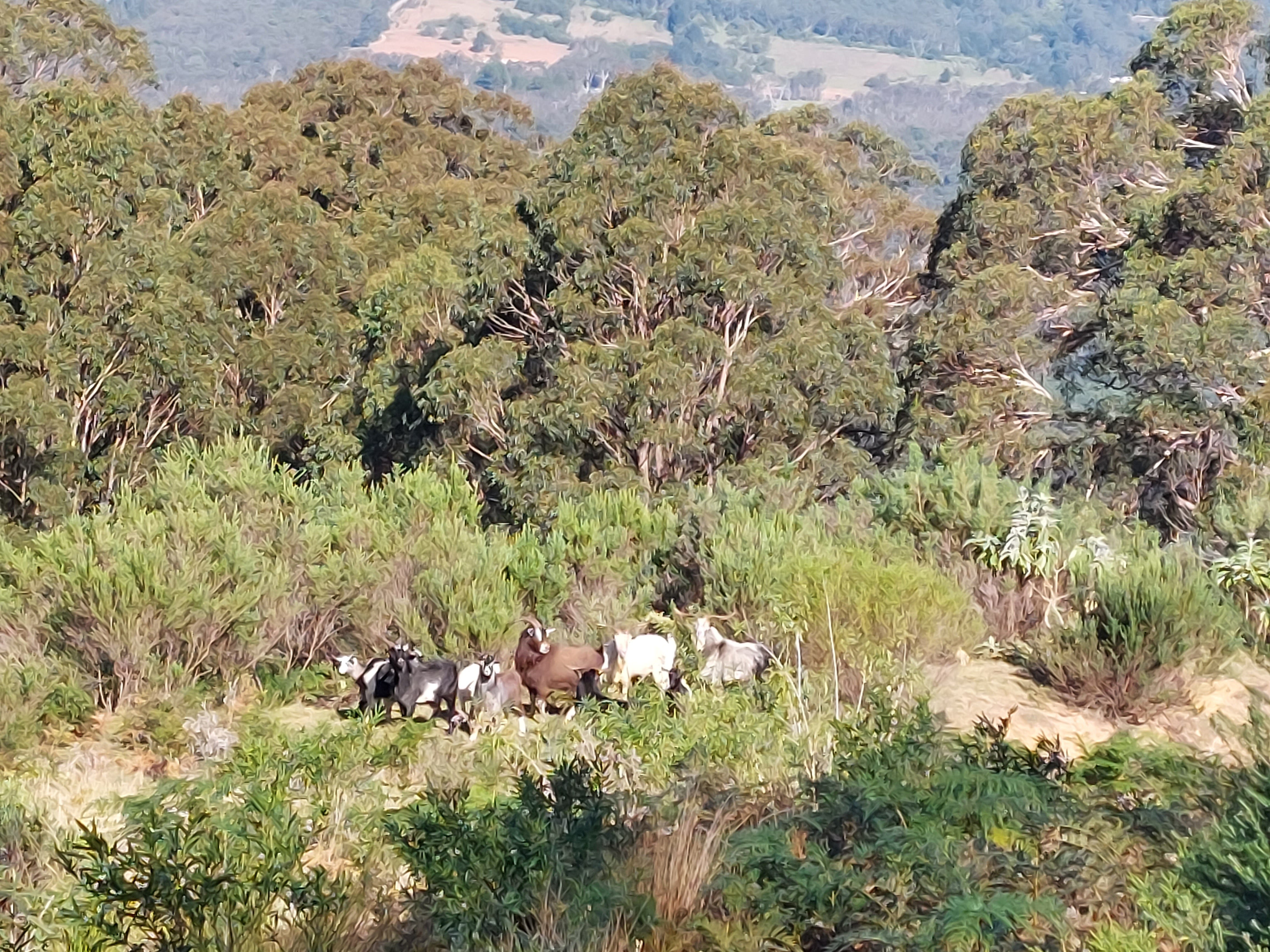
“Oh, they’re so beautiful! Thick wild coats, the fierce steps, their strength and energy — David, I may have been a mountain goat in my past life!”
“Yes, dear.” He sighed, puzzled and a little concerned. “I feel like we’re on the right track, but I’m confused with this map.”
“We’re definitely on the right track. Look how many of them are moving. If there wasn’t a way, such a large group wouldn’t be heading that way.”
“Yeah, I guess they aren’t heading to jump off a cliff.”
We followed the herd of mountain goats over a farmland. This was a very picturesque part of the trail with flowers, sheep, mountains on the horizon and a cliff.
A cliff!
“Shit. David. Cliff. Don’t — don’t come. I’m standing at the cliff edge. What of earth? How did the mountain goats…” Then the realisation kicked in. That’s why they are called the mountain goats. Failed an intelligence test here.
Guys, if you are unsure of the way, do not follow the mountain goats. Mountain goats follow the mountain goat trail (cliff edges), not the human trail. Ok, it was pretty funny. We were disappointed, annoyed, tired and laughing at ourselves — also slightly worried because we had no idea where the turn-off was and how far we still had to walk.
We retraced our steps back uphill under the hot sun. The following few kilometres had two exhausted and annoyed hikers, paranoid about where and when to turn left. If we couldn’t find a trail, we would have to walk back to the Jeep.
After what felt like a long while, I noticed a rectangular wood on the trail. I picked it up from the ground and noticed that this was the sign to show the trail. So there was a sign with an orange arrow, but it had fallen on its face and was half covered by the blown leaves. It was like discovering treasure on a trail.
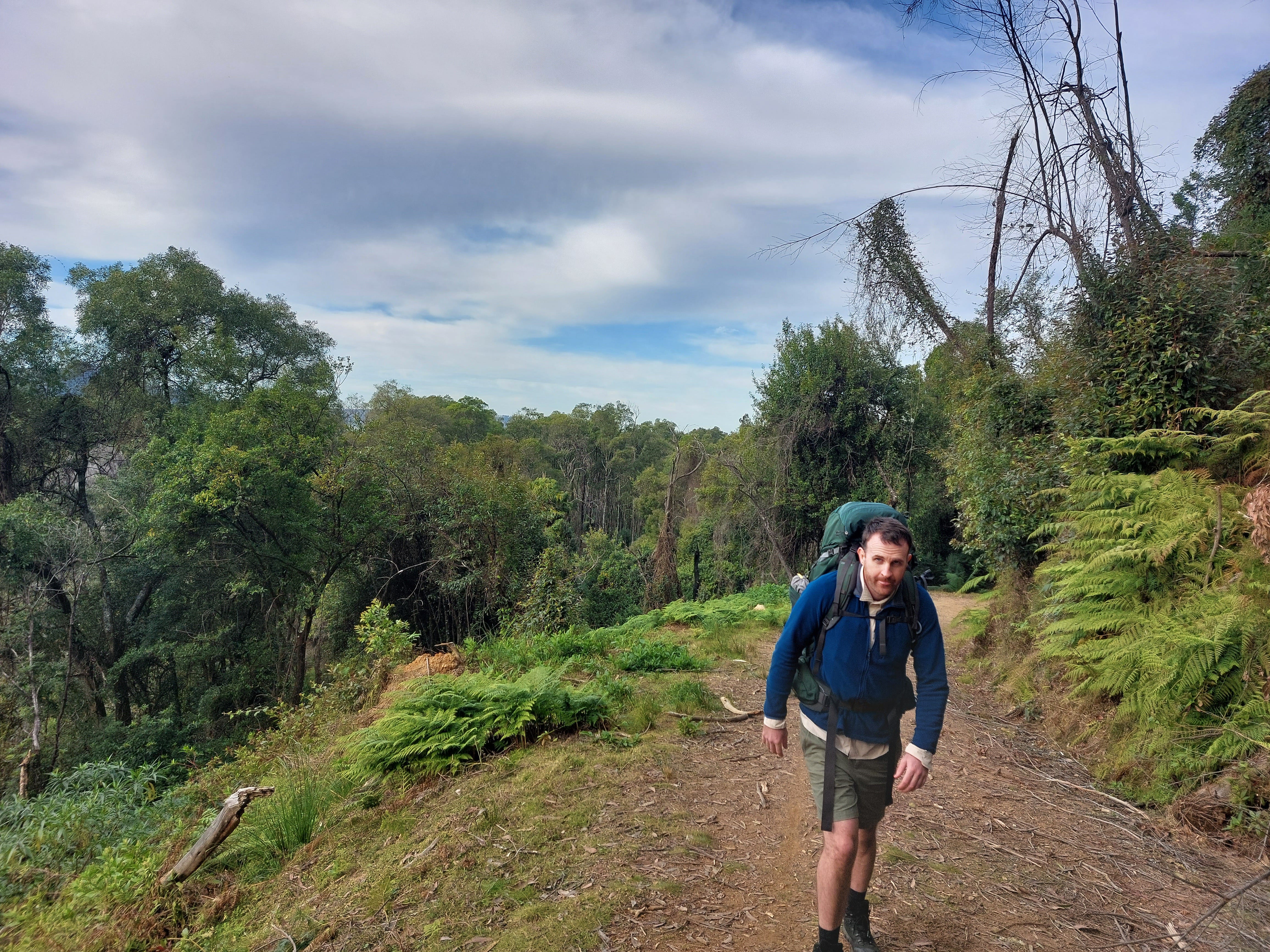
To motivate ourselves, we grabbed some lollies from our snack bag. The trail continued into a rich green forest with some overgrowth, ferns, moss and mushrooms. This is when the trail got a bit rougher, and our constant descent began.
Given winter, we were restricted by the sunrise and sunset. At the time, we also didn’t own headlamps. We did not have time for 8 more kilometres on the trail and could not camp on the Jacks Corner Road, so we began looking for a campsite on some flat land.
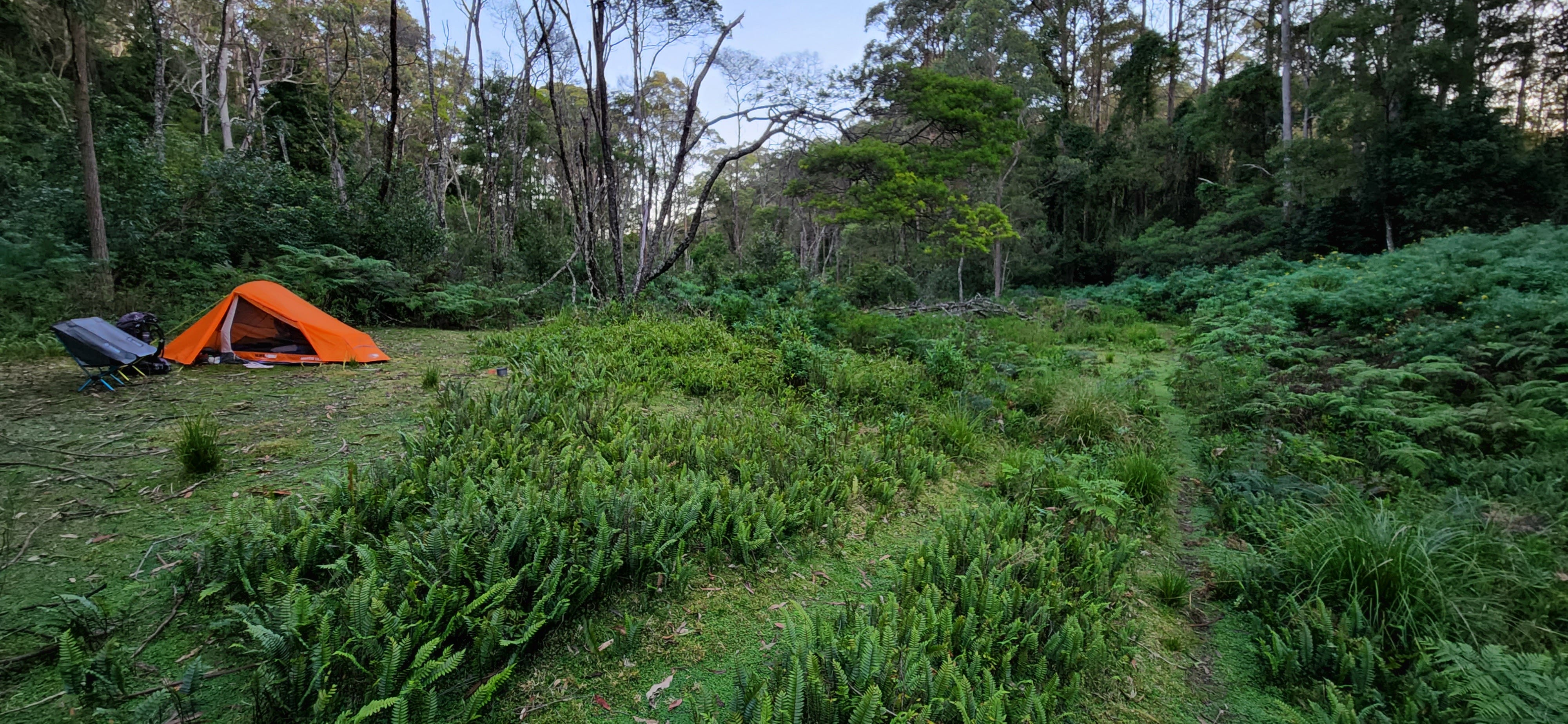
On a trail with heavy growth, we were not very hopeful, but to our surprise, we came out of a dense tree section into an open flat area with lots of ferns. There we saw a flat and empty space which looked perfect for camping. Not sure why this isn’t mentioned on All Trails (maybe we weren’t allowed to camp there), but 3 or 4 tents could have easily fit in this area. The only issue was that there were no sources to collect water.
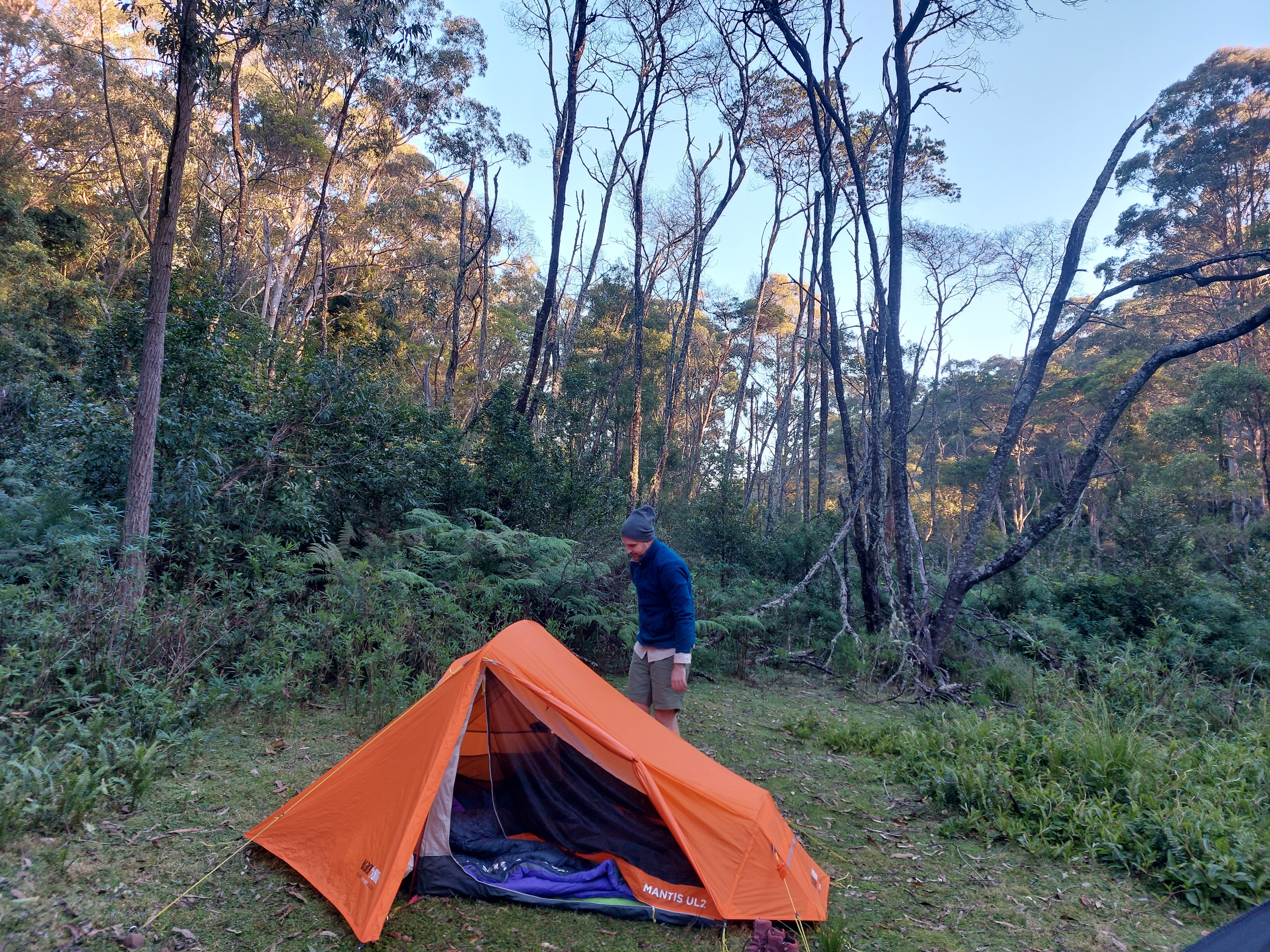
The temperature began dropping steeply, and we could see the sun hiding behind palm trees. So we dropped our bags and set up the camp. By the time we put our camping chairs down and began cooking, it was very cold. Rice with tomatoes, tuna and beans — delicious. Even better, we had a gorgeous view of an orange, red and yellow sky, layered between palm trees.
Day 2: Bush Camp to Griffin’s Farm Campground
13.5 km, approx. 5 hours
We woke up with the dawn. The cold was numbing my fingers and toes, but the view of ferns with glitters of golden light warmed my heart. There were wallabies on the move at the distance. What a beautiful place to wake up in!
I really should have brought gloves as packing up the tent with frozen fingers is a painful activity. I felt better when we put on the gas canister to burn and cooked some mixed berry quick oats.
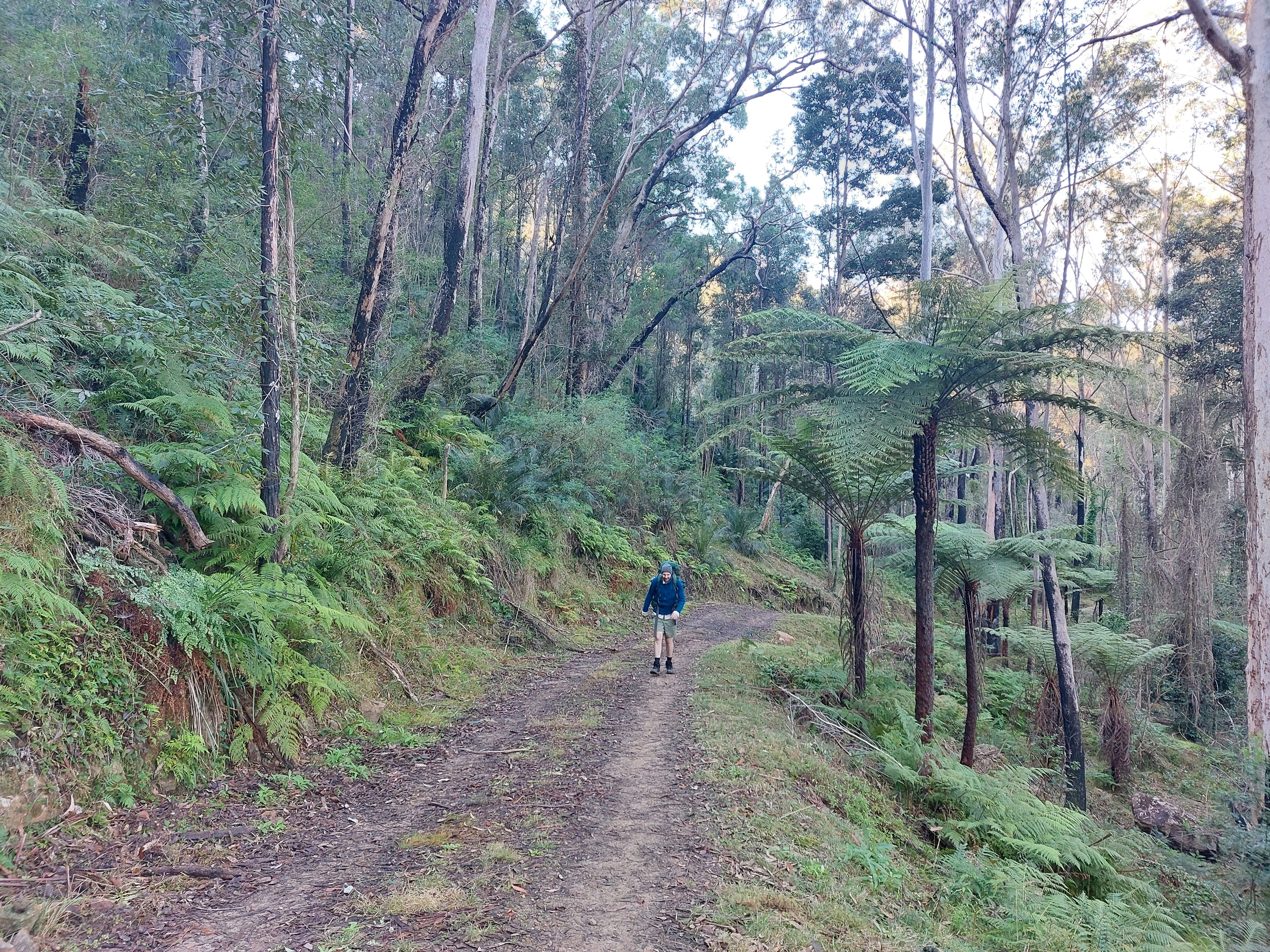
The hike began at about 8.15 am on a constant descent (about 300m) for the first 2 kilometres in the forest. There were lots of palm trees around. I remember the soil trail being well-maintained despite a lot of growth around. There were lots of birds on the trail, but no sight of other hikers.
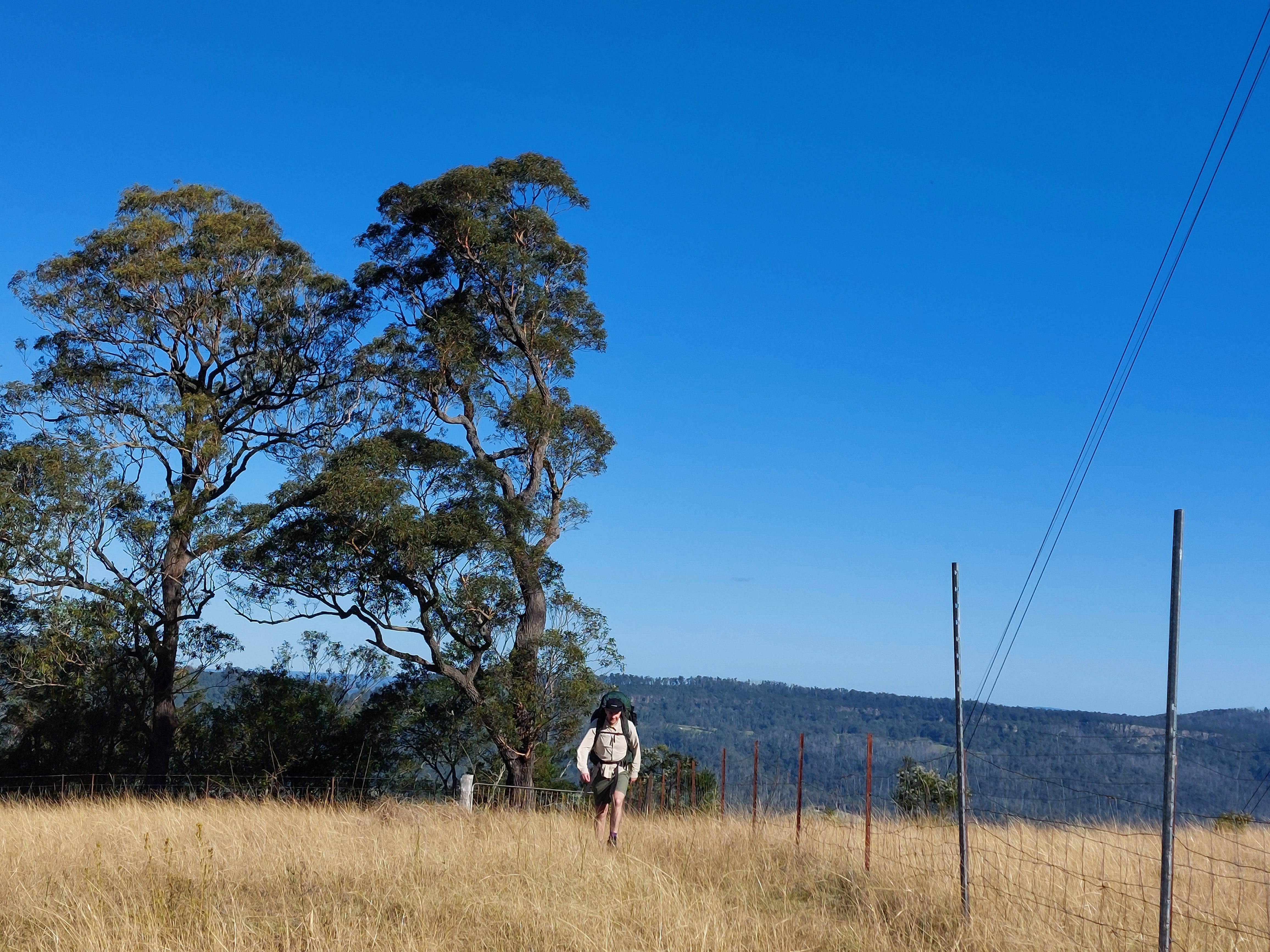
Eventually, our trail let to another private land (farmland) with cows, then intersected with the curvy Jacks Corner Road. I must admit the lack of guidance (i.e. arrows, pink ribbons, wooden signs) on these private lands and some of the fire trails.
Jacks Corner Road is the boring part of the trail, which goes on and on. Again, don’t turn your back on the oncoming traffic. I think we walked for about 5km here.
The main road eventually curves to the left. We kept going and immediately saw another left turn off, which is a different fire trail than the one we needed to follow. We kept following the road straight and found ourselves back on a dry fire trail. This is called the Griffin’s Fire Trail, a sign that we were close to our campground (a little over 60%).
The trail continues to be flat and dives back into the forest. You will know you are close to the campground when you start a 100m descent to the Yarrunga Creek. There is a little crossing there which was not flooded and relatively easy to cross with our hiking boots.
This is where we had our snack break and wondered if we should collect our water from here. But we expected a tap or a water filling station to be available at the campsite, so we did not bother. While munching on food, we saw a couple riding their bikes through this trail. A biking and camping trip — seems very cool.
We hiked for another kilometre on a rocky trail, turned left and found a long drop. It was 1.30 pm when we arrived to the Griffin Farm Campsite. We dropped our bags and admired the location. Having a campsite near a wide and long creek is quite nice.
As we couldn’t refill our water bottles at the previous campsite, we were dehydrated and really looking forward to some water. I found the tap mentioned in the information brochures and twisted it to run. Surprise. No water. I twisted the knob to the right, to the left, and back to the right, and no water came out. I let out a big sigh. Hiking trips may be one of the only types of trips that I don’t enjoy coming across surprises, because most of the time, they are not pleasant.
We were neither fit nor experienced back in 2023, so my feet were crushed after a long day of hiking, and David’s right calf was hurting. But no water meant no dinner and more dehydration. I was determined to explore options. I could hear the sounds of running water from a distance, so a part of me was hopeful.
I went out to explore. 5-10 minutes of walking on the trail got me realising that there has been a large landslide down to a creek. This was our water supply but getting down was an issue. I looked around for things to hold onto, but nothing was in sight. Eventually, I took the risk, crouched down for balance and began to slide down the soil. Bit of a tumble down, but made it to the creek safely. The water wasn't very clear as the soil was washing down to the stream. I rolled my pants up and walked in the creek. Froze my feet, filled up the water bottles, crawled up the soil and made my way back to the camp. Bit of an undesired adventure, but things can never be perfect when out in nature.
By the time I was back, another pair of bikes came to the campsite. They had over 200km to travel, riding their bikes all around the wider region, camping along. We set up the tent and our camping chairs. We made lentil soup and shared some rice with tuna. Then, there was a pretty view to enjoy.
There isn’t much to do once you set up camp and have dinner, especially during the months when the sun goes down early. We decided to carry a book/Kindle, cards to play with, or a notebook and pens on our future trips. In the end, we fell asleep quite early.
Around midnight, while I was sleeping so deeply, I was woken up by “Doa, Doa,” fidgeting sounds in the tent, “you awake?”
“Yes. What happened?”
“There is a mouse.”
That was enough to wake me up immediately. “What? Where? Here?”
“No, it’s outside the tent, but trying to get into something. I can’t see it, but I can hear it moving.” He grabbed the torch and shone it around. “There! Go, go away, go.” The mouse went away for only 1 minute. “It wants our food.”
You don’t want to discuss how to fight off a mouse for the first time at midnight after a long day of hiking. That was a very persistent and determined mouse!
Should we take our food in? No, what if it chews through the tent? How do we know it’s not chewing through the bag now? Where is this thing? Should we give it our rubbish and see what happens? What if the wind comes and blows our rubbish off everywhere? We don’t want to litter the environment. Should we throw it some food? What if it calls its family over because we’re giving out food? Can mice really have that ability? Are we sure it’s only one mouse? If we just leave it to be, would it eventually give up? How will we hike back if it chews through all our gear? Our bags are outside, so if we open our tents to grab our bags or food, then what if the mouse runs straight into our tent? What if it accidentally bites David’s hand (cause I’m not putting my hand out there)? Would that be an emergency situation? Did we bring anything for animals bites in our first aid kit?
“Doa, I’m done with this thing. I’m going to pull out our rubbish bag. Our tuna smells. I’m going to throw that out and weight it down with my plate so it doesn’t fly away. It’s not a windy night. It can try to get into the scraps. We need to sleep.”
As he pulled the tent zip, the scaredy cat me got into my sleeping bag to hide. I honestly don’t remember the rest because when I’m tired my speed of falling asleep is impressively quick. However, the next morning, I heard that David continued the Battle of Griffin Farm with the mouse for the following few hours. He won with minor losses to the equipment, but woke up defeated and grumpy. I said with a big smile, “thank you for fighting off the bad guys so I could sleep.”
Several unimportant parts of our bags had holes in them, which was frustrating. I was still glad that the bags were still in use. The plastic lid of water bottles on the other hand were completely chewed through, which was a bit of a problem.
Day 3: Griffin’s Farm Campground to Fitzroy Falls Visitor Centre
20 km, approx 8 hours
We woke up quite early, as this was going to be a long day and we were keen to wrap up the hike before 4pm. After our berry oatmeals, we packed up and began the day following the creek.
The first 6km is a constant climb of 530m in total through the forest. The trail is wider and the trees are shorter in this section. We passed a few muddy sections on grass, but most of our journey was along dry rocky ground or soil. While hiking through, it made sense why we saw people riding their bikes along this trail.
Along here, you’ll come across 3 split offs. These go to different fire trails and campsites. Easy to get lost and follow them, so keep your eyes on the map. We did not see arrows, signs or other indicators showing us the correct way. However, I recall seeing some road works happening (bit of a construction site).
After the aggressive climb (the initial section), the trail becomes easier, but you will continue to ascend slightly. After about 3km, you’ll come across another tricky section. This is a private land (farm) with 4 split-offs. Keep on the trail, as the 2 side trails go down to the farmland and the other 2 follow a fire trail to Meryla State Forest.
Once you pass this section, you’ll be on Redhills Road. Before getting on this road, we had our lunch break. It’s hard to believe that both of us were pretty tired. To put things into perspective, we had only been actively hiking for less than 12 months prior to this journey and this was our 2nd multi-day hike. Now, a 20km day is just the norm. Crazy how fast one adapts and grows stronger.
Seeing the road was an incredible feeling of relief even though we still had 6km to go. Walking on a gravel road, every time a ute drove past, I wanted to put my hand up to hitchhike back to the information centre. But no matter how exhausted you are, the dopamine always kicks in when you realise you are on the home stretch.
Counting down the kilometres, one foot in front of the other, we finally made it back to a fire trail. Honestly, I don’t remember much of this part of the journey, as I spent my time feeling sorry for myself. However, I remember the excitement I felt when the trail began looking more like a forest; that was the West Rim Track. Soon after, we saw the Renown Lookout, then the Starkeys Lookout. We knew there was less than 3km left to go.
We explored the lookouts on our way and sped up towards the finish line. The Twin Falls Lookout was nice even though the waterfalls looked a bit dry. This was a nice spot last time we came too. 2 other lookouts, then came the Fitzroy Falls, which is actually a very nice spot to take pictures.
100m and we made it back to the information centre. 4 pm. I was so happy. We got in the Jeep and took off our boots.
Sunday afternoon in a country town of Australia — nothing but Dominos was open. But when you’re starving, that doesn’t matter where you get your food. One XL pizza with extra toppings and one cheesy garlic bread was demolished under 15 minutes. Warm and soft dough, cheesy and meaty toppings that stretched with each bite, indulgent drizzle of sauce — what a relief. It was like finding peace. Never have I ever left the Jeep with no snacks when driving out for a hiking trip again.
Questions: if you have any questions about my notes, leave a comment and I’ll reply.
Thanks for reading! Subscribe for free to receive new posts and support my work.